
-
 16468 Hits
-
 89.39% Score
-
 29 Votes
|
|
Mountain/Rock |
|---|---|
|
|
46.44729°N / 13.85509°E |
|
|
Mountaineering, Trad Climbing, Scrambling, Skiing |
|
|
Spring, Summer, Fall |
|
|
7962 ft / 2427 m |
|
|
Overview
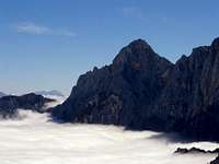
 Kukova špica (left) and Široka peč from the NW
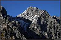 The southern side
Intro
In Slovenian language č, š and ž are pronounced like ch, sh, and zh. Our mountain is written: Kukova špica.
What's New Here?
> Dec 6th, 2014: Climbs list updated.
> Dec 9th, 2007: Pictures attached, some more text added.
> Jun 10th, 2004: Initial set up of the page.
Kukova Spica Gets Presented
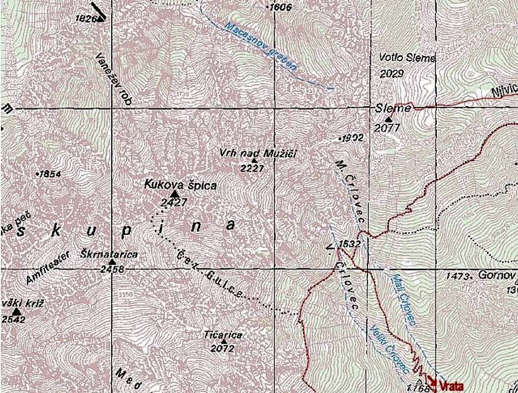
Kukova špica is a nice mountain to start Martuljek Group, the most beautiful one in Julian Alps, with. Actually, it stands as the first high mountain on the eastern side of the group. It's a sharp, rocky pyramid, from Gorenjska plane people often think they're looking at Špik, the most famous cone peak in the group. A few fine, sharp ridges and high faces, rising some 1500 m above valleys would make it hard accessible, if towards the south there wouldn't be one less steep slope, allowing ascent, which requires only a careful scramble. The most beautiful view on Kukova špica is from the east, where its summit sends two sharp ridges down towards valleys. Also nice is the view from the north-west, from Martuljek village, or from Srednji vrh, the terrace above it. From there, in the brilliant parade of high, sharp Martuljek peaks, Kukova špica is seen on the left, starting end. Let's see the area some more in detail:
A Bit of Geography
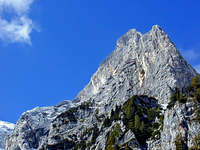 SE ridge
Eastern side
On the NE Martuljek mountain chain starts with Vrtaški vrh, 1898 m and Sleme, 2077 m, both grassy and pleasant hiking and ski tour mountains. After Sleme the ridge becomes sharp, first reaching the unimportant summit Vrh nad Mužiči, 2227 m and then rising steeply to Kukova špica. Towards the SE Kukova špica sends in many steps a beautiful rocky ridge down to Vrata valley. This is also a nice rock climb. Between the two ridges there's a high scree slope (Kukovi prodi), ending with a short rock face allowing also an ascent where some easy climbing is required.
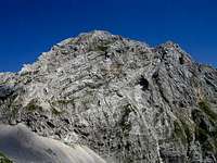 Bor - SW face
South-western side
The SW ridge descends from the summit to Gulce saddle, where Kukova špica is attached to the next high Martuljek summit - Škrnatarica, 2448 m. The southern slope close to this ridge is mixed rocky and grassy and offers the easiest ascent. We come to it through the high valley (also called Gulce), separating Kukova špica and Škrnatarica.
 Bor - NW wall
North-western side
Towards the NW a distinctive ridge descends to Vanežev rob, 1890 m and further to Rutarski Vršič, 1696 m. This ridge is also rocky and offers a nice climb. Between this ridge and the ridge towards Gulce, a high and crumbly wall falls down towards Za Akom high basin. It is not attractive for climbing, and is characterised by a big, red landslide.
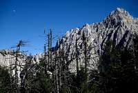 Haubi - From Rutarski Vršič
North face
Also the N face is high and rocky, but not very attractive for more demanding climbing. It falls down into the end of Beli potok (White creek) valley, some 800 meters. From the end of Beli potok, below the north face of Kukova špica goes a long ravine, called Macesnov graben. In early summer it is a true couloir, promissing a passage up towards the summit of Sleme. But when you try it, you realise that on the upper part it is so crumbly that passing through would be too dangerous. A scrambling route, characterised by a hard orientation, crosses the north face of Kukova špica above this ravine.
Above Vrata valley, just close to the road, there's one more natural beauty - on the slopes of Kukova spica there's a nice Peričnik waterfall. It is easily accessible by a path, you can go behind its water curtain and you can also ascend by a good path on its top, where its smaller and neglected brother is. Very beautiful! North of Kukova špica there's a lonesome valley of Beli potok (White creek). There's a hunters' path into it, worth trying to find it (our hunters allways hide beginnings of their paths!), because the valley hides some beautiful waterfalls and cascades and also its end is picturesque. But visiting of waterfalls is difficult and dangerous!
Summit Panorama
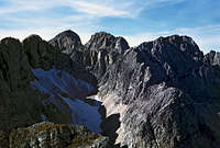 Amfiteater
As Kukova špica stands on the edge of a group, it offers a nice panorama - to the north walls of wild Martuljek mountains, deep into Vrata valley and the huge Triglav above it, on the rest of Triglav group and towards the N and E over the lower Karavanke mountain range far to Austria, to Hohe Tauern, Dachstein etc. and to Gorenjska plane and Kamnik Alps above it. From nowhere Krnica za Široko pečjo, popularly called Amfiteater, is seen so nice as from Kukova špica. This hidden valley behind the broad wall of Široka peč, 2497 m, is closed to all sides with high mountains. Climbers who were there say, that in it there's a perfect silence, although the main Sava valley with its traffic is not so far away.
Getting There
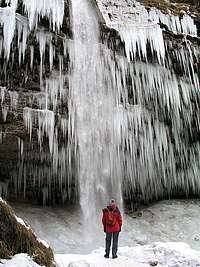 Peričnik
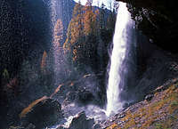 Peričnik
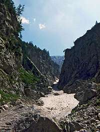
See the Julian Alps overview page. You reach Martuljek Group in Julian Alps by the valley of Sava river. To Jesenice you can get either from Ljubljana or from Austria through Karavanke tunnel. You can also reach the upper Sava valley from Austria (Villach) over Koren Pass or from Italy (Tarvisio). For the normal ascent the trailhead is at Črlovec scree ravine, on the road into Vrata valley. When you pass Peričnik waterfall, the road ascends steeply (Kreda slope) and soon afterwards it crosses Črlovec scree field. You park there or a bit above.
Routes Overview
Normal Ascent & an Easy Climb1. Normal ascent from the south. Along Črlovec ravine, then below the SE ridge towards the SW and again up through the valley towards the NW on Gulce pass. From there below the W ridge on top. Scrambling, easy climbing (UIAA I), 4 hours. This is also a ski tour, but conditions must be perfect and it is still very hard (alpinistic ski tour).
2. Eastern scree slopes and ridge, UIAA II. First climbed by K. K. Plaichinger and W. Lass, July 17, 1909.
|


Classical Harder Climbs
S Face and E Face
1. Brojanova smer (Brojan Route), UIAA III-IV, 400 m, 4 hours. First climbed by J. Brojan, A. Delavec and I. Jenko, May 19, 1946. The route has 2 variants.
2. Jugovzhodni raz (SE Ridge), UIAA III, 3 h. First climbed by H. Drofenik and M. Kajzelj, August 16, 1928.
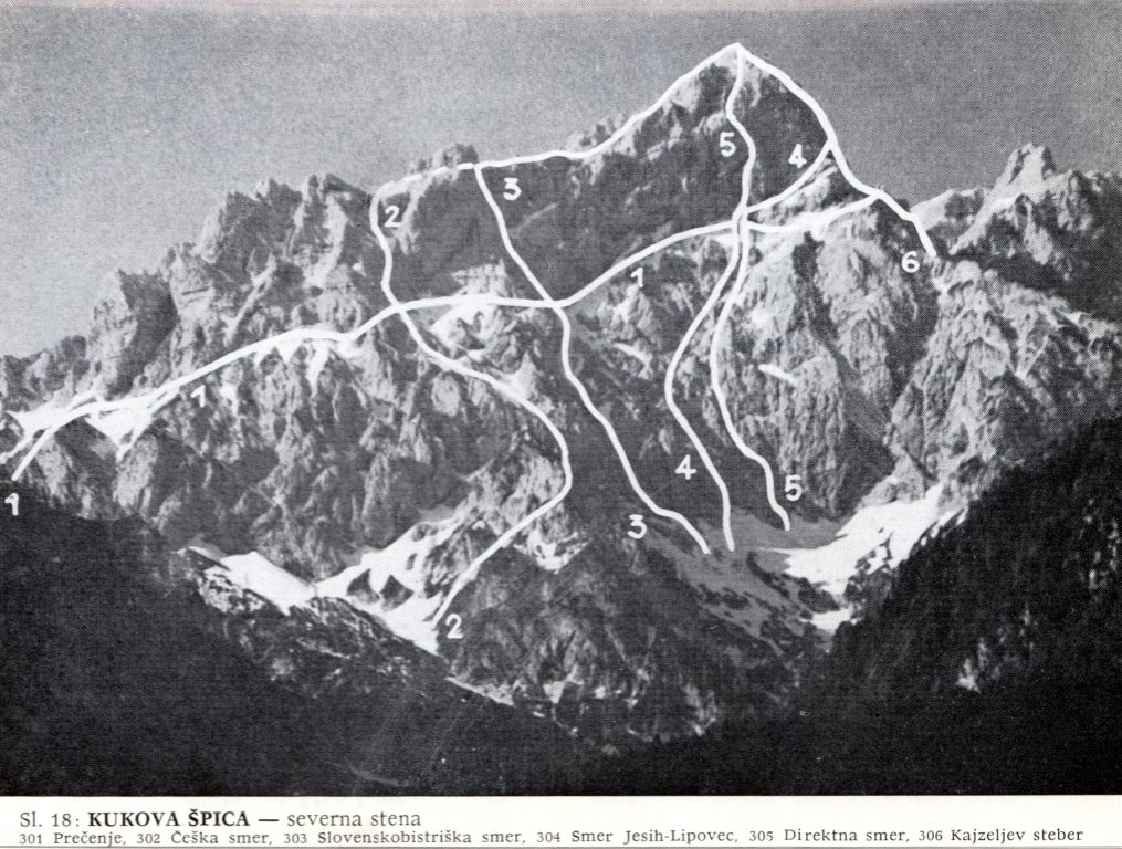
N Face
3. Prečenje S stene (N Face Crossing), UIAA III, 3 hours. First climbed by M. Šuštar, July 16, 1950.
4. Češka smer (Czech Route), UIAA II, 450 m, 5 hours. First climbed by J. Čermák, B. Franta and J. Komac, August 23, 1907.
5. Slovenskobistriška smer (Slovenska Bistrica Route), UIAA III/II, 350 m, 4 hours. First climbed by J. Blažej, J. Frangeš, F. Karner, J. Marn, J. Mirnik and J. Uršič, July 27, 1951.
6. Smer Jesih-Lipovec (Jesih-Lipovec Route), UIAA IV, 400 m, 3-4 hours. First climbed by P. Jesih and J. Lipovec, July 30, 1932.
7. Direktna smer (Direct Route), UIAA IV, 500 m, 8.5 hours. First climbed by J. Čop, D. Korenini and M. Potočnik, June 27, 1937.
8. Kajzeljev steber (Kajzelj Pillar), UIAA IV, 200 m, 2-3 hours. First climbed by H. Drofenik, M. Kajzelj and V. Križaj, June 25, 1927.
NW Face
9. Smer Krušic-Šilar (Krušic-Šilar Route), UIAA V, 250 m, 6 hours. First climbed by J. Krušic and J. Šilar, September 28, 1949.
10. Smer Župančič-Baebler (Župančič-Baebler Route), UIAA III, 200 m, 1 hour. First climbed by L. Baebler and U. Župančič, June, 1937.
Maps:
- Kranjska Gora (community tourist map), 1:30000.
- Julijske Alpe - Vzhodni del (Eastern part). Planinska zveza Slovenije. 1:50000.
Red Tape
No limitations.
When To Climb
 Early summer in Macesnov graben
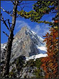 Autumn below the SE side
Summer and autumn (best months are usually July - October) are the best for normal ascents. Late spring is best for tour skiing (Usually march - May), but as said, the tour from the summit is very hard, it's an alpinistic skiing.
Camping
- No mountain hut can help you much.
- All approaches from Vrata valley are 1500 m high.
- If you sleep on Vrtaška planina, 1462 m (NE of the summit, ex shepards hut, closed for public visit, bring sleeping bag or tent) you have a long crossing to start the normal ascent.
- For the NW ridge, you can use Bivak III (bivouac, 1340 m, 8 beds, open), accessible by marked path from Martuljek (Sava valley).
 |
 |
Mountain Conditions
Weather: see the official page for Slovenia here. Even better site is wunderground - here's the direct link to Kredarica station, 2515 m (below Triglav summit): 