
-
 16363 Hits
-
 87.76% Score
-
 25 Votes
|
|
Mountain/Rock |
|---|---|
|
|
46.44010°N / 14.21260°E |
|
|
Mountaineering, Trad Climbing, Scrambling, Skiing |
|
|
Spring, Summer, Fall, Winter |
|
|
7155 ft / 2181 m |
|
|
Overview
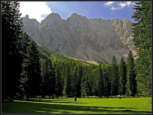 Vrtača from the north
 Vrtača from the SE
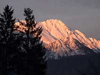 JFS - Vrtača from the SW
 flow - Vrtača from the west
What's New Here?
> Jan 25th, 2019: Design corrections.
> A complete page redesign.
> Decr 26th, 2004: Many links inserted.
> May 8th, 2004: Initial set up of the page.
Vrtaca Gets Presented
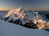
Although mountains in Karawanks are not very high, Vrtača / Wertatscha has all features of a big summit (it is the second highest in Karawanks). Its north face is some 600 meters tall and offers also hard rock climbs, there are many approaches on its summit, which require scramble or easy rock climbing, there's a marked path and in winter and spring classical ski tours and also harder alpinistic ski descents can be done.
As all Karawanks summits also Vrtača offers a great panorama. The mountain presents itself very differently on different sides. For sure its most beautiful side is the northern one. Towards the end of Bodental / Poden its steep and broad north wall is falling, so beautifully contrasting the dark woods and a few lovely clearings in them. Maerchenwiese / Mlaka is an alpine meadow, where one could stay for hours, never getting tired of lovely scenes. Towards the south, Vrtača is less imposing. Its high, mostly grassy slopes are partly obscured by the completely unimportant summit of Srednji vrh, so the mountain is standing quite in the background of the whole scenery. Only from a few points in Gorenjska plane you can distinguish the second highest mountain of Karavanke. As by nature it is a ridge mountain, from the East and West Vrtača appears as a nice, high cone peak. But you must get qute close to see it - it is not seen from valleys, only from the nearby summits of Karavanke.

So, Vrtača is located in the central part of Karawanks, where this range has most alpine characteristics. From its summit a long main ridge is running towards the west, connecting it with the subgroup of Stol / Hochstuhl, 2236 m. In that ridge, the highest elevation is the rocky Grad, 2008 m, its traverse requires climbing of UIAA II+ difficulty degree. Close to the summit a short side ridge is deterring towards the SW, hosting also the normal ascent route. On the other side, the main ridge turns from the summit first towards the northeast, goes over the neighbouring summit of Zelenjak, 2024 m, after the summit of Palec / Selenitza, 2026 m it turns southeast and then continues over many lower summits (Na Možeh, 1784 m) towards the east. One more ridge descends from the summit of Vrtača. A short east-southeast ridge forms with the previous one a beautiful high valley, called Suho ruševje. The southern slopes of Vrtača are grassy, intermitted with rocky sections. Northeastern slopes, falling into Suho ruševje valley, are rocky, but offer passages through two not so difficult ravines. On the southern side, the summit slopes end on a small saddle, called Šija, 1693 m. South of it the summit of Srednji vrh rises.

It is mostly covered with pine bushes and woods, only towards the south its slopes are also rocky. South-east of Vrtača there is a nice alpine meadow, called Zelenica. Once a chair-lift reached it and it was a small ski resort. Now the chair-lift is not operating any more and the whole world between Vrtača and Begunjščica returned again into one of the most beautiful places for tour skiing. Towards the south-west, the slopes of Vrtača lower on a high karstic plateau, stretching towards the summit of Stol / Hochstuhl. In that plateau there are bigger and smaller basins, like V Kožnah, Vatelca, etc.
Geologically, the summit part of Vrtača is built of late Triassic limestone, called also Dachstein limestone, with some layers of dolomite embedded.
Summit Views
The panorama from Vrtača summit is broad, but can still not be compared with the one of Stol / Hochstuhl. The views in distance are great, except towards the west, where Stol is obscuring them. Nice is also the rocky scenery of the northern side of Karawanks.


Getting There
Vrtača is very popular in recent years. The reason is very free border regime after independence of Slovenia, with May 1st, 2004, when Slovenia entered European Union the border becoming virtually non-issue. The other reason is the road over Ljubelj / Loibl pass, where on the south portal of the tunnel, on 1058 m, the trailhead starts. This parking place is the first starting point for tours on Vrtača (46.431025,14.260574).
The second nice possibility is from the north. From Ljubelj/Loibl road near the church of Sopotnica / Sapotnitza a road deters westwards and brings you in Žabnica / Bodental, 1052 m. This is the trailhead for north wall ascents, ascents through Žleb (east of north wall) and on Vrtača saddle (west of the north wall) and further to the summit. The parking place at Bodenbauer has coordinates: 46.467723,14.215557.
The third trailhead is in Završnica valley, where the road brings you below the southern slopes of Vrtača. From Žirovnica, SE of Jesenice, you can drive by a narrow mountain road into the valley till the altitude of 1070 m, where you park by Tinčkova koča: 46.422786,14.199356.
And finally Vrtača can also be accessed from the west, from the Stol / Hochstuhl region, where you reach into Baerental the parking place near Stouhuette, 960 m. In summer, and often also in times of tour skiing you can even drive further up the valley to the parking place on Johannesruhe, 1152 m: 46.454002,14.159433.
Maps:
You can see a detailed map on: http://www.austrianmap.at/. That's in German, but as of classical maps, you can refer to:
Karavanke, 1:20.000. Planinska zveza Slovenije, or
Karavanke, Central part and Grintovci, 1:50.000. Planinska zveza Slovenije.
Routes Overview
As said, Vrtača can offer something to everyone. Besides all sorts of mountaineering routes on the sumit, also the neighbouring areas are very nice for various outdoor activities. In winter Bodental becomes a nice area for cross country skiing, in summer the area around Završnica lake is a nice recreational place, etc. The map on the left shows the main hiking and skiing routes on Vrtača, and below is the list of them.
 haubi - Vrtača in winter haubi - Vrtača in winter |
Summer routes
| Tour | start m | end m | alt. diff. | difficulty | marked | time | comment |
 |
1058 m | 2180 m | 1130 m | hike T3 | yes | 3 h 30 min | From Ljubelj to Zelenica hut, then by the upper path on the SW ridge and on top. |
 |
1070 m | 2180 m | 1100 m | hike T3 | partly | 3 h 15 min | From Tinčkova koča through Zagon on Šija saddle and on top. |
| 3 .Vrtača from Završnica | 1070 m | 2180 m | 1100 m | hike T3 | yes | 3 h 15 min | From Tinčkova koča to Koča pri izviru Završnice and on top. |
 |
1058 m | 2180 m | 1130 m | UIAA I | no | 3 h 00 min | From Podljubelj to Zelenica hut, then in Suho ruševje valley and by the SE ridge on top. |
 |
1052 m | 2180 m | 1150 m | hike T3 | no | 4 h 10 min | From Bodenbauer on the saddle 1855 m, then eastwards on the SW ridge and on top. |
| 6. Vrtača from Johannesruhe | 1152 m | 2180 m | 1050 m | hike T3 | partly | 4 h 00 min | From Johannesruhe (or Stouhuette) on Belščica saddle, then on the SW ridge and on top. |
 |
1058 m | 2180 m | 1130 m | UIAA II/I | no | 3 h 15 min | From Podljubelj to Zelenica hut, then in Suho ruševje valley and by the NE ravine on top. |
 |
1070 m | 1796 m | 730 m | hike T2 | no | 2 h 00 min | From Tinčkova koča on Šija saddle and on top. |
Ski tours and alpinistic ski descents
| Tour | start m | end m | alt. diff. | difficulty | time | comment |
 |
1058 m | 2180 m | 1130 m | 35 deg. PD+ | 4 h 00 min | As summer route #1 above. Skiing from the W summit ridge. |
 |
1058 m | 2180 m | 1130 m | 40 deg. AD | 4 h 00 min | Ascent as summer route #1 above. Skiing from the very top. |
| 3. Vrtača NE ravine | 1058 m | 2180 m | 1130 m | 45 deg. AD+ | 3 h 30 min | Ascent as summer route #7 above. Skiing from the very top. |
| 4. Vrtača from Bodental | 1052 m | 2180 m | 1140 m | 45 deg. AD+ | 4 h 00 min | From Bodenbauer on Žleb notch and by the NE ravine on top. |
| 5. Saddle 1855 m | 1052 m | 1855 m | 800 m | 30 deg. PD- | 2 h 30 min | From Bodenbauer on the saddle 1855 m. |
Classic climbs - summer
| Tour | height | difficulty | time | first ascent |
| 1. W ridge | UIAA II | |||
| 2. NE ridge (from the notch below Zelenjak) | 240 m | UIAA II | ||
| 3. Palec/Selenitza N ridge | UIAA IV- | R. Szalay & A. Ferch, 1924. | ||
| 4. Zelenjak N ridge | UIAA IV-V | 7-8 h | V. Pretterebner & J. Ressmann, 1936. | |
| 5. Direct route (Gipfelfallinie) | UIAA IV-V | 5-6 h | V. Pretterebner & W. Pretterebner, 1935. | |
| 6. NW buttress (Nordwestpfeiler) | 600 m | UIAA V | 8 h | V. Pretterebner & W. Pretterebner, 1934. |
| 7. Nova smer (New route, Neuer Weg) | UIAA III+ | 4 h | W. Wruhs, E. Kahlhofer & R. Begusch, 1934. |
Basic winter climbs
| Tour | difficulty |
| Leva grapa (Left ravine) in the NE face | 50 degrees |
| NE ravine in the NE face | 45 degrees |
Red Tape
No limitations.
When To Climb
In summer best months are from start of July till end of October. For tour skiing the best months are from December till April. First snow usually falls in November, in certain areas skiing is possible till start of May.
Camping
Huts in Stol region:
- Valvasorjev dom, 1171 m.
- Prešernova koča, 2172 m.
- Klagenfurter Huette, 1663 m.
Huts on Zelenica meadows:
- Planinski dom na Zelenici, 1536 m.
- Koča pri izviru Završnice, 1425 m.
Mountain Conditions
For weather see here.
External Links
- Austrian Map online Online digital maps of Austria (OEK 50, OEK 200 and OEK 500) by the BEV (Bundesamt für Eich- und Vermessungswesen) - in German
Your Help Is Needed
Please contribute the following information if you have it:
- Your experiences from classical rock climbs in north walls.
- You experiences from any harder alpinistic ski tour.