
-
 48933 Hits
-
 91.75% Score
-
 36 Votes
|
|
Area/Range |
|---|---|
|
|
46.43420°N / 14.17910°E |
|
|
Hiking, Mountaineering, Trad Climbing, Via Ferrata, Skiing |
|
|
Spring, Summer, Fall, Winter |
|
|
7335 ft / 2236 m |
|
|
Overview
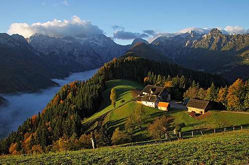
 Košutnikov Turn
What's new on this page?
- NOV 8th, 2019: Geology chapter rewritten.
- OCT 5th, 2019: Tolsta Košuta / Dicke Koschuta page added.
- JUL 3rd, 2016: Sadovnikov vrh added.
- SEP 19th, 2015: Geological Outline
- SEP 29th, 2013: SP V3 design updated, images embedded.
The name
General remark: (When reading Slovenian words on maps or in books, you will find special characters for ch, sh, and zh. They are written with c, s and z with a caron - little v above them.)
The name of the range is very old. Alredy Claudio Ptolomeo (Claudius Ptolemy) refers to it as: Καρουάγκας (karuankas). Some scholars see its origin in Celtic language. "Kar" is a rocky area and the neighbouring Carnic Alps might have a similar origin. The group I am describing here is named Karavanke in Slovenian language, Karawanken in German and Karawanks in English.
The purpose of this page
On this page I would like to summarise information, common to all summits of the range. Gradually important mountains have been receiving their own pages. Please add all specific information there, not here!
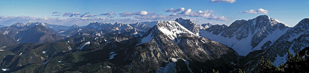
Karawanks presented
 Zell / Sela, north of Košuta range
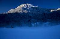 haubi - Pristovški Storžič
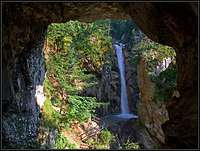 Šum waterfall
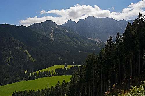 The valley of Bodental / Poden
In the not so distant past it was said that the Karawanks mountains are separating Slovenian people who are living south of the range from those who are living within the Austrian state north of the range. Later, when political relations warmed, it was said that the Karawanks mountains were connecting the German speaking people north of the range with Slavic people south of it. And today, luckily, all this political rhetoric is becoming more or less irrelevant. If mountains were not there, people would merge and communicate even more readily, as they are where they are, we both climb them and meet on their summits. And it's all well again, as long as European Union is fair to all the constituent nations.
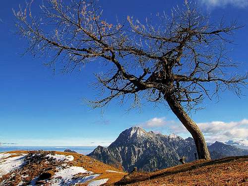
The Karawanks belong to Southern Limestone chain of European Alps. They are similar to Carnic Alps, Julian Alps or Kamnik Alps, although they are a bit lower, so many of their important peaks are grassy on southern side and rocky only on northern side.
The whole range stretches about 120 kilometers in the west-east direction. They begin on Megvarje vrata / Maglern Thoerl on the west and finish with forehills around Slovenj Gradec town. Northern border of the range is clear - it lies on Drava/Drau river. On the west, southern border is Sava river, but soon after Jesenice town the Karawanks range starts to hide behind Kamnik Alps (from our, southern perspective, of course). So from this point the southern border of the chain is hard to be described, it is evident from the embedded Google map below.
The Karawanks range is a paradise for hiking and tour skiing. Almost all summits can be reached by marked paths. Summits offer wonderful panoramas, especially on Julian Alps and Kamnik Alps, which are close, while towards the north views are far more open - till Grossglockner and Dachstein. In the range there are also some climbing areas.
Geological Outline

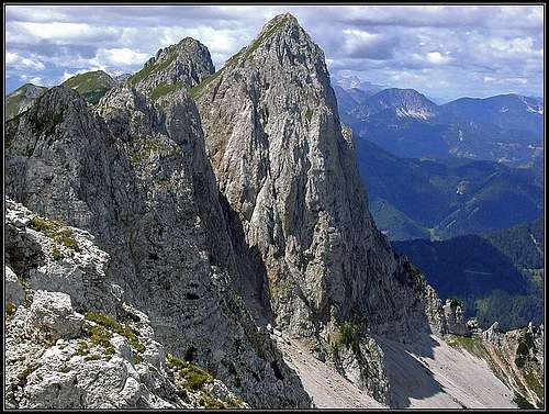
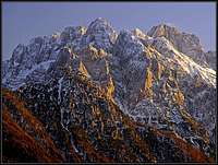
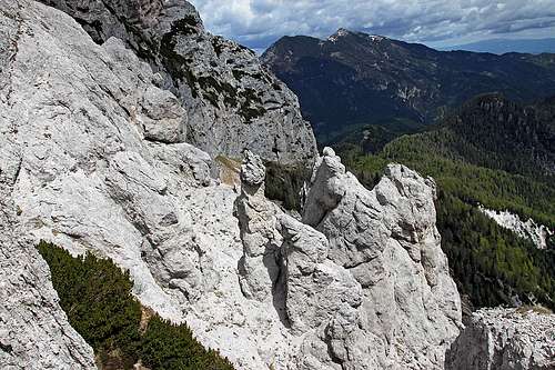 Rock towers in the E face of Tolsta Košuta
In a geological sense, the Karawanks are a very diverse mountains. As said, the chain is considered to be a part of the Southern Alps, a big mountain group with a predominant sedimentary rock structure (limestones and dolomites). But in a geological sense, this is only partially true.
The big periadriatic fault (on the bove picture red line, going just south of Eisenkappel) is actually cutting the long W-E oriented group into a roughly northern part and southern part. The fault is coming from the west by the valley of Gail/Zilja, then goes by the northern side of the Karawanks, but in the narrow group of Stol it goes by the northern side of Stol, Vrtača, Košuta, and then over Šajda saddle and Eisenkappel valley towards the east. Only the southern part of Karawanks (the highest mountains - white triangles on the map) geologically belongs to the Southern Alps, and has to a certain degree similar lithological structure. The northern part (Obir, Peca,...) is in the upper part also built of Mesozoic rocks, but belongs to the Austroalpine nappe, specifically to the "Drauzug" ("Drau Chain"), so its history of sedimentation is similar to the one of the Northern Limestone Alps. In between, in the vicinity of the Periadriatic fault (around Eisenkappel) a stretch of metamorphic rocks is unearthed (granit, tonalit, diabase, ...) and more towards the east also a stretch of volcanic rocks can be found.
Only the summits of Karawanks mountains are built of Triassic limestones (and partially dolomites). These are superimposed on older paleozoic rocks. The latter are in the very western end of Karawanks forming also the rounded summits (Peč), similarly as in the nearby (across Ziljica river) Eastern Carnic Alps. More towards the east Paleozoic rocks can be found mostly in the valleys and around geological faults. The exception is the broader area W and N of Jezersko (Stegovnik, Virnikov Grintovec, Pristovški Storžič, ...). On these, Devonian limestones are forming also the summits and ridges, being thrusted over younger Carboniferous flysch layers. By its geological diversity and abundance of fossils, Dovžanova soteska (canyon) is worldwide known. The highest summits of Karawanks are made of Triassic limestones and partially of other limestones and dolomites. Several hundred meters thick layers (Wetterstein, Dachstein limestone) are lying on Carboniferous and Permian layers. This is the highest thrust of the chain. The lower thrust can be clearly seen even more to the south. All the way from Kranjska Gora on the west towards Boč on the east, you can see rock structures thrusted from the north (so, having short, steep southern walls). Those hills are by origin of course much older, from Devonian to older Triassic era. On the south, the Karawanks are being bordered by the Sava fault. More to the east, the Southern Karawanks are closely connected to the Kamnik-Savinja Alps, another Southern Alps group, which is however even a bit younger by origin and also geologically more homogeneous.
What to do there?
The Karawanks range offers just something to everybody. Not a big, famous resort, which would be very popular across Europe, but in many areas still peaceful and with preserved nature. There you can do:
 Hiking Hiking |
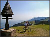 Biking Biking |
 haubi - Climbing haubi - Climbing |
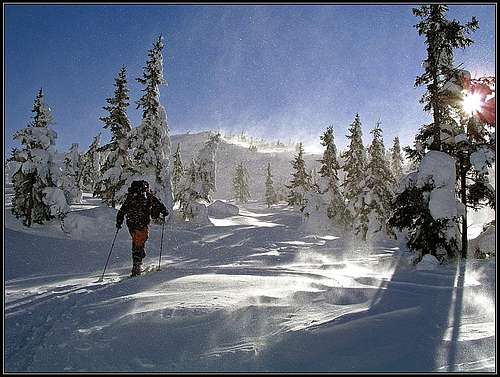
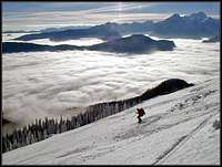 Tour skiing Tour skiing |
 Admiring nature Admiring nature |
 Enjoying panoramas Enjoying panoramas |
 Admire cultural heritage Admire cultural heritage |
I have only a day or two...
If you have time only for a weekend or so, then know the Karawanks by visiting their central part. Drive from the Austrian side into Baerental and continue below the north face of Stol/Hochstuhl. Any time of a year, there you can do a nice tour, in summer conditions also a round trip, including the highest summit.
Subgroups and summits
As there are no evident subgroups, I shall list here the important summits from the west towards the east. Because there are some passes, which cross the Karawanks range, summits will still be grouped. The summits, which have their own SummitPost pages, can be seen on the map below. Click on the marker of a mountain and then on the link to open its SP page.
View The Karawanks in a larger map
Western part
 Kepa from the west, from the summit of Mojstrovica
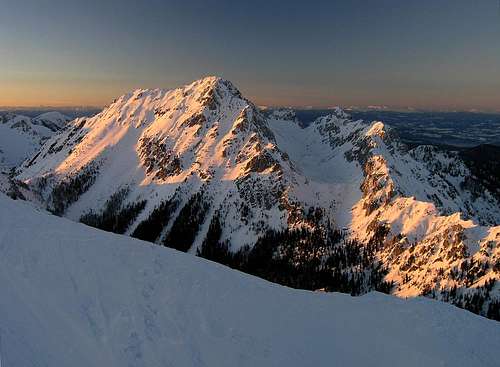 haubi - Begunjščica from Vrtača
Peč / Dreilaendereck / Tre Confini, 1510 m. Grassy summit on the border of three states (Austria, Italy, Slovenia), nice mountain bike tour, easy, nice ski tours, ski resort on the north.
Vošca, 1737 m. Grassy summit above Kranjska gora. Ski tour.
Trupejevo poldne / Techantinger Mittagskogel. 1931 m. Grassy and rocky summit above Martuljek. Ski tour.
Visoki vrh and Mojstrovica. Two less important summits just above the valley of Sava.
Kepa / Mittagskogel, 2143 m. Nice shaped cone peak, a true landmark of Austrian Kaernten. Marked paths, a ski tour towards the NE.
Visoki Kurjek / Baerenkogel, 1973 m. Rugged, rarely visited summit in the E part of Kepa / Mittagskogel narrow massif.
Dovška Baba, 1891 m. Grassy summit, very popular for tour skiing.
Hruški vrh and Klek, 1776 m. Grassy summits, very popular for tour skiing.
Golica, 1835 m. Grassy summit, steep ski tour, hut just below the summit. The area famous by narcissus fields.
Struška/Baerentaler Kotchna, 1944 m. Grassy summit, nice for tour skiing.
Vajnež, 2104 m. Grassy summit on the south, rocky on the north, close to the highest summit - Stol. A few great ski tours.
Stol/Hochstuhl, 2236 m. Grassy summit on the south, rocky on the north. A few great ski tours, a few rock climbs, a nice ferrata.
Kozjak/Geissberg, 2016 m. A nice, panoramic summit with great views on Stol/Hochstuhl. In winter nice for skiing.
Vrtača/Wertatscha, 2181 m. Steep grass on the south, high rocky north face. Hard ski tours, rock scrambles, a few harder climbs.
Palec/Selenitza, 2027 m. A sharp rocky summit, some nice climbs in the N face.
Begunjščica, 2060 m. Steep grass on the south, rocky on the north. Many nice, steep ski tours - very popular.
Eastern part
 Branko - On Košuta range
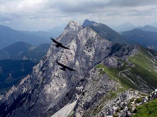
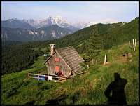
Košutnikov Turn, 2133 m (highest point of 12 km long Košuta ridge). Grassy on the south, rocky north face. Tour skiing, climbing.
Setiče, 1922 m. Grassy summit north of the main Karawanks range.
Hochobir/Ojstrc, 2139 m. A lonesome massif north of the main Karawanks range. Nice ski tour, great panorama.
Plešivec, Pečovnik, Virnikov Grintavec, Pristovski Storžič, Veliki Vrh, Ruč, Stegovnik, Mali Javornik, Ženiklovec/V. Javornik - Lower summits, covered with forrests and grass, only partly rocky. Nice views on Kamnik Alps and other groups. Hikes, some ski tours.
Oistra/Ojstra and Topitza/Topica - two lower summits in the northern range. Especially Oistra offers a nice view around.
Sadovnikov vrh / Sadonighöhe, 1624 m. Insignificant summit above Pavličev vrh / Paulitschsattel.
Olševa, 1929 m. Grassy and rocky ridge, popular with stone windows and a cave. Also a ski tour.
Peca, 2125 m. Very broad grassy and rocky massif. Ski resort on the northern side.
Uršlja gora, 1696 m. Grassy summit, easternmost in Karavange range. A hut and nice church just below the summit.
Foothills
See the page Mountains of Slovenia to read the discussion about the hilly range in the SE continuation of the Karawanks.
Mountain Biking
 On the panoramic road below Olševa - Klemenšek farm
The Karawanks are also great for biking tours. In this chapter I'll list only a few. When the list gets more complete, I might do a special page.
Peč, 1510 m. Wonderful, very panoramic tour. 22.0 km, 670 m of altitude difference. Difficulty: medium/hard. 2 hours. Course: Rateče (0.0 km, 870 m) - Podkoren (2.7 km, 840 m) - below Korensko sedlo turn left (5.5 km, 1080 m) - below Petelinjek turn right up (11.5 km, 1280 m) - summit of Peč (14.2 km, 1510 m) - back to the crossroads, there turn right (16.9 km, 1280 m) - Rateče (22.0 km, 870 m).
Blekova Meadow, 1629 m. Long, panoramic ascent, very steep and hard descent. 24.9 km, 859 m of altitude difference. Difficulty: hard/very hard. 3 hours. Course: Kranjska Gora (0.0 km, 810 m) - Podkoren (1.4 km, 840 m) - below Korensko sedlo turn right (4.6 km, 1080 m) - Jureževa planina (12.3 km, 1450 m) - Blekova planina (15.4 km, 1629 m) - Železnica valley (16.8 km, 1550 m) - Srednji vrh (20.2 km, 960 m) - Kranjska Gora (24.9 km, 810 m).
Veliki Vrh Saddle, 1230 m. Over fore-hills above Sava. 23.6 km, 650 m of altitude difference. Difficulty: medium hard. 2 hours. Course: Jesenice (0.0 km, 600 m) - Dovje (8.6 km, 700 m) - on Presušnik creek drive right (15.3 km, 1070 m) - Veliki Vrh Saddle (16.7 km, 1230 m) - via Plavški rovt down in Jesenice (23.7 km, 600 m).
Around Španov vrh and on Suha saddle, 1438 m. A bit more demanding on the upper part, where we reach the panoramic main ridge. 19.0 km, 578 m of altitude difference. Difficulty: partly hard. 2 hours. Course: Planina pod Golico (0.0 km, 950 m) - Prihodi (1.5 km, 860 m) - Around Španov vrh on Križovec saddle (10.1 km, 1222 m) - over Pusti rovt on Suha saddle (12.9 km, 1438 m) - back to Križovec saddle (15.6 km, 1222 m) - Planina pod Golico (19.0 km, 950 m).
Below Košuta, 1560 m. Beautiful, panoramic biking over nice alpine meadows. 29.8 km, 1048 m of altitude difference. Difficulty: very hard. 3 hours 30 minutes. Course: Tržič (0.0 km, 510 m) - Putrhof in Jelendol (6.4 km, 760 m) - right on next crossroads (10.4 km, 1220 m) - left on Zali potok crossroads (11.8 km, 1300 m) - Over Pungrat to Šija meadow (16.3 km, 1530 m) - Kofce hut (17.7 km, 1460 m) - right on the ridge elevation Ravne (18.9 km, 1300 m) - via Matizovec farm to Podljubelj (24.5 km, 680 m) - Tržič (29.8 km, 510 m).
Getting There
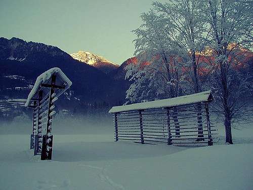 In Sava valley - winter time
By plane. The nearest airports are:
- Ljubljana airport, near the capital of Slovenia.
- Klagenfurt airport, Kaernten.
By bus. There are regular bus connections along Sava, Drava and Savinja valleys and over passes Korensko sedlo / Wuerzen pass, Ljubelj/Loibl pass and Jezerski vrh / Seebergsattel.
By car. See the map.
Maps. You can see a detailed map on: Austrian: http://www.austrianmap.at/. Slovenian: www.geopedia.si/. As of classical maps, you can refer to: Karavanke, 1:20000. Planinska zveza Slovenije, or Karavanke, Central part and Grintovci, 1:50000. Planinska zveza Slovenije. Kranjska Gora (community tourist map), 1:30000 (only for the western part to Rožca/Rosenbachsattel saddle).
The Passes of Karawanks
Even before the Antiquity, trade routes, overcoming the range and thus connecting the Adriatic with Central Europe were important. Let's only mention a few historical passes.
Ljubelj / Loiblpass*
Important already in Antiquity, it gained importance in the 16th century, when its bridle path was broadened into a road, which was renewed in the 17th century and in 1944, when the tunnel was opened.
Jezerski vrh / Seebergpass**
In Antiquity it was due to the Roman road even more important than Ljubelj / Loiblpass, but lost its primary position in the 17th century with the new road over Ljubelj / Loiblpass.
Other passes are less important. Korensko sedlo / Wurzen Pass*** is situated on the very west of the range. Pavličev vrh / Paulitsch Sattel**** is the connection only between the valley of Savinja and Eisenkappel. On the very east, around the massif of Peca the south-north connection through Mežica cuts the range.
Red Tape
No limitations. For a few private roads on the Austrian side you must pay toll.
146 Best Pictures
They are geo-located on the map below. Clicking on a location you'll get low resolution picture, clicking on it, you'll get a medium size picture. To get still a bit larger picture, click on the provided link.
When To Climb
In summer best months are from start of July till end of October. For tour skiing the best months are from December till April. First snow usually falls in November, in certain areas skiing is possible till start of May. For tour skiing almost every summit of the Karawanks is appropriate. For climbing the best resorts are: - north faces of Stol group and Vrtaca group - north faces of Kosuta
 Autumn Autumn |
 Winter Winter |
Camping
 Below Rožca saddle
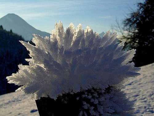 Hoar crystals in Lobnik valley
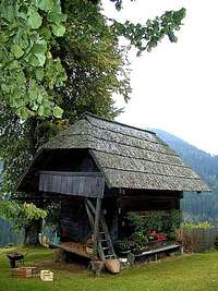
In valleys there are many tourist resorts. Along the whole Karawanks range there are many mountain huts, the most important are named below. In the massif there are no useful camping places.
Huts (from west to east):
Peč: Dreilaendereckhuette, 1423 m.
Kepa: Bertahuette, 1567 m, open from mid June to end of September, Tel 0664/5968677 and Mittagskogelhuette, 1527 m.
Golica: Koča na Golici, 1582 m.
Struška: Dom Pristava, 975 m.
Stol: Valvasorjev dom, 1171 m, mobi: 051/ 328-648.
Prešernova koča, 2172 m, mobi: 050/ 611 366, Klagenfurter Huette, 1663 m, tel.: 04253 / 8556, mobi: 0664 / 220 2929.
Vrtača, Begunjščica: Planinski dom na Zelenici, 1536 m. Tel.: 04/ 59-71 536.
Begunjščica: Roblekov dom, 1657 m. Košuta: Dom na Kofcah, 1488 m, Koschutahaus, 1279 m.
Obir: Eisenkappler Huette, 1553 m.
Olševa: Koča pod Olševo, 1232 m.
Peca: Dom na Peci, 1731 m,
Uršlja gora: Dom na Uršlji gori, 1696 m.
Mountain Conditions
For weather see here.
The Older History of This Page
 flow - Koschuta
- Jul 22nd, 2007 - Links to a new page added: Trupejevo poldne / Techantinger Mittagskogel.
- Mar 24th, 2007 - Links to two new pages: Oistra/Ojstra and Topitza/Topica.
- Jan 20th, 2007 - The Mountain biking chapter added.
- Oct 2nd, 2005 - Links to a new page: Peca/Petzen.
- May 31st, 2005 - Links to a new page: Golica/Kahlkogel.
- Apr 9th, 2005 - Links to a new page: Hochobir/Ojstrc. > Mar 21st, 2005 - Links to a new page: Stegovnik & the surroundings.
- Dec 26th, 2004 - Links to new pages: Palec/Selenitza, Struška/Baerentaler Kotchna.
- Nov 22nd, 2004: A new panoramic picture inserted.
- Aug 12th, 2004: Links to Begunjščica page.
- Jul 16th, 2004: Links to Kepa/Mittagskogel page.
- Jul 13th, 2004: A few pictures added, minor style corrections, one more map cited, Bertahuette info added.
- May 8th, 2004: Links to Vrtača/Wertatscha page.