
-
 10000 Hits
-
 82.48% Score
-
 15 Votes
|
|
Mountain/Rock |
|---|---|
|
|
46.38860°N / 9.29440°E |
|
|
Mountaineering, Trad Climbing |
|
|
Summer |
|
|
9892 ft / 3015 m |
|
|
Overview
| Also named "Cima di Pian Guarnei" (CNS) this summit can be considered the ending one of the Val S.Giacomo (Valle Spluga) and the starting of the Catena Mesolcina. 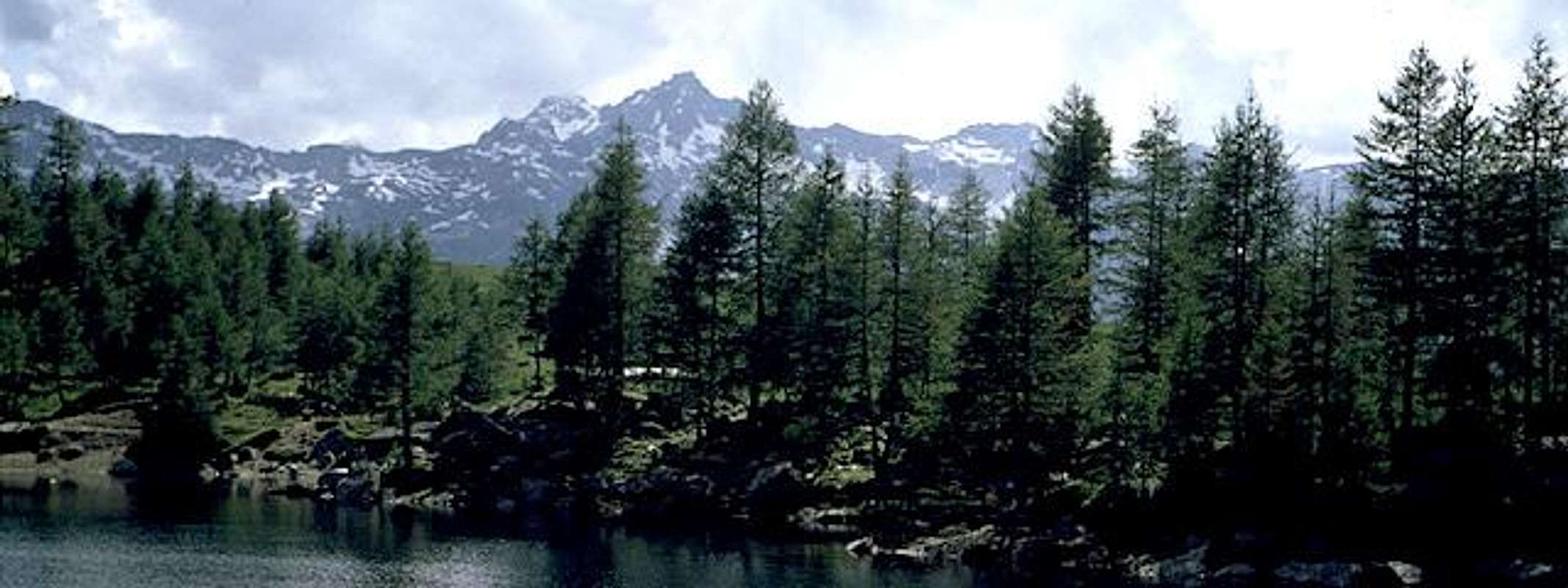 Very fine and smart from Valle Spluga, not at all from Val Mesolcina where from it is hard to distinguish this summit on the ridge. Wonderful view from the summit !
|


Getting There
| starting from Milano (Italy) by car : starting from Chur (CH) |
Routes overview
| The usual starting points are, from this valley, Starleggia and Rifugio Carlo ed Emilio (Lago di Truzzo) from Starleggia NW ridge fine, amusing, not banal (PD), the best to this summit from Val Sancia (4-5 hours) North wall a fine climb, not easy (AD) and not always safe for rock quality. East ridge - normal route easy (F) but not amusing in the low part (3-4 hours) from Rifugio Carlo ed Emilio SE side normal route (F) not amusing SW ridge from the saddle between Pizzo Sevino (3026m) and Pizzo Quadro (PD inf) from Keyser Soze Routes from Mesocco The various routes from Mesocco to the summits of P.Quadro, P.Sevino and P.Forato are very interesting and wild. Guiseppe Brenna's guide "Alpi Mesolcinesi" lists various routes. We did Nrs 555 (Piz Nebion) and 573 (Piz Pombi/Forato) and they were absolutely great! There are historic traces of smuggler's presence all over the place. It is worthwile to follow the entire ridge between P.Forato/Pombi and P.Quadro/Pian Guarnei - not too difficult (F/F+).
|

When To Climb
| from june to september ski-mountaneering only on the sorrounding summits Mathias Zehring told me : "I've got a swiss map with ski routes - and there is a ski route drawn in, rated with OSA." With skis you can reach the slopes under Pizzo Mottascio, at about 2700m so It's hard to consider it as a ski-mountaneering : I think it only as a winter climb using skis only to approach the ridge
|


Accomodations
| Campingplace in Campodolcino, just near the tunnel-funicular to Alpe Motta. This summit can be climbed in one day trip from the north-western area of Lombardia (I) or Canton Ticino (CH). Bivacco del Servizio info Rifugio Carlo ed Emilio info Rifugio Curti info |