
-
 70384 Hits
-
 97.89% Score
-
 74 Votes
|
|
Area/Range |
|---|---|
|
|
46.54090°N / 12.13710°E |
|
|
Hiking, Trad Climbing, Sport Climbing, Big Wall, Scrambling, Via Ferrata, Skiing |
|
|
Spring, Summer |
|
|
10709 ft / 3264 m |
|
|
This page has been done ...
... just to give an overall idea of where one can go when coming here to spend one or more weeks of summer holidays.
|
Overview
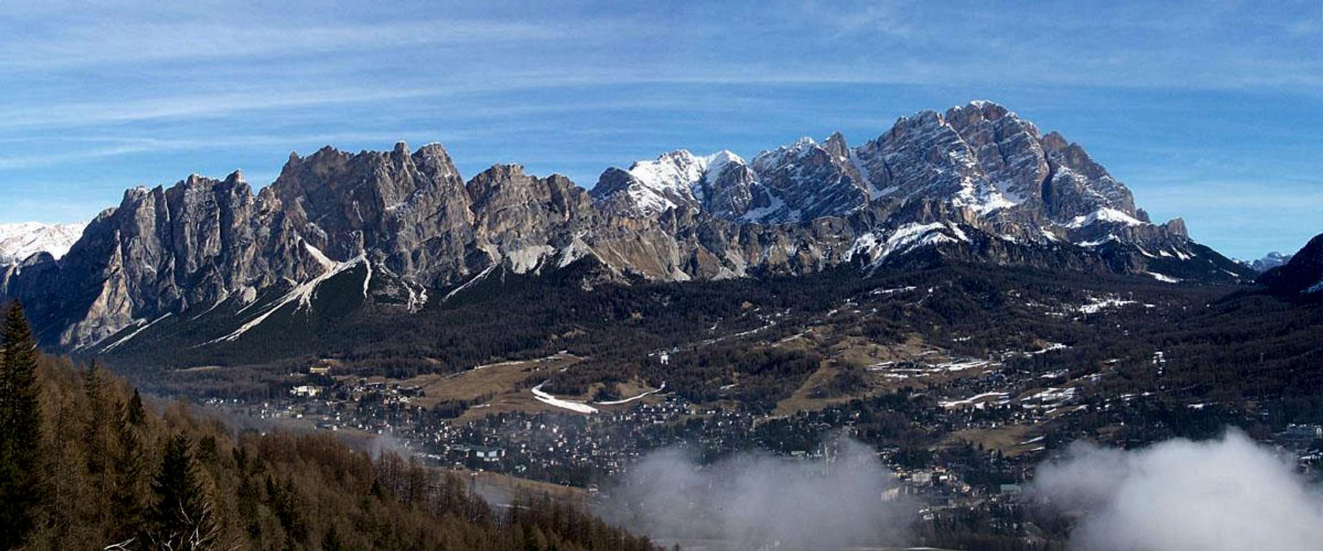
Cortina is known all over the world as "the dolomites' pearl" due to its position in a big basin sorrounded by many dolomite groups very different from each other but all very fine for walking, hiking and climbing.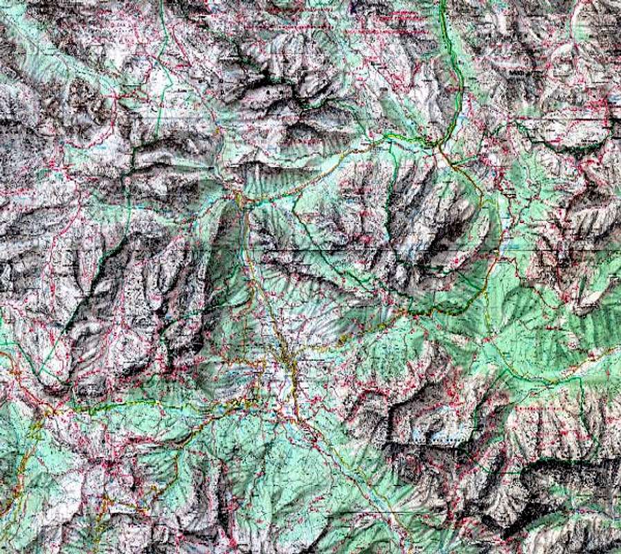
google map
Almost all can be done starting directly from Cortina, many roads can take you just near the groups,
so that almost all Rifuges are often used only as "restaurants" or, at most, as a base for hikers making the "Dolomites high ways".
Boundaries ot the area :
SE - San Vito di Cadore - on the Alemagna road - between Antelao and Pelmo groups
S - passo Giau - between Croda da Lago and Nuvolau groups
SW - passo Falzarego - between Nuvolau and Tofane groups
NW - passo di Cimabanche - between Croda Rossa and Cristall groups
NE - passo 3 Croci - between Cristallo and Sorapiss groups
Getting There ... and moving
Many different ways to get here :
from Veneto
Motorway from Venezia (Venice) to Ponte nelle Alpi - then follow to Cortina (route 51 - Alemagna)
from Sud Tirol
from Bressanone (Brixen) follow for Val Pusteria (Pustertal) till Dobbiaco (Toblach) then Passo Cimabanche route till Cortina
from Trentino
from Val di Fassa - Passo Pordoi - Arabba - Passo Falzarego
Moving in Cortina basin can be a gamble ... a lot of traffic but :
wherever you are in Cortina bus services allow you to get the Falzarego pass, Cimabanche and other sites
with a regular, cheap and comfortable summer and winter service.
here you can get all info about the lines (pdf file)
Maps & Books
strongly recommended here !!!
Tabacco 1:25.000 - sheet 03 - Cortina D'Ampezzo e Dolomiti Ampezzane : complete and absolutey the best !
Kompass 1:50.000 - sheet 55 - Cortina d'Ampezzo - easy use
here the link to 40 submaps
many white routes are often open and allow to draw nearer the mountains
Best guiding book here (the most complete) are the CAI-TCI Guida dei Monti d'Italia - Dolomiti Orientali I-II - they are in Italian and perhaps not so easy to use, but containing a lot of infos about all : paths, hiking, climbs, history ... not so fine for ferratas
When To Climb
summertime for most of the groups
some lower groups (like 5 Torri) can be climbed almost in all seasons)
some ski-areas starting from here
Camping
3 very confortable campings in Campo di Sotto (4 km south of Cortina) and one in Fiames (north of Cortina on the route to Cimabanche pass)
These are the best bases to spend confortable weeks in summer, just remember only to start before 9 o'clock in the morning if you must cross Cortina by car (strong traffic in august
Antelao
In the south-eastern side of the basin: this is the highest group of this region, with a huge rock wall in the south side.
The most "alpine" group of the area, even a snow-ice route to the main summit.
Antelao from west
Huts :
- Rifugio S.Marco (1823 m) - Rifugio Galassi (2018 m) - Rifugio Antelao (1796 m)
Main summits : Antelao (3264 m) - Cima Fanton (3142 m)
Antelao - mountain page
Antelao - photo album
Antelao - photo album of the normal route
Sorapiss
In the eastern side of the basin: a big high ridge with huge northern wall.
Some hiking routes sorround it using high (and not always easy) ledges.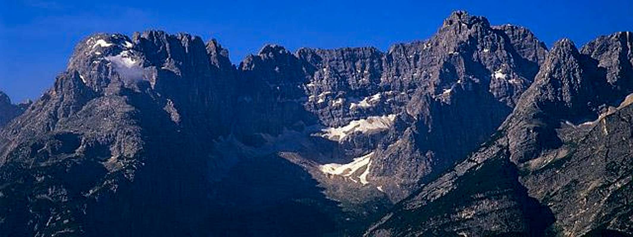
Sorapiss from north
Huts :
- Rifugio Vandelli (1928 m) - Bivacco Slataper (2600 m) - Bivacco Comici (2000 m) - Rif. Faloria (2123 m) - Rifugio S.Marco (1823 m)
Main summits : Croda Marcora (3154 m) - Punta di Sorapiss (3205 m) - Punta Zurlon (2720 m) - Tre Sorelle (3005 m) - Cime di Valbona (2899 m) - Punta Nera (2847 m)
Sorapiss - mountain page
Sorapiss - photo album
Marmarole
Marmarole is a wild and complex group, rarely frequented, some little summits and many possible routes still are waiting to be climbed.
This group should be considered apart from this region but, as it is normally accessed from the Sorapiss and Antelao sides, most of the hikings start from here, using the road bringing near the Rifugio San Marco and the Rifugio Galassi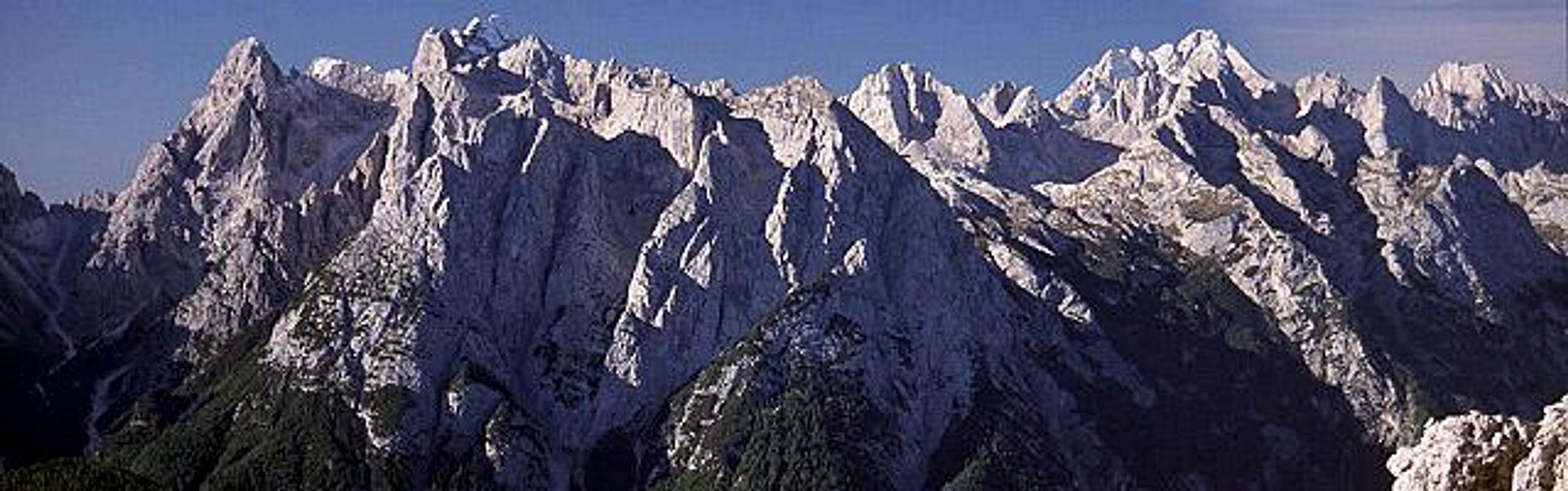
Marmarole from NNE
Huts :
- Rifugio S.Marco (1823 m) - Rifugio Galassi (2018 m) - Rifugio Chiggiato (1911 m) - Rifugio Marmarole (1786 m) - Rifugio Casera Baion (1828 m) - Bivacco Fanton (1750 m) - Bivacco Tiziano (2246 m) - Bivacco Musatti (2111 m) - Bivacco Voltolina (2082 m)
Main summits :
Bel Pra subgroup: Torre dei Sabbioni (2531 m) - Corno del Doge (2615 m) - Cima Bel Pra (2917 m) - Cima Scotter (2800 m) - Bastioni (2926 m) - Croda De Marchi (2769 m)
central subgroup: Campanile San Marco (2777 m) - Pala di Meduce (2864 m) - Cima Tiziano (2802 m) - Monticello (2803 m) - Punta della 68° Compagnia Alpina (2595 m) - Cimon del Froppa (2932 m) - Cresta degli Invalidi (2783 m) - Croda Bianca (2841 m)
Ciastelin subgroup: Monte Ciastelin (2570 m) - Cima del Carro Armato (2525 m) - Denti di Pomadonna (2463 m)
Marmarole - group page
here a good album
Cadini di Misurina
Cadini di Misurina is a true "Babele" group: a lot of pinnacles in wonderful environment.
Normally used approaches start from Misurina (Cortina-passo 3 Croci), quite near Cortina, so, even if this group do not belong to this area, we thought to insert it here.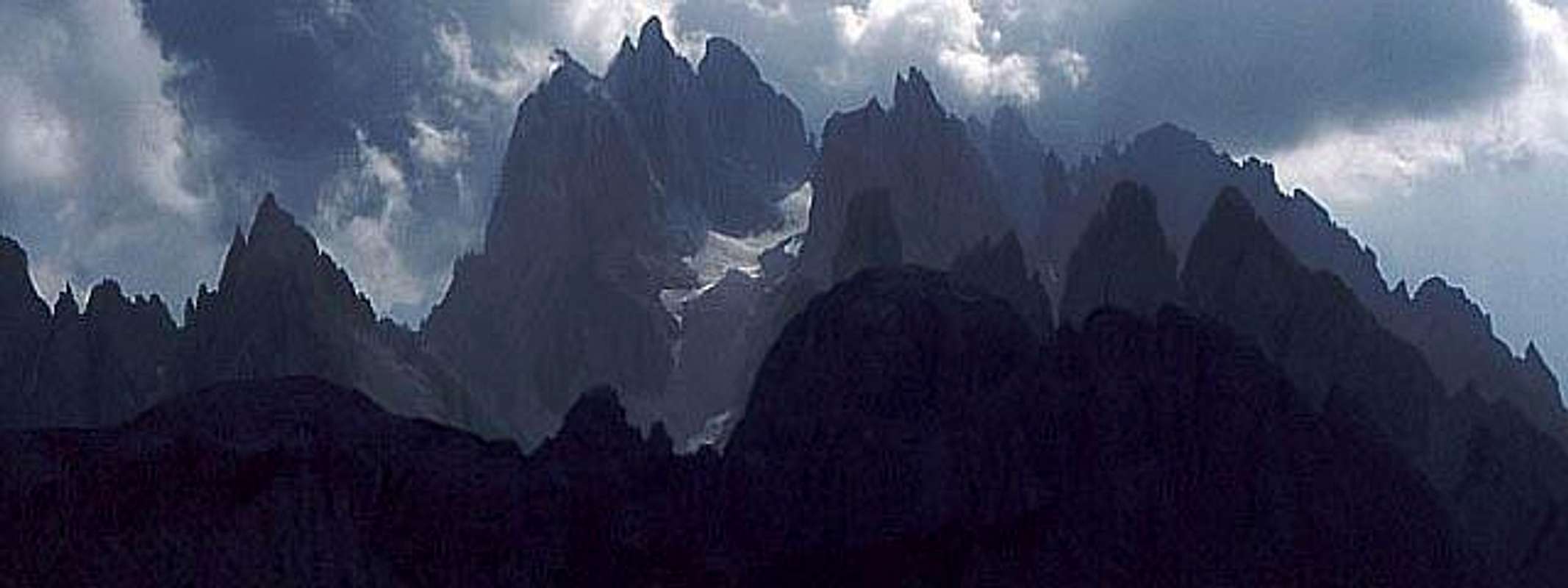
Cadini from NE
Huts :
- Rifugio Fonda Savio (2359 m) - Rifugio Città di Carpi (2110m) - Capanna Col di Varda (2115 m)
Cadini group can be divided in many Branches: (locally called Rami) that are the main ridges on which summits rise :
Misurina - Neve - San Lucano - Croda Liscia - Nevaio - Diavolo - Tocci - Rimbianco - Campoduro
Cadini - group page
Cadini - Sentiero Bonacossa album page
Pomagagnon - Cristallo - Popena
Pomagagnon-Cristallo-Popena is a complex group in the northern side of the basin.
Two different big ridges divided by a high valley, many frequented climbing routes on the lowest branch (Pomagagnon)
Some wonderful hiking routes (its western ridge was the stage for many scenes of "Cliffhanger" with Stallone)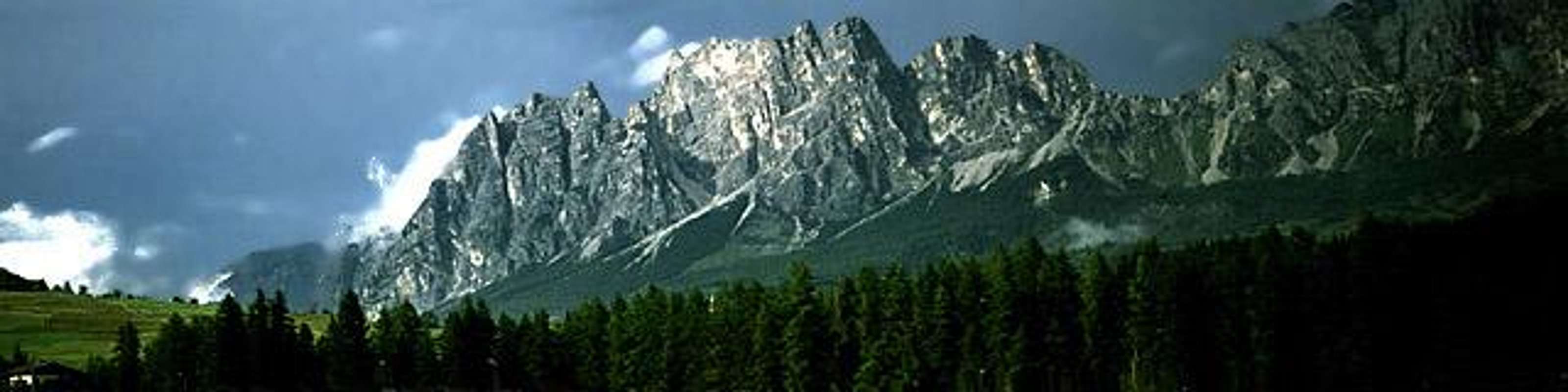
Pomagagnon from south
Huts for Pomagagnon: no need ... directly from the roads
Pomagagnon main summits : Punta Fiames (2240 m) - Punta della Croce (2300 m) - Campanile Dimai (2310 m) - Croda di Pomagagnon (2450 m) - Testa e Costa del Bartoldo (2442 m) - Croda Cestelis (2342 m) - Punta Erbing (2301 m)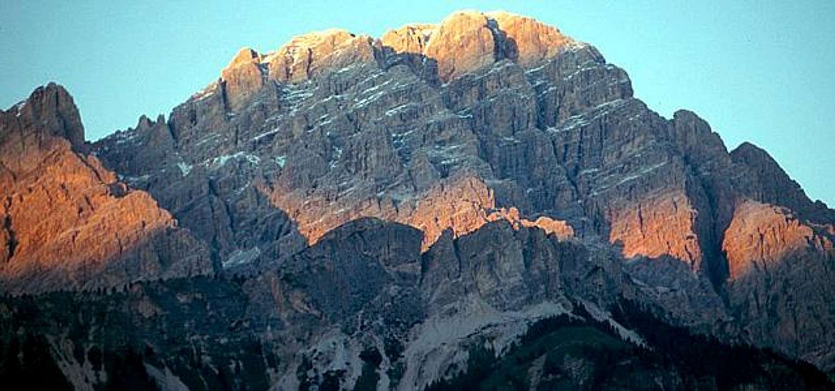
Cristallo at sunset from south
Huts for Cristallo: Rifugio Somforca (2215 m) - Rifugio Lorenzi - forcella Staunies (2932 m)
Cristallo subgroup main summits : Vecio del Forame (2868 m) - Cristallino d'Ampezzo (3008 m) - Cristallo (3221 m)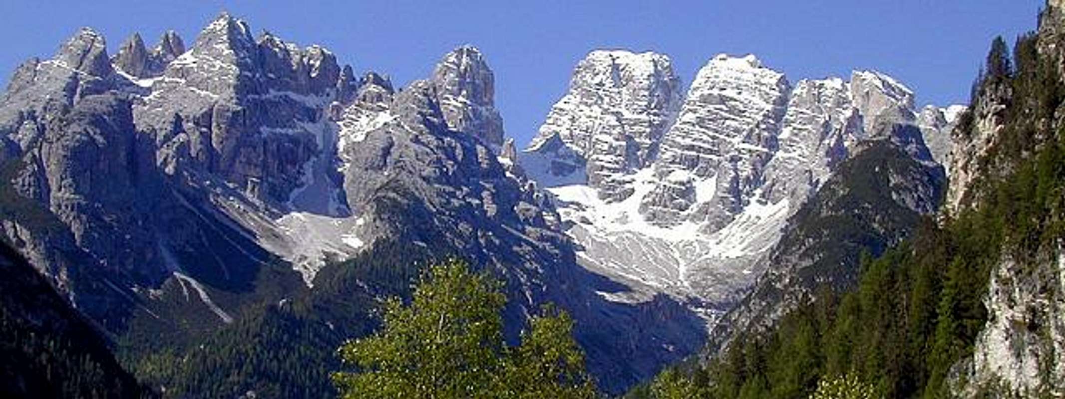
Popena and Cristallo from north
Huts for Popena: ... directly from the roads
Popena subgroup main summits : Piz Popena (3152 m) - Punta Michele (2898 m) - Guglie di Val Popena alta (2614 m) - Cristallino di Misurina (2775 m) - Torri di Popena (2479 m) - Corno d'Angolo (2430 m) - Campanile Misurina e Guglia De Amicis - Monte Popena (2225 m)
Pomagagnon - mountain page
Cristallo - mountain page
Cristallo - album page
Croda Rossa d'Ampezzo (Hohe Gaisl)
Croda Rossa d'Ampezzo (HoheGaisl) is a wild group with fantastic possibilities of hiking in the north-western side of the basin.
Only its southern subgroup (Croda Rossa / Hohe Gaisl) belongs to Cortina Dolomites ... the northern part belongs to Sénnes subgroup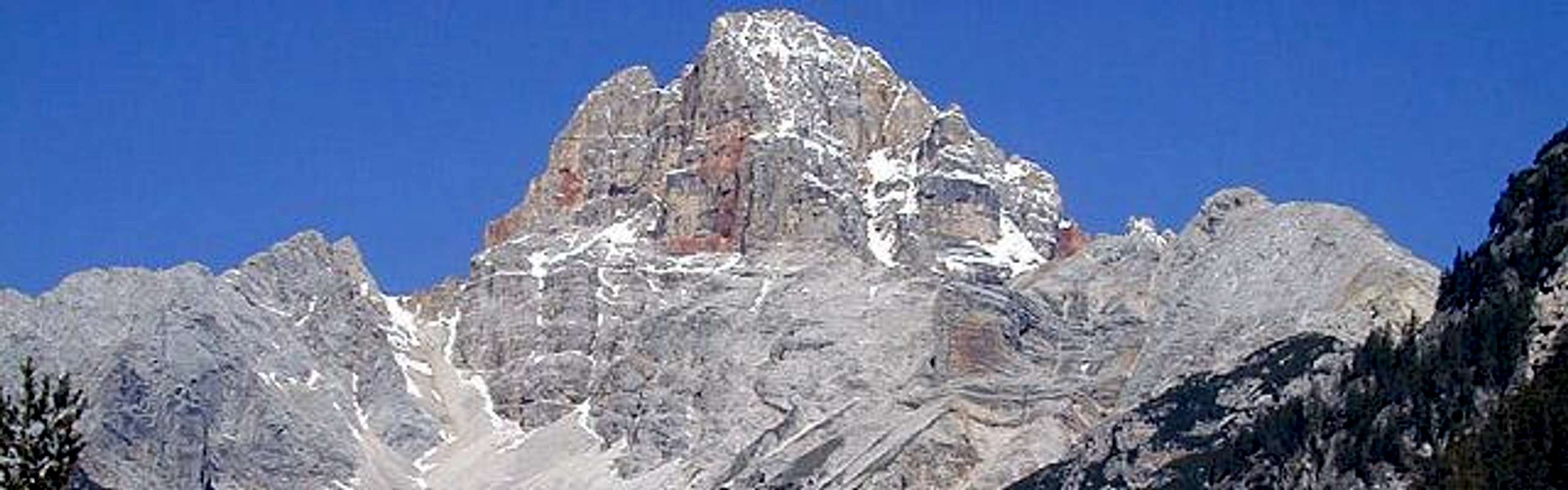
Croda Rossa (Hohe Gaisl) from east
Huts for all subgroups: Rifugio Fodara Vedla (1972 m) - Rifugio Sénnes (2122 m) - Rifugio Biella (2327 m) - Bivacco Da''Oglio (2253 m) and directly from the roads
Main summits :
Sénnes subgroup: Punte di Riodalato (Seitenbachspiten) (2499 m) - Cima Cadin di Sènnes (Senneskarspitze) (2659 m) - Piccola Croda del Becco (Kleine Seekofel) (2762 m) - Croda del Becco (Seekofel) (2810 m)
Signore subgroup: Torre del Signore (Herrsteinturm) (2395 m) - Sasso del Signore (Grosser Herrstein) (2447 m)
Croda Rossa subgroup: Rémeda Rossa (Rote Wand) (2605 m) Croda Rossa d'Ampezzo (Hohe Gaisl) (3146 m)
 |
 |
Col Becchei
 |
the Becchei subgroup is boundered and divided from Croda Rossa group, on its NE side, by the Valsalata It really belongs to Cortina Dolomites and has a bulwark structure on whose S side (Spalto Col Becchei) yellow vertical and overhanging walls call extreme rock climbers Main summits : Taè (2511 m) - Taburlo (2261 m) - Croda Camin (2610 m) - Castello di Banedalsé (2400 m) |
Tofane
Tofane group is the most alpinistic area with its big walls on Falzarego road side.
Western boundary of the basin: 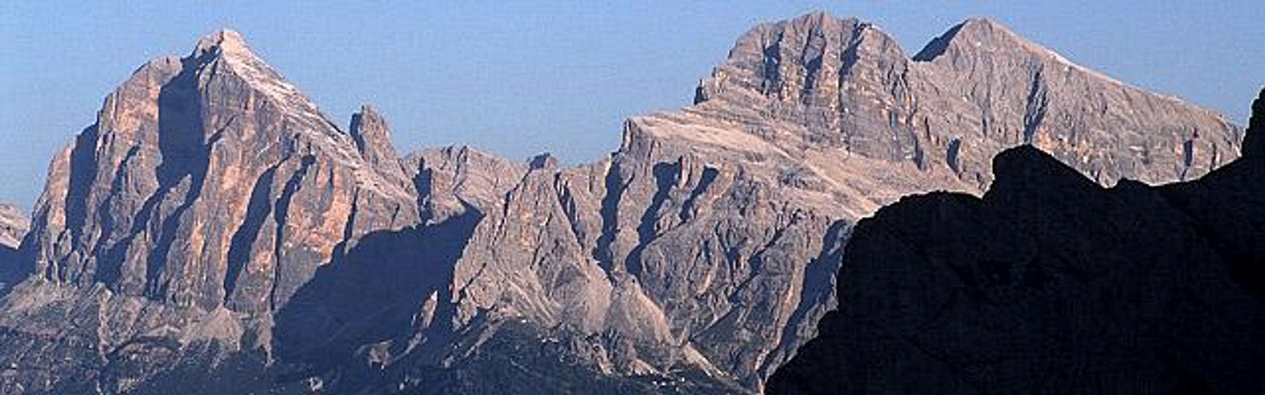
Tofane from east
Huts for all summits: Rifugio General Cantore (2542 m) - Rifugio Giussani (2561 m) - Rifugio Dibona (2083 m) - Rifugio Pomedes (2303 m) ... directly from the road of Falzarego pass
Main summits : Castelletto (2656 m) - Tofana di Rozes (3225 m) - Tofana di Mezzo (3244 m) - Punta Giovannina (2936 m) - Tofana di Dentro (3238 m) - Punta Anna (2731 m) - Torrioni Pomédes (2850 m) - Col Rosà (2156 m)
... hiking in Tofane range
 |
 |
 |
 |
 |
Averau - Nuvolau
Averau-Nuvolau, in the south-western side of the basin, is the most frequented area, in winter and summer, small but amusing summits
5 torri from west
Nuvolau group from east
Huts for all summits: Rifugio 5 Torri (2137 m) - Rifugio Scoiattoli (2230 m) - Rifugio Nuvolau (2574 m) ... directly from the roads of passo Giau and passo Falzarego
Main summits : Monte Gusela (2595 m) - Averau (2647 m) - Cinque Torri (2361 m)
Croda da Lago - Formin - Cernera
Croda da Lago-Formin-Cernera
in the southers side of the basin: 2 different, parallel ridges with medium drop walls.
Very fine easy hiking, but summits are only for climbers except for Lastoni di Formin wich is a big bulwark in the western base of the whole group (easy paths from east - walls from west)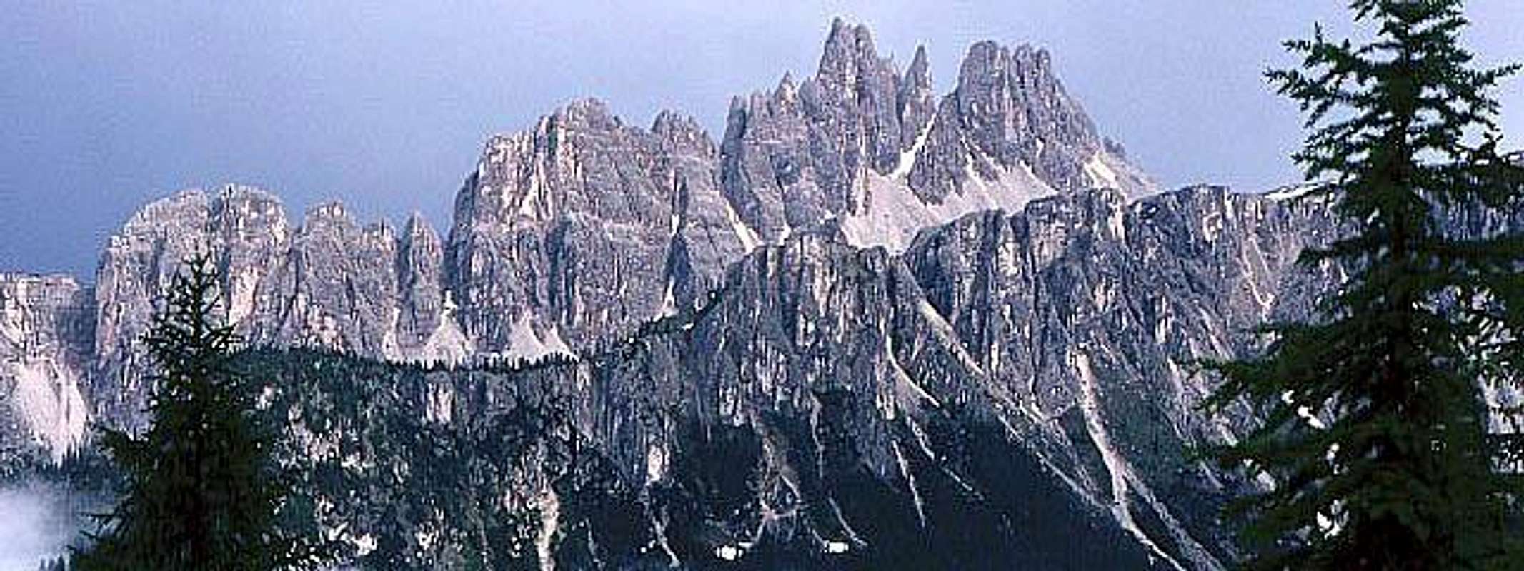
Croda da Lago from north west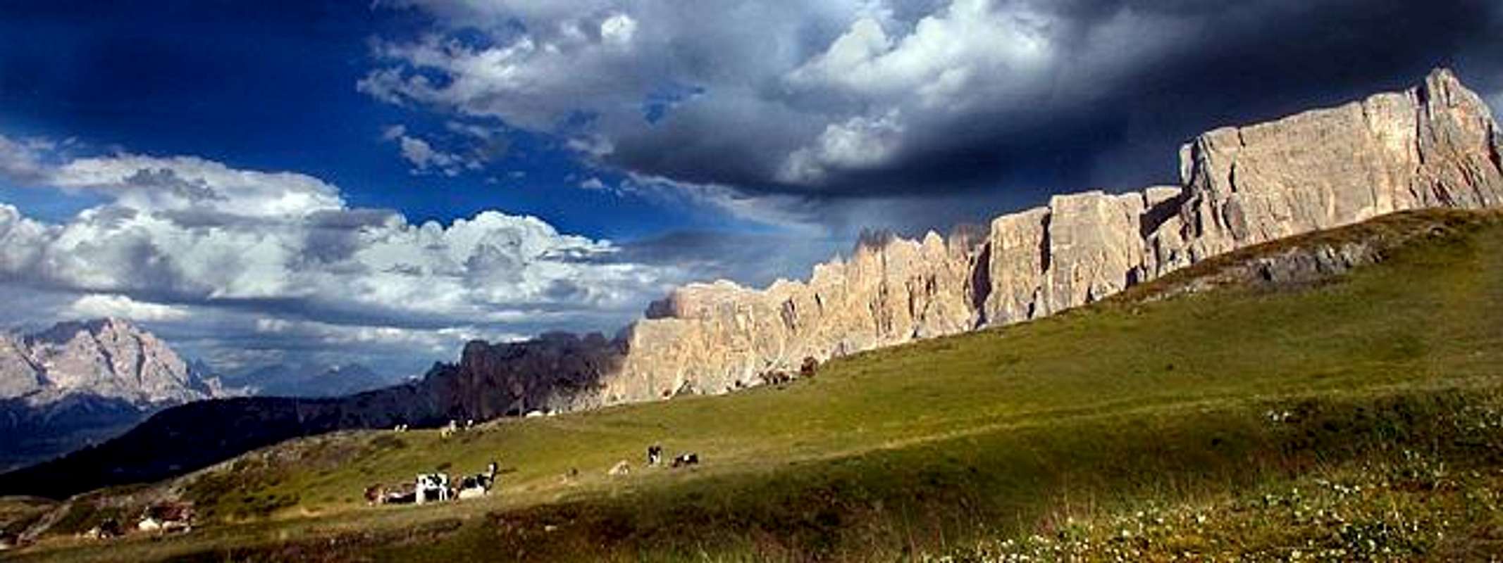
Lastoni di Formin
Huts for all summits: Rifugio Palmieri (2046 m) - ... directly from the road of passo Giau
Main summits : Becco di Mezzodì (2603 m) - Cima d'Ambrizzola (2715 m) - Croda da Lago (2701 m) - Cima Cason di Formin (2376 m) - Lastoni di Formin (2657 m) - Monte Cernera (2657 m)
Croda da Lago - mountain page
Hiking round Cortina ....
 |
 |
 |
 |
 |