
-
 75514 Hits
-
 84.26% Score
-
 18 Votes
|
|
Mountain/Rock |
|---|---|
|
|
48.13761°N / 120.80383°W |
|
|
Hiking, Mountaineering, Trad Climbing, Scrambling, Skiing |
|
|
Spring, Summer, Fall, Winter |
|
|
9082 ft / 2768 m |
|
|
Under New Ownership
This page was originally made by Bob Bolton. He has graciously allowed me to adopt this page and I would like to give him credit for some of the text written below.
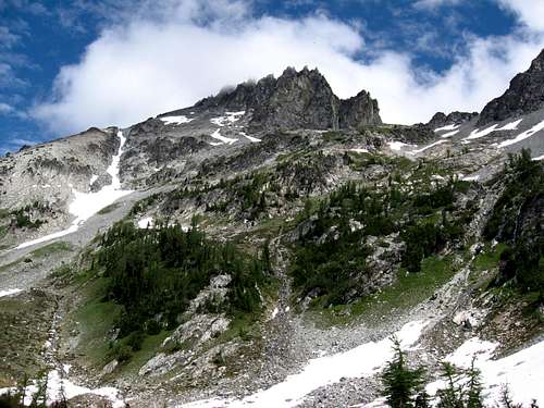
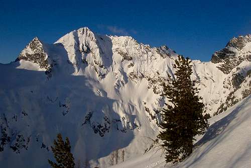 NE face of Mount Maude in winter
Overview
Mt. Maude is one of the three 9,000 foot peaks that comprise the spectacular headwaters cirque of the Entiat River, one of the major drainages on the east side of the Cascade crest and a tributary of the Columbia River. The other two 9ers are Seven Fingered Jack (9,100 feet) and Mt. Fernow (9,249 feet). Fernow is the 3rd highest non-volcanic summit in the Cascade Range, after nearby Bonanza Peak and Mt. Stuart, all three of which are in Chelan County. There are two main approaches to Mount Maude. The first, and one most used is from the west via the Chiwawa River Road to the Phelps Creek Trailhead and the Leroy Creek route. The other is from the east via the Entiat River Trail and Ice Creek Route. The western approach is much shorter and can be done over a typical weekend whereas it is a several day trip from the east. The standard south route of the peak is a fun walk-up or easy scramble with excellent views of the North Cascades.
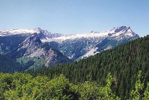
 Mount Maude with fresh September snow
Getting There
West Side Approach: Phelps Creek Trailhead - From Seattle head north on I-5 to Everett and follow US Highway 2 to the Coles Corner Junction with WA Highway 207. Follow Highway 207 until it crosses the Wenatchee River. Just past the bridge head north onto Road 62 towards Fish Lake. Follow Road 62 past the Grouse Creek Campground and continue onto Road 6200 as it parallels the Chiwawa River. This is a long rough road (just over 20 miles) that ends at the Trinity Gate where the Buck Creek Trail starts (elevation 2,900 feet). For the Phelps Creek Trail turn right onto FS 6211 at a signed junction just before reaching Trinity and switchback a couple times up the hill reaching the end of the road at 3,500 feet elevation which is one of the highest trailheads in the Glacier Peak Wilderness.
East Side Approach: Entiat River Trailhead - From Wenatchee, drive north on the highway west of the Columbia River (ALT Highway 97) 20 miles to the town of Entiat. Just south of town, turn west on the Entiat River road and follow it for 38 miles to its end at the Cottonwood Campground with an elevation of 3,140 feet. This long road is paved most of the way and easily driven in typical passenger cars. Note that the road turns into NF Road 51 and NF Road 5100.
 Buck Mountain from the Phelps Creek Trailhead Buck Mountain from the Phelps Creek Trailhead |
Approaches
Phelps Creek/Leroy Basin Route - From the trailhead, hike the Phelps Creek Trail for 3.5 miles to where it crosses Leroy Creek at 4,120 feet. Cross the creek either on a large tree or by rock hopping (difficult in early season) and locate the well-worn climber's path up the north side of the creek. The path leads steeply before leveling off to reach the upper Leroy Creek Basin. There is a large meadow at 6,100 feet that offers good camping and water.
Entiat River/Ice Lakes Route - From the trailhead parking area, begin hiking up the Entiat River Trail and continue on the trail to Ice Lakes. Fantastic camping can be found at both the lower and upper lake. Unfortunately the bridge over the Entiat River is located a little north of the Ice Creek valley meaning you must backtrack a little if you want to stay on the trail and utilize the bridge (recommended).
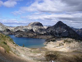
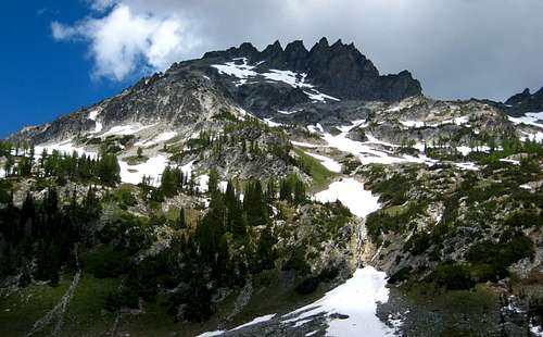 View from Leroy Basin View from Leroy Basin |
 Upper Ice Lakes Upper Ice Lakes |
Route Options
| Name | Photo | Rating | Brief Description |
| South Slopes |
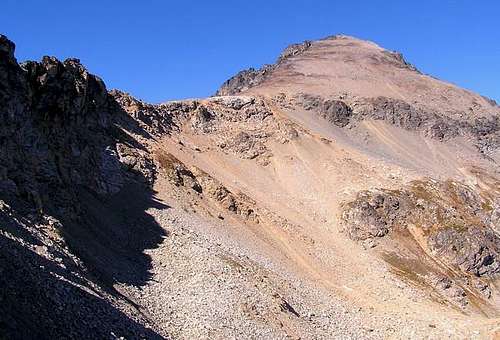 |
Class 2 | This is the easiest route on Maude. From the meadows at 6,100 feet in Leroy Basin, follow the trail southward to the 6840 foot saddle SW of Maude. Leave the trail and hike east up the broad ridge and meet the south ridge of Maude at 7,700 feet and follow that over easy terrain to the summit. Also easily done from Ice Lakes. |
| West Gully |
 |
Class 3 | "Hike south to 6450 where trail crosses the south fork of Leroy Creek, then scramble east-southeast up the gully to the ridge near 8000, then hike up the rest of the south slope." - John Gilbert This route has some fairly sustained Class 3 and is best avoided when wet by scrambling the broken rib just south of the gully. |
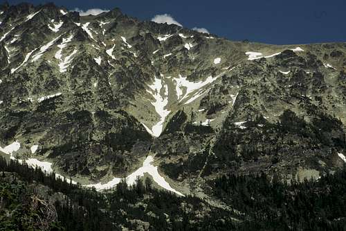
| North Face |
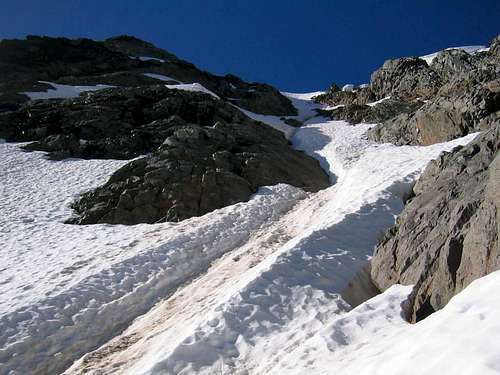 |
Class 3 Steep Snow/Ice | Best approached by heading over the 7FJ and Maude col and traversing southeast on loose Class 3 terrain until reaching the north face couloir. Then follow the 40-55 degree snow with a possibility of hard alpine ice near the top, where the face is steepest, and finish on easy talus 100 more feet to the summit. |
| 7FJ/Maude Combo |
 |
Class 3 | Ascend 7FJ via the standard SW slopes (or any other route). Traverse SE to the flat area at 7800 feet just below the connecting col and traverse the west face of Maude passing over numerous small Class 3 ribs and gullies. Reach the large west gully and finish Maude via the West Gully Route. Descend the standard South Ridge back to Leroy Basin. |
Map
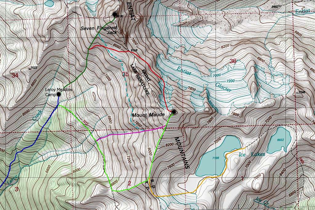
DARK BLUE: Leroy Basin Approach - Class 1
LIGHT GREEN: Mount Maude South Slopes Standard Route - Class 2
DARK GREEN: 7FJ Southwest Ridge Standard Route - Class 3
PURPLE: Mount Maude West Gully - Class 3
ORANGE: Mount Maude South Slopes via Ice Lakes - Class 2
RED: Mount Maude North Face - Class 3 & Steep Snow
DASHED LIGHT BLUE: 7FJ to Maude Combination - Class 3
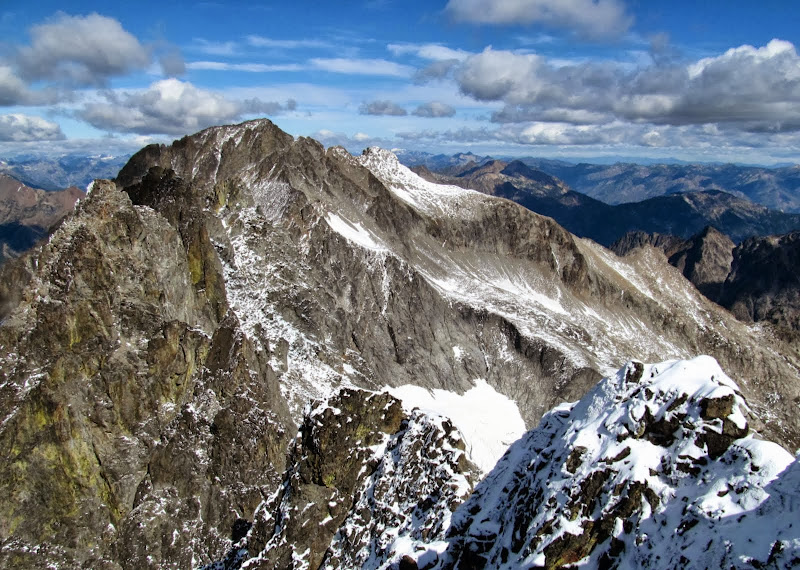
Summit View
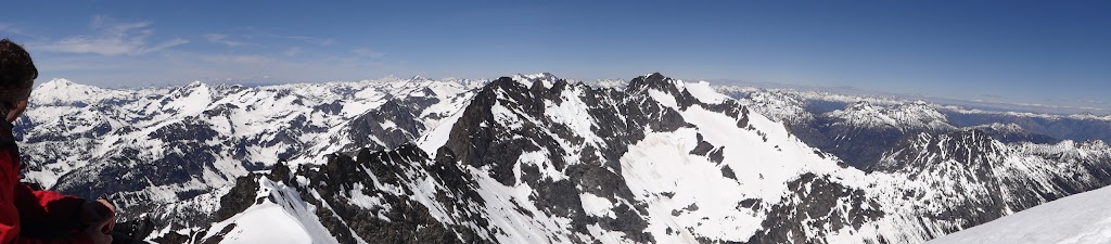 Mount Maude summit view in spring
 Maude summit view in fall
Camping/Red Tape
No red tape! This area lies within the Glacier Peak Wilderness therefore LNT is very important. The Phelps Creek Trailhead luckily doesn't require a NW Forest Pass (although none of the trailheads in WA actually require one but that's a different argument). The best camping is in the meadow near treeline in Leroy Basin but camping can also be found near the junction of Leroy Creek and Phelps Creek if you aren't interested in hauling all your camping gear up the steep Leroy Creek Trail.
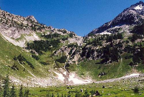 The large meadow in Leroy Basin
External Links
Excellent Report of a ski on the north face