
|
|
Mountain/Rock |
|---|---|
|
|
39.39700°N / 106.1°W |
|
|
Winter |
|
|
14265 ft / 4348 m |
|
|
<border="3">
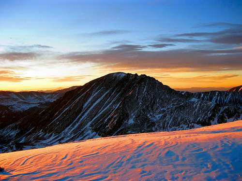
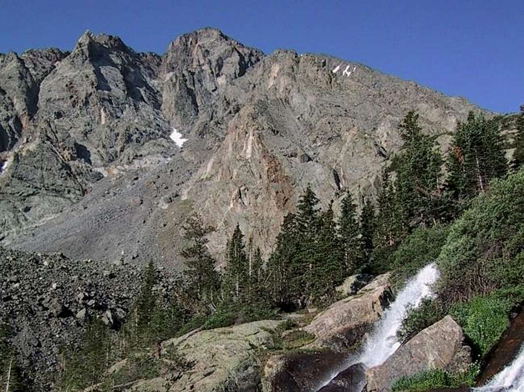
Quandary Peak as seen from Hoosier Ridge
by SP member Colonelpyat
<border="3">
https://www.summitpost.org/images/medium/781873.JPG
QUANDARY PEAK OVERVIEW
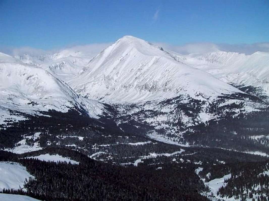
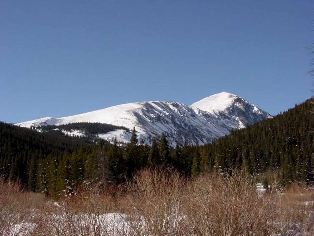
Quandary Peak is the highpoint of Colorado's Tenmile Range, an aesthetically-pleasing and rugged chain of peaks stretching south from Frisco to the Continental Divide. Easy year-around road access, a class 1 standard route, and panoramic views from the summit ensure that you'll rarely find solitude on Quandary's summit.
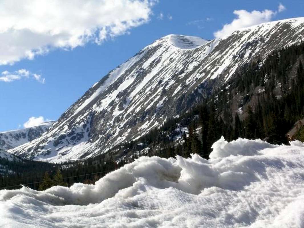
Climbing and skiing routes here options are plentiful on this complex, monolithic peak. Quandary's easiest route is the East Ridge, a walk-up and excellent introductory hike for the first time fourteener seeker. The broad, leeward slopes of which also provide many an introduction to beginner backcountry skiing.
More adventuresome scramblers will certainly enjoy a jaunt up the West Ridge, a class 3 climb with perplexing route finding challenges. The West Ridge route is often linked up with a short side-trip to the summit of Fletcher Mountain. For logistical reasons, West Ridge climbers often descend the class 2 "Cristo Couloir", a steep, direct line from Quandary's summit to the Blue Lakes trailhead. Under suitable conditions, the Cristo Couloir makes an excellent glissade or expert ski descent.
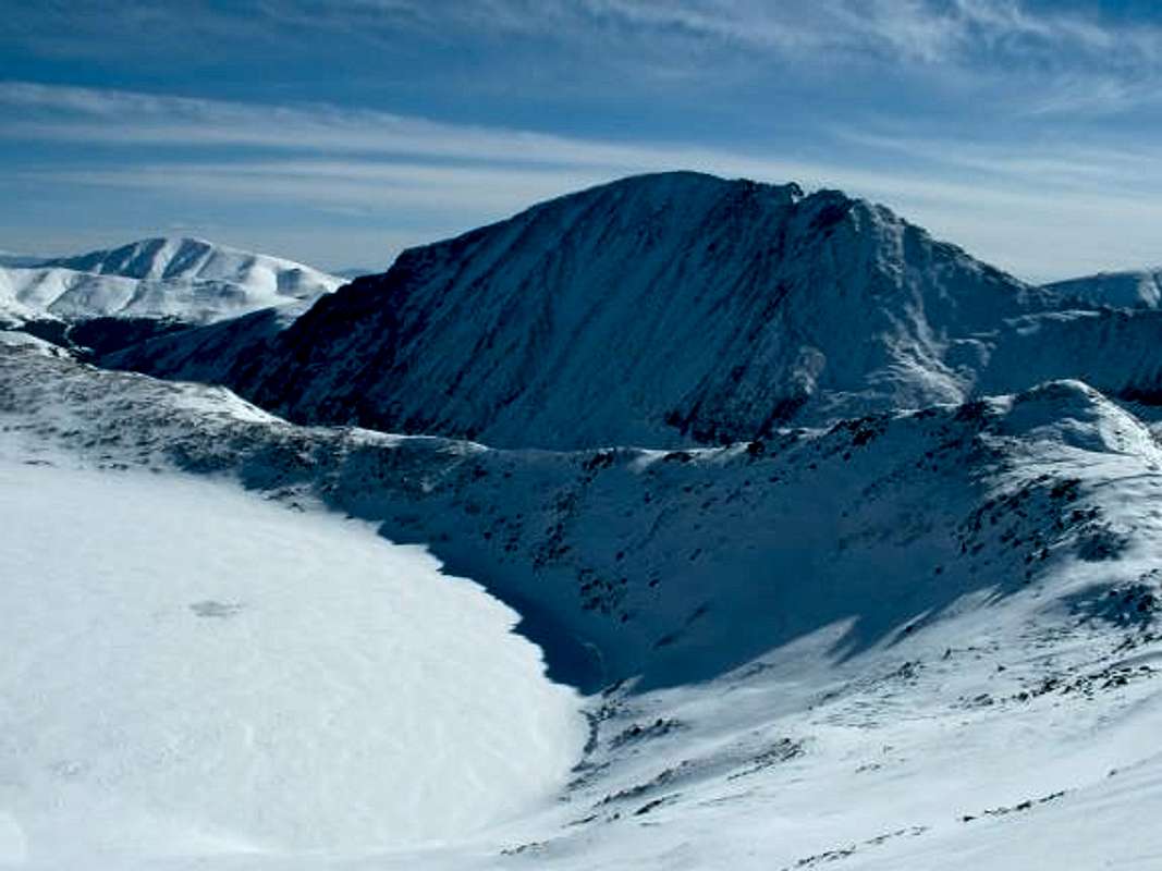
Quandary's north face boast even more difficult, if obscure, climbs. Here is an excellent description for the "Inwood Arete" route up the northeast face boats four pitches of 5.0-5.4 slabbing, followed by some exciting class 3 scrambling. A class 4 mixed route, "Quandary Couloir II", contains "Quandary's finest snow climb" (ref: Gerry Roach), with snow up to 45° and the possibility of ice pitches.
Recent image additions to Quandary Peak.
 |
 |
 |
 |
 |
GETTING THERE - YEAR ROUND ACCESS
Access to this peak is good year round, due to its proximity to plowed Highway 9. Crisco Couloir and Quandary Couloir II provide sporting snow climbs. All of the routes, with the exception for the East Ridge Route, on Quandary are susceptible to avalanches during times of snow. Before going out and climbing any of these routes in the winter please visit the Colorado Avalanche Information Center here for the most up to date information. Please observe the snow conditons before climbing these routes during the avalanche season.
The East Ridge Route is a safer alternative to the other routes when snow conditions are not good.
When one thinks of Quandary the vision of and easy fourteener comes to mind. Well, its had its share tragedies in the past as posted on this site. Be careful, and have fun.
 |
 |
 |
 |
 |
Three trailheads access Quandary's many routes; all are reached by Colorado Highway 9. From Denver, follow Interstate 70 west and take Highway 9 south from Frisco. The trailheads are approximately 8 miles south of the town of Breckenridge. From Fairplay and points south, follow Highway 9 north over Hoosier Pass (open year round). The trailheads are approximately 2 miles north of Hoosier Pass.
Access to the East Ridge (Quandary trail): From Highway 9, turn west onto Summit County 850, following the signs to "Blue Lakes". Take an immediate right (north) onto McCullough Gulch Road (Summit County 851) and drive 1000 feet to the main trailhead. There is another trailhead 1 mile up the road with a wood sign marked "Quandary Trail". Note:Finding the RIGHT trailhead for Quandary's East Slopes route (standard route) has been confusing over the years. With the addition of this sign in 2004. This should alleviate all concerns of where the actual trailhead is. An excellent map has been made by a fellow sp'er depicting all of the trailheads for the East Slopes Route, Here.
To access the West Ridge and Cristo Couloir: Simply follow Summit County 850 and park below Blue Lakes Dam in a large dirt lot.
Access to the north face routes is the same as for the standard route, but you must continue past the standard route trailhead until you reach a locked gate. Park here.
USGS 7.5' map = Breckenridge Colorado
 |
 |
 |
RED TAPE
Although pirvate property litters the area, there are no permits required, and no use, summit or parking fees. Colorado Highway 9 is open all year round. If you still have questions.
Dillon Ranger Distict
680 River Parkway, P.O. Box 620
Silverthorne, CO, 80498
Phone: 970-468-5400
AROUND QUANDARY
 |
 |
 |
| From Colo Hwy 9 | Blue Lakes road | From Mount Democrat |
 |
 |
 |
| From Pacific Peak | Inwood Arete | East Ridge Rt, (13000') |
CAMPING & LODGING
The trailhead area is surrounded by private property, but backcountry camping is likely permitted. Contact Clear Creek Ranger District of Arapaho National Forest ("Red Tape" section above) for permit information, if any.
External Links
- hoffmeyer.com
Steve has hundreds of digital images of Colorado's high peaks, including several great ones of Quandary Peak. - Morgan Brown's Fletcher Mtn./Quandary climb
September 2, 2000, Fletcher via northeast ridge, Quandary via West Ridge. - Quandary TR - August 3rd, 2003
- 2004 Rockies Winter Gathering
Alan and Jackie Ellis' website of their Quandary Peak climb during the Rockies Winter Gathering. - Breckenridge Mountain Cam: Horseshoe Bowl
A camera very near Quandary Peak. - Quandary Peak
- Quandary Peak TR
A trip report of a November ascent of Quandary along the East Ridge. - Quandary Peak (02/16/2004)
- 14ers.com - The Home of Colorado's Highest Peaks
Fourteener Photos, Route Descriptions, Forum, and more... - 1 hour and 45 minutes to the summit
rcorby2 - Oct 29, 2002 11:23 am - Hasn't voted
Untitled CommentThe correct ranger station covering Quandary Peak is the Dillon Ranger District. Their contact information is:
Dillon Ranger Distict
680 River Parkway, P.O. Box 620
Silverthorne, CO, 80498
Phone: 970-468-5400
I just spoke with them at this number to confirm this information is correct.
xyati - Aug 26, 2003 1:53 pm - Voted 10/10
Untitled CommentThe Inwood Aret is a seemingly forgotten rock climbing gem on Quandary's norwest ridge. One does not normally think technical rock climb when considering this peak, but there is a beautiful and rugged area on the "other side" of this peak. The route begins just east of a lake at the top of a series of waterfalls in McCullough Gulch. From there it's a ridge climb for about 1500 vertical feet. A direct 5.7 start, or a 5.4 slab start on the left leads you to a beautiful lower 5th class ridge. The climbing is mostly solid, but check for loose holds before you trust them. Use a rope unless you love wicked exposure on 5th class rock. After completeing the ridge, it's 3rd and 4th class to the summit ridge. People will give you strange looks if you are sporting your rack, rope and helmet because most of the summit teams just slogged up a long trail to catch the view and had no idea there was any "climbing" on this peak.
benhamiin - Aug 23, 2021 6:41 am - Hasn't voted
Red Tape ChangeHello, Parking at Quandary now requires a reservation or you are required to take the shuttle there from the Airport Rd parking area. The trail is getting more and more popular. Source: https://www.summitcountyco.gov/1446/Quandary