


-
 23557 Hits
-
 88.09% Score
-
 26 Votes
|
|
Mountain/Rock |
|---|---|
|
|
46.51350°N / 11.73750°E |
|
|
9829 ft / 2996 m |
|
|
Overview
 Pizes di Cin Dëic/ Fünffingerspitze / Punta delle Cinque Dita Pizes di Cin Dëic/ Fünffingerspitze / Punta delle Cinque Dita |
North of the peak the gigantic Langkofel is diveded by the Langkofelscharte from the Fünffingerspitze. To the south, the other big mountains of the Langkofel group are located: after the Fünffinger-Scharte the Grohmannspitze (3126 m), the Innerkoflerturm (3081 m) and the Zahnkofel (3001 m).
 |  |  |
There is no easy way up to the summit. Even on the regular route UIAA grade III+ climbing (YDS 5.4) and about 3 hours will be required to reach the summit from the Langkofelscharte. The common climbs of the Fünffingerspitze are very popular (for example, the famous traverse via the thumb or even the regular route). Most days there will be many parties climbing, remember that to avoid feeling frustrated in case of crowds. Crowding is aided by the easy mechanical lift up to the pass. Going early or late may be the best option for solitude.
Getting There
 Pizes di Cin Dëic/ Fünffingerspitze / Punta delle Cinque Dita
There are different villages below the Langkofel / Sassolungo Group: Ortisei / St. Ulrich, St. Christina and Selva di Gardena / Wolkenstein in Grödnertal / Val Gardena, Canazei and Campitello in Val di Fassa. Traveling to the Langkofel / Sassolungo Group most times means travelling to one of those villages. Grödnertal / Val Gardena and Val di Fassa are connected by the Sellajoch / Passo Sella. The common approch to the Langkofel / Sassolungo Group is done from Sellajoch / Passo Sella, which can be accessed by car or by public transportation from both sides.
Approach from S
- From the south (Lago di Garda, Trento, ...) take motorway A22.
- Leave it at Auer / Ora and follow SS48 through Val di Fassa to Campitello or Canazei.
Approach from N
- From the north (Germany, Austria, ...) take motorway A22 from Brenner / Brennero.
- Leave the motorway at Chiusa / Val Gardena and follow the road through Grödnertal / Val Gardena to St. Christina and Wolkenstein / Selva.
Approach from W
- From the west (Switzerland, Bodensee, ... ) take the road to Reschenpass / Passo Resia and travel SS38 through Vinschgau / Val Venosta to Meran / Merano and Bozen / Bolzano.
- Turn off onto SS241 east across Karerpass / Passo di Costalunga into Val di Fassa.
- At Vigo di Fassa take SS48 north to Canazei.
- Alternatively take the Brenner motorway A22 north from Bozen / Bolzano until you reach Klausen / Chiusa.
- Here turn off into Grödnertal / Val Gardena.
Approach from E
- From the east (Cortina d'Ampezzo, Sexten Dolomites, ... ) follow SS48 via Passo di Falzarego to Arabba.
- From Belluno (coming from Venezia or Friuli) you can reach Passo Pordoi using the Canale d'Agordo Valley until you reach Alleghe.
- A bit further north the road from Falzarego joins and leads you to Passo Pordoi.
- Cross the pass and turn onto SS242 to Sellajoch / Passo Sella.
For the most popular routes the base of the climb is directly behind the Demetz hut, just follow the crowds ...
Some of the routes on the N-side are starting at the Langkofelkar. Best approch for those is from the Langkofelkarhütte (Rif. Vicenza). This hut is reached from the Langkofelscharte in about 30 minutes on a very good (very crowded!) trail.
Routes
 Rapelling Fünffingerspitze
Be aware that the use of bolts isn't common at many of the classic routes of the Dolomites. The stances often are not bolted either! So bring a medium rack and some slings and for the more difficult routes even some pitons. Get an early start and bring a route topo. Unless the route follows a ridge, it can be quite easy to get lost, as Dolomite climbs often traverse in funny places or make diagonal traverses across vague rock.
 |  |  |  |
- Regular route
3+, 3 hours, some bolted stances, often very crowded, nevertheless a fantastic route! First ascent in L. Bernard, H. Wood, M. Barbaria and F. Fistli in 1891.
- N-face, 4+, 5 hours, a seldom done, classical climb which is using chimneys most time. First ascent by C. Klucker and L. Norman-Neruda in 1891.
- SW-ridge, 4, 4 hours from Fünffingerscharte, an other yery good route, very scenic, mostly done as descent from parties climbing the traverse of the Fünffingerspitze. This traverse is very recommended ! First ascent of the ridge by J. Boegle and M. Niedermaier in 1906.
- Zanardi/Landi, 6-, 3 hours, this route is using the S-ridge of the Ringfinger (ring finger). First ascent by V. Zanardi-Landi and G. Trevisanato in 1935.
- Diagonalriß, 5-, 4 hours, one of the big, classic climbs of the dolomites, done not so often but very recommended. First ascent by Kurt Kiene and Gabriel Haupt in 1912.
- Schmittkamin, 4+, 3 hours, the route of the first ascent, demanding, the routes is on a most times wet chimney. Take care of rockfall from the regular route.
- Daumenkante, 4-, 2 hours to the summit of the "Daumen" (thumb), 2 more hours to the main summit. This is the beginning of the famous traverse of the Fünffingerspitze, very popular and crowded but among the best climbs of this grade at the whole alps. There are bolted stances. First ascent by H. Huter, G. Jahn and D. Merlet in 1917.
First Ascent
 4th class terrain on the descent
The first ascent was done by Johann Santner and Robert Hans Schmitt in 1890 using the Schmittkamin route ("Schmitt chminey"), today rated UIAA 4+.
The "Diagonalriß" (UIAA 5+) was done by Kurt Kiene and Gabriel Haupt in 1912 and was one of the first "big" dolomite routes.
Red Tape
No red tape. Fee for the chair-lift to the Langkofelscharte, this can be avoided if you hike up ...Accommodation
Val di FassaGrödner Tal / Val Gardena
- www.valgardena.it
www.groeden.info
- St. Ulrich / Ortisei
- St. Christina / Santa Christina
- Wolkenstein / Selva di Val Gardena
You can find a number of campgrounds in Val di Fassa:
- Marmolada
via Pareda
Canazei
Tel.: +39 0462.601660
Fax: +39 0462.601722 - Catinaccio
via Avisio 15
Pozza di Fassa
Tel.: +39 0462.763305
Fax: +39 0462.763501 - Soal
via Dolomiti 32
Pera di Fassa
Tel.: +39 0462.764519
Fax: +39 0462.764609 - Vidor
Località Vidor
Pozza di Fassa
Tel.: +39 0462.763247
Fax: +39 0462.764780
Weather Conditions
Maps & Books
Books:There is one very recommendable book, Sella - Langkofel Extrem, which the original submitter kletterwebbi used to help put up this page. It gives an overview over hundreds of climbing routes in the area. One third of the book deal with the Langkofel Group.
- Climbing
- Sella - Langkofel Extrem
Richard Goedecke
Alpenvereinsführer
Rother Verlag
ISBN: 3-7633-1315-X
- Val di Fassa - Guida alle arrampicate sportive
Renato Bernard/Gabriele Bonnano
Dora' Publisher, Bolzano
- Sella e Sassolungo
Luca Visentini
Ed. Athesia, Bolzano/Bozen. (both in Italian and German languages)
- Classic Dolomite Climbs: 102 High Quality Rock-Climbs Between the Uiaa Grades III and VII (also available on CD)
Anette Kohler, Norbert Memmel
Mountaineers Books
ISBN: 0 8988 6693 6
- Sella - Langkofel Extrem
- Vie Ferrate
- Klettersteige Dolomiten
H. Höfler, P. Werner
Rother Verlag
ISBN: 3 7633 3096 8
- Hülslers Klettersteigführer
E.E.Hülsler
Bruckmann Verlag
ISBN: 3 7654 4161 9
- Klettersteige Dolomiten
- Hiking and Trecking
- Höhenwege in den Dolomiten
H. Dumler
Bruckmann Verlag
ISBN: 3 7654 3860 X
- Dolomiten
P. Fleischmann
Kompass Verlag
ISBN: 3 8705 1409 4
- Dolomiten 3
F. Hauleitner
Rother Verlag
ISBN: 3-7633-4060-2
- Dolomiten 4
F. Hauleitner
Rother Verlag
ISBN: 3-7633-4061-0
- Höhenwege in den Dolomiten
Maps:
I have been using the maps by Kompass Verlag. There are several which differ in scale:
- Val di Fassa, Marmolada, Gruppo di Sella
Kompass Map WK 686
ISBN: 3 8549 1768 6
Scale: 1:25000
- Sellagruppe / Gruppo di Sella
Kompass Map WK 59
ISBN: 3 8549 1066 5
Scale: 1:50000
- Val Gardena & Alpe di Siusi
Tabacco Map 05
In Memory of Stefan "kletterwebbi" Weber
 A note from the SP staff
Stefan Weber, the member we all used to know from his climbing pseudonym kletterwebbi, died on May 28th 2004 in southern France at the age of 37.
Stefan joined SP early on in 2002 and contributed a number of excellent pages and routes to this site. He was an accomplished climber excelling in difficult alpine and technical routes. The Dolomites, especially the area around Gröden / Val Gardena were special to him, as it was his old ancestral home.
kletterwebbi was always willing to share his knowledge and experience with other climbers, mainly here on SP, but also on other sites. He contributed his IT expertise as webmaster of his local section of the German Alpine Club, where he also engaged in leading trips for fellow members. Besides his climbing and mountaineering activities he was a musician, a composer of contemporary music. Stefan will be greatly missed by us all.
This page will be kept in honor of kletterwebbi, one of SP's most talented, knowledgeable members, and without a doubt, one of our greatest fellow mountaineers.
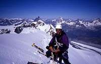
The picture was taken on the summit ridge of Lyskamm.