
|
|
Mountain/Rock |
|---|---|
|
|
46.88531°N / 10.86738°E |
|
|
Mountaineering, Skiing |
|
|
Spring, Summer, Fall, Winter |
|
|
12362 ft / 3768 m |
|
|
Overview
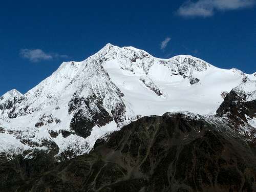
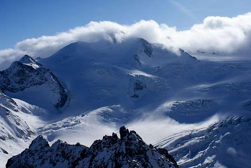 Wildspitze North Face Wildspitze North Face |
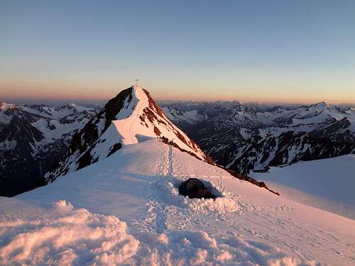 Wildspitze Alpenglow Wildspitze Alpenglow |
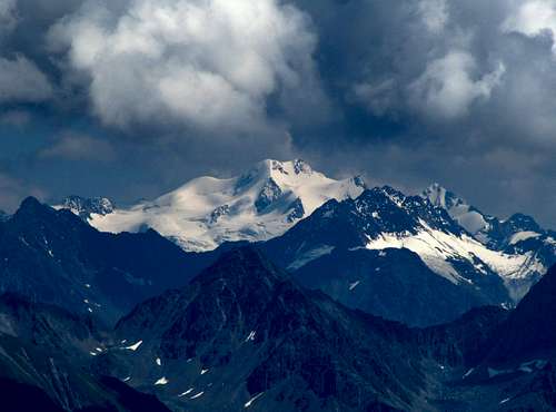 The White Queen The White Queen |
Wildspitze is the second highest mountain in Austria (after Grossglockner) and is the second highest mountain in the Provence of Tirol. It is the highest mountain in North Tirol. Wildspitze is one of the major peaks in the Alps when it comes to prominence. It ranks 4th in the Alps after Mont Blanc, Finsteraarhorn and Grossglockner with a prominence of 2261 meters. Wildspitze is also referred to as Oetztaler Wildspitze, because there is a second Wildspitze nearby: The Stubaier Wildspitze. Still, when the name Wildspitze is used, most people are talking about the Oetztaler Wildspitze. The nearest higher mountain of Wildspitze is Ortler (3905m), 48 kilometres to the South in Italy.
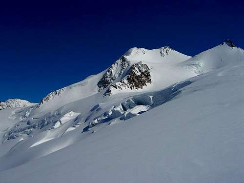
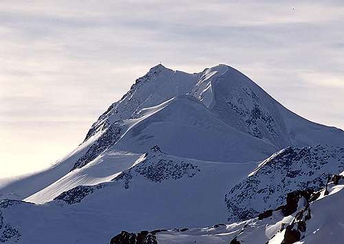
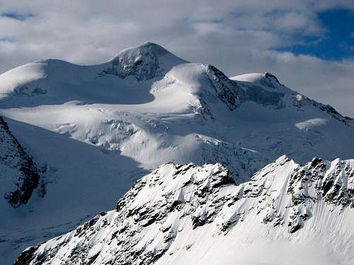
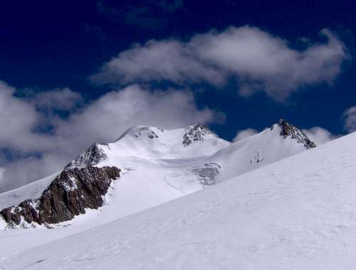
Wildspitze has two distinct summits, the north and south summit. The south summit is a 3768 meters high, rocky summit that contains the summit cross. The North summit consists of a big snowcap that is melting due to global warming. The North summit used to be the highest point of Wildspitze, but due to global warming the northern summit has been losing height dramatically ("Bergsteiger" edition 1/02, page15). Most guides and maps used to give 3772 meters as the altitude of Wildspitze, but the latest data give 3765 meters for the Northern summit and 3768m for the southern summit. Due to global warming the southern summit is now Wildpsitze’s highpoint with a altitude of 3768 meters (other sources say 3770m though). Because the south summit consists of rocks, the altitude is not likely to change anytime soon again.
 Wildspitze from the NW Wildspitze from the NW |
 Wildspitze from the E-SE Wildspitze from the E-SE |
 Wildspitze from the NE Wildspitze from the NE |
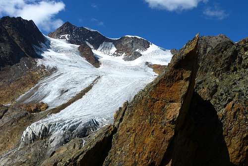
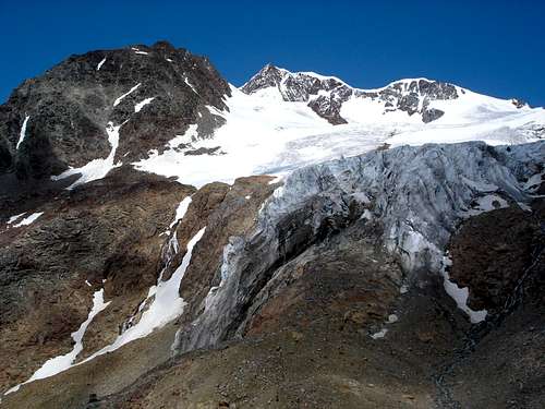
Wildspitze lies about 12 km north-east of the Main Ridge of the Alps. It is situated in the Weisskamm ridge (WhiteCrest) ,part of the Oetztal Alps , that reaches to the northeast towards Sölden. Wildspitze’s south and east Face rise above the Venter valley a side valley of the Ötztal valley. Its western and northern faces form the ending ofthe Pitztal valley. Wildspitze is heavily glaciated. To the north the Taschachferner glacier flows into the Pitztal, to the southwest flows the Mitterkar glacier and to the east flows the Rofenkarferner into the Venter valley.
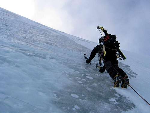
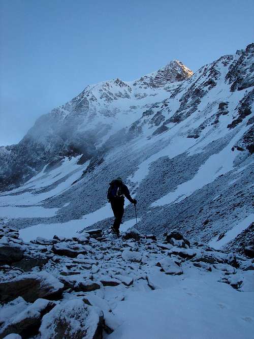
For climbing Wildspitze, experience with climbing glaciated mountains is obligated. Ice axe, crampons, harness and rope are essential. The help of a guide is essential for non-experienced climbers. The normal route on Wildspitze is graded PD- and therefore not too difficult, but when the snow is icy, the difficulties might increase substantially. Wildspitze is normally climbed from the mountain huts surrounding the mountain, like the Breslauer Hut, the Braunschweiger Hut and the Vernagthutte. Climbing Wildspitze requires two days in this case. There is a shorter alternative due to the presence of the Pitzaler Glacier cableway system. A cableway gets you up to an elevation above 3000 meters. As a result Wildspitze can be climbed in a single day using these facilities.
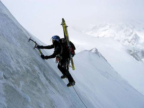 Climbing the North Face Climbing the North Face |
 the North Wall the North Wall |
 The N-Face The N-Face |
Besides the normal routes on Wildspitze, there are more possibilities. The North Face for example, is a true classic. This 250 meters long, 55 degrees steep route is climbed often (when in condition). Other ,more difficult routes compared to the Normal route areThe Southeast Ridge (including Otztaler Urkund), the Northeast ridge (Jubilaeumsgrat) and the Northwest Face.
In 1933, Wildspitze received a summit cross . It was broken down into individual parts, transported to the mountain and assembled on top of Wildspitze . After 77 years it was replaced by mountain guides from Vent . In 2010, the assembly of the new Cross took place with the help of a helicopter . After cleaning and renovating, the old summit cross was placed at the Rofenache between the villages of Vent and Rofenhöfe. It is the only place in this valley from which you can see the Wildspitze.
 Wildspitze N-Face Wildspitze N-Face |
 Wildspitze SE-Face Wildspitze SE-Face |
 Summit View! Summit View! |
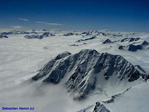
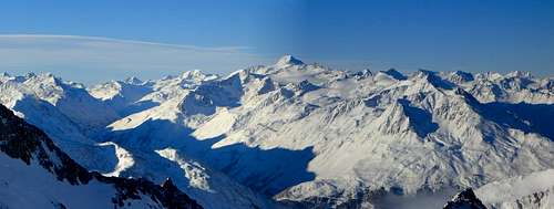
Standing on top of Wildspitze is a fantastic feeling.Because it is one of the most prominent mountains in the entire Alps you could say the view is only limited by the curvature of the earth. On clear days you can see as far as Grossglockner in the east and Finsteraarhorn in the west. To the SW Weisskugel, the 3rd highest mountain in Austria, dominates the view. To the south you can see the Otztal Alps with Similaun , Hintere Schwarze and many other summits.
Wildspitze was first attempted to climb in 1847 by Hermann and Adolf Schlagintweit, who reached ‘’point 3552m’’ on the north east ridge of the mountain. The first successful ascent was made in 1848 by Leander Klotz and an unnamed local farmer.
Routes
This section gives a short description of four of the main routes on Wildspitze. The other routes asre described under section V. All sections provide a link to the route pages on SP (when available).
I Normal Route
On the road to Mitterkarjoch
The route from the Breslauer Hut over the Mitterkarjoch to the summit of Wildspitze is considered the normal route on the mountain. The Breslauer Hut can be reached from Vent. From Vent it is possible to take a small chairlift to the Stablein Alm. This shortens the ascent by a fair amount. See the section ''Cableway Vent - Stablein'' for more information about the chairlift including operating hours. For more information about the Breslauer Hut see the Mountain Huts section.
The normal Route is graded PD- and is considered ''fairly easy''. Still, full glacial equipment is needed for Climbing Wildspitze. Also the part below the Mitterkarjoch involves some light climbing. The normal route is more and more often combined with the Rofenkarferner route. This route can be used down to make a traverse of Wildspitze which includes the crossing from the Southern summit over to the Northern summit and further down. If you don't have experience with alpine climbing it is strongly advised to hire a guide. See the section below for weblinks.
The normal route from the Breslauer Hut has a very good route page here on SP by member rgg. Click here to go the route page for a detailed description of the Normal Route.
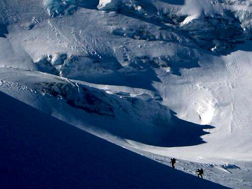
II North Wall
Getting near the top
The North Wall is a famous alpine ice climb offering 250 meters of ice or snow depending on conditions. The North Wall is 50/55 degrees steep. Because of the vicinity of the Pitztaler Glacier cableway system the route is easy accessible. The socalled Pitztal Express includes climbing the Taschachwand (55 deg., 600 m), the Petersenspitze (50 deg., 200 m), the Hintere Brochkogel (55 deg., 250 m) and the North Wall of the Wildspitze (50/55 deg., 250 m, an optional 4th climb). The North Wall route is dealing with the consequences of global warming just like many other (North wall) routes. The route usually is in best in condition in the winter months and springtime. The route is graded AD (III). See the route page by mvs for more information.
III from Pitztaler Glacier cableway
Approach from North
The Pitztaler Glacier cableway system offers new possibilities for climbing Wildspitze. From the top station of the Glacier Express mountain station Wildspitze can be climbed in a single day. You can reach the summit in approximately 3 hours. This route is very popular for ski mountaineering as well. The route leads over the immense Taschachferner Glacier towards Wildspitze. The route has no real technical difficulties and is graded PD-. For more information about the operating hours of the Pitztaler Glacier cableway system see the section ''Pitztaler Glacier cableway'' below. Also see the route page here on SP by member Huberschwiller.
IV Rofenkarferner Route
Rofenkarferner Route
The well-known German mountain magazine Alpin.de says it best: The Rofenkarferner route to the summit of Wildzpitze is often referred to as the ‘new normal route’. Although it should be said that the real normal route still is the Mitterkarferner Route from the Breslauer Hut, the Rofenkarferner Route is increasingly becoming more popular.
Main reason for this is the difficulty of the climb. The route offers a fairly easy ascent to the summit of Wildspitze. The route is graded PD- being mostly a walk over glaciated terrain. Under the north summit the slope is steepest with an angle of about 30/35 degrees.
Apart from the fact more and more people head up the Rofenkarferner Route from the Breslauer Hut, it is also great to use the route for a round trip. Go up the normal route from Breslauer Hut over the Mitterkarferner to the summit. Traverse the ridge from the real summit to the north summit. (From the north summit go further down along the Rofenkarferner Route until you get back at the Breslauer Hut again. This route makes for a great day trip.
See the route page here on SP for more information.
V Other Routes
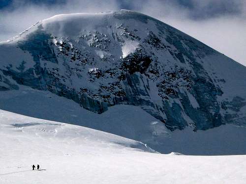
Climbers approaching the N-wall
All difficulties are based on regular conditions (experienced mountaineer, good weather, no icy snow!) as given in the guide. Note that when conditions are sub-optimal the difficulties will increase substantially.
-Starting from the Braunschweiger Huette via the Mitterkarjoch: 5 h (PD-).
-Starting from the Taschachhaus via the Mitterkarjoch: 3 1/2 h (PD-).
-Starting from the Vernagthaus via Bochkogeljoch and Mitterkarjoch (PD-)
-Northeast ridge (Jubilaeumsgrat, partly very steep; AD- (UIAA II))
-Southeast ridge (via the Oetztaler Urkund, AD, UIAA III)
-Northwest ridge ( 4:30h, 40 degrees, PD)
-Northwest face (45 - 50 degrees, 250 m)
A traverse from the southern to the northern summit is possible within 10 - 60 min (depending on conditions)
Getting There
I Oetztal - Vent
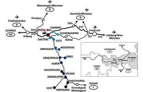
How to get there Map: Vent
From Vorarlberg towards Tirol over the Arlbergpass or through the Arlbergtunnel (S 16) - Landeck - Autobahn A 12 Innsbruck - Exit Ötztal after Roppener Tunnel - B 186 - Continue to Vent (53 km)
From the North:
- Bad Tölz - Achenpaß - B 181 - Jenbach - A 12 Innsbruck to Bregenz - Exit Ötztal - B 186 - Continue to Vent (53 km)
- Pfronten - Reutte - Fernpass - Imst - A 12 Richtung Innsbruck - Exit Ötztal after Roppener Tunnel - B 186 - Continue to Vent (53 km)
- Garmisch Partenkirchen - Ehrwald - Lermoss - Fernpass- Imst - A 12 towards Innsbruck - Exit Ötztal after Roppener Tunnel - B 186 - Continue to Vent (53 km)
- Garmisch Partenkirchen - Mittenwald - Scharnitz - Seefeld in Tirol - Telfs - A 12 towards Bregenz - Exit Ötztal - B186 - Continue to Vent (53 km)
From the East:
From München or Salzburg on the A 93 until after Kufstein, then on the A 12 towards Bregenz, over Innsbruck until Exit Ötztal - B 186 - Continue to Vent (53 km)
From the South:
From Bozen towards Brenner (Toll) - Brenner Autobahn über towards Innsbruck - from Innsbruck on the A 12 towards Bregenz until Exit Ötztal - B 186 - Continue to Vent (53 km)
II Pitztal - Mittelberg
From the North
coming from München (ca. 160 km)
Garmisch - Fernpass - Imst - Pitztal
or: Salzburg - Lofer - Wörgl - Imst - Pitztal
Garmisch - Fernpass - Imst - Pitztal
or: Salzburg - Lofer - Wörgl - Imst - Pitztal
coming from Stuttgart (ca. 280 km)
Kempten - Memmingen - Füssen - Reutte - Imst - Pitztal
Kempten - Memmingen - Füssen - Reutte - Imst - Pitztal
From the West
Arlberg - Inntalautobahn A12 towards Innsbruck - Ausfahrt Imst - Pitztal
From the South
Brennerautobahn - Innsbruck - Inntalautobahn A12 towards Bregenz - Imst - Pitztal
From the East
Felbertauern, St. Johann, Wörgl, Inntalautobahn A12 towards Bregenz - Imst - Pitztal
An online Route planner for the Pitztal can be found here
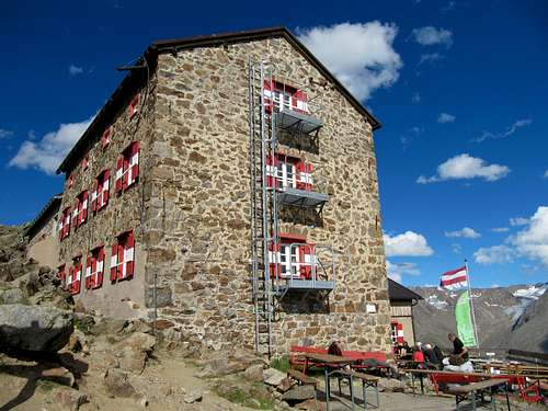
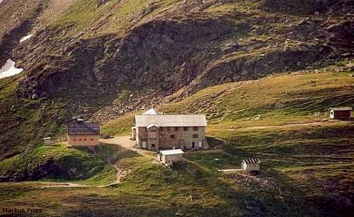
Mountain Huts
There are several Mountain Huts surrounding Wildspitze. The Breslauer Hut is the most frequently visited Hut for an ascent of Wildspitze, since the hut is located along the normal route. An alternative to the Breslauer Hut is the Vernagt Hut, which is located to the west of the Breslauer Hut and therefore somewhat further away from Wildspitze. Still, this Hut is frequently used for Climbing wildspitze. Both Huts are situated on the Southern side of Wildspitze.
The other two Huts, the Braunschweiger Hut and the Taschachhaus are both situated on the northern side of the mountain. The Braunschweiger Hutte is located 300+ meters higher compared to the Taschachhaus and therefore closer to Wildspitze. Instead of using one of the last named huts people are more often climbing wildspitze in a single day by using the Pitzaler glacier cableway system. For more information about the mountain Huts see the table below. Clicking on the name of the Hut will direct you to the official Internet page.
| Hut | Elevation | Telephone | SP Link | Photo |
| Breslauer Hutte | 2844m | +4352548156 | Here |
 |
| Vernagt Hutte | 2755m | +43/664/1412119 | / |
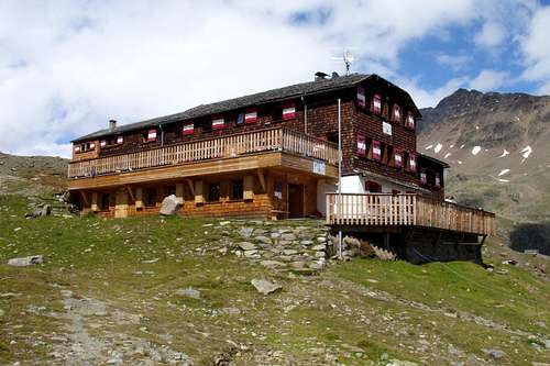 |
| Braunschweiger Hutte | 2758m | +43 664 20 12 013 | / |
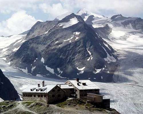 |
| Taschachhaus | 2432m | +43+664 1384465 | / |
 |
Online map
There is an Online digital Map of Austria by the BEV (Bundesamt für Eich- und Vermessungswesen) - in German
When To Climb
Oetztal Alps & Wildspitze by Sebastian Hamm
The Normal routes can be climbed best in July, August, September. The huts are guided in these summer months and if the conditions are good, there can be a lot of people ascending the mountain. To avoid crowds in the summer season try to avoid the weekends.
The North face route has become (too) dangerous in this summertime due too melting ice and as a result increased danger of rockfall. The best time for this route is the spring, but also in winter the North Face is often in good condition.
The North face route has become (too) dangerous in this summertime due too melting ice and as a result increased danger of rockfall. The best time for this route is the spring, but also in winter the North Face is often in good condition.
Mountain Conditions
Weather - A detailed weather Report by the Alpenverein
Current avalanche conditions - Current avalanche conditions by the Lawinenwarndienst Tirol
Maps
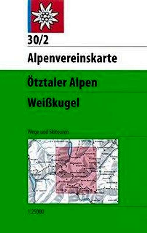
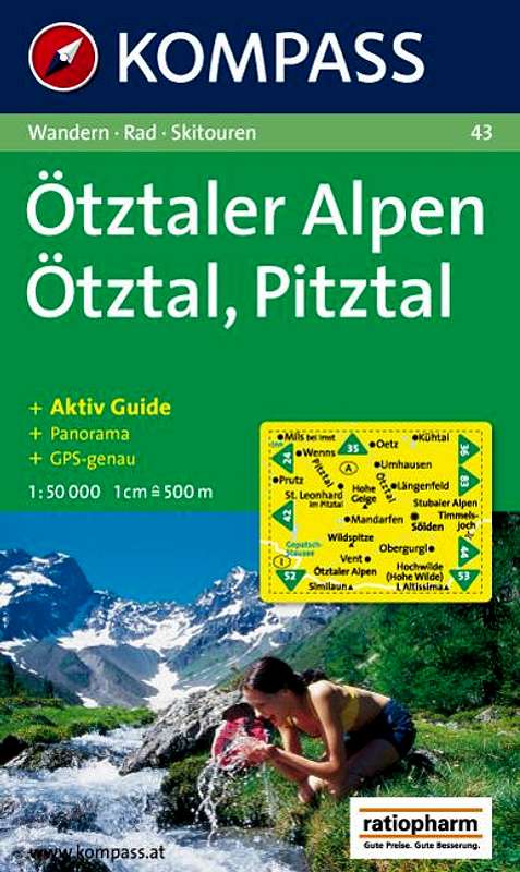
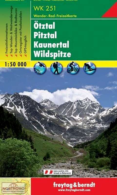
There are several good maps that cover the Wildspitze area. The advantage of the Alpenvereinskarten is that they are in a 1:25.000 scale. The Kompass and Freytag & Berndt map are on a 1:50.000 scale. The Alpenvereinskarten are available in two versions: One without and one with routes for ski mountaineering. The names for these maps are the same though. Alpenvereinskarten can be bought from the Alpenverein Shop. An English site that sells all maps listed below is Stanfords.
 |
 |
 |
 |
 |
| Type | Name | Scale | ISBN/ EAN | Additional Info. |
| Alpenvereinskarte | 30/6 Wildspitze | 1:25.000 | 9783928777452 | Covers the entire Wildspitze area |
| Alpenvereinskarte | 30/1 Gurgl | 1:25.000 | 9783928777384 | Covers the Southern part of wildspitze |
| Alpenvereinskarte | 30/2 Weisskugel | 1:25.000 | 9783928777391 | Covers the Southern part of wildspitze |
| Kompass Map | 43: Otztaler Alpen | 1:50.000 | 9783854910497 | Covers the entire Wildspitze area |
| Freytag & Berndt Map | WK 251: Otztal Pitztal.. | 1:50.000 | 9783850847544 | Covers the entire Wildspitze area |
Guides and Books
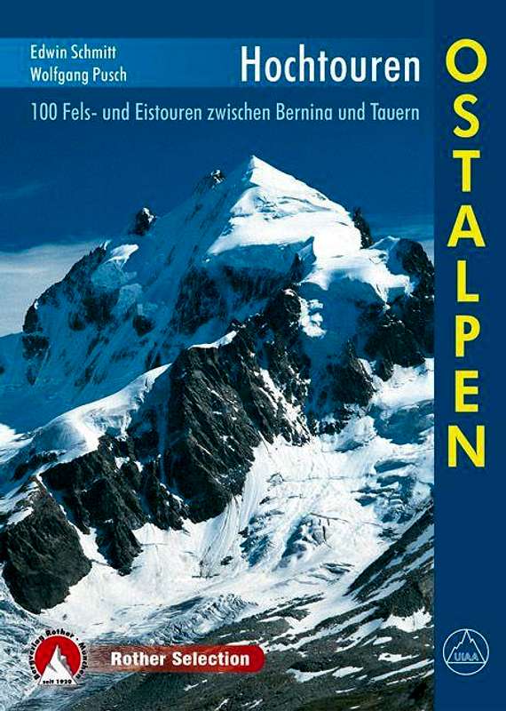
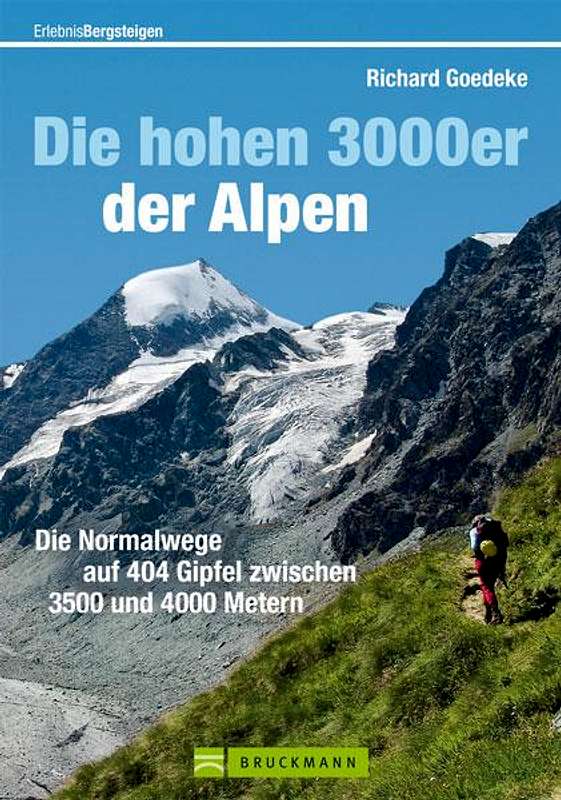
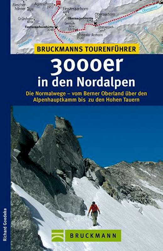
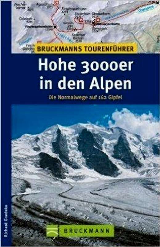
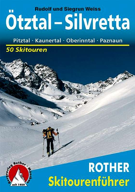
There are several good guides and books for Climbing Wildspitze. I would personally recommend the ''Hochtouren Ostalpen'' by Rother Verlag. The former guide by Rother covering Wildspitze is the "Alpenvereinsfuehrer Oetztaler Alpen" by Walter Klier. The latest print of this guide was back in 2006 and therefore outdated. Rother came up with a new series called Hochtouren with a version covering the Ostalpen (Eastern Alps) and a version covering the Western Alps (Westalpen Band I). The ''Hochtouren Ostalpen'', which includes Wildspitze, has very good descriptions on several routes like the Normal route and the North Wall. It also includes detailed route maps and useful route photos. Other options are the ''3000er'' series by Richard Goedeke. The ''3000er in den Nordalpen'' and ''Hohe 3000er in den Alpen'' are pocket size guides covering many 3000 meter peaks inclusing Wildspitze. The descriptions are somewhat shorter compared to the ''Hochtouren Ostalpen'', but provide all necessary information about Climbing Wildspitze. ''Die hohe 3000er der Alpen'' is a newer version of the ''Hohe 3000er in den Alpen'' guide, the book is slightly bigger and has a slightly more detailed description of the routes. The last book ''Otztal, Silvretta: 50 skitouren'' by Rother includes a detailed description for ski mountaineering Wildspitze.
Books from Rother Verlag can be purchased at their internet page . Books from Bruckmann Verlag can be purchased here.
 |
 |
 |
 |
 |
| Publisher | Name | Author | ISBN / EAN |
| Rother Verlag | Hochtouren Ostalpen | Wolfgang Pusch | 9783763330102 |
| Bruckmann Verlag | Die Hohen 3000er der Alpen | Richard Goedeke | 9783765461224 |
| Bruckmann Verlag | 3000er in den Nordalpen | Richard Goedeke | 9783765455438 |
| Bruckmann Verlag | Hohe 3000er in den Alpen | Richard Goedeke | 9783765452369 |
| Rother Verlag | Otztal Silvretta: 50 Skitouren | Rudolf Weiss | 9783763359172 |
First Ascent - Historical Facts
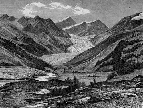
Mittelbergferner & Wildspitze around 1880
Wildspitze was first attempted to climb in 1847 by Hermann and Adolf Schlagintweit, who reached ‘’point 3552m’’ on the northeast ridge of the mountain. Wildspitze was first climbed in 1848 by Leander Klotz accompanied by a farmer from Vent. The first ascent took place from the Otztal/Venter side of the mountain and they reached the southern summit of wildspitze at 3768 meters. Back in those days, the Northern summit was the higher one with approximately 3774 meters. Leander Klotz was also the first one to reach the Northern summit of Wildspitze, 13 years later, in 1861. He climbed the southern summit as he already did in 1847, but went on to the Northern summit by crossing the ridge that seperates the two summits. The elevation of the Northern summit has shrunk from approximately 3774 meters to 3765 meters in present day, making the southern summit now the highest point of wildspitze with its 3768 meters (other sources say 3770m).
The first ascent from the other side of the mountain, the Pitztaler side, presumably should have taken place by unnamed residents of Mandarfen first. But the first certain ascent from the Pitztal side (nowadays from the Braunschweiger Hütte) was first made through the Mittelbergjoch by the Pitztal guides Abraham, Isaac and Franz Dobler and Dominic Schöpf somewhere before 1870. They were only equipped with mountain sticks and wooden axes.
The first tourist ascent of the Northern summit was done by Moritz von Statzer and Franz Senn with leaders Alois Ennemoser and Gabriel Spechtenhauser on September 24, 1870. The first first tourist ascent of the Southern summit was done by Joseph Anton Specht with leaders Nicodemus , Leander and Hans Klotz on August 26, 1857.
In ancient descriptions climbing the Wildspitze is portrayed as dangerous and very exhausting. In more recent times, the Wildspitze has become a very well-attended mountain; Already in the summer of 1905, it is reported that many groups were on their way to the summit from the Braunschweiger Hut. Of course, between 1905 and present day, Wildspitze has become more and more popular and is one of the most frequently climbed mountains in the Alps.
Pitztaler Glacier Cableway
Pitztaler Glacier Cableway from Mittelberg:
Summer operations – from July 1, 2016, daily from 8.30 am to 4.20 pm
Departure times Gletscherexpress: First ascent 8.30 am, every 30 minutes after 8.50 am
Alpinists’ early ascent: Every Friday at 7.00 am with the Glacier Express.
Cableway Vent - Stablein
Official Internet Page chairlift Vent - Stablein
The lift starts at 1.900 m and reaches 2.364 m. It shortens the ascent to the Breslauer Hut by +/- 1,5 a 2 hours
The chairlift is opened daily from 18. Juni bis 25. September 2016
- From 08:00 to 12:00 and
- From 13:00 to 17:00
Hotels & Campsites
Hotels:
Pitztal
Campsites:
There are three campsites in the Oetztal and one in the Pitztal.
Camping Soelden
(17 km from Vent)
Campsites:
There are three campsites in the Oetztal and one in the Pitztal.
Camping Soelden
(17 km from Vent)
Camping Oetztal Huben
(27 km from Vent)
Camping Oetztal Laengenfeld
(30 km from Vent)
Mountain Camp Pitztal
(25 km from St. Leonhard)
External Links
Bergfuhrer / Mountain Guides:
Wildspitze on Hikr
Webcam from Pitztaler Glacier on Bergfex
Wildspitze Skitour on Tourenwelt.at
Trip Reports on SP
Information about this page:
April 11th, 2016 - I adopted the Wildspitze page from Tuan Walter.
April 18th,2016 - After making extensive changes, the page is done, for now.