


-
 73110 Hits
-
 99.72% Score
-
 131 Votes
|
|
Canyon |
|---|---|
|
|
36.05720°N / 112.1375°W |
|
|
Hiking |
|
|
Grand Canyon - Overview
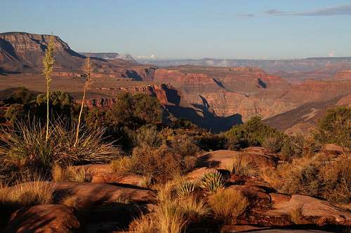
The Grand Canyon is one of the most beautiful land majestic places on Earth. Though the canyon proper runs hundreds of miles,this page will concentrate on Grand Canyon National Park and the three main trails that run from rim to river - North Kaibab, South Kaibab, and Bright Angel, as well as the Tuweep region.
If you'll allow a little altitudinal license, consider that this grandest of all canyons is really an "inverse" mountain, which presents unique challenges to those who choose to tackle it. "If the falls of Niagara were installed in the Grand Canyon between your visits and you knew it from the newspapers - next time you stood on that dizzy rim-rock you would probably need good field glasses and much patience before you could locate the cataract which in its place looks pretty big. If Mount Washington were plucked up bodily by its roots - not from where you see it, but from sea-level - and carefully set down in the Grand Canyon, you probably would not notice it next morning, unless its dull colors distinguished it in that innumerable congress of larger and painted giants. All this, which is literally true, is a mere trifle of what might be said in trying to fix a standard of comparison for the Grand Canyon. But I fancy there is no standard adjustable to the human mind."–Charles F.Lummis, 1909
Grand Canyon has been a locale for human use and occupation for millennia, with ruins and artifacts from inhabitants dating back nearly 12,000 years, In the early 1800's,trappers and expeditions sent by the U.S. government began to explore and map the canyon. It was first afforded Federal protection in 1893 as a Forest Reserve and later a National Monument, achieving National Park status in 1919.
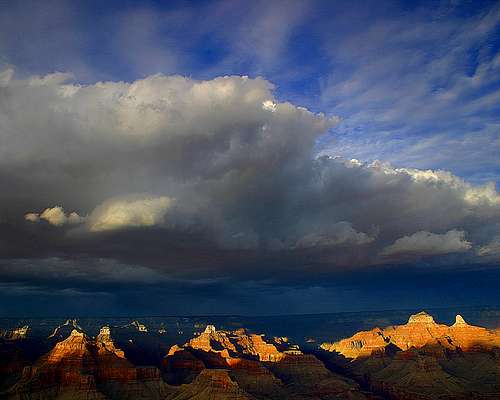
 Grand Canyon Grand Canyon |
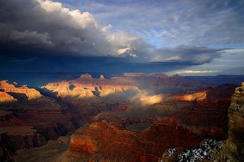
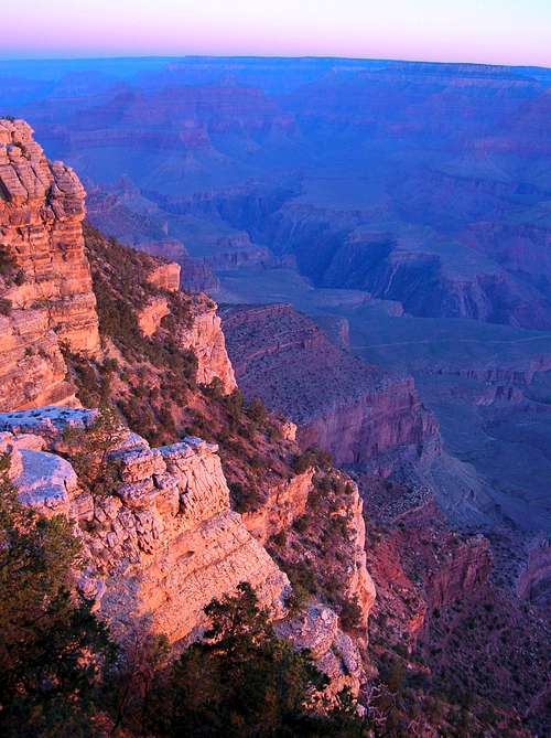
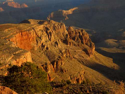
 Grand Canyon Sunrise Grand Canyon Sunrise |
 Grand Canyon Sunset Grand Canyon Sunset |
 Hopi Point Hopi Point |
Geography and History
Located in northern Arizona, the Grand Canyon is known throughout the world for its size and colorful landscape. The entire canyon, carved by the Colorado River for over 6 million years, is 277 miles in length, is from 4 to 18 miles wide, and is more than a mile deep in places. Nearly two billion years of Earth's history are thus exposed by the Colorado River and its tributaries.
Uplift associated with mountain building events moved sediments thousands of feet upward and created the Colorado Plateau. The massive rift created by the Colorado River and its tributaries exposed uplifted Proterozoic and Paleozoic strata, and is one of six distinct physiographic sections of the Colorado Plateau province. The higher elevation resulted in greater precipitation in the Colorado River drainage area, but not enough to change the Grand Canyon area from being semi-arid. The uplift of the Colorado Plateau is uneven, and the north-south trending Kaibab Plateau that Grand Canyon bisects is over a thousand feet higher at the North Rim than at the South Rim.
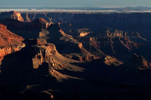
 Grand Canyon Grand Canyon |
 Looking Up Stream Looking Up Stream |
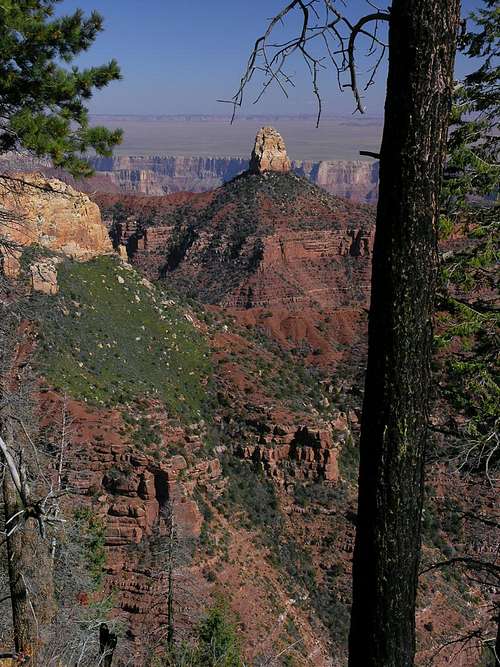
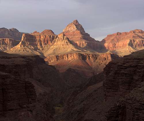 Vishnu Temple Vishnu Temple |
 Sinking Ship in Grand Canyon Sinking Ship in Grand Canyon |
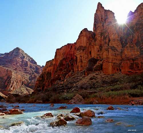
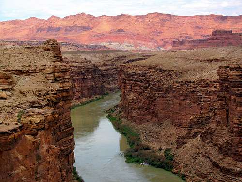
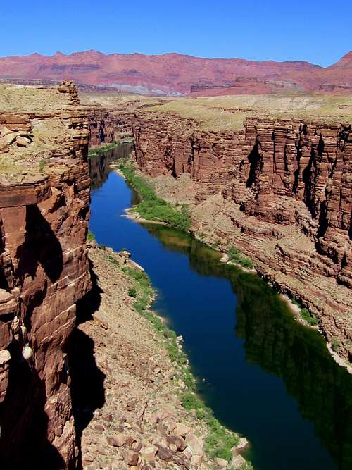 Colorado River Colorado River |
During prehistory, the area was inhabited by Native Americans who built settlements within the canyon and its caves. The Pueblo people considered the Grand Canyon ("Ongtupqa" in Hopi language) a holy site. The park's 11 Traditionally Associated Tribes and historic ethnic groups view management of archeological resources as preservation of their heritage. Archeological remains from the following culture groups are found in Grand Canyon National Park: Paleo-Indian, Archaic, Basketmaker, Ancestral Puebloan (Kayenta and Virgin branches), Cohonina, Cerbat, Pai, Southern Paiute, Zuni, Hopi, Navajo, and Euro-American. The park has recorded over 4,300 archeological resources with an intensive survey of over 5% of the park area.
The first European known to have viewed the Grand Canyon was García López de Cárdenas from Spain, who arrived in 1540. In 1869, Major John Wesley Powell, a one-armed Civil War veteran with a thirst for science and adventure, made the first recorded journey through the canyon on the Colorado River. He accomplished this trek with nine men in four small wooden boats, though only six men completed the journey. Powell referred to the sedimentary rock units exposed in the canyon as "leaves in a great story book".
In the early 1800s, trappers and expeditions sent by the U.S. government began to explore and map the Southwest, including the canyon. Although first afforded Federal protection in 1893 as a Forest Reserve and later as a National Monument, the Grand Canyon did not achieve National Park status until 1919, three years after the creation of the National Park Service. Today Grand Canyon National Park encompasses more than 1 million acres of land and receives close to 5 million visitors each year, a far cry from the annual visitation of 44,173 which the park received in 1919.
Getting There
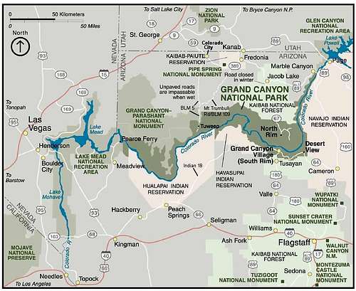
Grand Canyon Region Map
South Rim
Both Bright Angel Trail and South Kaibab Trail are located at the South Rim. To get to the South Rim, drive US 180 northwest from Flagstaff and turn right at AZ 64, which goes through the town of Tusayan and directly into Grand Canyon National Park. You can also approach the South Rim from US 89 by turning east on AZ 64 near Cameron. This takes you to Desert View, and then you drive 20 miles along the Rim to get to Grand Canyon Village.
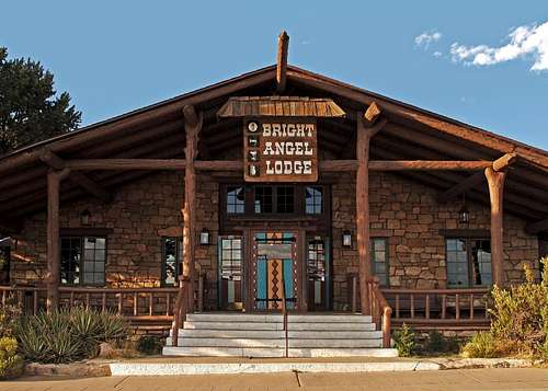
The Bright Angel trailhead is located next to the Bright Angel Lodge in the village. There's ample parking, but you'll have to compete for these spots with the many tourists. The South Kaibab trailhead is only accessible via free shuttle bus(daylight hours only) or taxi. You can catch the bus to this trailhead from the visitor center located across the street from Mather Point, or take a bus to Mather Point from Grand Canyon Village and change buses there. A 24-hour taxi service is available by calling (928) 638-2631.
North Rim
North Rim is accessible from Alt US 89 by turning south on AZ 67 near Jacob Lake. The North Kaibab trailhead is located about 1.5 miles from the lodge at the North Rim. There's a parking lot at the trailhead. You may also take a shuttle from the Grand Canyon Lodge at 4:15 a.m. and 6:15 a.m. fora fee of $7 (first hiker in party) or $4 (each additional hiker in a party).Once the Arizona Department of Transportation closes Highway 67 south of Jacob Lake to vehicle traffic for the winter season, the North Rim of Grand Canyon National Park also closes to vehicle traffic. The gate at Jacob Lake is closed and locked and the gate at the North Rim entrance station is closed and locked. Hiking in (including snowshoeing and skiing) are permitted at this time.
Tuweep
Tuweep (also know as Toroweap) is in a remote region of Grand Canyon National Park. It is open year-round, and is especially suited for those seeking solitude. Because of this, anyone traveling to it should be prepared for self-sufficiency. The sometimes graded, often dirt roads to it are suitable for most vehicles, though RVs, trailers and low-clearance vehicles are not recommended. Travelers should carry tools; a spare tire; and extra food, water and gas. Travel after rainfall and snowfall may be difficult to impossible. Tuweep can be reached from AZ 389 near Fredonia or Colorado City, AZ, or from St. George, UT. The NPS cautions that road signs in this area may be incorrect or misplaced.
- Sunshine Route (Also called Mount Trumbull Road and BLM road #109), the primary access route, leaves Highway 389 about seven miles west of Fredonia. It is 61miles long and is the most reliable route, but is subject to wash boarding and dust.
- Clayhole Road (Also called BLM Road #5) leaves Highway 389 at Colorado City. It is about 60 miles long, but may be impassable when wet.
- Main Street Route (BLM Roads #1069 and #5) from St. George is about 90 miles long and is the most scenic route. It may be impassable in winter due to snow on the slopes of Mt.Trumbull. This route is not marked on the adjacent NPS map.
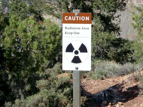
Radiation
An entrance fee of $30.00 (as of January 2018) a vehicle is charged to the national park (except at Tuweep, which has no entry fee.) There is talk for the entrance fee to be increased to $70 during the peak months. It covers all persons in a single, private, non-commercial vehicle and is valid for seven calendar days on both rims. The entry fee for pedestrians, bicyclists, motorcycles, motor scooters, or mopeds is $12.00 per person. There is no charge for anyone age 15 and under. Various passes are also accepted for entrance to the park.
For 2018 there are only four free fee entrance days (compared to 10 in 2017.) These four days are January 15, April 21, September 22 and November 11.
$10 per permit plus $8 per person or stock animal per night camped below the rim and $8 per group per night camped above the rim. Denied requests will not incur a charge. Permits cancelled at least four days in advance will receive hiker credit (minus a $10 cancellation charge) valid for one year. Backcountry Information Center charges are NON-REFUNDABLE!
If you wish to camp anywhere in the park, other than in developed campgrounds on the North Rim or the South Rim, you must obtain a permit from the Backcountry Information Center.
A backcountry permit is required for:
- overnight camping outside of Mather Campground, Desert View Campground, and North Rim Campground
- overnight camping in all sites at Tuweep Campground
- overnight camping anywhere on the North Rim of Grand Canyon National Park between Nov 1 - May 14 (includes ski-camping)
- off-river camping by river trip participants
- overnight camping with private stock outside of Mather Campground or outside of North Rim Campground (May 15 – Oct 31)
- packrafting, other than that which occurs under a river permit
A backcountry permit is NOT required for:
- day hikes (this includes nighttime "day" hikes)
- day stock rides
- overnight camping at Mather Campground and Desert View Campground (campground reservations for Mather Campground atwww.recreation.gov)
- overnight camping at North Rim Campground between May 15 – Oct 31 (campground reservations at www.recreation.gov)
- overnight camping with private stock at Mather Campground or (May 15 – Oct 31) North Rim Campground
- overnight stays at the dormitories or cabins at Phantom Ranch (advanced reservations with Grand Canyon National Park Lodges required)
Lodging and Camping
Lodges -Lodges at the Grand Canyon are often full, so reserve early (six months or more in advance).
 Bright Angel Lodge Bright Angel Lodge |
 Phantom Ranch Phantom Ranch |
 North Rim Lodge North Rim Lodge |
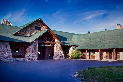
North Rim. There is one lodge within the national park on the North Rim, and seasonal commercial facilities outside the park. The closest is Kaibab Lodge located in the heart of the North Kaibab National Forest just five miles from the entrance to Grand Canyon National Park's north rim and 18 miles from the North Rim. another on is Jacobs Lake, 45 miles from the North Rim at the junction of Highway 67 and Highway 89 A. Highway 67 is the only way to or from the North Rim. Reservations within the park are handled by Forever Resorts. You can learn more and make reservations by calling (877) 386-4383, or by visiting their website at Grandcanyonforever.com.
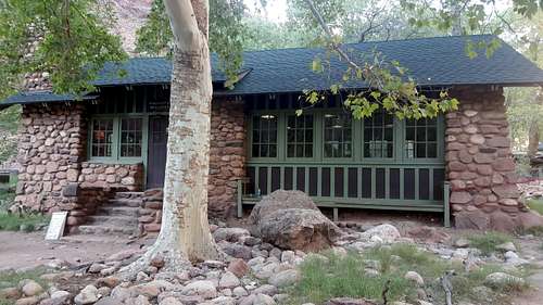
Phantom Ranch. Phantom Ranch provides lodging for overnight hikers within the canyon. A backcountry permit is not required for overnight stays at its dormitories or cabins. Reservations for meals (meals are not served without a prior meal reservation. Meal reservations can be made up to a couple of days in advance and are not conditioned by having a lodging reservation) and lodging are required, and may be made by calling (888) 297-2757. You can also make reservations online by visiting the Xanterra Parks and Resorts website at Grandcanyonlodges.com. To secure a reservation at Phantom Ranch is absolutely necessary to plan a year in advance. Cancellations happen but it takes a lot of luck and continuous effort to secure a last minute reservation.
![South Kaibab Trail]()
South Kaibab Trail
Hiking is open year-round. Summers are often pleasant for the rim walks, especially on the North Rim, but for the lower elevations it is the worst and hardest time to visit.
![Grand Canyon Bright Angel Trail]()
Grand Canyon Bright Angel Trail - Corkscrew section
If you go into the canyon during the summer, make sure you are prepared to hike in high temperatures, and take lots of water and salty foods. Winter travel may require snowshoes or skis on the rim trails, and always to reach the North Rim. The NPS may recommend using instep crampons, devices such as Yak Trax on some icy trails in winters, or may recommend against hiking certain trails altogether.
The main North Rim access road closes during the winter mid October to mid May (this does not affect access to places such as Tuweep or Marble Canyon). During this time, hikers, snow-shoers and cross-country skiers are allowed to enter. The NPS unlocks the entrance station gate for public vehicle access once the North Rim visitor facilities usually open up for the season on May 15. North Rim Lodge closes on October 16 but the National Park remains opened to vehicle traffic as long as the snow does not cover the road. There is no snow plowing service in the National Park. The North Rim can be accessed as late as December if there is no snow. Of course, there are no services whatsoever.![Heat Kills, declares one of...]()
Be careful - live to hike, don't hike to die
The hikes are divided into day hikes and overnight hikes. This is somewhat arbitrary, because what may be a suitable day hike for one strong hiker, may be more appropriately an overnight hiking destination for another less experienced person. Know your limits!
South Rim
North Rim
For additional information on hiking the Grand Canyon, be sure to read the Hiking Frequently Asked Questions on the NPS website or link below.
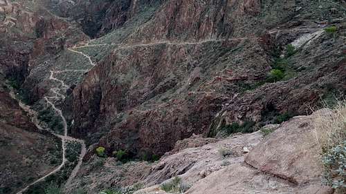
![Part of route]()
Part of route
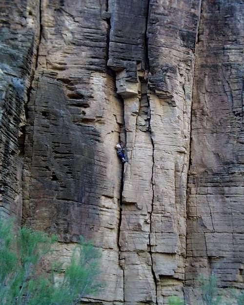
![An un-named 5.8 pitch in the...]()
An un-named 5.8 pitch
Climbing in the Grand Canyon is a different kind of climbing. The rocks are made of sandstone rather than granite, providing for a very dangerous adventure. For rock climbing enthusiasts, there are many peaks and buttes to conquer in the Grand Canyon. One of these is currently documented on SP:
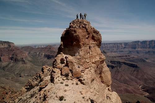
![Peace Like a River]()
Peace Like a River
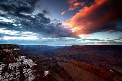
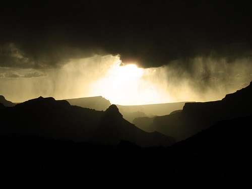
![sunset]()
Rain at Sunset
Weather in the Grand Canyon can be dramatically different between the rim and the depths of the canyon. It is possible to experience a 40° F temperature difference between the top and the bottom. It is said that hiking from the North Rim to the bottom of the Grand Canyon is equivalent to hiking from southern Canada to northern Mexico. Because of this, if you're planning a hike to the bottom, use the first link below with a certain grain of salt (and take plenty of water!):
There are several weather dangers to be particularly wary of. Lightning has been known to strike 10-miles across the canyon, reaching into the depths of the canyon itself. Being on the canyon floor does not provide protection. Rock falls may occur after heavy rains. Exercise caution when hiking through potential rock fall areas, especially after heavy rainfall. Flash floods may be caused by storms many miles away. Be aware of your surroundings, and keep possible escape routes in mind.
Front Country Camping
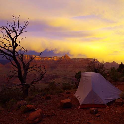 Camping at Grand Canyon Camping at Grand Canyon |
 Camping at Grand Canyon Camping at Grand Canyon |
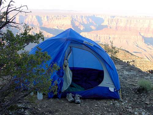 Camping at Grand Canyon Camping at Grand Canyon |
Camping is readily available, but strictly controlled. Most rim campgrounds require reservations, but they are usually open with a few days' notice. However, they can still be full around major holidays such as Memorial Day, July 4, and Labor Day. Inside the park there are four front country campgrounds:
- Mather Campground has 319 tent and RV sites centrally located in Grand Canyon Village on the South Rim. It is always busy because of its modern amenities, including shower and laundry facilities. Fees are $18 per night per site, or $15 during the winter (reservations not accepted during the winter).
- Desert View Campground, near the east entrance to the park's South Rim, provides 50 "dry" campsites for tents or smaller RVs. Fees are $12 per night per site, and reservations are not accepted. It is open from May to October.
- Trailer Village in Grand Canyon Village provides 78 sites with full hook-ups. It is operated by Xanterra Parks, so reservations are made by calling (888) 297-2757; or (928) 638-2631 for same-day reservations.
- North Rim Campground provides 83 "dry" campsites for tents and RVs from mid-May to mid-October. The fees are $18-25. A limited number of campsites are kept open on a first-come, first-served basis once AZ 67 is closed. Group campsites may be used during the winter by hikers and skiers with a valid backcountry permit.
- For those campgrounds that accept reservations, either call (877) 444-6777, or visit online at Recreation.gov. For further information on camping within the park, visit:
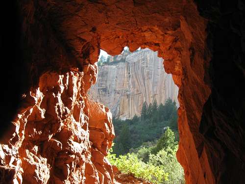 View from inside the Supai Tunnel View from inside the Supai Tunnel |
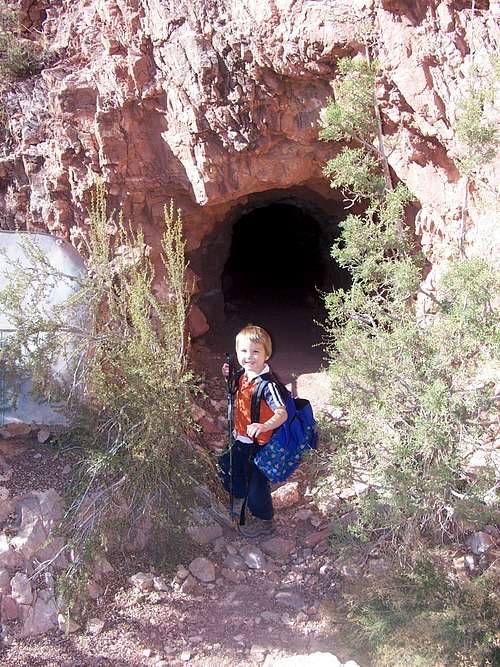 Copper Mine Copper Mine |
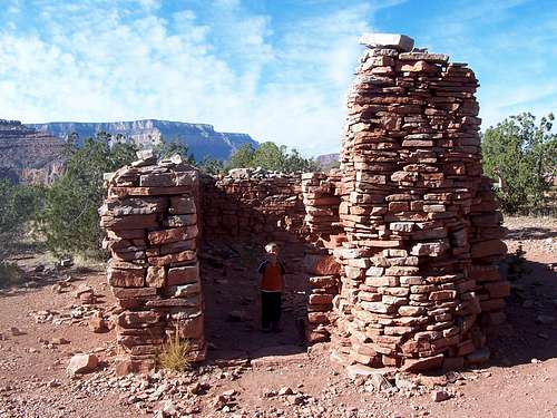 Old Miners Cabin at Horseshoe Mesa Old Miners Cabin at Horseshoe Mesa |
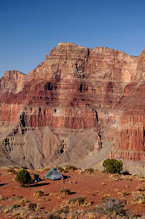
Backcountry permits are required to stay overnight in the canyon (except at Phantom Ranch--See Lodges section above). Campgrounds in the backcountry require reservations and are often booked months in advance. One can day hike to avoid the hassle. However, one might get lucky with reservations if someone cancels at the last minute or lets their reservation expire. So check with the backcountry office if you are interested in staying overnight inside the canyon. Based on the usage zones(see Hikingsection below), the following inner canyon campsites area vailable:
- CorridorZone. IndianGarden, Bright Angel and Cottonwood are Corridor Zone campsites.
- ThresholdZone. Hermit Creek, Hermit Rapids, Monument Creek, Granite Rapids, CedarSpring, Salt Creek, Horn Creek, Horseshoe Mesa, Clear Creek, Widforss, PointSublime and Fremita Mesa are Threshold Zone campsites.
- PrimitiveZone. Hance Creek, Cotton Creek, Grapevine, Cremation, Boucher, WalhallaPlateau, Ken Patrick, Robbers Roost, Outlet and Swamp Ridge are Primitive Zonecampsites.
- WildZone. Vishnu, Cheyava, Greenland Springs, Phantom Creek, Trinity Creek,Scorpion Ridge and ThomasCanyon are Wild Zone campsites.
The Primitive and Wild Zones are not recommended for use during summer months due to extreme high temperatures and the lack of reliable water sources.
During the winter season (approximately late October through mid-May), abackcountry permit is required for overnight use of the North Rim from thepark's northern boundary to Bright Angel Point on the canyon rim. Winter accessis by hiking, snowshoeing or cross-country skiing. Permit holders are allowedto camp at-large between the park's north boundary and the North Kaibab trailhead (but not at thetrailhead itself). Between the North Kaibab trailhead and the Bright Angel Point area, camping is permitted onlyat the North Rim Campground group campsite.
Tuweepprovides ten primitive campsites, including one group campsite. The sites areon the north rim, but are considered backcountry camping. They may be reservedthrough the backcountryreservation system. Visitors may also be able to obtain a walk-up permit,up to six days in advance and based on availability, by visiting PipeSpringNational Monument near Fredonia, Arizona or the St. George Public LandsVisitor Center in St. George, Utah. Picnic tables, fire grates, andcomposting toilets are provided, but no electricity or water is available.Firewood must be brought in.
When To Hike
South Kaibab Trail
If you spend much time at the bottom or lower elevations (say the Tonto Trail, Beamer Trail or Escalante Route for example) or the off trail low altitude routes, then for the North Rim early to mid-October is usually best, and for the South Rim March-mid April and late October-November are best. Most backpackers are only near the cooler rim for a short time and spend most of the time in the canyon.
May or even early October is pretty hot and, once you are away from the Corridor trails, lack of water is a pretty serious problem on many routes and can be deadly. Keep in mind that temperatures are taken in the shade and there is little shade in the exposed parts of the canyon. On routes in which water is fairly scarce (which are countless ones), even May can be deadly; unprepared hikers have died of heat, exhaustion and dehydration even in April and May.
Grand Canyon Bright Angel Trail - Corkscrew section
The main North Rim access road closes during the winter mid October to mid May (this does not affect access to places such as Tuweep or Marble Canyon). During this time, hikers, snow-shoers and cross-country skiers are allowed to enter. The NPS unlocks the entrance station gate for public vehicle access once the North Rim visitor facilities usually open up for the season on May 15. North Rim Lodge closes on October 16 but the National Park remains opened to vehicle traffic as long as the snow does not cover the road. There is no snow plowing service in the National Park. The North Rim can be accessed as late as December if there is no snow. Of course, there are no services whatsoever.
Hiking at the Grand Canyon

Be careful - live to hike, don't hike to die
Canyon hiking is quite different than the typical peak bagging hike; you go down first. This seemingly simple fact causes thousands of ill-prepared tourists to get into serious trouble. In average 12 people die and 250 have to be rescued each year. People die of heat, exhaustion or dehydration. Some lucky ones are being rescued by the National Park rescue team. However, depending on the time of day or place, their response time doesn't pay into everyone's advantage. You really have to know your capabilities and limits before attempting a hike into and out of the canyon.
The weather differences can also be extreme from top to bottom. Visitors at the 70° F rims often underestimate the desert climate at the bottom where temperatures can reach 120°+ F in the summer. A regular summer day might have low 40's temperature at the rim and 80's at the river at the same time, before sunrise. The keys to hiking the canyon successfully are knowledge and preparation!
The hikes are divided into day hikes and overnight hikes. This is somewhat arbitrary, because what may be a suitable day hike for one strong hiker, may be more appropriately an overnight hiking destination for another less experienced person. Know your limits!
Day Hikes
Day hikes are described in terms of round-trip distance. Links are provided to the SP route page (if there is one), or the NPS description page (again, if there is one). The NPS considers these to be relatively benign day hikes with suitable amenities for typical Grand Canyon visitors. This doesn't mean some aren't quite strenuous, however.South Rim
- Rim Trail - The Rim Trail extends from the village area to Hermits Rest. Begin from any viewpoint in the village or along Hermit Road. The Rim Trail offers excellent walking and quiet views of the inner canyon for visitors who desire an easy hike.
- Bright Angel Trail - The Bright Angel Trail begins just west of Bright Angel Lodge and offers day hikes that range in distance up to 12 miles (round trip). Some shade. Seasonal water subject to pipeline breaks. Check at the Visitor Center or Backcountry Information Center for water status. See link below
- South Kaibab Trail - The South Kaibab Trail begins south of Yaki Point on Yaki Point Road. Access to the trailhead is by walking or shuttle bus only (Kaibab Trail Route). There is no private parking allowed at the trailhead. Offers day hikes that range in distance up to 6 miles (round trip). Best views for a relatively short hike. Steep trail, no water, little shade. Water available at trailhead only.
- Hermit Trail - The Hermit Trail offers hikes to Santa Maria Spring, 5 miles (round trip), and Dripping Springs, 7 miles (round trip). Trail conditions are tougher than the Bright Angel and South Kaibab trails. Unmaintained steep trail requires caution. Begins 500 feet west of Hermits Rest. Water from springs must be treated before drinking.
- Grandview Trail - The Grandview Trail offers hikes to Coconino Saddle, 2.2 miles (round trip), and Horseshoe Mesa, 6.4 miles (round trip). Trail conditions are steeper and tougher than the Bright Angel and South Kaibab trails. Unmaintained trail requires caution. Begins on canyon side of retaining wall at Grandview Point on Desert View Drive (12 miles east of village).
North Rim
- Transept Trail - The Transept Trail is 3.0 miles (round-trip). It follows the canyon rim from Grand Canyon Lodge to the North Rim Campground.
- Uncle Jim Trail - The Uncle Jim Trail is 5.0 miles (round-trip). It winds through the forest to a point overlooking the canyon and the North Kaibab Trail switchbacks. Begins at the North Kaibab Trail parking lot. This trail is also used by mules.
- North Kaibab Trail - Distance and hiking times vary. This is the only maintained trail into the canyon from the North Rim. Even a short hike to Coconino Overlook (1.5 miles round-trip) or Supai Tunnel (4 miles round-trip) can give you an appreciation for the canyon's rich natural beauty and immense size. A hike to Roaring Springs and back is extremely strenuous and takes a full day (7-8 hours) - begin your hike before 7 a.m. Roaring Springs lies 3050 feet /930 m below the canyon rim and is 9.4 miles (round-trip). The NPS does not recommend a day hike past Roaring Springs. This trail is also used by mules.
- Widforss Trail - The Widforss Trail offers a 10 mile (round-trip) hike into blended forest and canyon scenery. Even a short walk can be very satisfying. Take the dirt road 1/4-mile south of Cape Royal Road for 1 mile to the Widforss Trail parking area.
- Ken Patrick Trail - The Ken Patrick Trail is a 10 mile (roundtrip) hike. It winds through the forest and along the rim from Point Imperial to the North Kaibab Trail parking area.
- Cape Final Trail - The Cape Final Trail is a 4.0 mile (round-trip) walk from the dirt parking area to Cape Final. This trail offers a view of the canyon.
- Cliff Springs Trail - The Cliff Springs Trail is a 1.0 mile (roundtrip) meander down a forested ravine, ending where a chest-high boulder rests under a large overhang. The spring is on the cliff side of the boulder. The water may be contaminated, so the NPS recommends to not drink it. Trail begins directly across the road from a small pullout on a curve 0.3 miles down the road from Cape Royal.
- Point Imperial Trail - The Point Imperial Trail is a 4.0 mile (roundtrip) hike. This easy trail passes through areas burned by the 2000 Outlet Fire and ends at the north park boundary. From there, connections are possible to the Nankoweap Trail and U.S. Forest Service roads.
- Tuckup Trail -- The Tuckup Trail is reached by a four-wheel drive road that branches off the main approach road to Tuweep. To get there start at Toroweap Road (BLM 109). Drive 32 miles, as if heading to Tuweep, looking for an unsigned "road" on the left. After about a half-mile you will drive past a corral and "June Tank". Continue on the main road for 16 miles, ignoring intersections. You will pass the park boundary just prior to Hancock Knolls. On the southern side of Hancock Knolls, the road veers east, ending in a small parking area. You should find a backcountry kiosk for Tuckup Trail. The trail itself runs for about 60-miles, with many sidetrails. From the trailhead, it is a 6.2-mile (roundtrip), mostly flat hike to Tuckup Canyon. There are few water sources. During the trip you will pass some of the most magnificent pictographs in the Grand Canyon. They were discovered by mule wrangler and guide, Gordon Smith in 1986, and are often called Gordon's Panel.
- Lava Falls Trail - The Lava Falls Trail is a 3.0-mile (roundtrip), 2,540-foot descent to the Colorado River. It starts below the western side of Vulcans Throne, and drops down a steep, unstable slope to the Colorado River. The NPS describes it as "not a trail, but a cairned route down loose scree." It ends near Lava Falls Rapids, which is considered to be the most difficult stretch to paddle in the Grand Canyon (in the not too distant past, it was considered unrunnable).
- Jackass Canyon - Jackass Canyon is a slot canyon in the northern part of the Grand Canyon in Marble Canyon. Most people who hike this route are fisherman looking for an easy way to the Colorado River. While the route ends in the national park, much of the route is on the Navajo Reservation. You may obtain a special permit to hike it in Cameron on Highway 89, or by calling (928) 679-2303.
Overnight Hikes
The overnight hikes are described in terms of one-way distance, the assumption being that the traveler will use these to form a loop that returns him to his parked vehicle. An existing SP route page is linked--refer to it for further details on that trail. The overnight hiker should also be aware that the NPS has divided the Grand Canyon into usage zones. These zones are helpful for planning a visit based on experience of the hiker. Campsites can be selected to support a desired level of hiking challenge (see Backcountry Camping above). The usage zones are:- Corridor Zone. Recommended for hikers without previous experience at Grand Canyon. Maintained trails. Purified water stations. Paved roads to trailheads. Toilets, signs, emergency phones, and ranger stations.
- Threshold Zone. Recommended for experienced Grand Canyon hikers. Non-maintained trails. Scarce water sources. Dirt roads to trailheads. Pit toilets.
- Primitive Zone. Recommended for highly experienced Grand Canyon hikers with proven route-finding ability. Non-maintained trails and routes. 4-wheel-drive roads to trailheads. Occasional signs. No other developments.
- Wild Zone. Recommended for highly experienced Grand Canyon hikers with extensive route finding ability. Indistinct to non-existent routes require advanced route finding ability. Water sources scarce to non-existent. No other development.
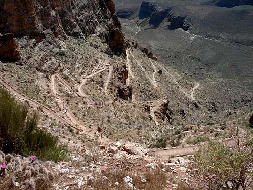
- South Kaibab. The South Kabib Trail runs 6.3-miles from the rim (at 7,200-feet) to the river (2,400-feet). It is the fastest way from the South Rim to the river. There are no water stations along the way, so many folks use this trail for descents only. There are two restrooms evenly spaced along the trail. Near the river, you'll go through a tunnel and a bridge. You can continue on to Phantom Ranch, head back up, or traverse a mile along the river to get to the Bright Angel Trail.
- North Kaibab. The North Kabib Trail runs 14.6 miles from rim (at 8,255-feet) to the river (at 2,400-feet). The trail is in good condition. Water is available along the trail at Supai Tunnel and Roaring Springs. The stretch from there to Phantom Ranch (next water source) is 8.5 miles. The North Kaibab is longer and more strenuous than the South Rim trails since it climbs over 1,000 feet higher. It's also less traveled for that reason, so you'll enjoy more solitude.
- Bright Angel Trail. The Bright Angel Trail runs 7.9-miles from rim (at 6,785-feet) to the river (at 2400-feet). If you choose to go to Phantom Ranch, it's an additional 1.7-miles. The trail is in good condition, but watch out for mules and their droppings. This is the more scenic trail on the South Rim. There are water stations every 1.5 miles between the rim and Indian Garden (exactly halfway between top and bottom). There are no water stations after Indian Garden until you near Phantom Ranch. There is a stream running more or less along the trail from Indian Garden to the river, but do not drink the water. It's very useful for wetting your shirt to keep you cool during the summer though.
- New Hance Trail. The New Hance Trail is known as one of the most difficult trails in the Grand Canyon. It has a bad reputation as being very steep and difficult. Because of this, it is also one of the least used trails on the South Rim of the Grand Canyon. It’s still a beautiful trail and worth doing. It is only seven miles to the Colorado River, making it the second shortest trail to that destination on the South Rim. There are several scrambling sections along the trail.
- Royal Arch Loop. The Royal Arch Loop is an epic backpacking/canyoneering trip in the Grand Canyon, and the only loop in the canyon. Once you arrive at the river it is a one way trip, because it involves a 20-foot rappel a few days in. This trip involves some strenuous work and some serious pathfinding. Poor map reading can leave you in some precarious situations in sweltering heat with no water and a lot of stress. Finding water is challenging, though not impossible. While the trip as a whole is an absolutely magnificent way of seeing the grand canyon (you may not see another hiker the entire time!), two particular highlights are the natural Royal Arch and Elves Chasm.
- Tanner Trail - The Tanner Trail provides primary access into the eastern Grand Canyon. From the trailhead at Lipan Point (7350 ft) to the Colorado River (2700 ft) is a demanding nine mile hike on an unmaintained and difficult south side trail. The hiker should not expect any water until the Colorado River is reached. For an experienced canyon hiker, the beauty of the area will more than make up for the extra effort.
| Hike Description (increasing difficulty) | Distance | Elevation |
|---|---|---|
| Bright Angel to Indian Garden to Plateau Point and back | 12.2 miles | 3,015 feet |
| South Kaibab to Phantom Ranch to Bright Angel | 14.2 miles | 4,800 feet |
| Bright Angel to Phantom Ranch and back | 19.2 miles | 4,385 feet |
| North Rim to South Rim (Bright Angel end) | 23.4 miles | 4,385 feet |
| South Rim to North Rim (South Kaibab start) | 20.9 miles | 5,855 feet |
| North Rim to Phantom Ranch and back | 27.6 miles | 5,709 feet |
| The ultimate Rim-to-Rim-to-Rim challenge (VERY advanced) | 44.3 miles | 10,240 feet |
For additional information on hiking the Grand Canyon, be sure to read the Hiking Frequently Asked Questions on the NPS website or link below.
Climbing in the Grand Canyon
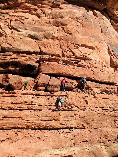
Part of route
An un-named 5.8 pitch
Zoroaster Temple - Northeast Arête. Zoroaster Temple has has been climbed in under 24 hours South Rim to South Rim. But with over 30 miles and more than 10,000-feet of elevation gained and lost, plus the inevitable temperature extremes of the canyon, most parties will need 3-4 days. The approach involves some class 4 scrambling with exposure. The most difficult part of the actual climb is a short 5.8 pitch.
If you're interested in beta on other climbs, the following book may prove useful:
Grand Canyon Summits Select - A guide to remote, backcountry climbs in Grand Canyon National Park.
 Summit of Vishnu Temple Summit of Vishnu Temple |
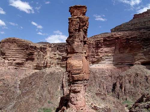 The Monument near Monument The Monument near Monument |
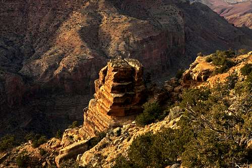 Castle Rock Castle Rock |
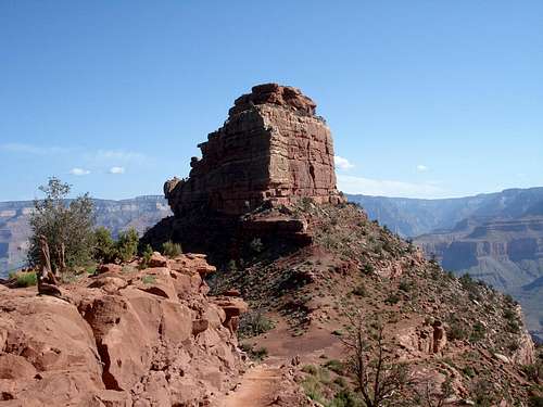 O'Neills Butte on South Kaibab Trail O'Neills Butte on South Kaibab Trail |
Water on trails
There is drinking tap water on all three main trails in the Grand Canyon. However, depending on the time of the year, some water stations are closed for the winter (usually from late October to May 15.) There is a water main that brings drinkable water from the North Rim to the South Rim. Along this water main there are, from place to place, faucets where hikers can get drinking water.The water pipe is old and breaks many times during the year, therefore causing unpredictable water closures. It is strongly suggested that before starting to hike down the trail, to visit the Backcountry Information Center and check any last minute water main closures. If the office is closed, they would have a note on the door listing the issues. (See link below for critical backcountry information/ water station availability.)
There is also plenty of water in the canyon, from various creeks or springs. It is strongly recommended to treat the water. Nevertheless, during the monsoon season July to September, the water in the canyon is muddy and undrinkable unless filtered and treated.
 Ribbon Falls Ribbon Falls |
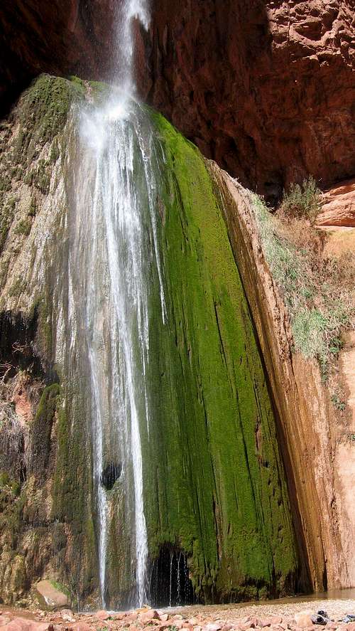
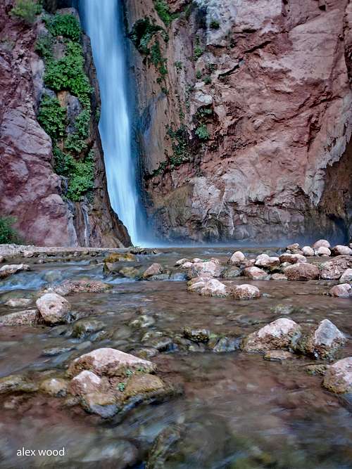 Deer Creek Falls Deer Creek Falls |
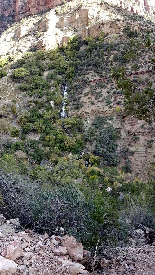 Roaring Spring Roaring Spring |
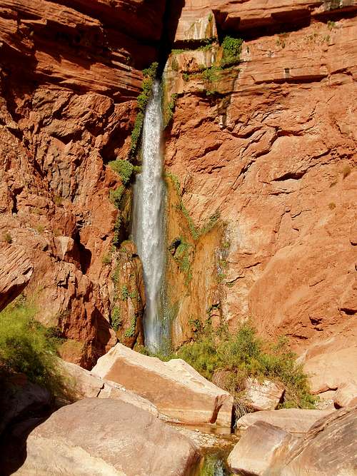 Lower Deer Creek Falls Lower Deer Creek Falls |
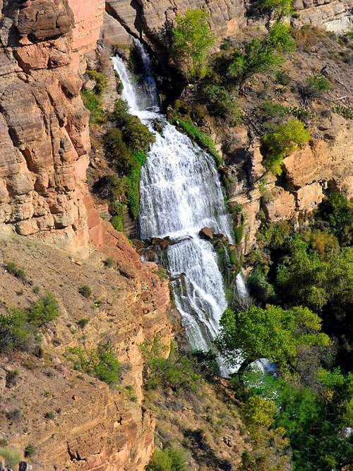 Grand Canyon Grand Canyon |
Below is a list of the water stations along these trails and the distances between them (water available only from Mid May to late October:) (See NPS link below for water stations and the facilities associated with them.)
Peace Like a River
Bright Angel Trailhead – water year-round
Bright Angel TH - Mile-and-a-Half Resthouse – 1.6
Mile-and-a-Half Resthouse - Three-Mile Resthouse – 1.5
Three-Mile Resthouse - Indian Garden – 1.7
Indian Garden (water year-round)
Indian Garden – Phantom Ranch/Bright Angel Campground – 5.1
Phantom Ranch/Bright Angel Campground – water year-round
South Kaibab Trailhead – water year-round
South Kaibab – Phantom Ranch/ Bright Angel Campground – 7.5 miles
(There is no water, either tap or creek, on South Kaibab trail.)
North Kaibab Trailhead (the only place with ice cold water on this trail.)
North Kaibab TH to Supai Tunnel - 1.7 miles
Supai Tunnel to Roaring Springs - 3 miles
Roaring Springs to Pumphouse Rest Area - .7 mile
Pumphouse Rest Area to Cotonwood Campground - 1.4 miles
Cotonwood Campground to Phantom Ranch/Bright Angel Campground - 7.2
Phantom Ranch/ Bright Angel Campground – water year-round
Weather
Rain at Sunset
National Weather Service forecast for Grand Canyon Village - Detailed, five day weather forecast for Grand Canyon Village. Includes current conditions for Grand Canyon National Park airport.
Grand Canyon National Park Climate Summary - SP's Scott provides a detailed fact sheet with weather and climate data for North Rim, South Rim, Phantom Ranch/Inner Canyon, Supai, Tuweep/Toroweap and Lees Ferry.
There are several weather dangers to be particularly wary of. Lightning has been known to strike 10-miles across the canyon, reaching into the depths of the canyon itself. Being on the canyon floor does not provide protection. Rock falls may occur after heavy rains. Exercise caution when hiking through potential rock fall areas, especially after heavy rainfall. Flash floods may be caused by storms many miles away. Be aware of your surroundings, and keep possible escape routes in mind.
External Links
- Grand Canyon - Hiking FAQs Page
- Grand Canyon Trails Map: http://www.nps.gov/grca/planyourvisit/upload/corridor_map.pdf
- Distances & facilities associated with each trail: http://www.nps.gov/grca/planyourvisit/trail-distances.htm
- Critical Backcountry Updates: http://www.nps.gov/grca/planyourvisit/trail-closures.htm#CP_JUMP_140503
- NPS Backcountry Permits page - Information for anyone who will require a backcountry permit for the Grand Canyon. Explains the procedures and priorities for obtaining a permit.
- NPS Backcountry Permit Request Form - A .pdf version of the NPS Backcountry Permit Request that can be filled out online, then printed
- Grand Canyon National Park - Backcountry Campsite Information
- Grand Canyon National Park - Corridor Hiking Trails Map
- NPS Grand Canyon National Park home page. - From here you can get to most information on the Grand Canyon.
- Grand Canyon Day Hiking - Information on various day hikes in the Grand Canyon
- Grand Canyon Backcountry Hiking - Info on backcountry hiking in the Grand Canyon, and how to obtain permits.
- Grandcanyonforever.com (North Rim) - Forever Resorts website provides info and reservation system for the Grand Canyon Lodge on the North Rim.
- Grand Canyon National Park - Backcountry Campsite Information - Extensive information on the campsites that are available in the Grand Canyon backcountry.
- Grand Canyon National Park - Corridor Trails Hiking Map - A map showing the locations, usage zones and additional information about backcountry campsites in the most popular areas.
- Grand Canyon National Park - Critical Backcountry Updates: Including Trail Closures and Restrictions - NPS page with the latest information on backcountry and trail conditions in Grand Canyon National Par.
- Zeitcam.com - Time-lapse movie of the Grand Canyon webcam.
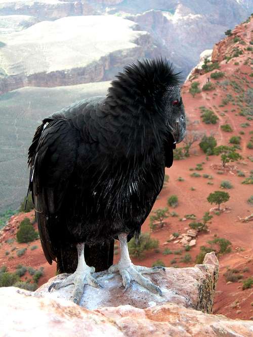 Condor Condor |
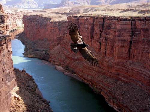 California Condor California Condor |
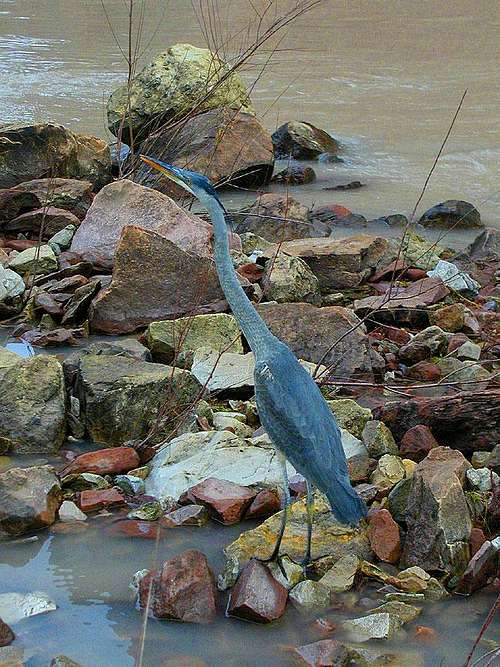 Heron Heron |