


-
 3155 Hits
-
 82.48% Score
-
 15 Votes
|
|
Route |
|---|---|
|
|
45.82727°N / 7.32794°E |
|
|
Mixed |
|
|
Spring |
|
|
Half a day |
|
|
Various according to the steepness of the slopes (by snowshoes) |
|
|
Note
|
La montagna chiama i suoi figli, ed essi rispondono fedelmente al suo appello… Osvaldo Cardellina, Diario alpinistico, 1964-65 Page texts: @ OsvaldoCardellina "Osva", passed away on May 2, 2022. Page owners: Christian Cardellina e Osvaldo Cardellina. Any updates from September 12, 2022: Antonio Giani, page administrator, friend and climbing companion. Testi della pagina: @ OsvaldoCardellina "Osva", scomparso il 2 maggio 2022. Proprietari pagina: Christian Cardellina e Osvaldo Cardellina. Eventuali aggiornamenti dal 12 settembre 2022: Antonio Giani, amministratore della pagina, amico e compagno di salite. |
Overview Saint Bernard, By Basin & Ollomont
After the 77 symbolic Routes with Snowshoes proposals for the South Slope of the Aosta Valley and the many along the balconies overhanging the course of the River Baltea, let us analyze a similar number of trips directed to the Northern hemisphere, or to the six valleys bordering with Switzerland as well as that of Saint Barthélemy which originates on the slopes of the beautiful Becca of Luseney, very popular and well-known peak in past centuries, then declined with an axis Northeast/Southwest toward the Central Valley. In order from West to East we have the valleys of the Great St. Bernard, Ollomomont with the upper Basin By, Valpelline, Saint Barthélemy, Valtournanche or Marmore Torrent, Ayas or Evançon and finally Gressoney or Lys Valley from Monte Rosa Chain. A series of other 77 trips that might become many more, depending on personal preferences. We propose these having them all done, but there is no reason to vary the routes enriching themselves with their choices. We propose these having them all done, but there is no reason to vary the routes enriching themselves with their choices. All these valleys descend in a more or less perpendicular to the Baltea, except, as already mentioned, that of Saint Barthélemy and long Valpelline that, with a similar trend, comes from the Dent d'Hérens; the other, or "Valtornenza" and Ayas, are at the foot of the Matterhorn and the chain that ends Breithorns from the Roccia Nera (Black Rock). As for the Great St. Bernard and Basin By these are huge terraces that lend themselves to hiking, to the other five valleys are held on long routes that share the same watersheds. In this paper we analyze the first part from Great Saint Bernard Lower/Middle/Upper Valley up By Conca (Basin) and Ollomont Valley.
![]()
Since this is a fairly wide area divide this work into two specific parts:
First Part:
1) - Gran San Bernardo Valley, in turn divided into two specific areas:
1a) - Southern Vallons.
1b) - Western & Northern Sides.
2) - Valley of Ollomont and superior By Basin.
Second Part:
3) - Valpelline.
4) - Valley of Saint Barthelemy.
5) - Valtournanche.
6) - Val d'Ayas.
7) - Valley of Gressoney.
Dopo le 77 simboliche Vie con Racchette da Neve proposte per il Versante Meridionale della Val d'Aosta e le altrettante lungo le balconate sovrastanti il corso del Fiume Dora Baltea, passiamo ad analizzare una similare serie di gite rivolte all'emisfero Settentrionale, ovvero verso le sei valli che confinano con la Svizzera oltre a quella di Saint Barthélemy originantesi alle pendici della splendida Becca di Luseney, frequentatissima e rinomata cima nei secoli passati, per poi discendere con un asse Nordest/Sudovest verso la Valle Centrale. In ordine da Ovest ad Est avremo le Valli del Gran San Bernardo, Ollomomont con la superiore Conca di By, Valpelline, Saint Barthélemy, Valtournanche o del Torrente Marmore, Ayas o dell'Evançon ed infine Gressoney o Valle del Lys che scende dalla Catena del Monte Rosa. Una serie di altre 77 gite che potrebbero diventare molte di più, a seconda delle personali preferenze. Noi proponiamo queste avendole tutte effettuate, ma nulla vieta di variare i percorsi arricchendo i medesimi con scelte proprie. Tutte queste valli scorrono in modo più o meno perpendicolare verso la Dora Baltea, tranne, come già detto, quella di Saint Barthélemy e la lunga Valpelline che, con analogo andamento, proviene dalla Dent d'Hérens; le altre, ovvero "Valtornenza" ed Ayas, sono ai piedi del Cervino e della Catena che dai Breithorns si conclude alla Roccia Nera. Mentre per Gran San Bernardo e Conca di By son questi enormi terrazzi che si prestano alle escursioni, per le altre cinque valli gli itinerari si svolgono sui lunghi spartiacque divisori le medesime In questo lavoro analizziamo la prima parte fino alla Conca di By ed Ollomont.
![]()
Trattandosi di un area alquanto vasta divideremo questo lavoro in due specifiche parti:
Prima Parte:
1) - Valle del Gran San Bernardo, a sua volta divisa in due specifici settori:
1a) - Valloni Meridionali.
1b) - Divisorio Occidentale e cresta di confine Settentrionale.
2) - Valle di Ollomont e suoperiore Conca di By.
Seconda Parte:
3) - Valpelline.
4) - Valle di Saint Barthélemy.
5) - Valtournanche.
6) - Val d'Ayas.
7) - Valle di Gressoney.
![]()
![]()
![]()
BY PLANE:
![]()
"With all these Getting Ther, Signs & Panels do not understand anything! ... / Con tutti sti Getting There & Panneaux non ci capisco più un tubo! ..."
![]()
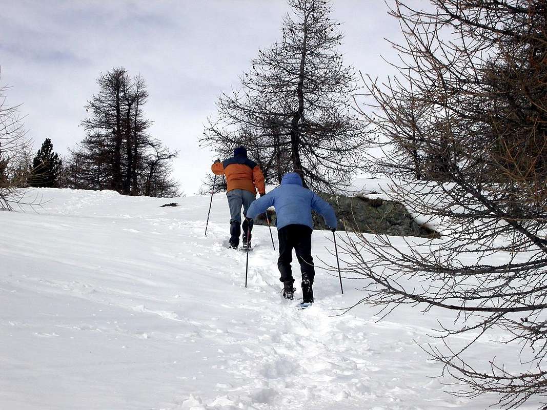
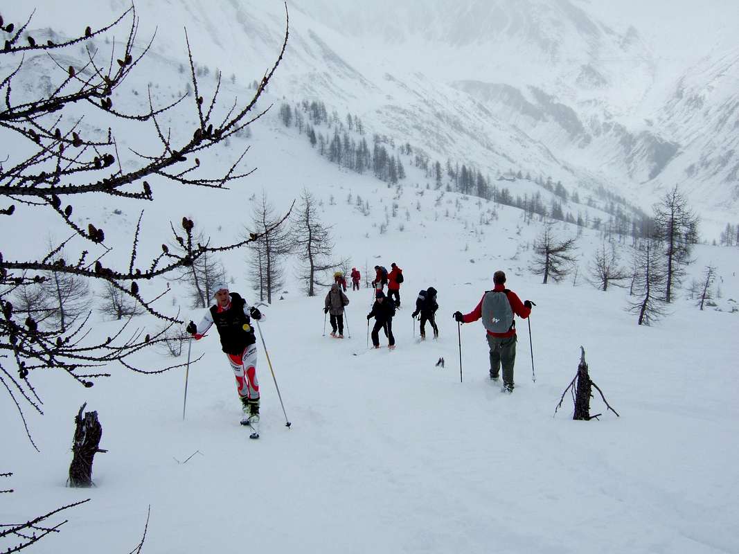
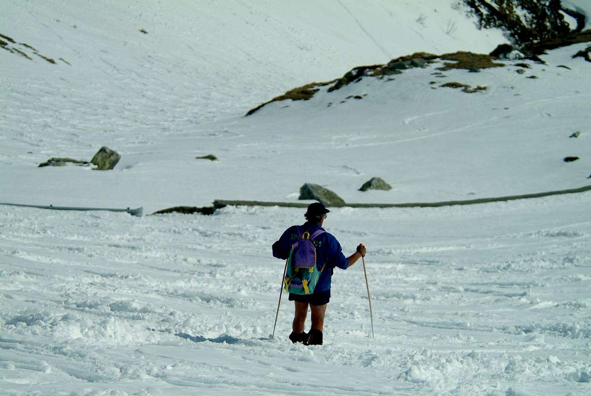
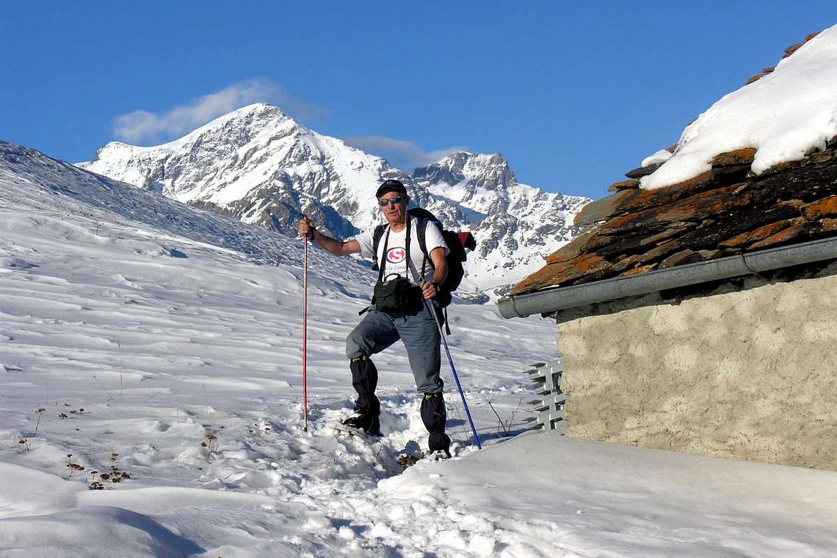
"Come on skis or by snowshoes? ... / Andiamo con gli sci o le racchette? ...", by andreaperino
![]()
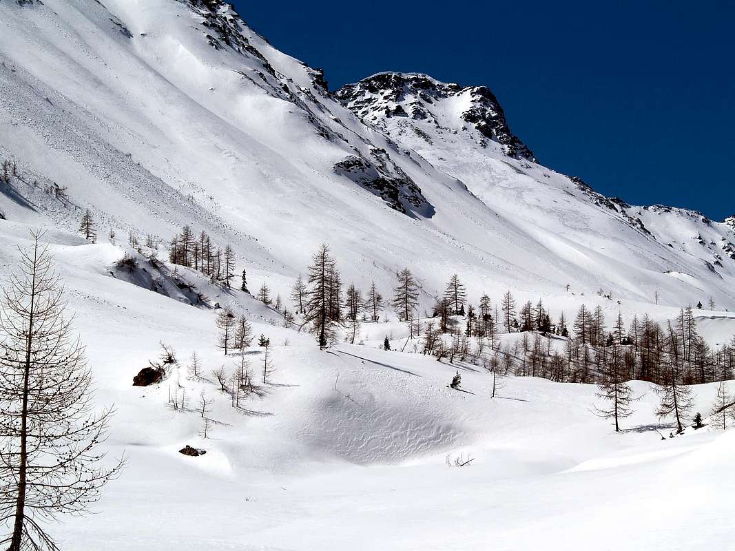
Great Saint Bernard Valley. Southern Vallons
It reaches from Gignod (9.88m), Etroubles (1.270m), Saint-Oyen (1.377m), Saint Rhémy en Bosses (1.619m) Municipalities.
Southern Side (From Pointe de Met to Malatrà Pass)
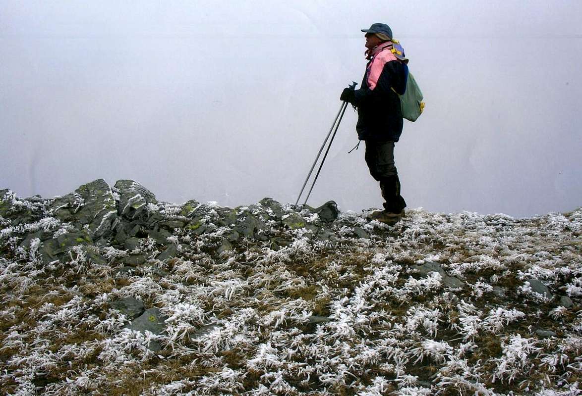
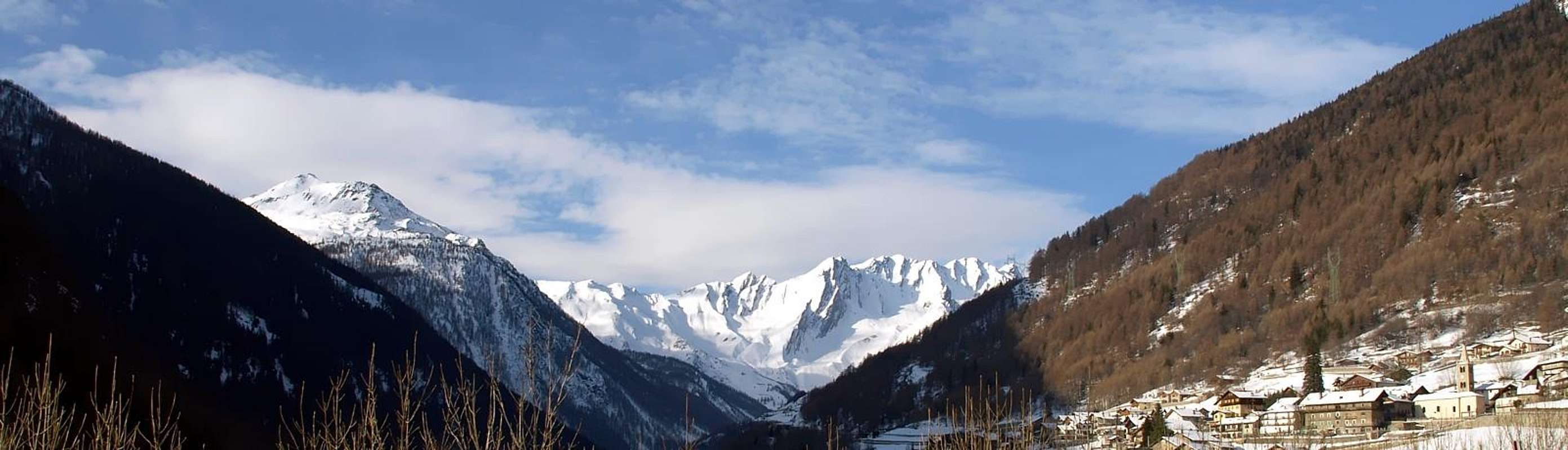
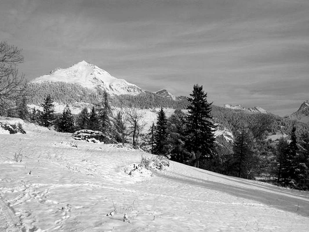
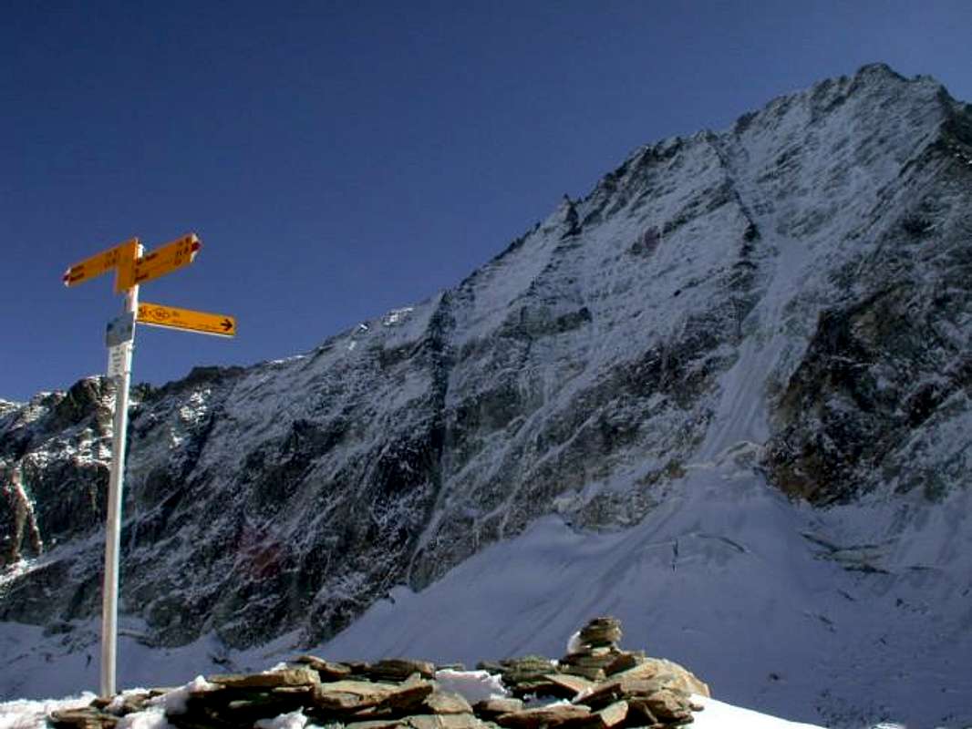
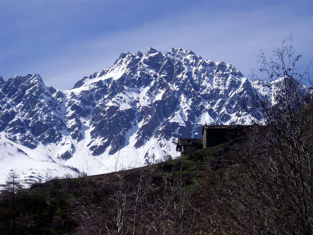
"At beginning of Great Saint Bernard Valley to Chaligne", by Maria Grazia Schiapparelli
![]()
1) - Basic Itinerary n° 1: from Grand Buthier-Champlorensal (1.315m) to Petit Buthier small Villages, Mendey (1.547m) Ronchaille (1.656m), Rombason (1.695m) Pastures (1.668m), Chaligne new Shelter nearby the homonym Alp (1.936m; E/F; 1h'45/2h'00), below Northeast Slope of Punta Chaligne (2.608m) and in East from Costa Tardiva Hill (2.410m).
2) - Minimum Route n° 1: from fork near Petit Buthier Village (1.409m; fountain), Mendey, Roncaille, Rombason Pastures to Arolla Dèsot (1.692m) or to Damon Alpages (1.794m; T/E; 1h'30/1h'45), always through dirt roads.
3) - Minimum Route n° 2: from fork 1.870 meters, unnamed pasture, Collet Alpage (1.919m; small dirt parking) to Lance Wood (between 1.850/1.950m; T; 0h'30/0h'45, for around half route). with dirt road to North-northeast.
"From Buthier Vallon to Chaligne Shelter", by sergioenrico
![]()
4) - Basic Itinerary n° 2: from Buthier (1.319m), Petit Buthier Villages towards Roncailles, Rombason, Collet Pastures, Cross 2.150 meters and traverse on watershed North/South of Costa Tardiva (2.380m) to Hill (M; 3h'45/4h'15).
5) - Variant n° 1: from Chaligne Shelter (1.936m) to Tardiva Hill, through West path in forest (E/F; 1h '45/2h '00).
6) - Variant n° 2: from Chaligne Shelter (1.936m; new since years 2000), through small path into forest, towards saddle (about 2.350m) on Eastern Crest of Punta Chaligne and traverse with short and easy descent to Met Alpage (2.261m; E/F; 2h'00/2h'15), in Southern Vallon below Eastern slopes of Met Summit and Hill (2.553m, 2.485m).
7) - Exceptional Route n° 1: from refuge, saddle about 2.350m, Punta Chaligne through final part of East Crest. NOTE: must be avoided both the ascent and the descent through the inviting especially the Northeast Slope; have already occurred on the same misfortunes mortal avalanche while backcountry skiing excursions. Even the Northern Ridge, which sends a branch to the Hill Tardiva and another to the Tsa Summit (2.742m), it is very dangerous; it should always be the first route that takes place inside the forest, and then it is certainly somewhat more safe and secure. Otherwise you must jump over the saddle, losing a little altitude, climb to the Col de Met (2.608m; M; 2h'45/3h'00).
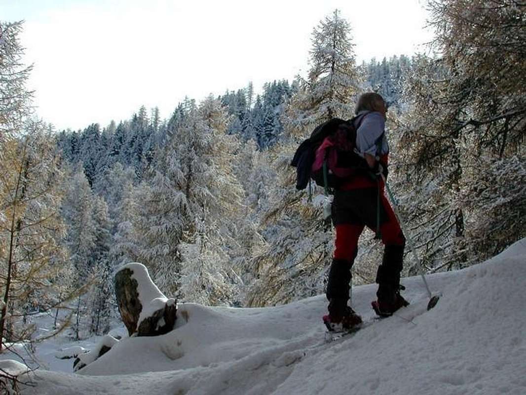
"To Arsy Tsa", by Antonio
![]()
8) - Basic Itinerary n° 3: from fork 1.750 meters towards Labié Wood, (Ru)Collet Pasture (1.919m) and along Collet Brook on dirt road to Arsy or Ars Alp and Ars Tsa Alpage (1.975m, 2.263m; E/F; 2h'15/2h'30), below Mont d'Arsy (2.830m)/Mont Fallère (3.061m)/three Lakes/Ars Pass (2.520m, 2.534m)/Mont de Labiez (2.832m), in homonym basin.
9) - Variant n° 3: from Tsa d'Arsy, pond (2.320m), with dirt road in Northwest towards unnamed alp (2.369m) in Ars Walloon; from this, with path in Southwest, to
![]()
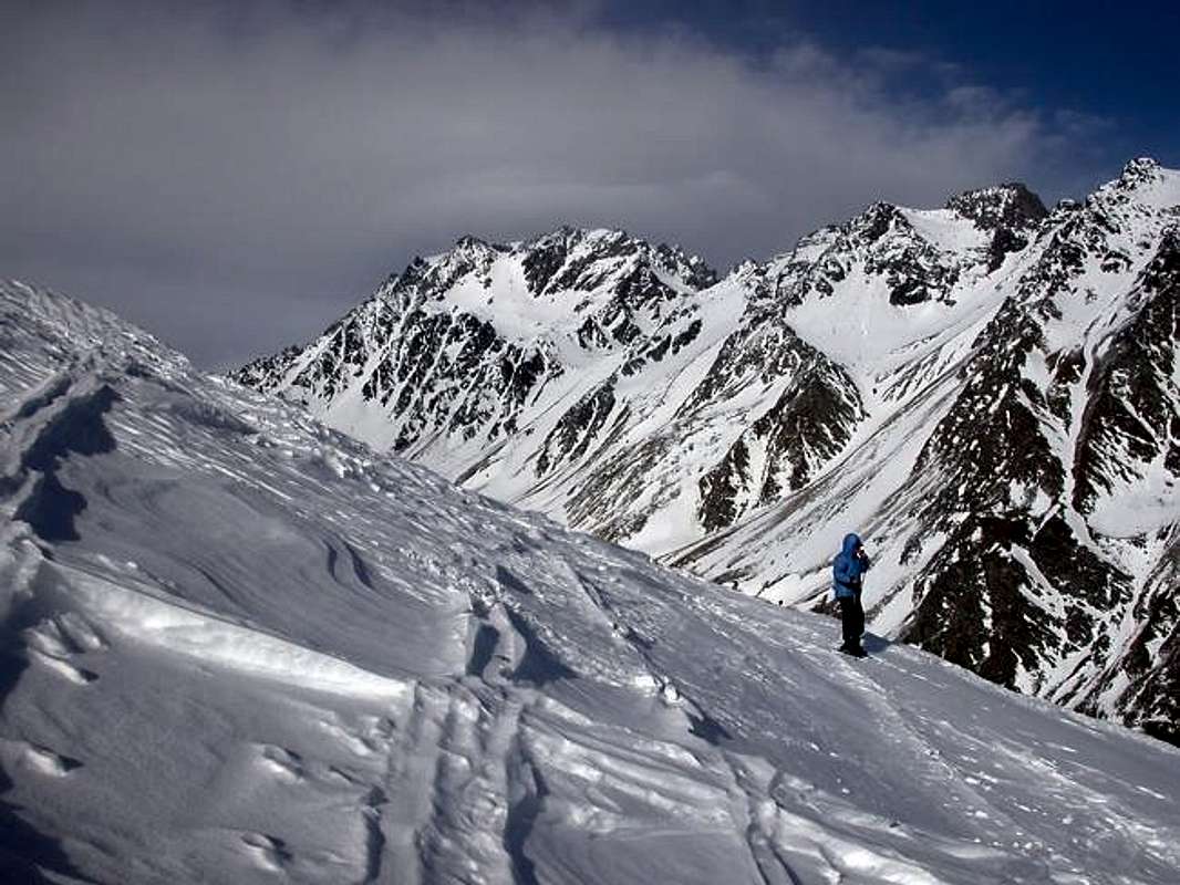
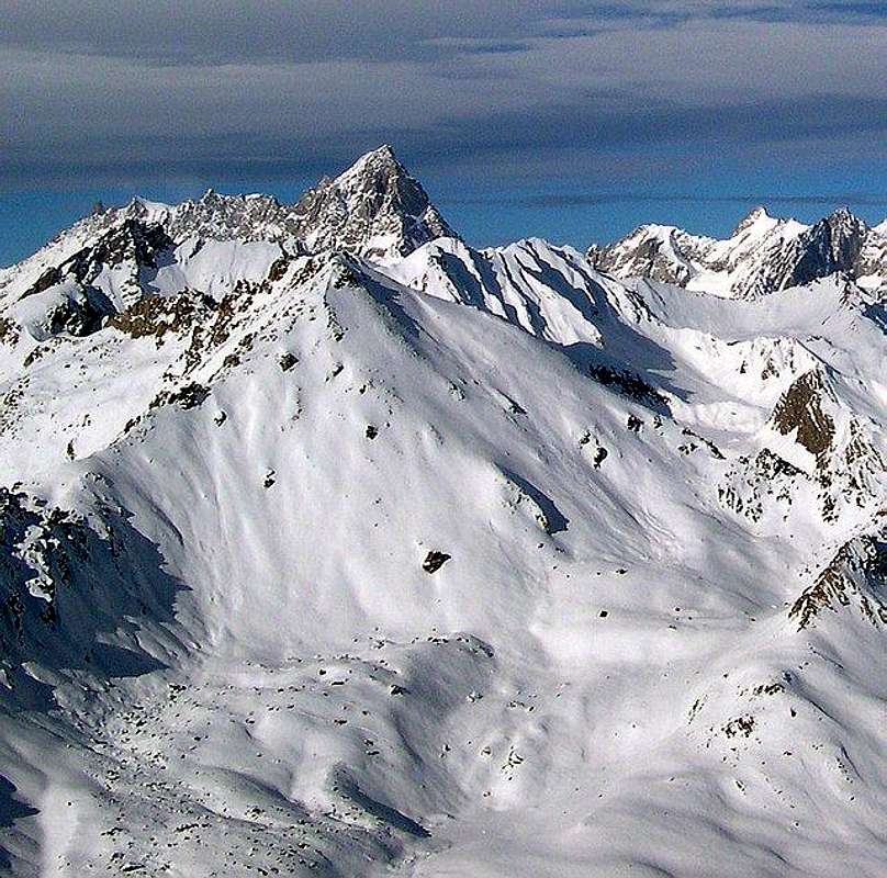
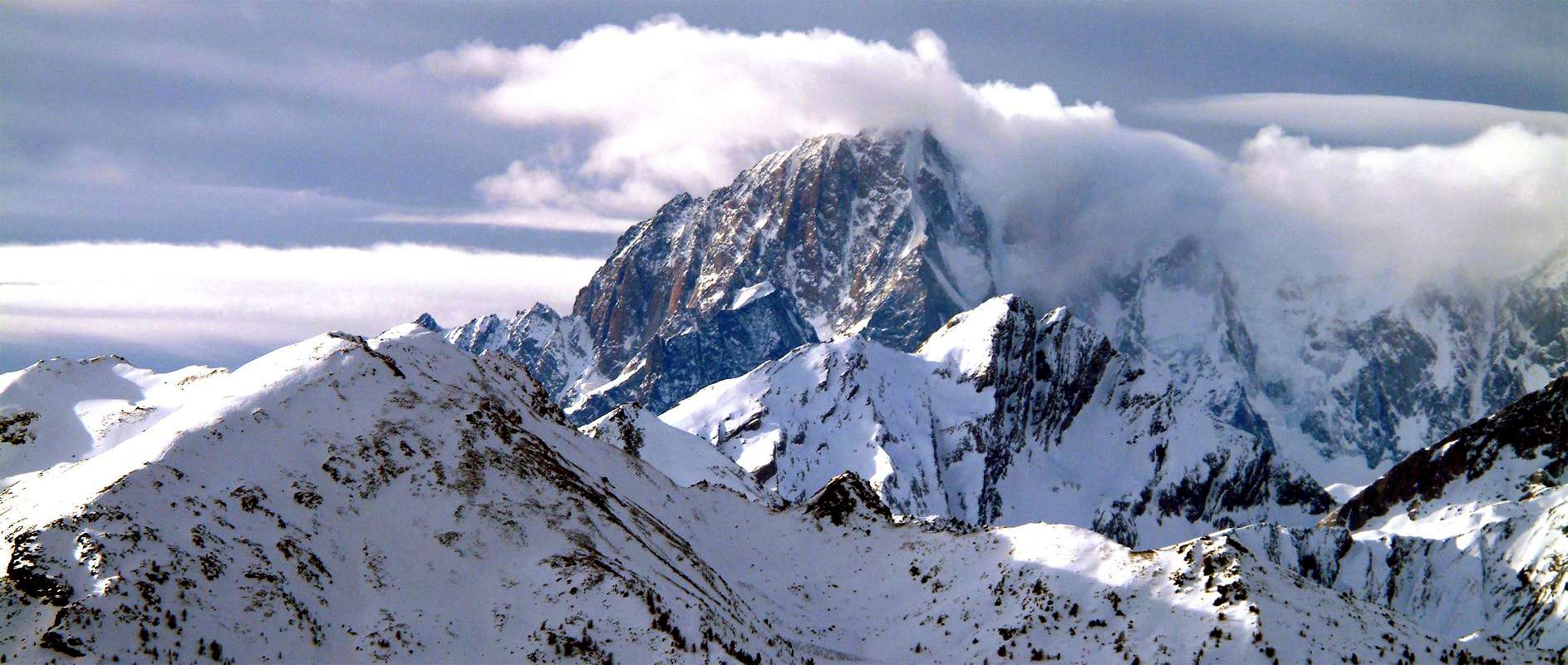
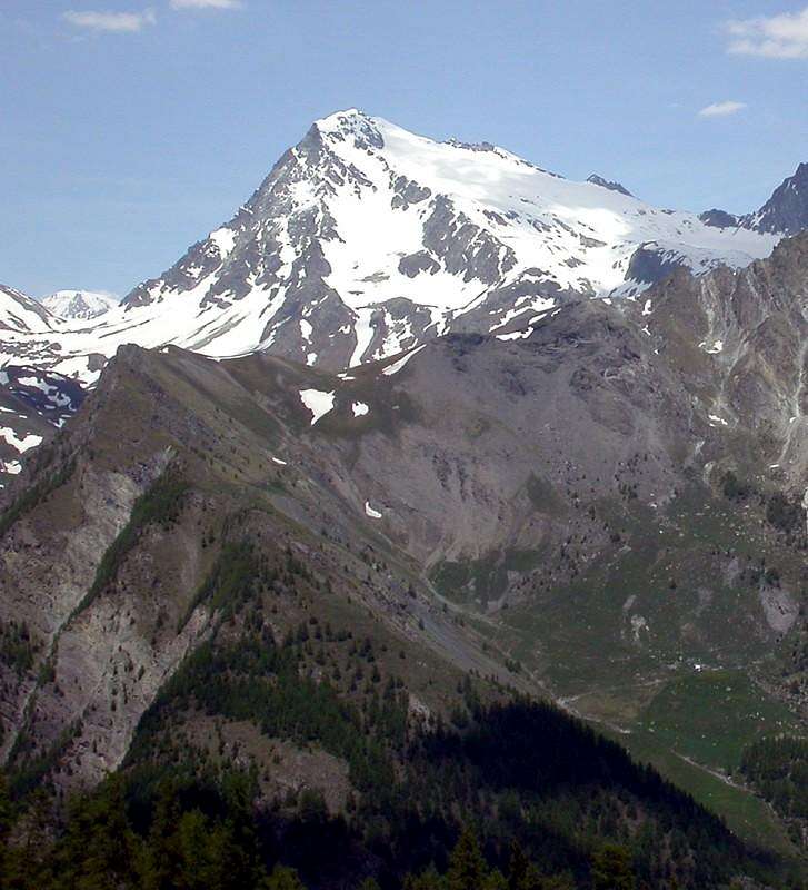
"Towards the Mount Blanc and above the Great St. Bernard", by emilius
![]()
![]()
"Arrivals to the Great, then vaulting over the Paglietta ... / Arrivi al Grande, poi volteggi sopra il Paglietta ...", by emilius
![]()
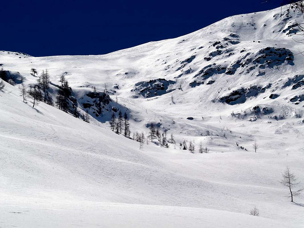
Great Saint Bernard Valley.
It reaches from Allein (1.251m), Etroubles (1.280m), Allein (1.251m), Saint Rhémy en Bosses (1.619m), Saint-Oyen (1.377m), Etroubles (1.270m) Municipalities.
Western & Northern Walloons (from Malatrà Pass to Mont Saron)
"Crossing Malatrà Pass", by Corvus
![]()
1) - Basic Itinerary n° 1: from Saint-Oyen, Mottes Fraction (1.660m; parking under Saint Bernard Road) also from Bosses-Cuchepache/Ronc Fractions (+; 1.648m; 1.775m) towards Comba Merdeux, Montagna Merdeux Dèsott (Low; 1.919m), Muanda or Moindaz Alp (1.973m), Tsa de Merdeux Upper Alp (2.285m), with various paths; to Malatrà Hill, with small path-traces, (2.928m), between Mont Quichette (3.043m)/Aiguille of Artanavaz (3.071m; E/F+; 1h'45/2h'00).
2) - Minimum Route n° 1: from Mottes towards Sez or Potz-Ardusi Alp, along Rio Artanavaz, at the entrance in Merdeux Comba (1.784m), Cotes Pasture (1.930m) to Merdeux Dèsot, Damon Alps (1.919m, 2.005m; T; 1h'15/1h'20).
3) - Basic Itinerary n° 2: from Muanda Alpage to fork (with dirt farms roads from Cuchepache Village 1.648m) about 2.125 metres at the beginning of Tula Basin and, along Tula or Thoules Torrent to frontal moraines of Bosses Glacier (about 2.675/80 meterts), below Petit Golliaz (3.234m)/Grand Golliaz (3.237m; E/F+; 2h'15/2h'30) small amphiteatre.
4) - Exceptional Route n° 1: from fork 2.675/80 meters, just below the frontal moraine of hanging Bosses Glacier, to Saulié or Cengles Pass (2.817m), with small path and traces in final part on North Slope and from this crossing to Aiguille of Saulié or Cengles, through rocky and indented West-northwest Crest (2.869m; from M to D-; 1h'30/1h'40).
5) - Variant n° 1: from preceding fork on moraines, below Bosses Glacier, in Nort-northwest to Angroniettes Pass, through scarce traces on debris and progressively steep moraines; reached a small and generally snowy basin, in diagonal route in Northeast to a terminal part of 50 meters more steep and pass (+; 2.936m; M+; 1h'45/2h'00).
"Saulié (left) & Angroniettes Passes, below Great Golliaz", by emilius
![]()
6) - Basic Itinerary n° 3: from Muanda Alpage to fork about 2.125 meters at beginning of Tula Comba and, over in East Tula Torrent and below Cote des Ollines, to Saint Rhémy Hill, through West Slope (2.540m; E/F; 3h'00/3h'15).
7) - Variant n° 2: from Saint Rhémy Hill, through Northwestern Crest to Mont Rodzo (2.632m; M; 1h'15/1h'30).
8) - Basic Itinerary n° 4: from Bosses-Cuchepache Fraction (1.648m) towards Arp du Jeux Pasture (1.994m), Plan de Moudzon Tableland, forks on dirt road 2.052 meters, 2.130 meters, unnamed alp (2.379m), winding road (2.446m) to Crévacol Hill and Crévacol Testa (2.498m, 2.610m, nearby Forest Rangers Bivouac private, closed; M; 3h'15/3h'30).
9) - Variant n° 3: from Bosses-Cuchepache to preceding unnamed alp, same route, to Mont Bortsalet, through West Slope, with dirt road, or from Crévacol Hill with small path and traces on crest watershed (2.513m; M-; 3h'00/3h'15).
10) - Minimum Route n° 2: from Cuchepache to, same road, two ponds (2.347m), fork before unnamed alp and, with dirt road, to Basse Tête (2.450m, neighbor the arrival of ski lift (2.399m) from Arp du Jeux; E/F; 2h'45/3h'00).
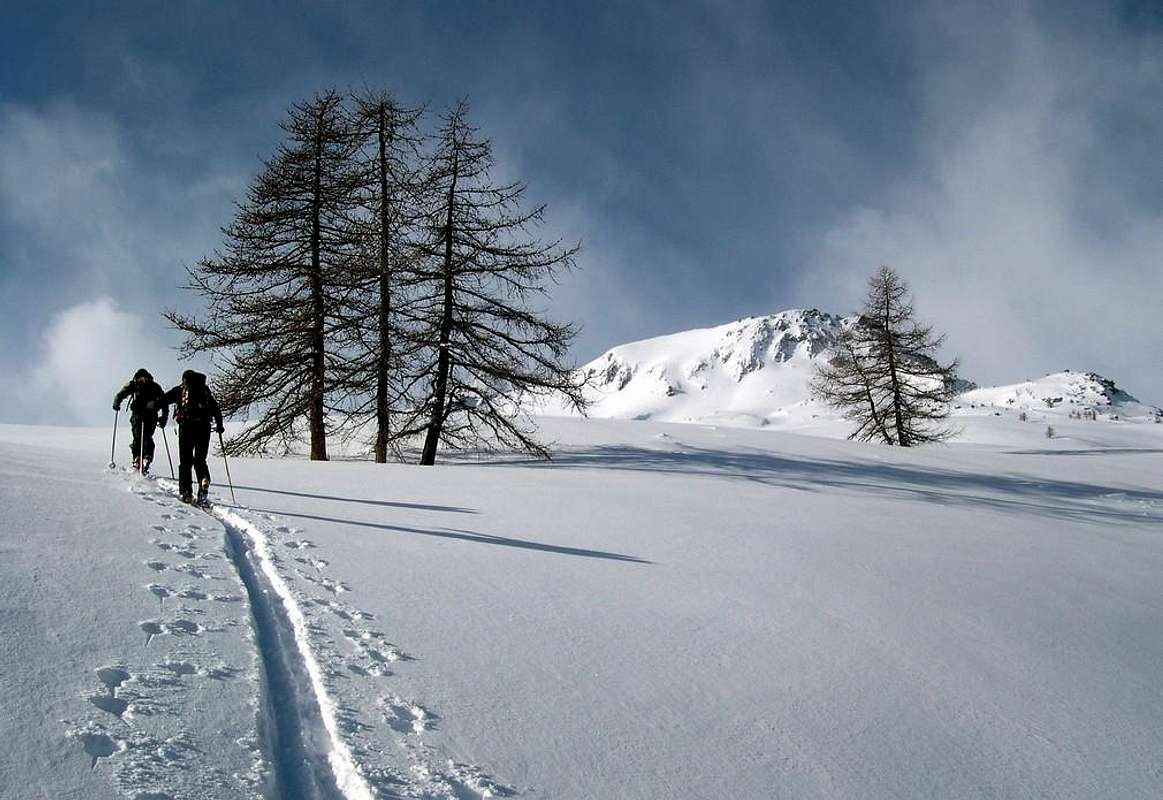
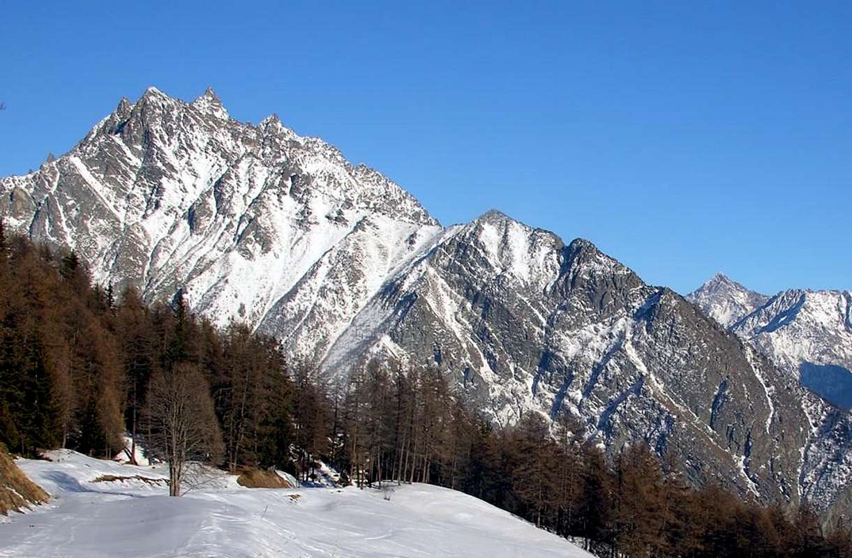
"Pain de Sucre/Fourchon/Fenêtre/Drone/Chenalette Vallons", by ronfo
![]()
11) - Basic Itinerary n° 5: from alternative immediately above Montagna Baou (2.356m), towards Fenêtre Vallon, alternative 2.400 meters to Fenêtre Hill, through Southern Slope, always with path, (2.600m; E/F+; 2h'30/2h'45).
12) - Basic Itinerary n° 6: from Praz d'Arc, on Great Saint Bernard State Road n° 27, (1.992m) or from following winding road (2.079m; mini parking) towards Farcoz Walloon, dirt road, to Tsa Praz de Farcoz (2.223m); from this, crossing Farcoz Torrent, to Saint-Rhémy Hill, through path in steep, grassy Eastern Slope (2.540m; E/F+; 2h'30/2h'45), between Southeast Crest of Aiguille de Leisaches or Aiguille des Sasses (3.015m)/Mont Rodzo-Crête des Ollines.
13) - Basic Itinerary n° 7 and descent Variant n° 4: from Montagna Baou or Baus, below dangling and overhanging Tower of Fous (2.576/9m), through good path in Northwest towards Fenêtre Vallon to fork about 2.500 meters; from this in North, on Southern Slopes, to Fenêtre de Ferret Hill (2.698m); E/F+; 1h'30/1h'45), between Tête de Fonteinte Southern Summit (2.772m)/Pointe de la Fenêtre (2.823m) at the beginning of long Arête des Vens.
Variant n° 4: possibility through short descent with path crossing the moraines to Swiss three Fenêtre Lochs (2.496m, 2.457m; E/F; 0h'30/0h'40), below Mont Telliers (2.951m)/Pointe du Bastillon (2.697m)/Pointe du Drone (2.949m).
14) - Variant n° 5: from parking on State Road, near Montagna Baou, towards Fenêtre Hill to Tête de Fenêtre Summit with path and through traces on East-northeast Slope and East Crest in terminal part (2.823m; F+; 1h'45/2h'00).
15) - Variant n° 5: from Montagna Baou (or from Great Saint Bernard Lake (2.477m), towards Northwestern little walloons) with small paths and traces, to Fenêtre d'en Haut or Fonteinte Pass, through steep debris on South Slope, (2.724m) and from this on crest to Fonteinte Southern and Northern Summits (2.772m, 2.775m; M-; 2h'20/2h'40).
"To Pain de Sucre", by emilius
![]()
16) - Exceptional Route n° 2: from Montagna Baou, with path in West-northwest and crossing the torrent in bottom, to fork about 2.500 meters; abandoning Northwest the path to Fenêtre Hill, continue more in West on walloon floor up to the a minipond (2.582m), passing completely towards Fenêtre Vallon. From this point, torning decisively South and through small traces reach a large saddle (about 2.810/5 meters), just in West of Pain de Sucre; before amongst great blocks and a small track on North-northwest Slope, after through the West Crest in terminal part, easily climbing a lower case "mauvais pas" but with great exposition on Southern Wall, to aerial Summit (+; 2.900m; D+; 3h'30/3h'45. Note: should be removed snowshoeing in the last part of that side and around 50 meters before reaching the crest).
17) - Exceptional Route n° 3: from Montagna Baou, alternative about 2.500 meters, minipond (2.582m), towards Pain de Sucre/Fourchon Vallon, large saddle (around 2.830/40m) to
![]()
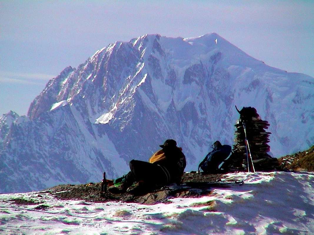
"On Malatrà Hill & to Mount Fourchon", by Corvus & emilius
![]()
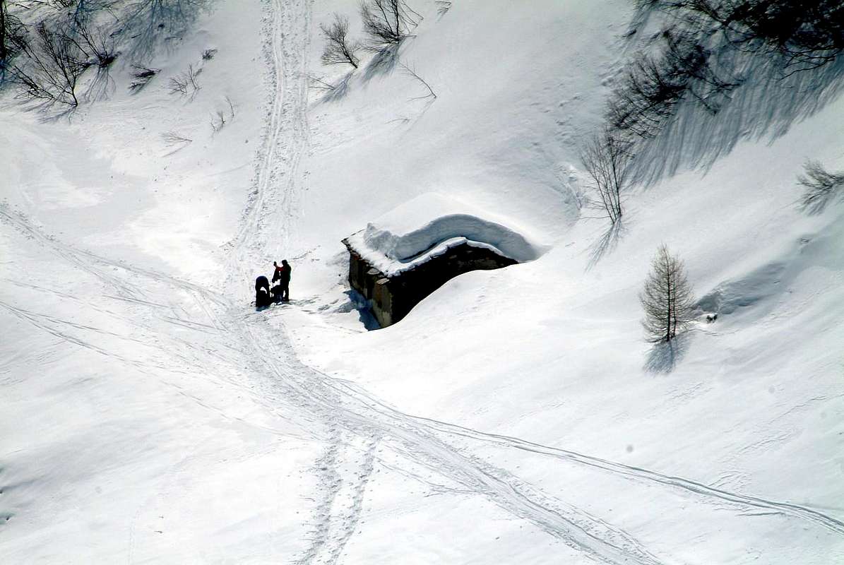
To By Conca, by sarme
![]()
![]()
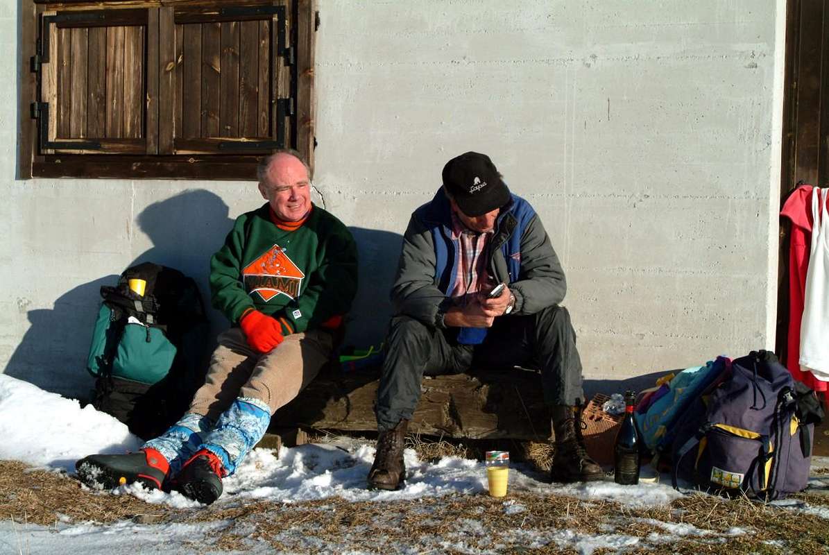
"In my opinion these two have little desire to work hard! ... /Per me sti due han voglia di far 'na mazza! ...", by emilius
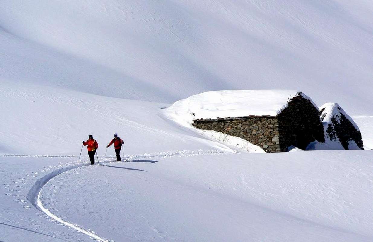
By ConcaIt reaches from Allein (1.251m), Doues (1.176m), Ollomont (1.356m) Municipalities.
Northern Basin & Eastern Side (From Mont Saron to Breuson Hill)
"Ollomont Valley & By Conca", by maria grazia s
![]()
![]()
"You rest above and below ... / Ti riposi sù e ti riposi giù ...", by emilius
![]()
Trattandosi di un area alquanto vasta divideremo questo lavoro in due specifiche parti:
Prima Parte:
1) - Valle del Gran San Bernardo, a sua volta divisa in due specifici settori:
1a) - Valloni Meridionali.
1b) - Divisorio Occidentale e cresta di confine Settentrionale.
2) - Valle di Ollomont e suoperiore Conca di By.
Seconda Parte:
3) - Valpelline.
4) - Valle di Saint Barthélemy.
5) - Valtournanche.
6) - Val d'Ayas.
7) - Valle di Gressoney.
Getting There
BY CAR:- From TORINO, MILANO, etc: Motorway A5. Exit at IVREA or Quincinetto (PIEDMONT).
- From IVREA Town: before in West to Aosta, after in Northwest to Gignod, Etroubles, Saint-Oyen, Saint Rhémy en Bosses, (Southwestern and Northwestern Sides) and in North to Allein, Doues, Valpelline (Northeastern Side) Municipalities.
- From Courmayeur Resort: before in East to Aosta, after in Northwest to Gignod, Etroubles, Saint-Oyen, Saint Rhémy en Bosses, (Southwestern and Northwestern Sides) and in North to Allain, Doues, Valpelline (Northeastern Side) Municipalities.
![]()
Southwestern Side:
From Aosta Town to Merdeux Basin - From Gignod Commune (988m) with Great Saint Bernard State Road n° 27 to alternative nearby Condemine Hamlet (1.137m); leaving left through Municipal Road to Grand e Petit Buthier Villages (1.302m, 1.439m) in Chaligne Comba. From this last, with private dirt farms roads and through Mendey, Roncaille, Rombason Pastures up to the Chaligne Shelter (1.936m), below Costa Tardiva (2380m), Tardiva Hill (2.410m) and neighbor the Punta Chaligne (2.608m).
- From Etroubles Commune (1.270m), with dirt road and through Champ-Reclos (1.425m), Yettes (1.591m), Eteley (1.716m), fork before Praz-Gallet (1.626m), Ars (1.975m) Pastures on Arsy Vallon, up to Chaz d'Arsy (2.543mn); from this paths to Ars Pass (2.534m), Costa Labiez (2.632m).
- From Etroubles Commune (1.270m), with dirt road through Champex (1.411m; fork), Flassin de Meitin (1.654m), Flassin (1.700m), Tsa de Flassin (2.258m) Pastures on Flassin Vallon; from this paths to Fenêtre Pass (2.729m), Flassin Hill (2.605m), Testa Cordella (2.663m) and Tête Bois de Quart (2.248m).
- From Saint-Oyen Commune (1.377m), with SR.27 to alternative 1.502 meters; leaving North the same to great St. Bernard Hill, continue West to St. Leonard Fraction.
- From this to Citrin Vallon up to the Mont Flassin (2.772m) Citrin Hill (2.484m), Punta Valletta (2.801m) and La Raye du Sodzé (2.640m).
- From Saint-Oyen Commune (1.377m), with previous Municipal Road to Mottes (1.660m) Fraction, Farettes (1.666m) Village; from this, with path through Arp du Bois Dèsott Pastures (1.936m), alternative 1.959 meters to Serena Vallon up to the Hill Serena (2.547m) and Testa Serena (2.830m). Variant: continue West from Farettes Village to Saint Michel (1.732m) Fraction; from this last, tourning South always with Municipal Road, to Arp du Bois Dèsott Pastures.
![]()
Northwestern Side:
From Malatrà Hill to Grand Saint Bernard Basin Basin up to the - From Saint-Oyen (1.377m), with previous road to Mottes, continue West-northwest to Devies Village (1.723m) at the beginning of Merdeux Comba; from this with paths through Merdeux Dèsott (1.919m), Cotes (1.930m), Manda (1.973m), Tsa de Merdeux (2.285m) Pastures to Malatrà Hill (2.928m).
- From Saint Rhémy en Bosses Commune (1.619m), through Municipal Road, on Merdeux Comba to Tsa de Merdeux (2.285m) and Malatrà Hill (2.928m).
- From Saint Rhémy en Bosses Commune (1.619m) to Tula Comba to Saulié Pass (2.817m), Aiguille des Cengles (2.869m) and Angroniettes Pass (2.936m).
- From Saint Rhémy en Bosses Commune (1.619m) to Grand Saint Bernard Valley up to the Crévacol Hill and Testa (2.498m, 2.610m) Saint Rhémy Hill (2.540m), Mont Rodzo (2.632m), Pain de Sucre (2.900m), Mont Fourchon (2.902m), Fenêtre de Ferret Hill (2.600m) and Grand Saint Bernard Hill (2.469m).
Northeastern Side:
From Allain/Doues to Ollomont/Valpelline Communes with By Basin
- From Allein Commune (1.251m), with Regional and Municipal Roads, to By Basin; from the entrance of this (various alpages reached by private dirt farms roads), through paths, up to the Mont Saron Southern Antesummit (2.681m) and traverse on crest to Tete de la Praz (2.751m) and Crou de Bleintse (2.824m).
- From Doues Commune (1.176m), with in asphalt Municipal Road, to By Basin; from this, with paths or dirt roads, to Mont Saron (2.681m), Crou de Bleintse (2.824m), Letey Refuge below Champillon Pass (2.430), Mont Chenaille two Summits (3.144m), Tsa d'Ansermin (2.388m) and Monte Rotondo (2.572m).
- From Ollomont Commune (1.356m), trhough noumerous paths and variaous upper dirt farms roads, to By Conca; from this various routes in all directions up to the Maria Cristina Rosazza at Savoie Bivouac (2.674m), Refuge Franco Chiarella-Amiante (2.979m), Filon Alp (2.478m), Bonne Mort Pass (2.646m), Fenêtre Durand Hill (2.797m), Nino Regondi Bivouac (2.599m) and Lakes, Tsa de Berrio Alp (2.165m), Cormet Hill (2.354m) and Breuson Hill (2.194m).

- From FRANCE: through the Mont Blanc Tunnel to Entrèves-crossroads to Vény/Ferret Valleys - Mountain Guides of Courmayeur - La Saxe Rock Gym - Courmayeur. By Little Saint Bernard Pass, closed since November until half May to La Thuile Valley - Pré Saint Didier - Courmayeur. It is not necessary to take Motorway A5: you can drive on SS.26, in the direction of AOSTA - IVREA - TURIN.
BY PLANE:
- Aeroporto "Corrado Gex" Saint Christophe (Aosta).

Great Saint Bernard South Side to "Coumba Freida"
It reaches from Gignod (9.88m), Etroubles (1.270m), Saint-Oyen (1.377m), Saint Rhémy en Bosses (1.619m) Municipalities.
Southern Side (From Pointe de Met to Malatrà Pass)
1) - Basic Itinerary n° 1: from Grand Buthier-Champlorensal (1.315m) to Petit Buthier small Villages, Mendey (1.547m) Ronchaille (1.656m), Rombason (1.695m) Pastures (1.668m), Chaligne new Shelter nearby the homonym Alp (1.936m; E/F; 1h'45/2h'00), below Northeast Slope of Punta Chaligne (2.608m) and in East from Costa Tardiva Hill (2.410m).
2) - Minimum Route n° 1: from fork near Petit Buthier Village (1.409m; fountain), Mendey, Roncaille, Rombason Pastures to Arolla Dèsot (1.692m) or to Damon Alpages (1.794m; T/E; 1h'30/1h'45), always through dirt roads.
3) - Minimum Route n° 2: from fork 1.870 meters, unnamed pasture, Collet Alpage (1.919m; small dirt parking) to Lance Wood (between 1.850/1.950m; T; 0h'30/0h'45, for around half route). with dirt road to North-northeast.
4) - Basic Itinerary n° 2: from Buthier (1.319m), Petit Buthier Villages towards Roncailles, Rombason, Collet Pastures, Cross 2.150 meters and traverse on watershed North/South of Costa Tardiva (2.380m) to Hill (M; 3h'45/4h'15).
5) - Variant n° 1: from Chaligne Shelter (1.936m) to Tardiva Hill, through West path in forest (E/F; 1h '45/2h '00).
6) - Variant n° 2: from Chaligne Shelter (1.936m; new since years 2000), through small path into forest, towards saddle (about 2.350m) on Eastern Crest of Punta Chaligne and traverse with short and easy descent to Met Alpage (2.261m; E/F; 2h'00/2h'15), in Southern Vallon below Eastern slopes of Met Summit and Hill (2.553m, 2.485m).
7) - Exceptional Route n° 1: from refuge, saddle about 2.350m, Punta Chaligne through final part of East Crest. NOTE: must be avoided both the ascent and the descent through the inviting especially the Northeast Slope; have already occurred on the same misfortunes mortal avalanche while backcountry skiing excursions. Even the Northern Ridge, which sends a branch to the Hill Tardiva and another to the Tsa Summit (2.742m), it is very dangerous; it should always be the first route that takes place inside the forest, and then it is certainly somewhat more safe and secure. Otherwise you must jump over the saddle, losing a little altitude, climb to the Col de Met (2.608m; M; 2h'45/3h'00).
8) - Basic Itinerary n° 3: from fork 1.750 meters towards Labié Wood, (Ru)Collet Pasture (1.919m) and along Collet Brook on dirt road to Arsy or Ars Alp and Ars Tsa Alpage (1.975m, 2.263m; E/F; 2h'15/2h'30), below Mont d'Arsy (2.830m)/Mont Fallère (3.061m)/three Lakes/Ars Pass (2.520m, 2.534m)/Mont de Labiez (2.832m), in homonym basin.
9) - Variant n° 3: from Tsa d'Arsy, pond (2.320m), with dirt road in Northwest towards unnamed alp (2.369m) in Ars Walloon; from this, with path in Southwest, to
1) - Arsy Pass. From pass, path in North under the watershed, to, through South Crest,
2) - Costa Labiez, near private and closed Forest Rangers Bivouac (2.632m; E/F; 2h'00/2h'15).
"To Arsy Pass", by Antonio
![]()
10) - Basic Itinerary n° 4: from Saint-Oyen (+; 1.373m) towards wooden small bridge above Artanavaz Torrent, Hotel Mont Velan, Campings "Mulino & Pineta", through dirt road between Rond/Champex Pastures, Flassin de Meitin Pasture (+; 1.654m), Montagna Flassin (1.700m), crossing the torrent in altitude around 2.210/20 meters to Upper Tsa Flassin (2.258m; E/F; 3h'30/4h'00), into large hemi circular Northern basin below Testa Cordella (2.663m)/Mont Flassin (2.762m)/Flassin Hill (2.607m)/Fenêtre Pass (2.728m)/Western Shoulder (2.971m)/North-northeastern Ridge of Mont Fallère (3.061m; private and closed shelter by Forest Rangers)/Ars Pass (2.533m)/Costa Labiez/Grande Testa (2.457m).
"To Flassin Tsa", by andreaperino
![]()
11) - Exceptional Route n° 2: from Saint-Oyen towards Tsa de Flassin to moraines below Fenêtre Pass (2.729m), through North Slope with progressively more steep groundstones and blocks in terminal part (M+; 3h'45/4h'00).
12) - Variant n° 4: from Saint-Oyen Municipality towards Flassin Basin, Tsa de Flassin Upper Pasture, with dirt road; from alpage to Fenêtre Pass, through North Slope on steep debris, blocks and rotten rocks; easily continue, with traces amongst various hunting cairns and shelters on Northeast Crest, to Mont Vertosan (2.822m; M+; 4h'00/4h'15).
"Flassin Vallon from Fenêtre Pass", by livioz
![]()
13) - Exceptional Route n° 3: from Saint-Oyen towards Flassin Comba and above, in East, Flassin Torrent, Tsa de Flassin to Flassin Hill (2.605m), through small traces amongst debris on North-northeast Slope (M; 3h'30/4h'00).
14) - Exceptional Route n° 4: from Saint-Oyen towards Flassin Combe (Basin), Lower Flassin, Tsa (Upper) de Flassin, unnamed alp (2.439m; ruins) to Testa Cordella (2663m), through path-traces on Southeast Slope (M; 3h'30/4h'15).
"Flassin Vallon & Testa Cordella", by Marco Cossard "Crevassino"
![]()
15) - Variant n° 5: from Saint-Oyen, neighbor Flassin Camping at the beginning of Flassin Walloon, towards Lower Flassin to Tsa de Flassin Alpages, with dirt road in Flassin Comba (Basin); from this to Tête Bois de Quart, nearby Forest Rangers Bivouac (2.248m; private), through easy diagonal path on South-southeast Slope (E/F; 1h'00/1h'15).
16) - Basic Itinerary n° 5: from Saint-Oyen-San Leonardo (+; 1.519m) towards small bridge above Artanavaz Torrent, Lower Citrin Pasture (1.504m) and Middle (2.005m) to Tsa de Citrin, always with path (2.312m; E/F+; 1h'45/2h'00).
17) - Exceptional Route n° 5: from Saint-Oyen-San Leonard (1.519m), Comba (+; 1.499m), Pont Fractions, "Chalybeate Source", Citrin de Meitin (2.005m), Tsa de Citrin or Damon (2.312m), Citrin Hill (2.484m), with paths; to Mounts Flassin (2.767m, 2.772m), through West-northwest Crest (better to remove snowshoes; D-; 5h'30/6h'15).
"Citrin Vallon, Punta Valletta & La Raye du Sodzé from Mont Flassin", by andreaperino
![]()
18) - Exceptional Route n° 6: from Saint-Oyen towards Tsa Citrin upper alp, fork 2.397 meters, Citrin mini Pond (2.445m) to Punta Valletta (2.801m), through traces amongst debris, blocks on Northeast Slope (D; 5h'45/6h'30).
19) - Variant n° 6: from Tsa de Citrin to La Raye du Sodzé (2.640m), through East Slope (M+/D-; 1h'00/1h'15).
20) - Basic Itinerary n° 6: from Saint-Oyen-Maytie (1.676m) toward bridge above Artanavaz Torrent, Farettes Village (1.666m), near Ponty Pasture (1.685m), Arp du Bois Dèsot (1.936m) to Serena Hill (2.547m; E/F+; 3h'45/4h'00).
"To Serena Hill", by lucabertollo
![]()
21) - Exceptional Route n° 7: from Saint-Oyen-Mottes towards Serena Vallon, Serena Hill, with path; to Testa Serena (2.830m), through quite easy West-northwest rocky Crest (better to remove snowshoes; D-; 5h '00/5h '30).
"To Testa of Serena, by Western Crest", by ronfo
![]()
^^^^^^^
10) - Basic Itinerary n° 4: from Saint-Oyen (+; 1.373m) towards wooden small bridge above Artanavaz Torrent, Hotel Mont Velan, Campings "Mulino & Pineta", through dirt road between Rond/Champex Pastures, Flassin de Meitin Pasture (+; 1.654m), Montagna Flassin (1.700m), crossing the torrent in altitude around 2.210/20 meters to Upper Tsa Flassin (2.258m; E/F; 3h'30/4h'00), into large hemi circular Northern basin below Testa Cordella (2.663m)/Mont Flassin (2.762m)/Flassin Hill (2.607m)/Fenêtre Pass (2.728m)/Western Shoulder (2.971m)/North-northeastern Ridge of Mont Fallère (3.061m; private and closed shelter by Forest Rangers)/Ars Pass (2.533m)/Costa Labiez/Grande Testa (2.457m).
11) - Exceptional Route n° 2: from Saint-Oyen towards Tsa de Flassin to moraines below Fenêtre Pass (2.729m), through North Slope with progressively more steep groundstones and blocks in terminal part (M+; 3h'45/4h'00).
12) - Variant n° 4: from Saint-Oyen Municipality towards Flassin Basin, Tsa de Flassin Upper Pasture, with dirt road; from alpage to Fenêtre Pass, through North Slope on steep debris, blocks and rotten rocks; easily continue, with traces amongst various hunting cairns and shelters on Northeast Crest, to Mont Vertosan (2.822m; M+; 4h'00/4h'15).
13) - Exceptional Route n° 3: from Saint-Oyen towards Flassin Comba and above, in East, Flassin Torrent, Tsa de Flassin to Flassin Hill (2.605m), through small traces amongst debris on North-northeast Slope (M; 3h'30/4h'00).
14) - Exceptional Route n° 4: from Saint-Oyen towards Flassin Combe (Basin), Lower Flassin, Tsa (Upper) de Flassin, unnamed alp (2.439m; ruins) to Testa Cordella (2663m), through path-traces on Southeast Slope (M; 3h'30/4h'15).

15) - Variant n° 5: from Saint-Oyen, neighbor Flassin Camping at the beginning of Flassin Walloon, towards Lower Flassin to Tsa de Flassin Alpages, with dirt road in Flassin Comba (Basin); from this to Tête Bois de Quart, nearby Forest Rangers Bivouac (2.248m; private), through easy diagonal path on South-southeast Slope (E/F; 1h'00/1h'15).
16) - Basic Itinerary n° 5: from Saint-Oyen-San Leonardo (+; 1.519m) towards small bridge above Artanavaz Torrent, Lower Citrin Pasture (1.504m) and Middle (2.005m) to Tsa de Citrin, always with path (2.312m; E/F+; 1h'45/2h'00).
17) - Exceptional Route n° 5: from Saint-Oyen-San Leonard (1.519m), Comba (+; 1.499m), Pont Fractions, "Chalybeate Source", Citrin de Meitin (2.005m), Tsa de Citrin or Damon (2.312m), Citrin Hill (2.484m), with paths; to Mounts Flassin (2.767m, 2.772m), through West-northwest Crest (better to remove snowshoes; D-; 5h'30/6h'15).
18) - Exceptional Route n° 6: from Saint-Oyen towards Tsa Citrin upper alp, fork 2.397 meters, Citrin mini Pond (2.445m) to Punta Valletta (2.801m), through traces amongst debris, blocks on Northeast Slope (D; 5h'45/6h'30).
19) - Variant n° 6: from Tsa de Citrin to La Raye du Sodzé (2.640m), through East Slope (M+/D-; 1h'00/1h'15).
20) - Basic Itinerary n° 6: from Saint-Oyen-Maytie (1.676m) toward bridge above Artanavaz Torrent, Farettes Village (1.666m), near Ponty Pasture (1.685m), Arp du Bois Dèsot (1.936m) to Serena Hill (2.547m; E/F+; 3h'45/4h'00).
21) - Exceptional Route n° 7: from Saint-Oyen-Mottes towards Serena Vallon, Serena Hill, with path; to Testa Serena (2.830m), through quite easy West-northwest rocky Crest (better to remove snowshoes; D-; 5h '00/5h '30).
Great Saint Bernard North Side to Saint Bernard Hospice

It reaches from Allein (1.251m), Etroubles (1.280m), Allein (1.251m), Saint Rhémy en Bosses (1.619m), Saint-Oyen (1.377m), Etroubles (1.270m) Municipalities.
Western & Northern Walloons (from Malatrà Pass to Mont Saron)

1) - Basic Itinerary n° 1: from Saint-Oyen, Mottes Fraction (1.660m; parking under Saint Bernard Road) also from Bosses-Cuchepache/Ronc Fractions (+; 1.648m; 1.775m) towards Comba Merdeux, Montagna Merdeux Dèsott (Low; 1.919m), Muanda or Moindaz Alp (1.973m), Tsa de Merdeux Upper Alp (2.285m), with various paths; to Malatrà Hill, with small path-traces, (2.928m), between Mont Quichette (3.043m)/Aiguille of Artanavaz (3.071m; E/F+; 1h'45/2h'00).
2) - Minimum Route n° 1: from Mottes towards Sez or Potz-Ardusi Alp, along Rio Artanavaz, at the entrance in Merdeux Comba (1.784m), Cotes Pasture (1.930m) to Merdeux Dèsot, Damon Alps (1.919m, 2.005m; T; 1h'15/1h'20).
3) - Basic Itinerary n° 2: from Muanda Alpage to fork (with dirt farms roads from Cuchepache Village 1.648m) about 2.125 metres at the beginning of Tula Basin and, along Tula or Thoules Torrent to frontal moraines of Bosses Glacier (about 2.675/80 meterts), below Petit Golliaz (3.234m)/Grand Golliaz (3.237m; E/F+; 2h'15/2h'30) small amphiteatre.
4) - Exceptional Route n° 1: from fork 2.675/80 meters, just below the frontal moraine of hanging Bosses Glacier, to Saulié or Cengles Pass (2.817m), with small path and traces in final part on North Slope and from this crossing to Aiguille of Saulié or Cengles, through rocky and indented West-northwest Crest (2.869m; from M to D-; 1h'30/1h'40).
5) - Variant n° 1: from preceding fork on moraines, below Bosses Glacier, in Nort-northwest to Angroniettes Pass, through scarce traces on debris and progressively steep moraines; reached a small and generally snowy basin, in diagonal route in Northeast to a terminal part of 50 meters more steep and pass (+; 2.936m; M+; 1h'45/2h'00).
6) - Basic Itinerary n° 3: from Muanda Alpage to fork about 2.125 meters at beginning of Tula Comba and, over in East Tula Torrent and below Cote des Ollines, to Saint Rhémy Hill, through West Slope (2.540m; E/F; 3h'00/3h'15).
7) - Variant n° 2: from Saint Rhémy Hill, through Northwestern Crest to Mont Rodzo (2.632m; M; 1h'15/1h'30).
8) - Basic Itinerary n° 4: from Bosses-Cuchepache Fraction (1.648m) towards Arp du Jeux Pasture (1.994m), Plan de Moudzon Tableland, forks on dirt road 2.052 meters, 2.130 meters, unnamed alp (2.379m), winding road (2.446m) to Crévacol Hill and Crévacol Testa (2.498m, 2.610m, nearby Forest Rangers Bivouac private, closed; M; 3h'15/3h'30).
9) - Variant n° 3: from Bosses-Cuchepache to preceding unnamed alp, same route, to Mont Bortsalet, through West Slope, with dirt road, or from Crévacol Hill with small path and traces on crest watershed (2.513m; M-; 3h'00/3h'15).
10) - Minimum Route n° 2: from Cuchepache to, same road, two ponds (2.347m), fork before unnamed alp and, with dirt road, to Basse Tête (2.450m, neighbor the arrival of ski lift (2.399m) from Arp du Jeux; E/F; 2h'45/3h'00).
11) - Basic Itinerary n° 5: from alternative immediately above Montagna Baou (2.356m), towards Fenêtre Vallon, alternative 2.400 meters to Fenêtre Hill, through Southern Slope, always with path, (2.600m; E/F+; 2h'30/2h'45).
12) - Basic Itinerary n° 6: from Praz d'Arc, on Great Saint Bernard State Road n° 27, (1.992m) or from following winding road (2.079m; mini parking) towards Farcoz Walloon, dirt road, to Tsa Praz de Farcoz (2.223m); from this, crossing Farcoz Torrent, to Saint-Rhémy Hill, through path in steep, grassy Eastern Slope (2.540m; E/F+; 2h'30/2h'45), between Southeast Crest of Aiguille de Leisaches or Aiguille des Sasses (3.015m)/Mont Rodzo-Crête des Ollines.
13) - Basic Itinerary n° 7 and descent Variant n° 4: from Montagna Baou or Baus, below dangling and overhanging Tower of Fous (2.576/9m), through good path in Northwest towards Fenêtre Vallon to fork about 2.500 meters; from this in North, on Southern Slopes, to Fenêtre de Ferret Hill (2.698m); E/F+; 1h'30/1h'45), between Tête de Fonteinte Southern Summit (2.772m)/Pointe de la Fenêtre (2.823m) at the beginning of long Arête des Vens.
Variant n° 4: possibility through short descent with path crossing the moraines to Swiss three Fenêtre Lochs (2.496m, 2.457m; E/F; 0h'30/0h'40), below Mont Telliers (2.951m)/Pointe du Bastillon (2.697m)/Pointe du Drone (2.949m).
14) - Variant n° 5: from parking on State Road, near Montagna Baou, towards Fenêtre Hill to Tête de Fenêtre Summit with path and through traces on East-northeast Slope and East Crest in terminal part (2.823m; F+; 1h'45/2h'00).
15) - Variant n° 5: from Montagna Baou (or from Great Saint Bernard Lake (2.477m), towards Northwestern little walloons) with small paths and traces, to Fenêtre d'en Haut or Fonteinte Pass, through steep debris on South Slope, (2.724m) and from this on crest to Fonteinte Southern and Northern Summits (2.772m, 2.775m; M-; 2h'20/2h'40).

16) - Exceptional Route n° 2: from Montagna Baou, with path in West-northwest and crossing the torrent in bottom, to fork about 2.500 meters; abandoning Northwest the path to Fenêtre Hill, continue more in West on walloon floor up to the a minipond (2.582m), passing completely towards Fenêtre Vallon. From this point, torning decisively South and through small traces reach a large saddle (about 2.810/5 meters), just in West of Pain de Sucre; before amongst great blocks and a small track on North-northwest Slope, after through the West Crest in terminal part, easily climbing a lower case "mauvais pas" but with great exposition on Southern Wall, to aerial Summit (+; 2.900m; D+; 3h'30/3h'45. Note: should be removed snowshoeing in the last part of that side and around 50 meters before reaching the crest).
17) - Exceptional Route n° 3: from Montagna Baou, alternative about 2.500 meters, minipond (2.582m), towards Pain de Sucre/Fourchon Vallon, large saddle (around 2.830/40m) to
1) - Mont Fourchon, East Slope and short East Crest in final part (2.902m; D-; 3h'00/3h'15). Also through North Crest from fork 2.730 meters, in moraines after the pond 2.582 meters, to
2) - Quota (2.855m); traverse on watershed tourning right a small white pinnacles (D; 3h'15/3h'30. Note: In the first case, remove the snowshoes just before the end of the rocks; in the second, the arrival at the ridge).
"Watershed from Mount Fourchon to Pain de Sucre", by emilius
![]()
18) - Minimum Route n° 2: from Montagna Baou to cross 2.500 meters, minipond (2.582m; E/T; 1h'30/1h'45).
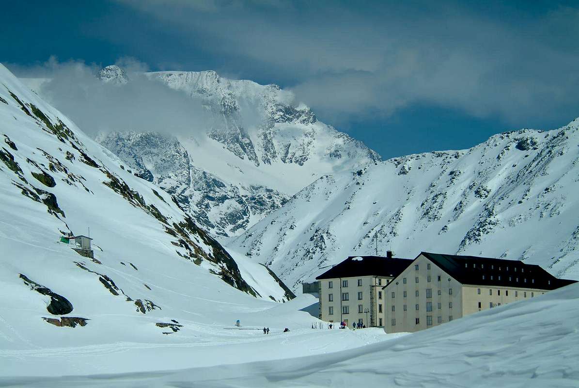
19) - Basic Itinerary n° 8: from parking just after Saint-Rhémy Center towards Great Saint Bernard Valley, crossing under Saint Bernard Tunnel Road in altitude 1.860 meters, forks between Praz Dzentor/Plan d'Arc (1.876m), Praz d'Arc (1.992m), Fonteinte Pastures (+; 2.203m near "La Cantine d'Aoste"); continue with State Road to Montagna Baou below Tour des Fous, and after a short tunnel in a terminal diagonal to Great Saint Bernard Lake & Hill, through Southern Slopes, (2.469m; "Roman Mansio, Jupiter Statue, Hotel Italia, Restaurant of Lake, Saint Bernard Hospice, Bazars, Exposition Saint Bernard Dogs, Ancient Morgue". M-; 3h'30/3h'45)). From the pass possibility of descent to Entremont Valley in Switzerland with Swiss State Road and towards the Combes des Morts (Le Tronchet, Hospitalet 2.116m), Bourg Saint Bernard (1.918m) near Mauvoisin Dam, Bourg Saint Pierre (1.632m) to Orsières Commune (879m).
20) - Minimum Route n° 3: from Saint-Rhémy to cross 1.621 meters (signal no transit), and through dirt road to Plantaluc Alpages, crossing between Coupé/des Teppes Woods, fork around 1.825 meters over Morguinaz small Village (1.729m), alternatives (1.898m, 2.009m) from Barasson Alpage (1.868m) to Plan Puitz (2.127m; E/T; 1h'45/2h'15).
21) - Variant n° 6: from Saint-Oyen towards Blanchun (1.554m), Morguinaz Villages, through the "Old Napoleonic Route" in diagonal South-southeast with a rocky gallery, to Plan Puitz wooded promontory (E/T; 2h'15/2h'30).
22) - Minimum Route n° 4: from Saint-Oyen or from Etroubles Communes to Eternon Village (1.645m), by Municipal Roads; from this last, through dirt farms road, to alternative 1.715 meters (double signals no transit) before Essanaz Village (1.820m; E/T; 0h'50/1h'05) at the foot South Slope Monte Paglietta (2.476m) and Mont Morteret (2.307m).
"From Essanaz or Lessanaz with South view to Emilius", by emilius
![]()
23) - Basic Itinerary n° 9: from Eternon Hamlet to Essanaz smallVillage; from this last, always with dirt road, and through Rovine Forest to Barasson Torrent in altitude around 1.860 meters; crossing the same to Barasson Alp (1.868m; E/T; 1h'10/1h'20), below Plan Puitz (2.127m)/Tete de Tchoume (2.351m) and at the beginning of Barasson Coastline.
24) - Exceptional Route n° 4: from Eternon, Essanaz Villages towards and between Rovine/Grand Plan Woods to Mont Morteret, through Southwestern Slope and Monte Paglietta, through South-southeast Crest (E/F+; 3h'10/3h'20).
25) - Exceptional Route n° 5: from Etroubles or from Saint-Oyen Communes, by Municipal Roads (roads connection in altitude around 1.375 meters), toward Prailles Dessous (about 1.530/40 meters; "Agriturisme La Grandze in Tsi Inconnu"), Dessus, Bezettes (1.629m), Quaye Pastures and Villages (around 1.650 meters signal no transit) and, through dirt road on Menouve or Menovy Vallon, to Combe German, Plan Bois, Menovy (1.913m), Arvus (1.983m) Pastures, Molline Vieille old Alp (2.295m; ruins) to Molline Bivouac, neighbor Molline Alp (2.415m; M; 3h'30/4h'15).
"Descent to Saint-Rhémy en Bosses", by emilius
![]()
26) - Basic Itinerary n° 9: from Allein-Saint Stefan (+; 1.253m) by Municipal Road towards alternative 1.362 meters, Ville (ex Mulino; 1.485m; "Farm Holidays Lo Ratelé" and through dirt farms road to fork by Comba Pasture nearby Maurier Village (1.653m); from this continue North direction towards Pied du Plan (1.722m), Baravex Dèsott, Baravex du Meitin, Baravex Damon (1.925m) Pastures to Orgières Alpage. From this, leaving West the level and subsequent dirt road to Fontaines Alpage (1.892m), always with dirt road before in East after West-northwest into Eastern Fontaines Forest to Parc (2.014m) Alp. (E/F; 2h'45/3h'00), below Mont Saron or Mont Champ-Rion Southern Slope (+; 2.681/95m).
27) - Exceptional Route n° 4: from Parc Alp towards Fontanin Alp (2.227m; source), alternative 2.250 meters to Mont Saron Southern Antesummit (+; 2.681m), through
18) - Minimum Route n° 2: from Montagna Baou to cross 2.500 meters, minipond (2.582m; E/T; 1h'30/1h'45).
19) - Basic Itinerary n° 8: from parking just after Saint-Rhémy Center towards Great Saint Bernard Valley, crossing under Saint Bernard Tunnel Road in altitude 1.860 meters, forks between Praz Dzentor/Plan d'Arc (1.876m), Praz d'Arc (1.992m), Fonteinte Pastures (+; 2.203m near "La Cantine d'Aoste"); continue with State Road to Montagna Baou below Tour des Fous, and after a short tunnel in a terminal diagonal to Great Saint Bernard Lake & Hill, through Southern Slopes, (2.469m; "Roman Mansio, Jupiter Statue, Hotel Italia, Restaurant of Lake, Saint Bernard Hospice, Bazars, Exposition Saint Bernard Dogs, Ancient Morgue". M-; 3h'30/3h'45)). From the pass possibility of descent to Entremont Valley in Switzerland with Swiss State Road and towards the Combes des Morts (Le Tronchet, Hospitalet 2.116m), Bourg Saint Bernard (1.918m) near Mauvoisin Dam, Bourg Saint Pierre (1.632m) to Orsières Commune (879m).
20) - Minimum Route n° 3: from Saint-Rhémy to cross 1.621 meters (signal no transit), and through dirt road to Plantaluc Alpages, crossing between Coupé/des Teppes Woods, fork around 1.825 meters over Morguinaz small Village (1.729m), alternatives (1.898m, 2.009m) from Barasson Alpage (1.868m) to Plan Puitz (2.127m; E/T; 1h'45/2h'15).
21) - Variant n° 6: from Saint-Oyen towards Blanchun (1.554m), Morguinaz Villages, through the "Old Napoleonic Route" in diagonal South-southeast with a rocky gallery, to Plan Puitz wooded promontory (E/T; 2h'15/2h'30).
22) - Minimum Route n° 4: from Saint-Oyen or from Etroubles Communes to Eternon Village (1.645m), by Municipal Roads; from this last, through dirt farms road, to alternative 1.715 meters (double signals no transit) before Essanaz Village (1.820m; E/T; 0h'50/1h'05) at the foot South Slope Monte Paglietta (2.476m) and Mont Morteret (2.307m).
23) - Basic Itinerary n° 9: from Eternon Hamlet to Essanaz smallVillage; from this last, always with dirt road, and through Rovine Forest to Barasson Torrent in altitude around 1.860 meters; crossing the same to Barasson Alp (1.868m; E/T; 1h'10/1h'20), below Plan Puitz (2.127m)/Tete de Tchoume (2.351m) and at the beginning of Barasson Coastline.
24) - Exceptional Route n° 4: from Eternon, Essanaz Villages towards and between Rovine/Grand Plan Woods to Mont Morteret, through Southwestern Slope and Monte Paglietta, through South-southeast Crest (E/F+; 3h'10/3h'20).
25) - Exceptional Route n° 5: from Etroubles or from Saint-Oyen Communes, by Municipal Roads (roads connection in altitude around 1.375 meters), toward Prailles Dessous (about 1.530/40 meters; "Agriturisme La Grandze in Tsi Inconnu"), Dessus, Bezettes (1.629m), Quaye Pastures and Villages (around 1.650 meters signal no transit) and, through dirt road on Menouve or Menovy Vallon, to Combe German, Plan Bois, Menovy (1.913m), Arvus (1.983m) Pastures, Molline Vieille old Alp (2.295m; ruins) to Molline Bivouac, neighbor Molline Alp (2.415m; M; 3h'30/4h'15).
26) - Basic Itinerary n° 9: from Allein-Saint Stefan (+; 1.253m) by Municipal Road towards alternative 1.362 meters, Ville (ex Mulino; 1.485m; "Farm Holidays Lo Ratelé" and through dirt farms road to fork by Comba Pasture nearby Maurier Village (1.653m); from this continue North direction towards Pied du Plan (1.722m), Baravex Dèsott, Baravex du Meitin, Baravex Damon (1.925m) Pastures to Orgières Alpage. From this, leaving West the level and subsequent dirt road to Fontaines Alpage (1.892m), always with dirt road before in East after West-northwest into Eastern Fontaines Forest to Parc (2.014m) Alp. (E/F; 2h'45/3h'00), below Mont Saron or Mont Champ-Rion Southern Slope (+; 2.681/95m).
27) - Exceptional Route n° 4: from Parc Alp towards Fontanin Alp (2.227m; source), alternative 2.250 meters to Mont Saron Southern Antesummit (+; 2.681m), through
1) - Southern Slope; also from alp to
2) - small saddle 2.250 meters around on Southwest Crest an by the same to Quota 2.450 meters, Antesummit (E/F/F+ or F+/M-; 3h'00/3h'15).
28) - Variants n° 7: from fork 2.250 meters in East-northeast through a secondary path to fork about 2.325 meters.
* Two Departure Variants: through before dirt road and after path from Arp du Praz (2.048m), above Doues Commune to fork; also from Crou Village (1.596m), in Northeast and above Allein Municipality to previous paths fork). From this cross to Mont Saron, through easy South-southeast Crest, more steep in final part (M; 3h'30/3h'45).
29) - Minimum Route n° 5: from Pied du Pian (1.722m) to Baravex, Orgières, Parc Pastures (E/T; 1h'45/2h'00).
"To Mont Saron or Mont Champ-Rion", by Antonio
![]()
^^^^^^^
28) - Variants n° 7: from fork 2.250 meters in East-northeast through a secondary path to fork about 2.325 meters.
* Two Departure Variants: through before dirt road and after path from Arp du Praz (2.048m), above Doues Commune to fork; also from Crou Village (1.596m), in Northeast and above Allein Municipality to previous paths fork). From this cross to Mont Saron, through easy South-southeast Crest, more steep in final part (M; 3h'30/3h'45).
29) - Minimum Route n° 5: from Pied du Pian (1.722m) to Baravex, Orgières, Parc Pastures (E/T; 1h'45/2h'00).
Ollomont & By Basin or Grand Combin Comunity
Northern Basin & Eastern Side (From Mont Saron to Breuson Hill)
1) - Basic Itinerary n° 1: from Doues-Planavilla (1.176m) or (in winter; signal) from Haut Praz-Bas (1.479m), through Municipal Road, to Plan Debat (2.076m); from this or from fork 2.007 metres (small parking in soil), with dirt road, to Arp du Praz (2.048m), cross under point 2.029 meters and, through path on South-southeast Crest, to Mont Saron rAntesummit (+; 2.681m; M; 2h'15/2h'30, at the end of long Southern Mont Velan Buttress (Têtes de Faceballa and Faudery/La Salliaousa/Tête des Crêtes/Mounts Chenaille/Champillon Hill/Crou de Bleintse/Tête de la Praz/Mont Saron true Summit). From Antesummit traverse in North to highest Summit, removing the snowshoes, on rocky and short ridge with a difficult passage in opposite on final part (D-; 0h'20/0h'40 depending snow condition on rocks and frames).
"At the entrance of By Basin", by Antonio
![]()
2) - Minimum Route n° 1: from Doues-Planavilla, with Municipal Road in Northwest to Haut Praz-Bas Hamlet; from this continue in North to Pointier (1.635m), Piolet Dèsot (1.657m), Meitin, Piolet Damon Villages, Plan Taredaz (1.881m) nearby Farm Holidays "Vorbé", Cheséry (1.969m), Baita Novella, alternative 2.007 meters, Plan Debat, Notre Dame de Neige/Champillon (+ stone Cross; 2.078m; parking with wooden fountain; 2.050m; T/E; 1h'30/1h'40), at entrance in By Conca (Basin). Splendid circular views to 180°: in North-northeast La Salliaousa and Velan Horns; in North Grand Combin above Grand Tête de By. Moreover in Northeast from Avril/Gelé to Morion rocky Range with numerous summits.
"Neighbor Notre Dame de Champillon to Emilius Group", by emilius
![]()
3) - Minimum Route n° 2: from parking of Champillon Alp near the wooden fountain, with private dirt farms road in North, to the entrance of By Basin; continue towards Néan (2.087m), Crêtes (2.062m), Togne (2.072m) Alpages, reaching, through a secondary dirt road in Northwest, the alternative around 2.120 meters. From this, tourning decisively West-northwest, to Ansermin Alp (2.120m; small parking in soil; T; 1h'15/1h'25), below South slopes of Monte Rotondo (2.572m) and under two Mont Chenaille (3.144m)/Tête des Crêtes (3.258m)/La Salliaousa (3.228m) East Faces.
"From By Conca (Ansermin Alp) to Valpelline Southern vallons", emilius
![]()
4) - Basic Itinerary n° 2: from Ansermin Alp, through narrow and steep dirt farms road, to Tsa d'Ansermin (2.388m); from this to Monte Rotondo (F+; 2h'00/2h'15 from Tsa; 3h'45/4h'00 from Champillon), in East from La Salliaousa.
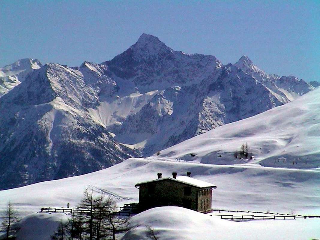
"Champillon Refuge below Champillon Pass & Mont Chenaille", by Antonio
![]()
5) - Basic Itinerary n° 3: from Champillon parking in Northwest towards, Pessinoille Pastures (2.146m), Alp Tsa (2.297m; source) to new Letey Refuge, near Champillon Tsa and below Champillon Pass (2.430m; E/F; 2h'15/2h'30).
6) - Exceptional Route n° 1: from the Shelter towards Champillon Pass (2.709m), Quota 2.991 meters to Mont Chenaille South and Northeast Summits (3.144m, about 3.150 metres); D-; 2h'45/3h'00), through traces on Southern Ridge.
7) - Variant n° 1: from Champillon Pass to Crou de Bleintse or Bleinchy (true and very ancient name since year 1.337m), through North-northwest Crest (2.824m D+; 1h'00/1h'15 from pass), on watershed to Tête de la Praz/Mont Saron.
"to Champillon Pass below Crou de Bleinchy", by Antonio
![]()
8) - Variant n° 2: from Arp du Praz (2.055m), after cross 2.007 meters, crossing the Praz Wood to mini pond (2.153m), Tête du Praz or de la Praz, through East-southeast Slope and East Crest in final part (2.751m; M-; 2h'45/3h'00).
9) - Basic Itinerary n° 4: from Doues-Planavilla or from Haut Praz-Bas also from Notre Dame/Champillon, towards Eastern By Basin, to Crêtes, Togne Pastures and, always through dirt farms road with short descent, to Chevrière (1.928m), unnamed pastures 1.930 meters, alternative amongst three of Chesal/Seytives/Berruard Alpages (2.039m, 2.088m, 1.947m); T/E; 2h'00 from Champillon Alp, 3h'00/3h'30 from Haut Praz-Bas, 4h'30/4h'45 from Doues).
"To Champillon at the beginning of By Basin", by Osw
![]()
10) - Exceptional Route n° 2: from Chesal Alp (2.039m), through a small vallon along Boégno Bà Torrent, Plan Bagò (2.436m), Plan Bagò point (2.533m) to Rosazza at Savoie Bivouac, neighbor Boégno Bà Hill (2.674m; M-; 2h'45/3h'00 from alpage, 7h'00/7h'30 from Doues), below Valsorey Pass (3.107m)/Trois Frères Summit/Five Valsorey Molaires.
11) - Variant n° 3: from Porchère Alp (2.102m), Tsa de Porchère (2.290m), Dos (Hump) de Boégno Bà, altitude 2.507 meters to Bivouac (M+; 2h'30/2h'45 from pasture, 5h'00/5h'15 from Champillon-N. Dame), through dirt road.
"From Ollomont Valley to Coumba Freida & Aosta Town", by Antonio
![]()
12) - Basic Itinerary n° 5: from Valpelline Municipality to alternative 1.033 meters, below Semon Chez Cailleur (+; Saint Roch) to Ollomont-Croux (+; 1.356m), by Regional Road; from this, through Municipal Road, to Rey/Mont Rion, Fontaine, Court, Vouèce, Vaus, Glacier or Glassier (+; 1.562m; fountain) Villages along Buthier of Ollomont Torrent. From Glacier in North to Pont (+; 1.690m), Crottes (1.733m), Cheval Blanc (+; 1.962m), Casa (House) Farinet neighbor a mini artificial loch (1.987m; T/E; 1h'30/1h'45), below Rosazza at Savoie Bivouac and old Amiante-Franco Chiarella Shelter.
13) - Variant n° 4: from Glacier in West-southwest, through dirt private road, to cross 1.775 meters and in Northeast to fork near Pont Pasture (+; 1.670m) and, with diagonal path, Casa Farinet and previous route (T/E; 1h'40/1h'50).
14) - Variant n° 5: from Glacier in Southwest, through dirt road, to fork 1.775 meters and in Northwest, through path, to Berruard Pastures (1.947m); from this in Northeast, through dirt road, to Lake, Casa Farinet (T/E; 2h'00/2h'10).
"From Amiante Chiarella Refuge to Mont Velan", by marco979
![]()
15) - Exceptional Route n° 3: from Casa (House) Farinet, through private dirt farms road in North, to By (2.050m), Commune de By (2.049m) Pastures; from this, crossing the Torrent de la Grande Maison in altitude around 2.200 meters, to Tsa Commune Alpage (2.304m) and, crossing again a secondary torrent in quota 2.518 meters, through evident path (numerous yellow signals) with an equipped (various chains) terminal passage just below the Refuge Chiarella-Amiante (2.979m; D; 4h'30/5h'00 from alpage, 7h '00/7h '30 from Glacier), below the Punta Garrone (3.290m)/Grand Tête de By (3.288m)/Amiante Pass (3.308m)/Tête Blanche de By (3.413m)/Upper Gabelou and By Passes (3.129m, 3.224m).
16) - Basic Itinerary n° 6: from Casa Farinet, through private dirt farms road in East-northeast, to Balme de Bal Pastures (2.128m; source); from this, reached the alternative immediately before Lombardin Alpage (2.309m; source), continue Northwest going on steep winding roads to upper Filon Alp (2.478m; source; E; 2h'30/2h'45), below and in right (Southeast) of the small, narrow Filon Vallon and between Mont de la Balme (2.702m)/Dent d'Ansermin (2.657m).
"High By Basins of Filon, Balme, Avril", by Antonio
![]()
17) - Variants n° 6: from Filon Alp or just before, crossing two small torrents, to Bonne Mort Pass (2.646m; E; 0h'50/1h'00) or to Mont de la Balme, through Eastern Slopes, South Crest in terminal part, (EE; 1h'10/1h'20).
18) - Exceptional Route n° 4: from Filon Alp, through small path and traces in North-nortwest along Filon Torrent, to stone and grassy Plan (Tableland) du Filon pathless; continue towards rocky narrowing around 2.900 meters up to the Filon Pass, through progressively steep part on Southern slopes (3.251m; D+; 3h'00/3h'30 from alpage; 6h'00/6h'30 from Casa Farinet; 8h'00/9h'00 from Glacier Village), between Tête du Filon (3.306m)/Tête de Balme (3.313m).
19) - Basic Itinerary n° 7: from Casa Farinet, through dirt road in East-northeast, to Balme de Bal, Lombardin, Thoules Alpages (2.381m; E; 2h'15/2h'30), at the end of Comba Eaux Blanches (White Waters) below Mont Gelé.
"Fenetre Durand Hill & Mont Gelé", by buxlex
![]()
20)- Exceptional Route n° 5: from Thoules Alp, with path in North-northeast along Fenêtre Torrent, to Fenêtre Lake (2.711m), Fenêtre Durand Hill (2.797m; M; 2h'00/2h'15 from alpage; 4h'30/6h'00 from Casa Farinet; 6h'30/7h'10 from Glacier Village), between Mont Avril, East-southeast Crest (3.347m)/Mont Gelé, Northwest Ridge (3.518m).
21)- Exceptional Route n° 6: from Thoules Alpages, in South with small path to altitude 2.490 meters, Basèya or Bonseya Lake (2.513m), Nino Regondi Bivouac (2.599m; M-; 2h'15/2h'30 from alpage; 4h'15/4h'30 from Casa Farinet; 6h'30/7h'00 from Glacier Village), below Mont Clapier (3.437m)/Punta Fiorio (3.332m)/Tête Bonin (3.142m).
22)- Minimum Route n° 3: from Glacier parking, through steep but short private dirt road concomitant with path in South-southeast, to Crottes Pasture (1.591m); continue on nice path to Gaula Oratory, (+; 1.863m; T; 1h'00/1h'10).
23)- Basic Itinerary n° 8: from Glacier Village towards Crottes Pasture, Gaula Oratory, Places Alp (2.150m), small bridge 2.223 meters on Fenêtre Torrent, Plan de Breuil immediately above Comba des Eaux Blanches, fork 2.465 meters, between Clusa or Inclousa (2.418m)/Leita (2.538m) Lakes to Regondi Bivouac (EE; 4h'30/5h'00), through paths.
"Faceballa Saddle, Velan Horns above By Basin from Lower Berrio Alpage", by archiloco
![]()
24) - Minimum Route n° 4: from Ollomont-Cognen (+; 1.356m), through dirt road and path in terminal part from fork 1.725 meters, to Berrio Dèsot Pasture (1.720m; T; 2h'00/2h'10), below Southern Crest of Mont Corm(n)et and Hill.
25) - Basic Itinerary n° 9: from Ollomont-Cognen (beyond the Churc), through dirt road, to fork 1.700 meters around (to Berrio Dèsot), source 1.845 meters, Berrio Damon (1.932m; E; 2h'45/3h'15), in tableland below Monte Berrio.
"Berrio Vallon below Cormet Hill, Mount Berrio & Brison Pass", by SalVal
![]()
26) - Exceptional Route n° 7: from Berrio Damon Alp, with path before in Northwest, towards Tsa de Berrio Upper Alp (2.165m), after in Northeast to Cormet Hill (2.354m), above Cormet Loch (2.335m), and along Ru (Brook) du Lac to promontory with Leita, Inclousa Lakes and Bivouac Nino Regondi (EE; 2h'45/3h'00; from Ollomont 5h'45/6h'00).
27) - Exceptional Route n° 8: from Ollomont to Berrio Damon Alp, through private dirt farms road concomitant with the path High Route number 1; from this, through path with long diagonal in East-northeast and following narrow hairpin bends, to Brison or Breuson Hill (2.194m; M; 1h'45/2h'00), between Faceballa/Arsines various Summits.
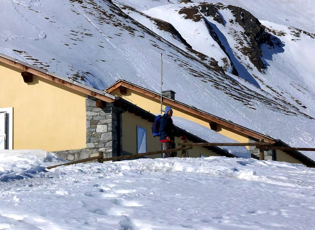
"Ascending to Chaligne Refuge with view on Punta Fiorio & Brison Pass", by SalVal
![]()
^^^^^^^
2) - Minimum Route n° 1: from Doues-Planavilla, with Municipal Road in Northwest to Haut Praz-Bas Hamlet; from this continue in North to Pointier (1.635m), Piolet Dèsot (1.657m), Meitin, Piolet Damon Villages, Plan Taredaz (1.881m) nearby Farm Holidays "Vorbé", Cheséry (1.969m), Baita Novella, alternative 2.007 meters, Plan Debat, Notre Dame de Neige/Champillon (+ stone Cross; 2.078m; parking with wooden fountain; 2.050m; T/E; 1h'30/1h'40), at entrance in By Conca (Basin). Splendid circular views to 180°: in North-northeast La Salliaousa and Velan Horns; in North Grand Combin above Grand Tête de By. Moreover in Northeast from Avril/Gelé to Morion rocky Range with numerous summits.
3) - Minimum Route n° 2: from parking of Champillon Alp near the wooden fountain, with private dirt farms road in North, to the entrance of By Basin; continue towards Néan (2.087m), Crêtes (2.062m), Togne (2.072m) Alpages, reaching, through a secondary dirt road in Northwest, the alternative around 2.120 meters. From this, tourning decisively West-northwest, to Ansermin Alp (2.120m; small parking in soil; T; 1h'15/1h'25), below South slopes of Monte Rotondo (2.572m) and under two Mont Chenaille (3.144m)/Tête des Crêtes (3.258m)/La Salliaousa (3.228m) East Faces.

4) - Basic Itinerary n° 2: from Ansermin Alp, through narrow and steep dirt farms road, to Tsa d'Ansermin (2.388m); from this to Monte Rotondo (F+; 2h'00/2h'15 from Tsa; 3h'45/4h'00 from Champillon), in East from La Salliaousa.
5) - Basic Itinerary n° 3: from Champillon parking in Northwest towards, Pessinoille Pastures (2.146m), Alp Tsa (2.297m; source) to new Letey Refuge, near Champillon Tsa and below Champillon Pass (2.430m; E/F; 2h'15/2h'30).
6) - Exceptional Route n° 1: from the Shelter towards Champillon Pass (2.709m), Quota 2.991 meters to Mont Chenaille South and Northeast Summits (3.144m, about 3.150 metres); D-; 2h'45/3h'00), through traces on Southern Ridge.
7) - Variant n° 1: from Champillon Pass to Crou de Bleintse or Bleinchy (true and very ancient name since year 1.337m), through North-northwest Crest (2.824m D+; 1h'00/1h'15 from pass), on watershed to Tête de la Praz/Mont Saron.

8) - Variant n° 2: from Arp du Praz (2.055m), after cross 2.007 meters, crossing the Praz Wood to mini pond (2.153m), Tête du Praz or de la Praz, through East-southeast Slope and East Crest in final part (2.751m; M-; 2h'45/3h'00).
9) - Basic Itinerary n° 4: from Doues-Planavilla or from Haut Praz-Bas also from Notre Dame/Champillon, towards Eastern By Basin, to Crêtes, Togne Pastures and, always through dirt farms road with short descent, to Chevrière (1.928m), unnamed pastures 1.930 meters, alternative amongst three of Chesal/Seytives/Berruard Alpages (2.039m, 2.088m, 1.947m); T/E; 2h'00 from Champillon Alp, 3h'00/3h'30 from Haut Praz-Bas, 4h'30/4h'45 from Doues).
10) - Exceptional Route n° 2: from Chesal Alp (2.039m), through a small vallon along Boégno Bà Torrent, Plan Bagò (2.436m), Plan Bagò point (2.533m) to Rosazza at Savoie Bivouac, neighbor Boégno Bà Hill (2.674m; M-; 2h'45/3h'00 from alpage, 7h'00/7h'30 from Doues), below Valsorey Pass (3.107m)/Trois Frères Summit/Five Valsorey Molaires.
11) - Variant n° 3: from Porchère Alp (2.102m), Tsa de Porchère (2.290m), Dos (Hump) de Boégno Bà, altitude 2.507 meters to Bivouac (M+; 2h'30/2h'45 from pasture, 5h'00/5h'15 from Champillon-N. Dame), through dirt road.

12) - Basic Itinerary n° 5: from Valpelline Municipality to alternative 1.033 meters, below Semon Chez Cailleur (+; Saint Roch) to Ollomont-Croux (+; 1.356m), by Regional Road; from this, through Municipal Road, to Rey/Mont Rion, Fontaine, Court, Vouèce, Vaus, Glacier or Glassier (+; 1.562m; fountain) Villages along Buthier of Ollomont Torrent. From Glacier in North to Pont (+; 1.690m), Crottes (1.733m), Cheval Blanc (+; 1.962m), Casa (House) Farinet neighbor a mini artificial loch (1.987m; T/E; 1h'30/1h'45), below Rosazza at Savoie Bivouac and old Amiante-Franco Chiarella Shelter.
13) - Variant n° 4: from Glacier in West-southwest, through dirt private road, to cross 1.775 meters and in Northeast to fork near Pont Pasture (+; 1.670m) and, with diagonal path, Casa Farinet and previous route (T/E; 1h'40/1h'50).
14) - Variant n° 5: from Glacier in Southwest, through dirt road, to fork 1.775 meters and in Northwest, through path, to Berruard Pastures (1.947m); from this in Northeast, through dirt road, to Lake, Casa Farinet (T/E; 2h'00/2h'10).
15) - Exceptional Route n° 3: from Casa (House) Farinet, through private dirt farms road in North, to By (2.050m), Commune de By (2.049m) Pastures; from this, crossing the Torrent de la Grande Maison in altitude around 2.200 meters, to Tsa Commune Alpage (2.304m) and, crossing again a secondary torrent in quota 2.518 meters, through evident path (numerous yellow signals) with an equipped (various chains) terminal passage just below the Refuge Chiarella-Amiante (2.979m; D; 4h'30/5h'00 from alpage, 7h '00/7h '30 from Glacier), below the Punta Garrone (3.290m)/Grand Tête de By (3.288m)/Amiante Pass (3.308m)/Tête Blanche de By (3.413m)/Upper Gabelou and By Passes (3.129m, 3.224m).
16) - Basic Itinerary n° 6: from Casa Farinet, through private dirt farms road in East-northeast, to Balme de Bal Pastures (2.128m; source); from this, reached the alternative immediately before Lombardin Alpage (2.309m; source), continue Northwest going on steep winding roads to upper Filon Alp (2.478m; source; E; 2h'30/2h'45), below and in right (Southeast) of the small, narrow Filon Vallon and between Mont de la Balme (2.702m)/Dent d'Ansermin (2.657m).
17) - Variants n° 6: from Filon Alp or just before, crossing two small torrents, to Bonne Mort Pass (2.646m; E; 0h'50/1h'00) or to Mont de la Balme, through Eastern Slopes, South Crest in terminal part, (EE; 1h'10/1h'20).
18) - Exceptional Route n° 4: from Filon Alp, through small path and traces in North-nortwest along Filon Torrent, to stone and grassy Plan (Tableland) du Filon pathless; continue towards rocky narrowing around 2.900 meters up to the Filon Pass, through progressively steep part on Southern slopes (3.251m; D+; 3h'00/3h'30 from alpage; 6h'00/6h'30 from Casa Farinet; 8h'00/9h'00 from Glacier Village), between Tête du Filon (3.306m)/Tête de Balme (3.313m).
19) - Basic Itinerary n° 7: from Casa Farinet, through dirt road in East-northeast, to Balme de Bal, Lombardin, Thoules Alpages (2.381m; E; 2h'15/2h'30), at the end of Comba Eaux Blanches (White Waters) below Mont Gelé.
20)- Exceptional Route n° 5: from Thoules Alp, with path in North-northeast along Fenêtre Torrent, to Fenêtre Lake (2.711m), Fenêtre Durand Hill (2.797m; M; 2h'00/2h'15 from alpage; 4h'30/6h'00 from Casa Farinet; 6h'30/7h'10 from Glacier Village), between Mont Avril, East-southeast Crest (3.347m)/Mont Gelé, Northwest Ridge (3.518m).
21)- Exceptional Route n° 6: from Thoules Alpages, in South with small path to altitude 2.490 meters, Basèya or Bonseya Lake (2.513m), Nino Regondi Bivouac (2.599m; M-; 2h'15/2h'30 from alpage; 4h'15/4h'30 from Casa Farinet; 6h'30/7h'00 from Glacier Village), below Mont Clapier (3.437m)/Punta Fiorio (3.332m)/Tête Bonin (3.142m).
22)- Minimum Route n° 3: from Glacier parking, through steep but short private dirt road concomitant with path in South-southeast, to Crottes Pasture (1.591m); continue on nice path to Gaula Oratory, (+; 1.863m; T; 1h'00/1h'10).
23)- Basic Itinerary n° 8: from Glacier Village towards Crottes Pasture, Gaula Oratory, Places Alp (2.150m), small bridge 2.223 meters on Fenêtre Torrent, Plan de Breuil immediately above Comba des Eaux Blanches, fork 2.465 meters, between Clusa or Inclousa (2.418m)/Leita (2.538m) Lakes to Regondi Bivouac (EE; 4h'30/5h'00), through paths.
24) - Minimum Route n° 4: from Ollomont-Cognen (+; 1.356m), through dirt road and path in terminal part from fork 1.725 meters, to Berrio Dèsot Pasture (1.720m; T; 2h'00/2h'10), below Southern Crest of Mont Corm(n)et and Hill.
25) - Basic Itinerary n° 9: from Ollomont-Cognen (beyond the Churc), through dirt road, to fork 1.700 meters around (to Berrio Dèsot), source 1.845 meters, Berrio Damon (1.932m; E; 2h'45/3h'15), in tableland below Monte Berrio.
26) - Exceptional Route n° 7: from Berrio Damon Alp, with path before in Northwest, towards Tsa de Berrio Upper Alp (2.165m), after in Northeast to Cormet Hill (2.354m), above Cormet Loch (2.335m), and along Ru (Brook) du Lac to promontory with Leita, Inclousa Lakes and Bivouac Nino Regondi (EE; 2h'45/3h'00; from Ollomont 5h'45/6h'00).
27) - Exceptional Route n° 8: from Ollomont to Berrio Damon Alp, through private dirt farms road concomitant with the path High Route number 1; from this, through path with long diagonal in East-northeast and following narrow hairpin bends, to Brison or Breuson Hill (2.194m; M; 1h'45/2h'00), between Faceballa/Arsines various Summits.

Campings
Remember that free camping is forbidden (except for emergency reasons, over 2.500m, from darkness until dawn).Mountain Condition
- Meteo: you can find all the needed informations at the official site of the Valle d'Aosta Region:
- Valle d'Aosta Meteo
Important Information
- REGIONE AUTONOMA VALLE D'AOSTA the official site.
- FONDAZIONE MONTAGNA SICURA Villa Cameron, località Villard de la Palud n° 1 Courmayeur (AO) Tel: 39 0165 897602 - Fax: 39 0165 897647.
- A.I.NE.VA. (Associazione Interregionale Neve e Valanghe).
Useful numbers
- Protezione Civile Valdostana località Aeroporto n° 7/A Saint Christophe (Ao) Tel. 0165-238222.
- Bollettino Meteo (weather info) Tel. 0165-44113.
- Unità Operativa di Soccorso Sanitario Tel. 118.