Toggle navigation
Mountains
Routes
Images
Trip Reports
Forum
What's New
People
Areas & Ranges
Articles
Trailheads
Canyons
Huts & Campgrounds
Albums
Logistical Centers
Fact Sheets
Lists
Custom Objects
Gear
Plans & Partners
WELCOME TO SUMMITPOST
SIGN IN
REGISTER
Troglav
Additional Parents
Image
Sajkovici route towards...
View High-Resolution Image
Sajkovici route towards...
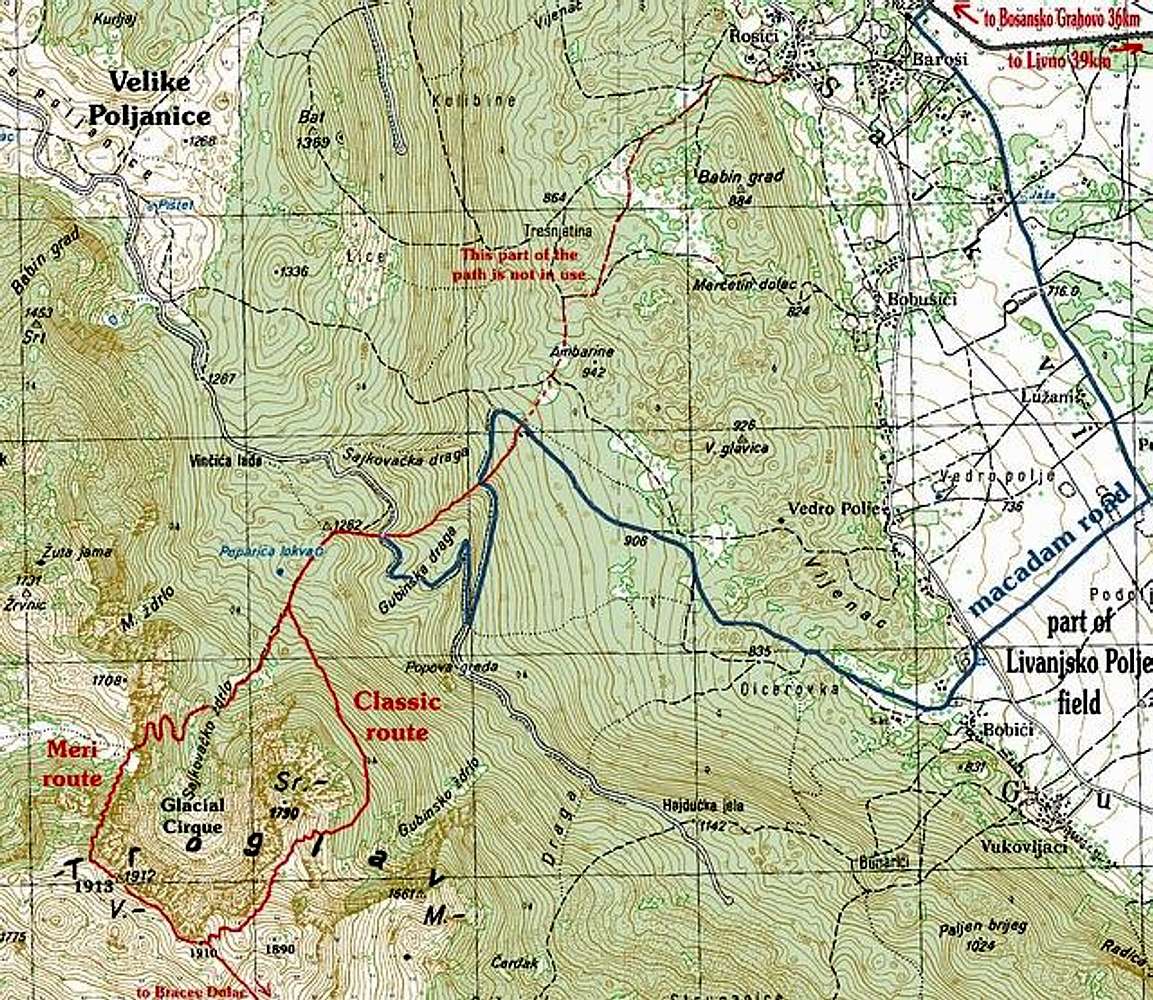
Sajkovici route towards Troglav (1913m). Red line is marked path while blue line is part of macadam road over which you drive or walk, on the way to the summit.
« PREV
NEXT »
Velebit
on
May 25, 2003 6:38 am
Comments & voting
Other parents
Lat/Lon:
43.95000°N / 16.60000°E
Image ID:
20836
5439 Hits
71.17
% Score
2
Votes
Log in to vote
Comments
No comments posted yet.
to post!
Don't have an account?
Troglav
(Mountain/Rock)
« PREV
Viewing
#57 of 61
GALLERY
NEXT »
Velebit's Image Gallery
« PREV
Viewing
#1918 of 1984
GALLERY
NEXT »
×
You need to login in order to vote!
User Name
Password
Remember me
Forgot your password?
Log me out when I close my browser.
Keep me logged in all the time.
sign in as a user
Don't have an account?
Register now for FREE
Rating available
Suggested routes for you
People who climb the same things as you
Comments Available
Create Albums
Register Here


