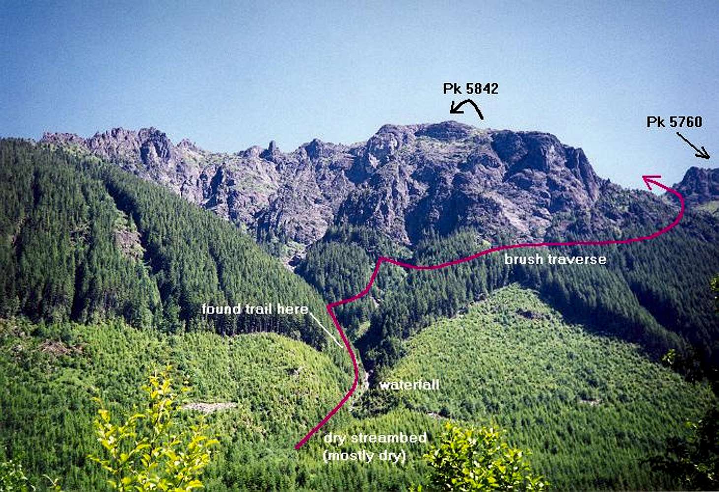
This is the route I took to Gunn Peak from Barclay Creek. This is an approximation. Once across Barclay Creek, I followed an old overgrown road eastward until I came to a mostly dry streambed. Turning left (north) in the bed, I followed it for a few hundred yards until I came upon a
picturesque waterfall. After climbing steeply up the left side of the falls, I then found the "trail" in the steep forest. It goes up for a while then turns right to traverse below the south cliffs of Pk 5842, whose top is not visible here. The trail then more or less fades in an ugly brush traverse. Beyond the brush, the terrain opens up to the basin starting one mile due south of Gunn's summit. Photo taken July 7, 1996.
For the real route, see this sketch.


