Toggle navigation
Mountains
Routes
Images
Trip Reports
Forum
What's New
People
Areas & Ranges
Articles
Trailheads
Canyons
Huts & Campgrounds
Albums
Logistical Centers
Fact Sheets
Lists
Custom Objects
Gear
Plans & Partners
WELCOME TO SUMMITPOST
SIGN IN
REGISTER
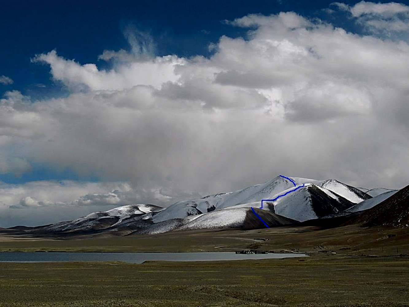
Route seen from afar
View High-Resolution Image
Route seen from afar
A good overview of the peak and the vincinity.
In the foreground - old and "drowned" Sirengou.
Further up the road, about 4km - new Sirengou. Populated.
Place your BC where the blue line starts.
Walk up the first non-snowy slope along the path of least resistence.
Continue on the long, flat and wide ridge until you see a gorge on your left.
Head straight up the snowy slope on your right until you hit the top of the ridge.
Walk along the summit ridge to the summit.
« PREV
NEXT »
Corax
on
Nov 18, 2007 3:47 pm
Comments & voting
Other parents
Lat/Lon:
34.68720°N / 80.20820°E
Image Type(s):
Alpine Climbing
Image ID:
357904
1619 Hits
75.81
% Score
6
Votes
Log in to vote
Comments
No comments posted yet.
to post!
Don't have an account?
North Ridge
(Route)
You are at
the First
Image
Viewing
#1 of 1
GALLERY
You are at
the Last
Image
Corax's Image Gallery
« PREV
Viewing
#537 of 683
GALLERY
NEXT »
North Ridge
(Route)
Loading....
×
You need to login in order to vote!
User Name
Password
Remember me
Forgot your password?
Log me out when I close my browser.
Keep me logged in all the time.
sign in as a user
Don't have an account?
Register now for FREE
Rating available
Suggested routes for you
People who climb the same things as you
Comments Available
Create Albums
Register Here


