Ptarmigan Traverse overview from Sahale Peak

Ptarmigan Traverse overview from Sahale Peak

An overview photo of the Traverse from Sahale Peak to the north. Note the green route lines for stages 1, 2, and 4 ("standard" schedule). Stage 3 is entirely hidden behind Spider Mountain. The highest point on the Traverse proper is Spire Col at just over 7,800 feet. Photo taken in August 1989 about a year after we did the Traverse.
Bob Bolton
on Nov 9, 2005 12:27 am
Image Type(s): Informational,  Scenery
Image ID: 135483

Comments

Post a Comment
Viewing: 1-2 of 2
mvs

mvs - Feb 3, 2006 10:25 am - Voted 10/10
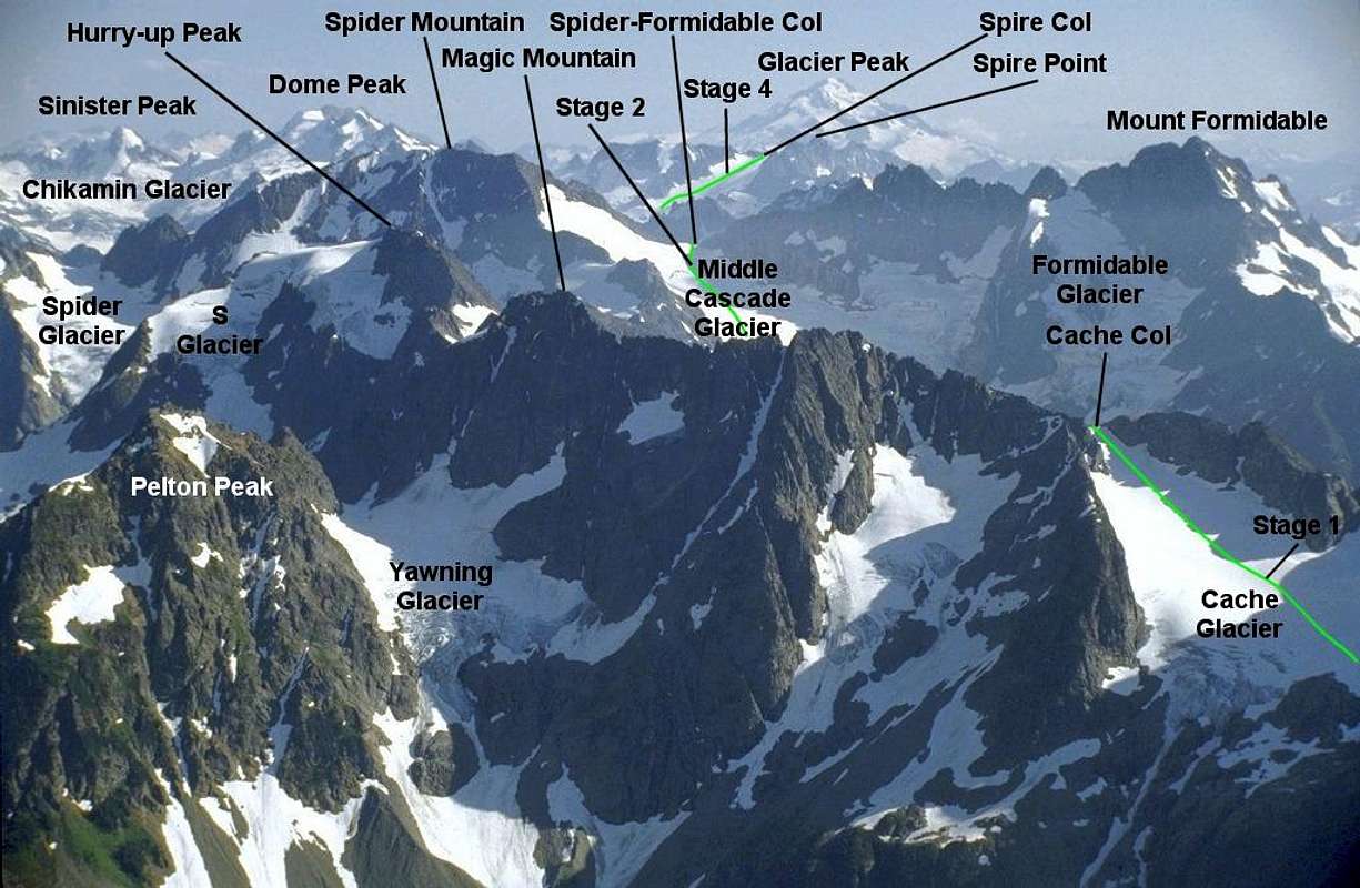
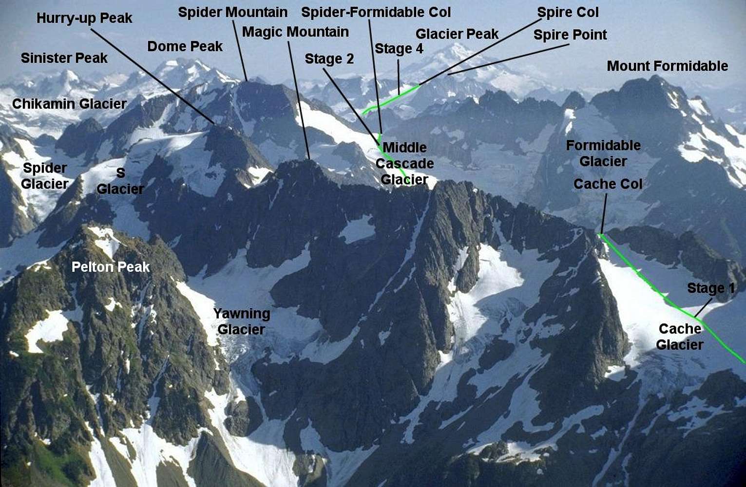
nice diagram

Robert, that is a great diagram...who needs a map now? :-D

Bob Bolton

Bob Bolton - Feb 3, 2006 8:23 pm - Hasn't voted

Re: nice diagram

:-) Thanks Michael. I guess the map might be helpful in navigating the hidden areas. -Bob

Viewing: 1-2 of 2