Toggle navigation
Mountains
Routes
Images
Trip Reports
Forum
What's New
People
Areas & Ranges
Articles
Trailheads
Canyons
Huts & Campgrounds
Albums
Logistical Centers
Fact Sheets
Lists
Custom Objects
Gear
Plans & Partners
WELCOME TO SUMMITPOST
SIGN IN
REGISTER
Pawnee Pass
Additional Parents
Image
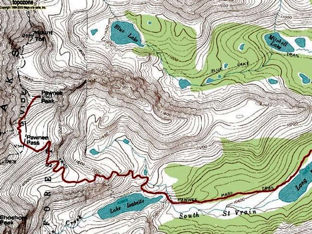
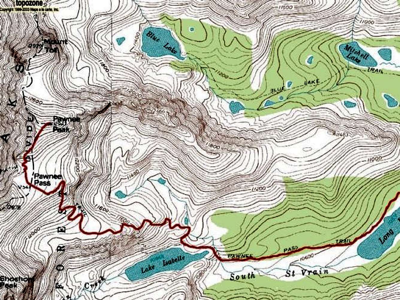
Pawnee Pass route topo
View High-Resolution Image
Pawnee Pass route topo
The standard Pawnee Pass route. Note that the trail shown on the USGS topo directly above Lake Isabelle is obsolete. The current route ascends from the east end of the lake, then switchbacks west to the plateau below the pass.
« PREV
NEXT »
CharlesD
on
Jul 18, 2004 12:53 am
Comments & voting
Other parents
Lat/Lon:
40.08170°N / 105.6325°W
Image Type(s):
Informational
Image ID:
61153
8283 Hits
75.81
% Score
6
Votes
Log in to vote
Comments
No comments posted yet.
to post!
Don't have an account?
Pawnee Pass
(Route)
« PREV
Viewing
#2 of 6
GALLERY
NEXT »
CharlesD's Image Gallery
« PREV
Viewing
#141 of 325
GALLERY
NEXT »
Pawnee Peak
(Mountain/Rock)
Loading....
×
You need to login in order to vote!
User Name
Password
Remember me
Forgot your password?
Log me out when I close my browser.
Keep me logged in all the time.
sign in as a user
Don't have an account?
Register now for FREE
Rating available
Suggested routes for you
People who climb the same things as you
Comments Available
Create Albums
Register Here


