

Marcsoltan - May 30, 2010 8:11 pm - Voted 10/10
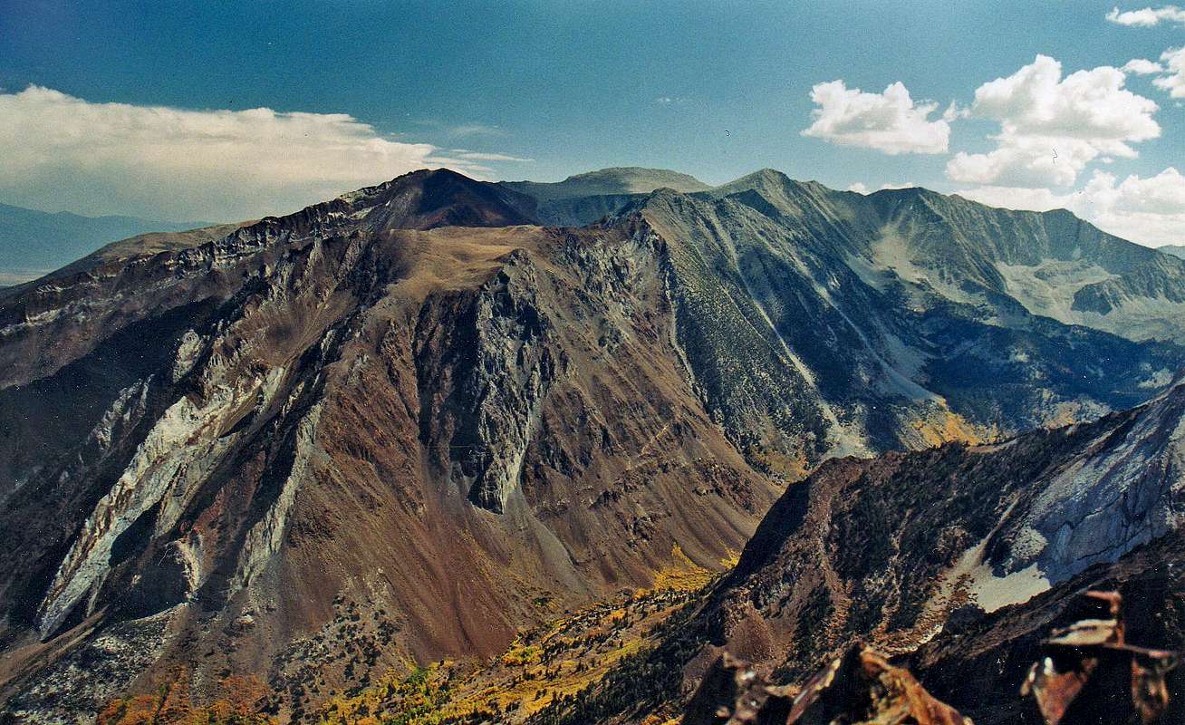
What is...that trail way down there? It seems to get to the top of that brown mountain. What is that brown mountain? How many miles, one way, to Mt. Aggie?
Thank you for being the best source of information in the Eastern Sierras.

Noondueler - May 31, 2010 12:08 am - Hasn't voted
Re: What is...Hi Marc!
I don't think that is a trail cutting through the brown slope in the center, I think it's a dike intrusion in the rock. There is no trail indicated on the 7 1/2 minute USGS topo. That dark left skyline is the Nevabe Ridge (the summit is the dark highpoint back left). Mt. Morgan (north) is the round grey peak top center with Mt. Stanford (north) just to it's right. The major bulk of brown across the canyon is unnamed. The east face of the Nevabe Ridge has all those stripped rock bands that you've probably seen from 395.
Mt Aggie east ridge to summit is about 2.2 miles and 3,500' gain from Upper McGee campground and the northeast ridge about 3.9 miles and 4,000' gain from Convict Lake


Comments
Post a Comment