|
|
Mountain/Rock |
|---|---|
|
|
52.86914°N / 118.05541°W |
|
|
3839 ft / 1170 m |
|
|
Overview
Looking east toward Old Fort Point summit
I do realize that the creation of this page may offend the sensibilities of local SPers, as Old Fort Point barely qualifies for foothill status. My real motivation for the creation of this page was to help out visiting Yankees, who almost always have a wife and/or kids in tow. Old Fort Point is easy and quick enough to a. Enjoy with the wife and/or kids b. Hike up while the wife shops for cheap Chinese trinkets in the local gift shops, or c. Provide a nice view of Jasper for those too cheap to pay for a $37 gondola ticket up Whistlers Peak.
Note: As I do not live anywhere near Jasper, AB, I will gladly give up ownership of this page to someone more local or more familiar, if they desire to have it.
Getting There
Jasper, AB and vicinity
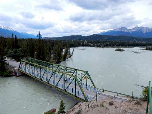
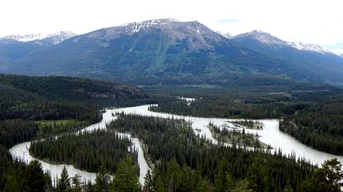
Bridge over Athabasca River near Old Fort Point trailhead
Route
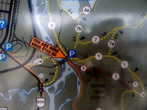
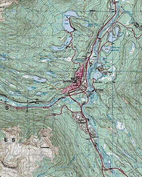
A portion of the Old Fort Point trailhead map
Upon pulling into the trailhead, you will notice a large wood staircase leading steeply up a rock bluff. This marks the start of the trail.
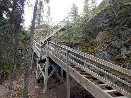
Start of Old Fort Point trail
At the top of the staircase, the trail turns E/SE, and heads directly toward Old Fort Point. After a short distance, the trail will split. Ignore trail '9a', which leads off to the right, and stay on the main trail to the left, labeled as '1'.
Trail 1/Trail 9a split on the way up Old Fort Point
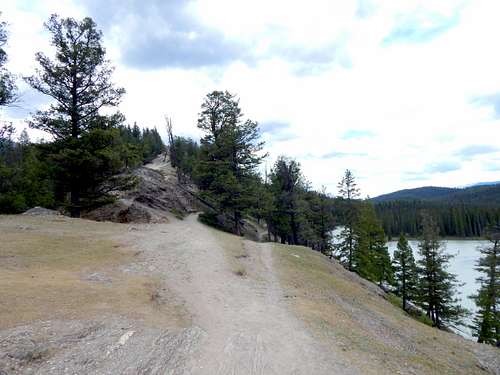
The trail will climb steeply for the next several hundred yards, with concrete steps on the steepest sections. At the top of the steep section, the trail will level off, and the 'summit' will come into view.
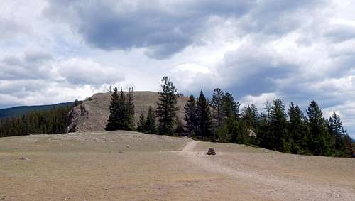
Looking east toward Old Fort Point summit
While it would be possible to hike directly to the top from this point, it is much easier to stay on the trail, and approach from the east.
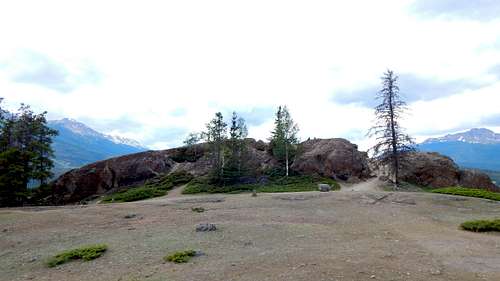
Looking west toward the summit of Old Fort Point
Total distance to the top will be about 0.5 miles (0.8km), and the hiking time will be 10 to 20 minutes. As you approach the summit, use caution (particularly if hiking with small children), as there are substantial cliffs on the northeast side of the hill.
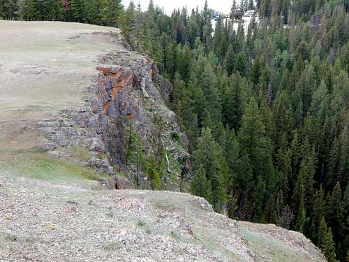
Cliffs near the summit of Old Fort Point
Old Fort Point yields great views of the Jasper area, as well as a number of prominent peaks in the distance. Peaks will be identified to the best of my abilities - please feel free to correct any errors I may have made.
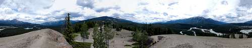
Old Fort Point summit pano
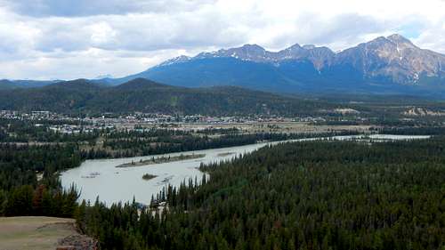
Downtown Jasper from Old Fort Point. Victoria Cross Range and Pyramid Mountain in the background.
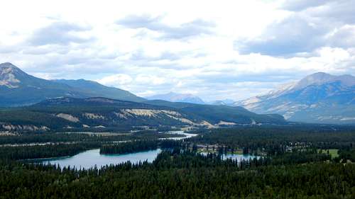
Jasper Park Lodge and Beauvert Lake from Old Fort Point
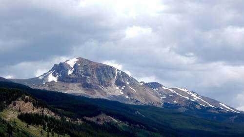
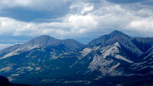
Mount Tekarra from Old Fort Point
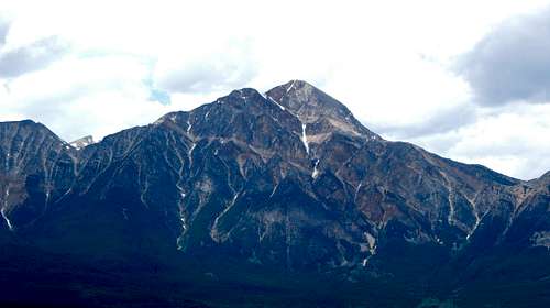
Pyramid Mountain from Old Fort Point
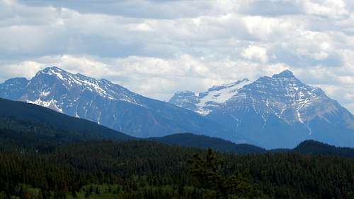
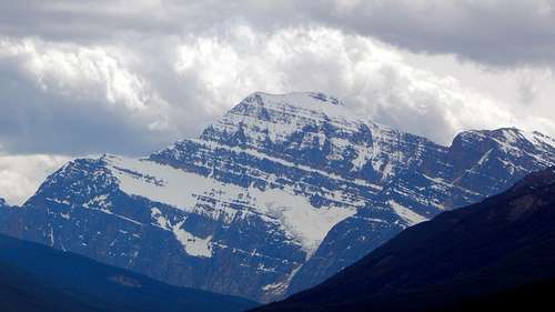
Mount Hardisty and Mount Kerkeslin from Old Fort Point