
|
|
Route |
|---|---|
|
|
38.97836°N / 108.62886°W |
|
|
Hiking |
|
|
Spring |
|
|
Less than two hours |
|
|
Easy- Moderate on a hot day |
|
|
Notch-'O-Pass
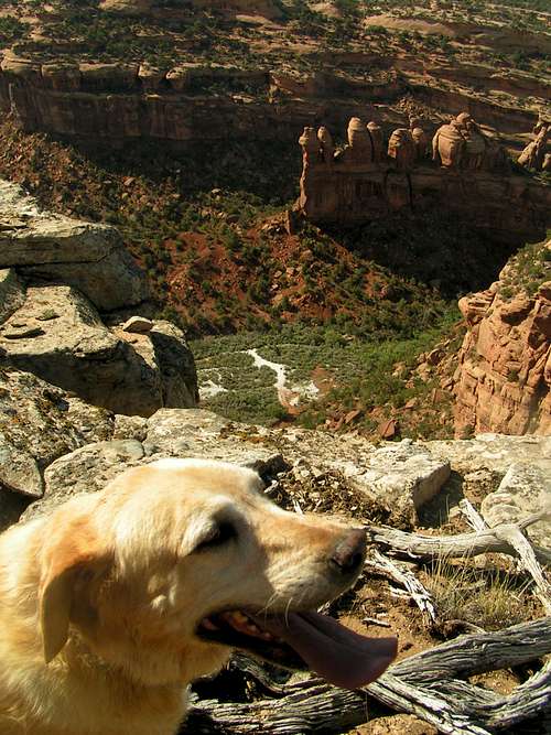
Moose smiles on the view to the west from on top of Notch-O-Pass to upper Rough Canyon, some toothy sandstone towers, and white quartz powder left by the mica mine.
This one’s for the dogs, the actual four-legged variety that through no fault of their own find themselves banished from the great and convenient hiking trails of the Colorado National Monument. My wife’s two yellow Labrador retrievers named Moose and Bell were born to a Montana cattle ranch where they ran through fields, forests, and flowery meadows everyday. Now they have relocated to a downtown backyard in the desert, and they get more stir-crazy and boggle -eyed than I do when they don’t get out for a strenuous or at least scenic hike, (or to chase rabbits, jump in the lake, often after a fishing lure, wallow in stanky mud, and chase more rabbits, all of which they love even more than hiking, even though they are too old and sloppy catch any rabbits!)
Getting There
[img::aligncenter:medium:]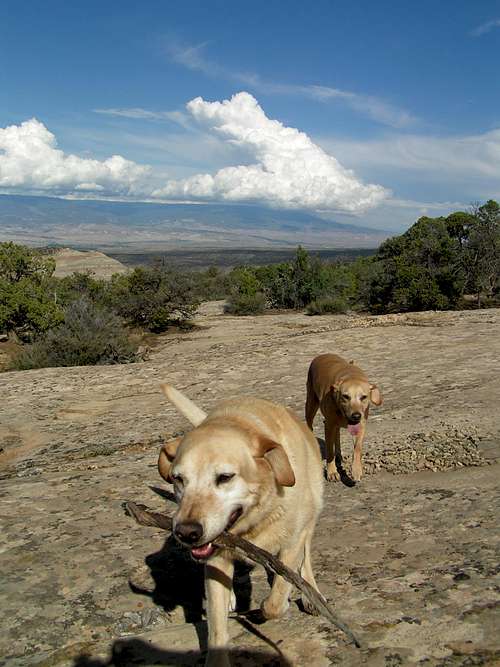
Moose and Bell hiking up the slabs of the "Natcho."
You don’t have to bring the dogs to enjoy the treats of Notch-O’Pass! But if you don’t bring a friend with less than three legs you’ll probably be lonely. Drive Grand Avenue west over the tracks and Colorado River, Turn Left (South) on Monument Road. Take the second Left onto Rosedale Drive just before the road crosses a canal bridge. Follow Rosedale to a Right up Little Park Road. Follow Little Park Road for (several steepish miles) to a Left onto the Tabequache (also a Ute name) Trail Parking Lot. Several dog friendly hikes abound including the Mica Mine Trail, the exploratory Rough Canyon Trail, and the fun mountain bike and multi-use slab rock trail down to the “falls” and potholes just above the first usually dry creek crossing of the Tabeguache-Whitewater section.
Route Description
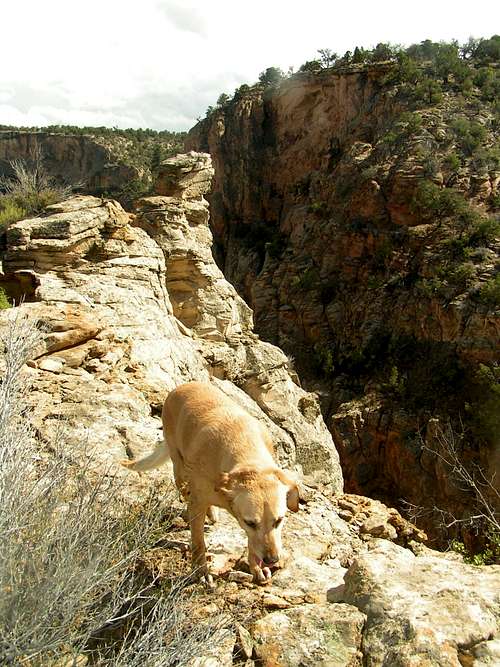
Bell gingerly walking the edge of the nacho just above the gap of Notch-O-Pass.
Higher Calling-
I had been neglecting the dogs far too long so the first rainy weekend this summer, I decided to tempt fate and scurry my two wheel adventure mobile thirty miles up to the cool wet forests surrounding Fruita Reservoir number three. Moose and Bell were thrilled and tromped with tails wagging hard through wet underbrush and rolled in the grass while I threw some line in the small still lake. This peaceful scene lasted about five lure casts and two pieces of TJ’s Glade Park Mesquite Jerky when sharp-whip-cracks of lightening and rumbling thunder signaled the end of gentle mountain weather and the beginning of get out of here down pour.The car slopped around rain-laden corners safely past the Glade park store. I turned right on to Little Park Road and headed for the sure fire dog pleaser, a fun little route I call “Notch-O-Pass!”
Route To Notch-O-Pass-
The route begins at the Tabeguache Trail Staging Area. From the parking lot the route goes to the bottom of the rock cut road then right following the sign to the Mica Mine. Just a few paces past the usually dry creek crossing a hard left leads straight up an obviously steep hill rather. If you miss this you will continue up the creek bed to the Mica Mine. This faint old jeep trail is on the very right hand corner of what I think of as a very large upward leaning triangle (perhaps more rounded from a topographic view, but if you hike this route it tapers to a point). Hence I call it the "nacho". Atop this triangle is a notch between this triangle and a point protruding from a bench that gradually sweeps up to the pine covered Pinyon Mesa. Further hence why I refer to this hike as "Notcho-O-Pass". Might be too clever, but I think it is fitting.
Most of this old jeep road is on fractured blocks and ledges interspersed with vast sections of large slick rock slabs. Follow the winding road up the right hand side of a broad slope (the big “nacho”) to gain the “Notch” Or “Pass” above. Great views can be had from several airy perches on the north side of the notch, but more views, intruige, and fun is added with a "dip" into the Notch just beyond these towers.
A sneaky single-track trail drops down a subtle ramp west of the Nacho's summit. Cross the Notch-O-Pass and continue up the west (right) side of a narrow ridge. This rocky trail holds firm to the pine-fortified wall with rudimentary retaining walls, perhaps placed by Ute’s who frequented the flats above the rim. These swerving switchbacks are the deal sweetener as you gain the top of the rim affording views of dragon jaw spires; quartz dusted roadleft over from the Mica Mine, and the bonsai like gardens adorning upper Rough Canyon west and beneath the rim. A pale green expanse of Rough, Cross, and Bangs Canyon's lie below the extending edge of the Uncompahgre rise. Further eastward; views of Palisade, the great edge of the Grand Mesa, the expansive “Stinking Desert” and glimpses of the West Elk and San Juan Mountains glimmer in the distance.
A note of history and nomenclature here; Uncompahgre is not named for a proselyte of the catholic faith as some pronounce it. The name’s origin is Ute Indian for the “red stinking water” hot springs of the town named in Chief Ouray’s honor. Apparently geologists and cartographers named the high plateau that created "Notch-O-Pass"for the same “uplifting” heat source that warms Ouray’s swimming pool. Following suit, the “Stinking Desert” Preservation Society bestowed the high desert between Whitewater and Delta with the proper English translation to “Uncompahgre” but added teh desert part (a fitting double meaning too…very clever!) Rumor has it that heavy sheep grazing contributed to the near lifeless condition of the now “stinking desert.” I sincerely appreciate the desert’s present state of starkness and hope there won’t be a subdivided strip mall to replace this open country…that would truly stink up our “western” landscape.
Enough about the past, the sound of two heavy breathing dogs dictate that we scamper back across the notch to cool off in the shady (and sometimes wet!) Rough Canyon before the dogs pant and drool their own salivated river!
Essential Gear
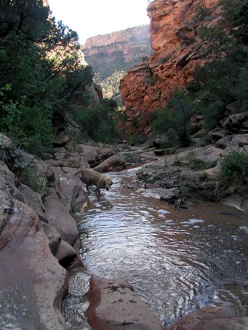
Moose preparing to wallow in upper rough canyon creek. (I don't think its good for the fogs or the creek but the water was moving on so not that big a deal.?)
External Links
Moose preparing to wallow in upper rough canyon creek. (I don't think its good for the fogs or the creek but the water was moving on so not that big a deal.?)
entrada - Oct 13, 2014 10:08 am - Hasn't voted
Turn left insteadThis is a nice hike, but in the Route Description, it should say turn Left, or southwest, rather than Right to exit the stream bed soon after coming down the road cut through the rocks. There is also an old road on the right, but following it just gets you back to Little Park Road. Don't ask how I know that...
seth@LOKI - Mar 2, 2015 11:48 pm - Hasn't voted
Re: Turn left insteadHI, I edited this. Thank you!