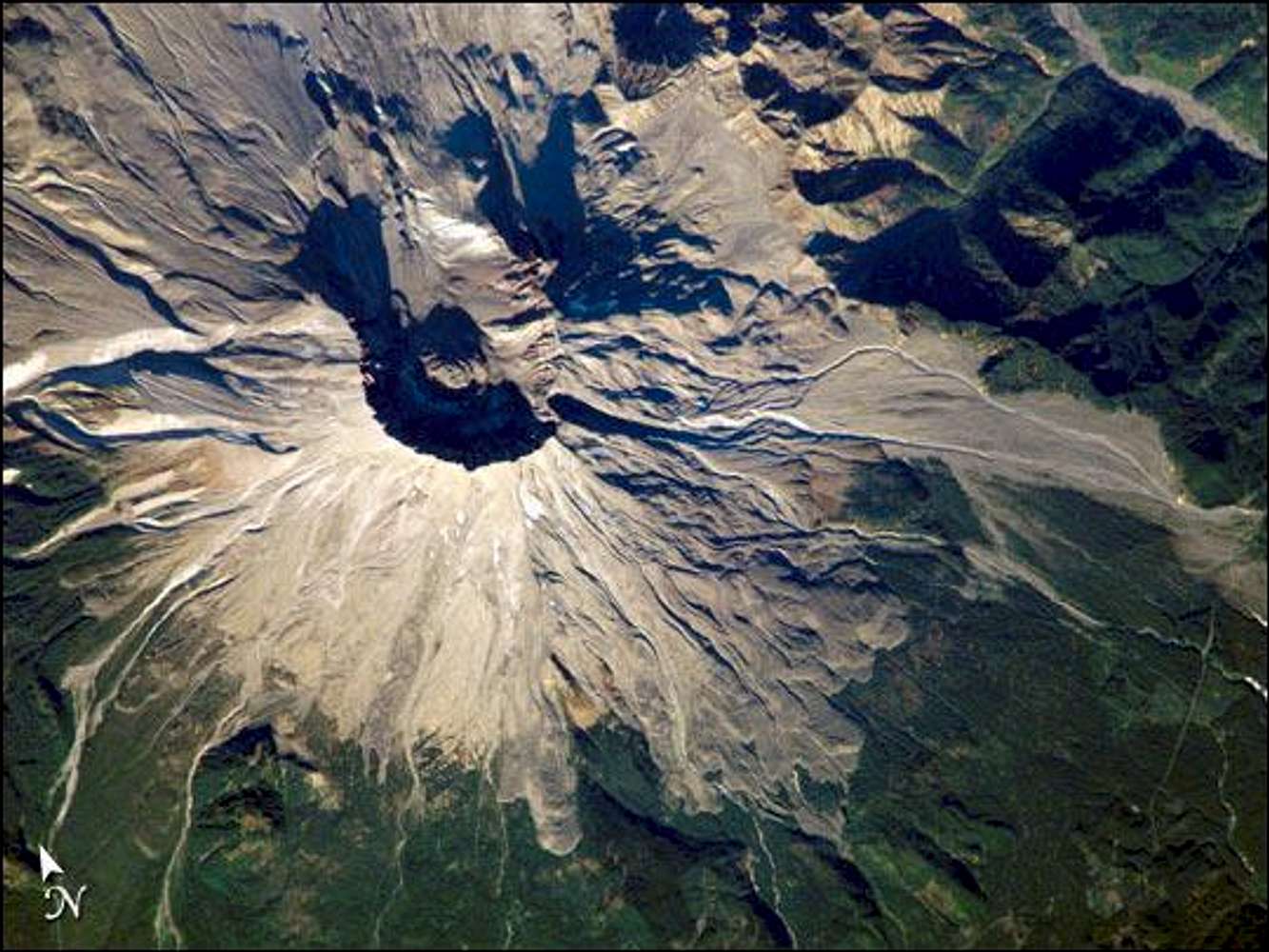
NASA astronaut photograph ISS005-E-18511 was taken October
25, 2002, with a Kodak DCS760 digital camera equipped with
an 800-mm lens, and is provided by the Earth Observations
Laboratory, Johnson Space Center. "This week marks 24 years since the eruption. On an earlier Space Station expedition, astronauts observed and captured this detailed image of the volcano’s summit caldera. In the center of the crater sits a lava dome that is 876 feet above the crater floor and is about 3,500 feet in diameter. The dome began to form after the 1980 eruption, but there have been no dome building eruptions for more than a decade. Afternoon lighting accents the flow features in the volcanic and debris flows and the steep valleys eroded into the loosely consolidated material near the summit.
The upper slopes of the 1980 blast zone begin at the gray colored region that extends north (upper left) from the summit of the volcano. The volcanic mud and debris from the eruption choked all of the drainages in the region. The deeply incised valley to the left (west) is the uppermost reach of the South Fork of the Toutle River. Devastating mudslides buried the original Toutle River Valley to an average depth of 150 feet, but in places up to 600 feet. Even today, heavy precipitation can send unconsolidated volcanic debris downstream. A special dam was constructed on the North Fork of the Toutle River to catch the sediments from moving further downstream. Levees and dredging also help stem further mudslides. The dark green area south of the blast zone is the thickly forested region of the Gifford Pinchot National Forest." More information and
additional credits at source URL
http://
earthobservatory.nasa.gov/Newsroom/NewImages/
images.php3?img_id=16546.


