

Bob Bolton - Jun 8, 2005 8:09 pm - Hasn't voted
Just to cover our......backsides, you might want to change the 9,000 feet in the caption to 8,920 feet. Klenke is likely to pull a John Roper on us and claim that we went to the wrong spot! 
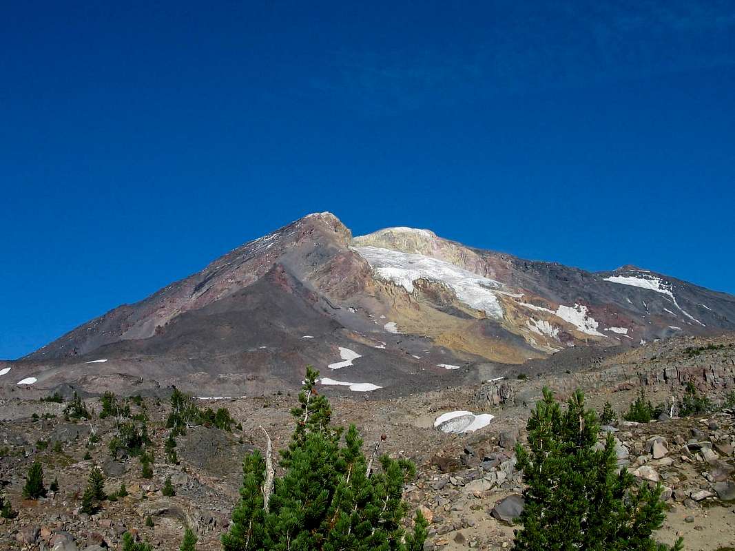
Actually, if the truth were known, Don and I think that the area on the topo map where the 8920-foot+ spot shows may be air now. The speed with which that mountainside is disintegrating suggests that any spot that close to what was essentially a cliff back when the map was drawn may no longer be there. Don was thinking that when he was there, and I can't argue based on what we saw.
We did indeed have much more severe conditions than they had, that's for sure!
Bob Bolton - Jun 8, 2005 8:36 pm - Hasn't voted
Re: Just to cover our...I shot a photo of my GPS here just to prove that we did get high enough to go into Yakima County. I took the shot while standing on the edge of the abyss, and when I got home and saw on Topozone where the shot had been taken, I was very confused. Then when Don told me his theory, it all made sense.

Don Nelsen - Jun 8, 2005 8:47 pm - Hasn't voted
Re: Just to cover our...Interestingly, the spot you linked to no longer exists! I've sent each of you a .jpg of my GPS track. Do we have a Mt. St. Helens situation here, except that the mountain went down, instead of up!?
don

Dean - Jun 8, 2005 10:22 pm - Hasn't voted
Re: Just to cover our...Wrong spot? The way we covered that mountainside, I'm sure we hit everything in creation that could've qualified. It doesn't surprise me one bit to think that that whole section may have changed. But when we were there, it was there. : )
Bob Bolton - Jun 8, 2005 11:00 pm - Hasn't voted
Re: Just to cover our...I think Don's right that the mountain we saw doesn't resemble the topo map. Like I said, I was confused when I got home because my GPS reading was taken right on the edge of the abyss, and it was some distance south of the edge showing on Topozone. Don's track also provides evidence since it goes right over the spot I took my GPS photo. Not to worry, however, we got the HP. It's just not where the topo map said it would be.
Don Nelsen - Jun 9, 2005 10:41 am - Hasn't voted
Re: Just to cover our...I'm sure you and Dean got the high point but previous climbers, if they kept to the ridgeline, would probably have climbed what is now just air! It would be interesting to compare pictures from several years ago.


Comments
Post a Comment