Comments
No comments posted yet.
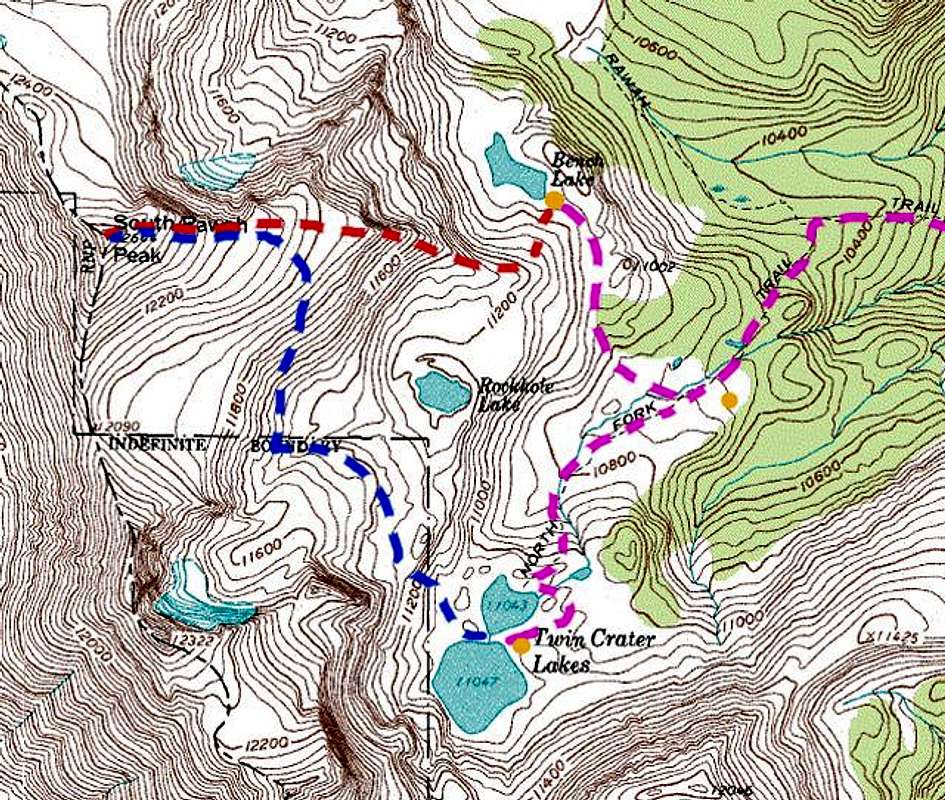
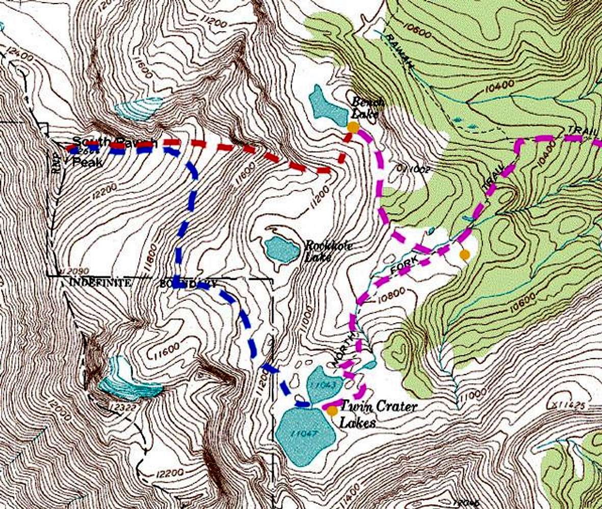
| Map of South Rawah Peak and eastern slopes. The pink, dashed line shows possible routes of approach. The red, dashed line shows the east ridge ascent I took from my camp at Bench Lake. The blue, dashed line shows a possible route of ascent from the Twin Crater Lakes Area. The orange dots show good locations for a campsite. Visit my website for more Rawah Wilderness photos: www.leachfam.com. |


