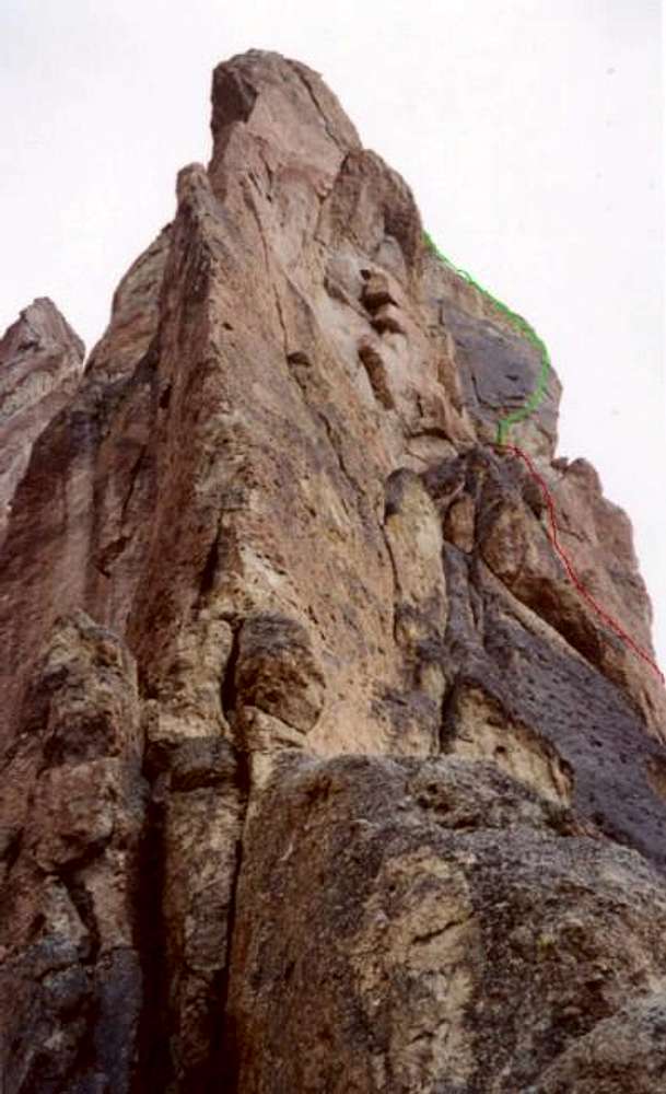
Looking (roughly) south from
Asterisk Pass. The Asterisk Boulder is directly behind me. The 5.8 R two-pitch
Sky Ridge route goes directly up this arete (more or less - it actually climbs the left and right faces of the arete a few times on the way up) in the foreground and tops out about 70 feet below the top of
Wherever I May Roam route. In the right half of the photo are pitches three (red line) and four (crux, green line) of
Wherever I May Roam route (March 10, 2003).


