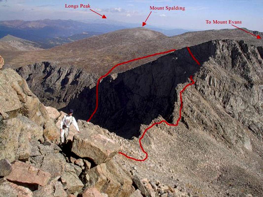
View of The Sawtooth route. This photo was taken near the summit of Mount Bierstadt looking north. This route takes you along the east face of The Sawtooth for most of the way and then you swing over to the west face towards the end. You can see the steep, tricky climb off The Sawtooth at the north end (in shadow). From there you head down the slope to the gully (also in shadow) that will take you back to the beaver ponds and eventually the trailhead. Colonelpyat pointed out that I misslabeled the photo. What I indicated as Mount Spalding is actually Gray Wolf Mountain. Mount Spalding is the high point on the right under the word "Evans." Visit my website for a complete set of my Mount Bierstadt photos: www.leachfam.com.


