Toggle navigation
Mountains
Routes
Images
Trip Reports
Forum
What's New
People
Areas & Ranges
Articles
Trailheads
Canyons
Huts & Campgrounds
Albums
Logistical Centers
Fact Sheets
Lists
Custom Objects
Gear
Plans & Partners
WELCOME TO SUMMITPOST
SIGN IN
REGISTER
Clouds Rest
Additional Parents
Image
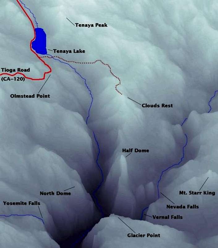
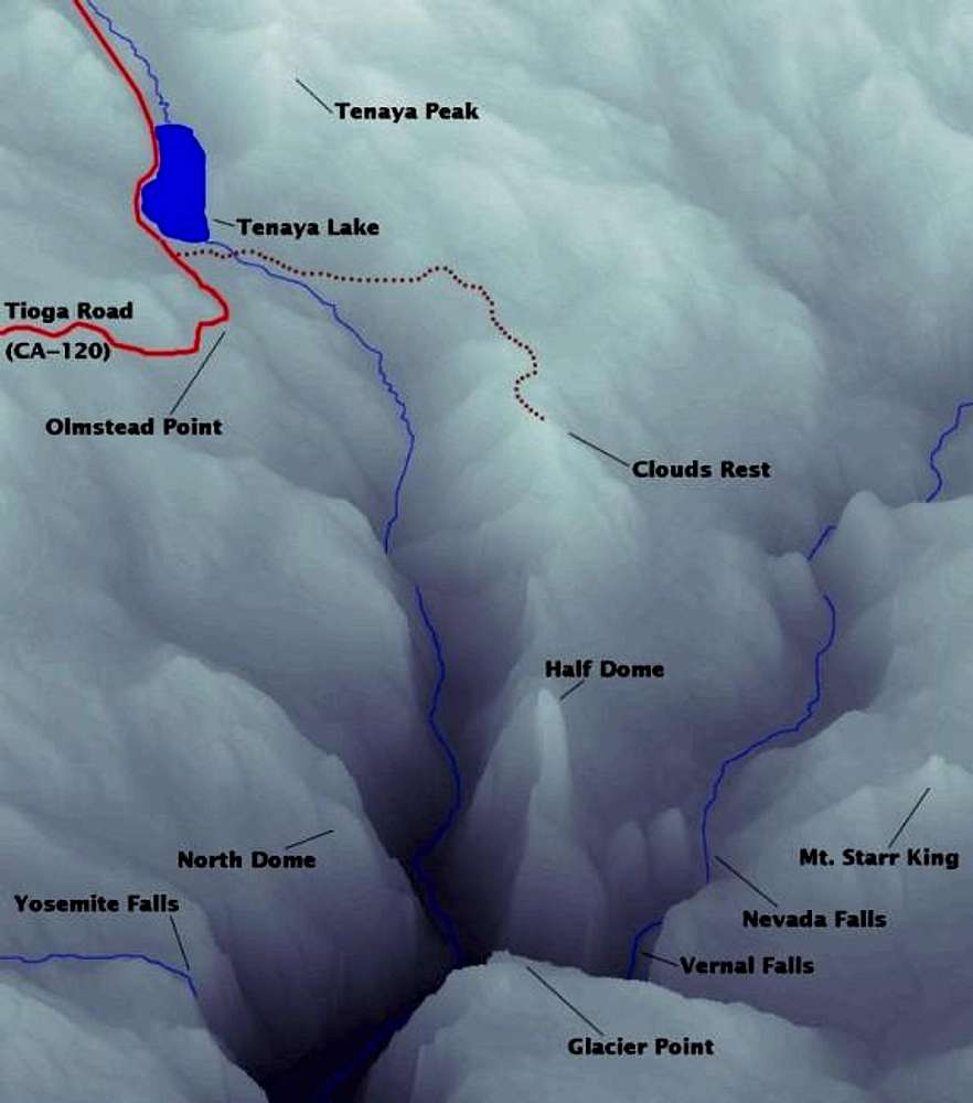
Shaded relief map of our hike...
View High-Resolution Image
Shaded relief map of our hike...
Shaded relief map of our hike up Clouds Rest the Sunrise Lakes Trailhead at Tenaya Lake. Vertical exaggeration=2.
Click here for a full-sized version
.
« PREV
NEXT »
mpbro
on
Jul 22, 2001 12:59 pm
Comments & voting
Other parents
Lat/Lon:
37.76780°N / 119.4883°W
Image ID:
1172
14272 Hits
74.18
% Score
6
Votes
Log in to vote
Comments
No comments posted yet.
to post!
Don't have an account?
Clouds Rest
(Mountain/Rock)
« PREV
Viewing
#66 of 124
GALLERY
NEXT »
mpbro's Image Gallery
« PREV
Viewing
#107 of 305
GALLERY
NEXT »
×
You need to login in order to vote!
User Name
Password
Remember me
Forgot your password?
Log me out when I close my browser.
Keep me logged in all the time.
sign in as a user
Don't have an account?
Register now for FREE
Rating available
Suggested routes for you
People who climb the same things as you
Comments Available
Create Albums
Register Here


