

-
 55664 Hits
-
 94.02% Score
-
 45 Votes
|
|
Area/Range |
|---|---|
|
|
61.63691°N / 8.31144°E |
|
|
Hiking, Mountaineering, Trad Climbing, Ice Climbing, Skiing |
|
|
Spring, Summer, Winter |
|
|
8100 ft / 2469 m |
|
|
Overview
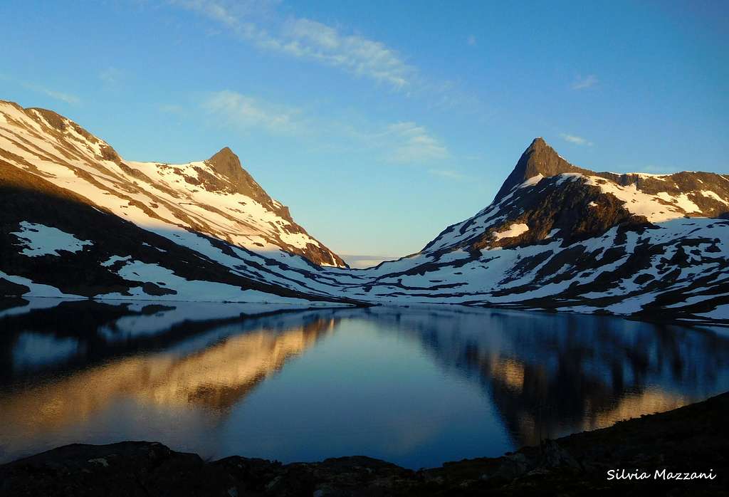
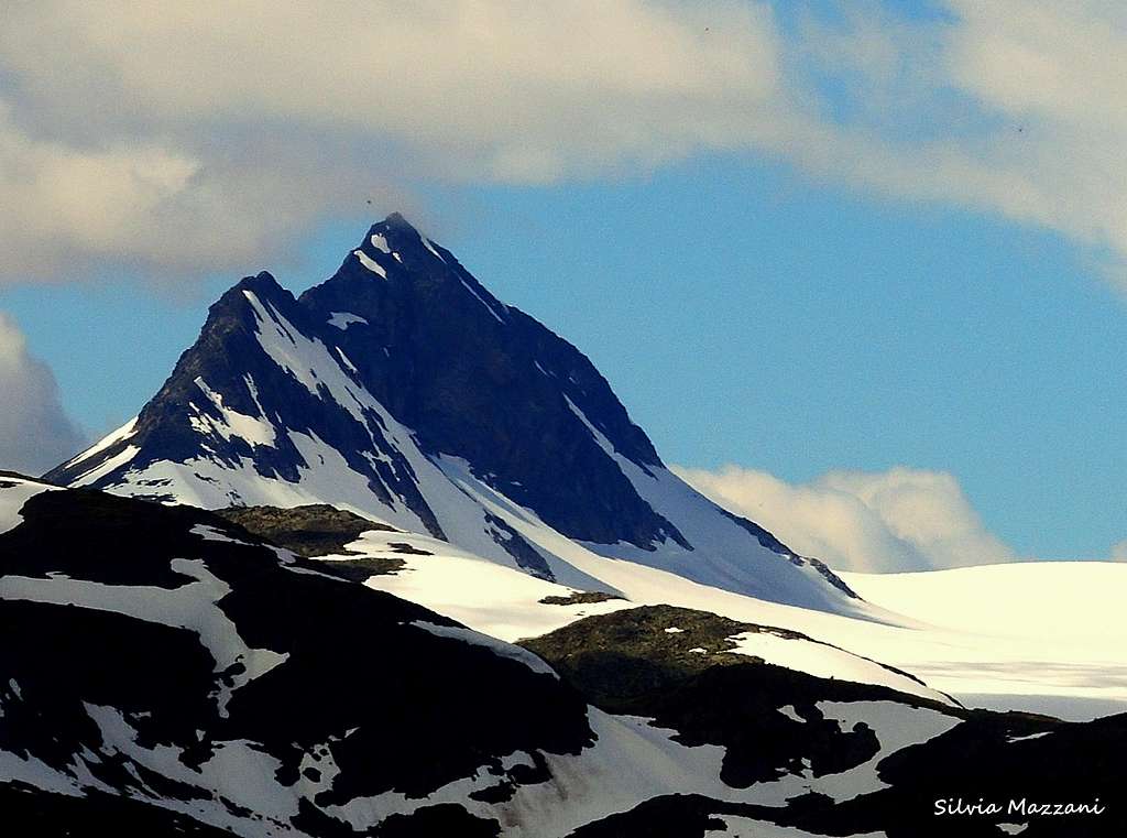
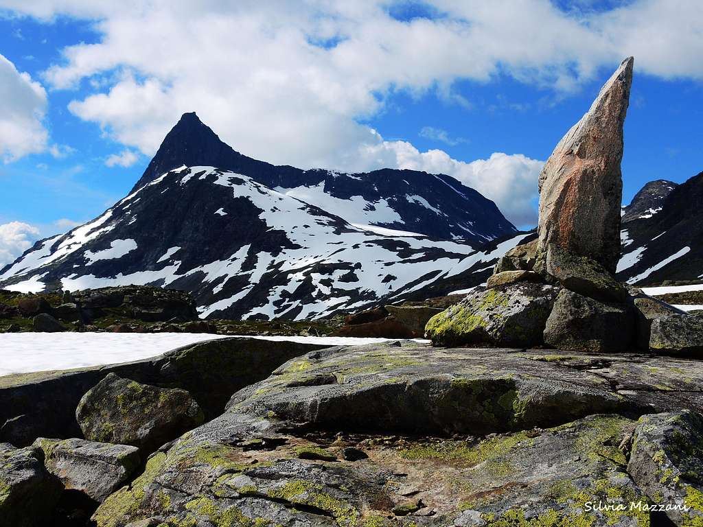
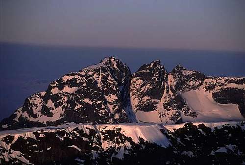
The Jotunheimen range
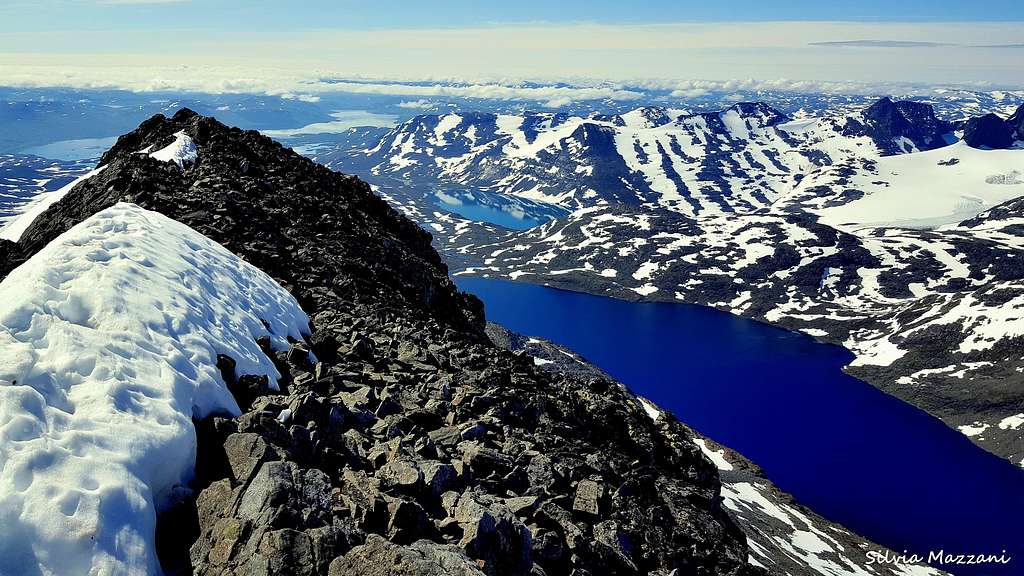
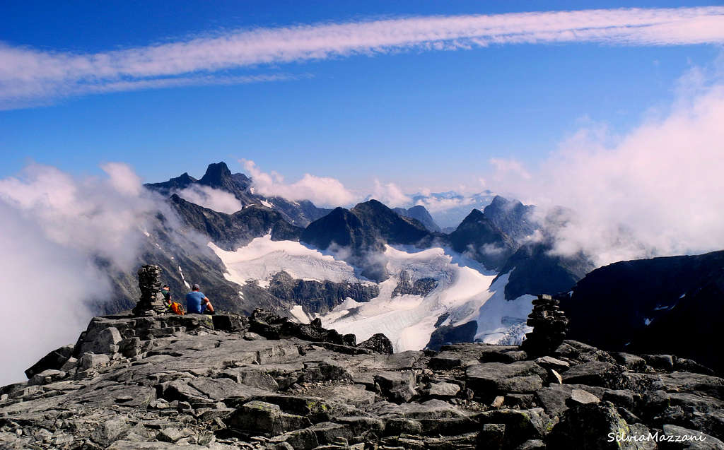
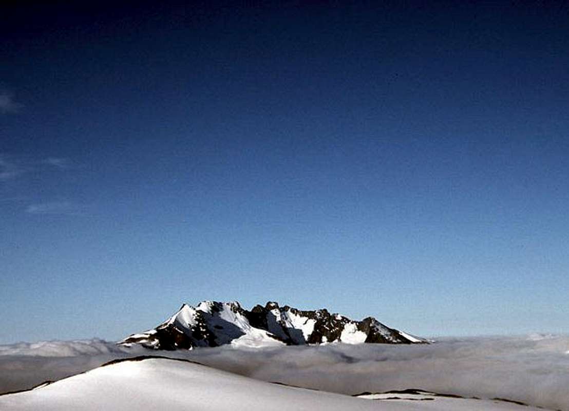
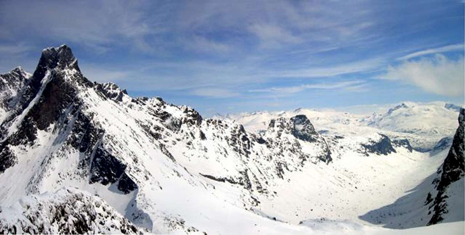
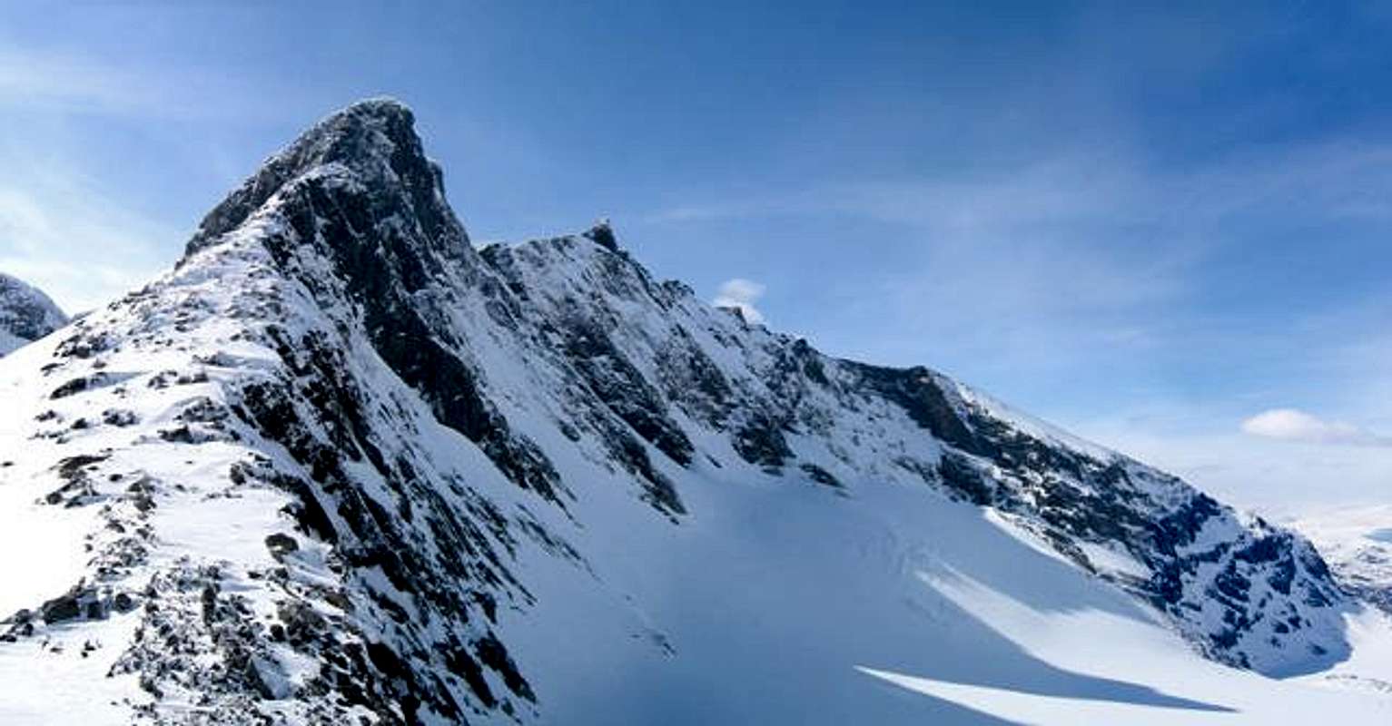
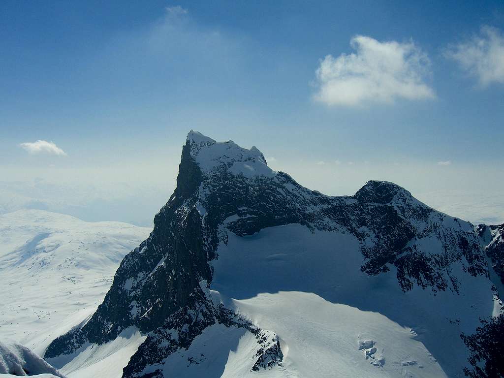
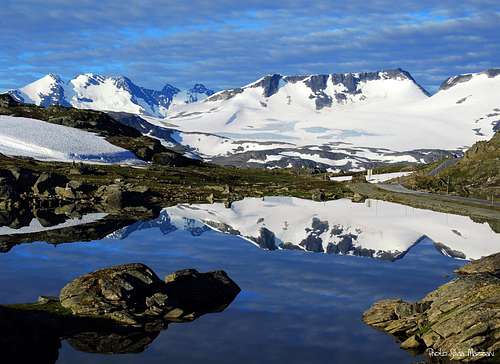
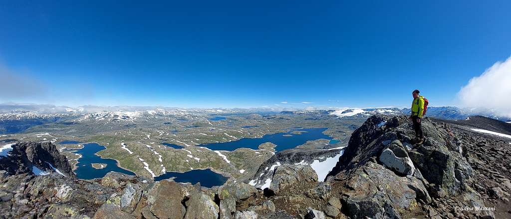
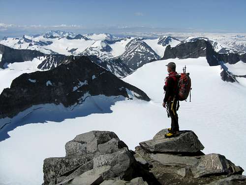
The Jotunheimen (meaning "Home of the Giants") is without any doubt the most famous mountain area in the whole Scandinavia. Located in the Southern part of Norway, it's a magnificent range covering an area of approximately 3,500 km² and including the highest mountains in Norway. The highest mountain in the Jotunheimen and in the whole Norway is the Galdhøpiggen 2469 m, closely followed by the Glittertind 2464 m, which is only a handful of meters lower and located immediately East of Galdhøpiggen. According to the most recent official elevation it is only five meters lower than Galdhøpiggen, but its height varies depending on the depth of its summit snow and icecap. Galdhøpiggen summit is rocky, while Glittertind summit is icy. As the difference in altitude between the two mountains is minimal, a dispute arose in the past regarding the ranking, also because the measurements showed that when the Glittertind summit glacier was measured, the height of Glittertind was supposedly greater than that one of Galdhøpiggen. However, since then, the Glittertind summit glacier has retreated and so the dispute no longer exists. This mountains are two of Norway's 198 peaks overcoming the 2000 meters. A huge majority of these are located in the Jotunheimen area, including all over 2300m. Jotunheimen highest mountains are located in the Eastern part of the range and altough here the mountains have a decidedly modest height when compared to those ones in the Alps, the difference in level from the valleys to the peaks is considerable, as the valley-altitude is typically between 400-1400 meters.
Although Scandinavia highest mountains, Galdhøpiggen and Glittertind, are found in the Eastern Jotunheimen, Hurrungane and Smørstabbtindane in the Western part have more alpine character. Jotunheimen has many glaciers, the biggest of those are found in the Western area, which has several mountains that cannot be climbed without crossing a glacier.
According with the ancient Norwegian mythology the gods lived in Åsgard, the humans in Idgard and the bad giants in Jotunheimen.
Location
Jotunheimen is located in the middle of Southern Norway. Normally Jotunheimen is considered to be bordered:

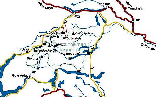
- by Vågåvatnet, Bøverdalen, Leirdalen and the road n. 55 (Sognefjell Mountain Road) to the North and NW
- by road n. 51 to the East (Valdresflye)
- by Bygdin, Tyin and Årdal to the South
- by mountain road between Årdal and Turtagrø to the West.
For further information about geographical locations, see Maps - The Norwegian Trekking Association.
Detailed Jotunheimen National Park road-map can be found at Norgesnasjonalparker
Getting There
Public
- Regular buses from Oslo to Gjendesheim that are put up in the seasons by the Norwegian Mountain Touring Assosiation (DNT). You must have a reservation on these buses. Ask at the DNT office in Oslo (email).
- Train to Otta, from where buses (Nor-Way, Ottadalen Billag) cross the Sognefjell mountain road summertime. Good starting points by this road are Krossbu (Smørstabbtindane) and Turtagrø (Hurrungane).
- Other than this it's diffcult to get to Jotunheimen with public transport. But suring summer season there are so many people going to Gjendesheim, Spiterstulen and Eidsbugarden that hitching should be no problem.
Car
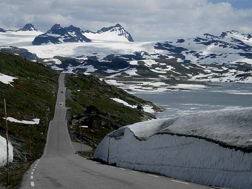
- From Oslo north on E6 to Otta (308km), road 15 to Lom (64km), finally road 55 (Sognefjell Mountain Road) and/or various minor roads to starting points.
- Alternatively it is possible to take a southern route via Fagernes (E16, 191km from oslo) and Sogndal (further 175km from Fagernes, there's a short ferry before arriving in Sogndal, fee of which may well be a nasty surprise). From Sogndal, 76km along road 55 to Turtagrø.
- For Øvre Årdal (Utladalen) 75km along E16 from Fagernes, then 37km along road 53.
- Eastern areas are easiest to reach from Fagenes along road 51 (70km from Fagernes to Gjendesheim)
- Some of the public roads in the area are also closed in the winter. This goes for Valdresflya between Gjendesheim and Bygdin which is closed November - April and Sognefjell mountain road between Bøvertun and Turtagrø which is closed September - May. The other roads are usually kept open, but might be closed during bad weather.
-The roads to Spiterstulen, Juvasshytta and Leirvassbu are open for normal traffic, but there's a fee of NOK 50-100. The roads to Spiterstulen is open year-round while the two others are closed in winter. The road to Glitterheim is closed the year round. The road to Eidsbugarden on the south side of Jotunheimen is free but is closed in winter. Anyway, in the winter there is operated a weasel-route on this road. The road from Turtagrø to Øvre Årdal is private, has a fee of NOK 60 and is closed September - May.
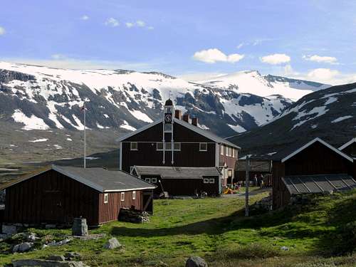
Accomodation
There are different types of accommodation:
- Staffed DNT lodges, which are open for overnight stops and which serve all meals.
- Big private huts. They are quite similar to staffed DNT lodges.
- Self-serviced DNT huts, which are fully stocked with blankets and pillows, kitchen equipment and have canned and freeze-dried food for sale.
- Unstaffed DNT huts, which do not have food, but are otherwise fully equipped. A few of them require the use of sleeping bags. Some unstaffed huts may offer a lower standard.
- Huts of local and alpine clubs.
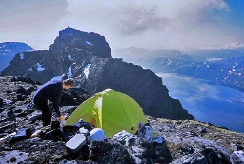
- Tenting is permitted everywhere.
Normal opening time for summer season is approximately middle of June and closing time middle of September. Contact the DNT information office in Oslo for the latest info. Prices in DNT huts are about 30-50% higher for non-members. It is possible to become a member at warden huts. Note that the discount is only availably for members of DNT, not members of UIAA!
For most of the self-service huts a general key is needed. It is available only for DNT members and can be obtained from DNT, warden huts or tourist bureaus against a deposit. The same key is needed for unwarden DNT huts. Some of the chalets belonging to local branches are locked with special keys. Apply to the DNT or the appropriate local association for further information.
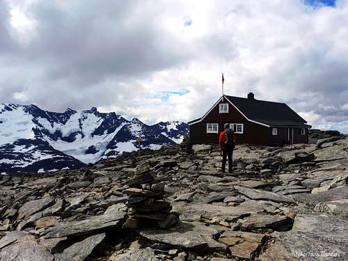
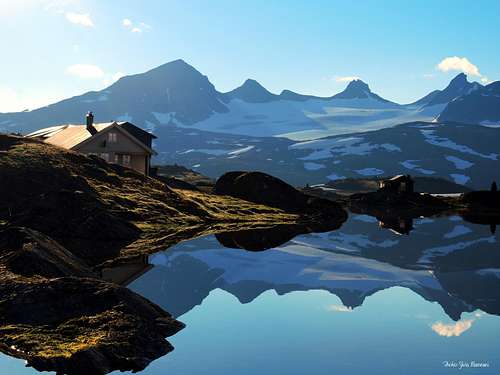
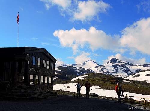
West (Smørstabbtindane & Hurrungane)
- Fannarakhytta 2069 m
- Krossbu 1267 m
- Leirvassbu 1405 m
- Sognefjellshytta 1410 m
- Skagadalshytta 1350 m
- Skagalstølsbu 1756 m
- Stølsmaradalen 849 m
- Turtagrø Hotel 884 m
South (Utladalen, Gjende & Ura-/Raudalen)
Bygdin Høyfjellshotel 1065 m
Eidsbugarden 1062 m
Fremre Hjelledalen 763 m
Gjendebu 990 m
Gjendesheim 995 m
Olavsbu 1440 m
Skogadalsboen 831 m
Torfinnsbu 1060 m
Tyinholmen 1080 m
Valdreflya UH 1386 m
Vetti 240 m
Vettismorki 683 m
Vormeli 612 m
North (Nautgardstinden, Memurutindane, Glittertind, Galdhøpiggen & Kvitingskjølen)
Bessheim Fjellstue 964 m
Besstrond Seter 985 m
Brimi Fjellstugu 880 m
Glitterheim 1384 m
Hindseter Fjellhotell 950m
Juvashytta 1841 m
Lemonsjø Fjellstue 870 m
Maurvangen 960 m
Memurubu 1008 m
Randsverk 730 m
Soleggen Fjellstugu 970 m
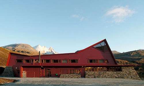
Spiterstulen 1106 m
Red Tape
The central areas of Jotunheimen lie in the Jotunheimen National Park , established in 1980, covering an area of 1140 km² and including the 27 highest peaks in Norway. Utladalen lies in a lanscape protected area. However, as opposed to many national parks in many other countries, climbers and hikers are by no means limited to marked paths. Norway (and other Nordic countries) has a special law granting everyone the right to unobstructed hiking anywhere in forest and mountain areas, regardless of ownership to the land, as long as you leave nature in the same condition as when you came.
Thus, for example, wild tenting is allowed.
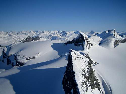
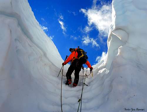
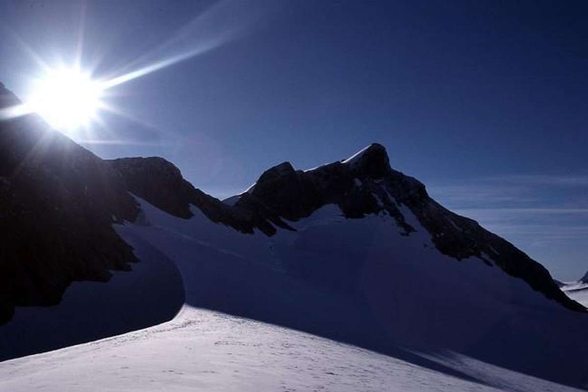
Climate and Climbing seasons
Despite it's moderate altitude in comparison with other mountain ranges, the Northern latitude give Jotunheimen a typical high alpine climate. Gulf stream brings lots of precipitation that is released especially on the Western parts of Jotunheimen. Rapid weather changes are possible and winter conditions are not impossible even in the middle of summer.
Spring has most sun and least precipitation. In the begining of May the average temperature of 24h is usually above zero at 1000m. The same happens in the middle of May at 1500m and in the beginning of June at 2000m. In the warmest month (July) average temperature is normally 10-12°C at 1000m and 3°C at 2000m.
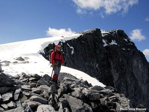
Traditionally summer climbing season begins in July. With the exeption of June and July, when temperatures tend to keep above freezing, stone fall danger is higher during the daytime. Despite the July being the warmest month, it is also often wet, so June and August have probably better weather. There are some pure snow/ice routes, that are usually in reasonable condition during the summer.
Early winter conditions may be extremely difficult with ice-covered rocks, deep loose snow, flooded streams, very short days and lots of bad weather.
Winter conditions are at its best during spring (ski mountaineering season peaks around eastern). During that time weather may be reasonably stable (or not). However, avalanches and rock falls may be a problem. Some rock routes melt quickly but generally snowed-up rock conditions are to be expected. Obviously snow and ice routes are often in good condition.
Current meteo for Jotunheimen: yr.no/en/forecast/daily-table
Climbing info
Overview
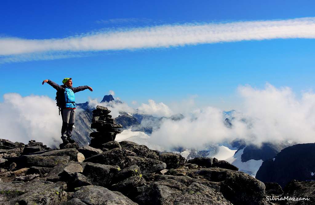
Jotunheimen has a lot to offer to the alpinists. Alpine climbing is found all over the area. However, although Scandinavia's highest mountains, Galdhøpiggen and Glittertind, are found in the Eastern Jotunheimen, Hurrungane and Smørstabbtindane in the Western part and Gjende Alps to the SE are most alpine areas. The area has everything from easy alpine routes to serious routes of 15 pitches and more. The best rock quality is found on the peaks between Gjende and Bygdin.
Short sport crags are found at Vågå and Lom and superb ice fall climbing is found especially in Laerdal, Utladalen and Valdres on spectacular icefalls if the weather is cold enough for them to freeze properly. The routes tend to be long (4-8 pitches) and steep (grade WI4 and up). The archetype is Vettisfossen in Utladalen (the highest free falling water fall in northern Europe) which falls free for 270 m, giving four pitches up a detached pillar (WI6, 330 m, FA by Henry Barber and Rob Taylor in 1977).
Apart from most popular routes in Hurrungane, many climbs in Jotunheimen are scarcily described. Thus Jotunheimen gives good oppurtunities for a climber with interest in exploratory climbing. Most routes in Jotunheimen are usually substantially less frequented than most popular areas in the Alps, don't count on any fixed gear or rappell slings to be found on the routes. Downside of Jotunheimen as a climbing area is unstable climate, as especially Hurrungane has some miserable weather.
NTK guidebook does not grade mountain routes with overal grade. Neither is any kind of winter-conditions grade given. Rock pitches are graded with Norwegian scale, that is related to UIAA scale (As a rule of thumb, Norwegian grades are about two minuses stiffer than UIAA grades though, i.e. NOR 3+ is more or less as difficult as UIAA IV). If an alpine route has significant difficulties on ice/snow, the degree of inclination may be given, but don't count on this. For ice fall climbing, old style Scottish grading system with Roman numbers is generally applied. However, ist is nowadays also possibly to see more internationally used WI-grade applied.
Mobile phone coverage in the mountains is not very trustworthy. Rescue operations are organised by the police who coordinates with Red Cross, alpine rescue groups and mediheli. The police can be contacted with 112.
History
Earliest visitors to Jotunheimen were reindeer hunters and botanists. However, the alpine history of Jotunheimen can be traced back to Chr. Boecks and B.M.Kailhaus's trip in 1820 during which first ascent of i.e. Falketind and Nordre Skagalstølstind. H.N.S. Wergeland made the first ascent of Glittertind in 1842. First ascent of Galdhøpiggen was made in 1850 by Steinar Sulheim.
The British William Cecil Slingsby from Yorkshire made altogether 15 trips to Norway between 1872 and first World War. His first ascent of Store Skagastølstind 21.7.1876 from Slingsbybreen (of which final part solo) is sometimes considered the start of Norwegian mountaineering. Within 15 years most of the mountains in Hurrungane were climbed mostly by Danish Carl Hall. Most famous norwegian climbers were Matias Soggemoen, Johannes Vigdal and Ola Berge.
A - Hurrungane
Hurrungane (Western Jotunheimen, to the west of Utladalen ) is Norway's classic climbing area, opened by C.W. Slingsby (British) in the late 1800's. The mountains are alpine in character, with numerous glaciers, steep faces and narrow ridges. Rock quality is generally good. Most approaches require glacier crossing. Hurrungane offers varied climbing with several long ridge traverses, rock and mixed faces and pillars and some glacier ascents and several steep now and ice routes. The area also holds great potential for winter climbing and ski mountaineering.
Most climbs in Skagastølsmassivet and eastern routes of Dyrhaugsmassivet can be reached either directly from Turtagrø, or from higher up Skagastølsdal. Skagastølsbu (aka Hytte på Bandet, 1756m), is well located for the normal routes of Storen. From Bandet it is also possible to access ascents of Maradalen and and southern Dyrhaugsmassif; these areas can also be accessed from Utladalen (starting from Øvre Årdal). Western routes of Dyrhaugsmassivet and western routes of Austabottmassivet are reached easily from Ringsdalen. To western routes of Austabottmassivet and climbs from Stølsmaradalen, road from Turtagrø to Øvre Årdal is the best starting point.
Skagastølsmassivet
The most famous climbing objectives of Hurrungane are found in Skagastølsmassivet. It consists of three intervening ridges, Styggedalsryggen (Gjertvasstind - Styggedalstind - Centraltind - Vesle Skagastølstinden), Skagastølsryggen (Store Skagalstølstinden - Vesle Skagalstølstinden - Nordre Skagastølstinden - Skagastølsnebbet) and Maradalsryggen. Styggedalsryggen joins Skagastølsryggen at Mohns Skar and Maradalsryggen joins Styggedalsryggen at Centraltind. All ridges offer worthwhile traverses with Skagastølsryggen (Nor 4-, one day) and Styggedalsryggen (two days, Nor 3 to Mohns skar) considered classics.
Most sought after climbing peak in Jotunheimen is Store Skagalstølstind (often called simply Storen, 2405m), a superb mountain, perhaps the finest in Norway. Storen is third highest mountain of Scandinavia and unlike the two highest mountains, Storen has no easy route to the summit.
The climbs are mostly long and start from the alpine grade AD-. Most popular route during the summer is Heftyes renne (Nor 4- (only short section), ~AD+), during the winter Andrews Renne may be a better alternative (Nor 3/3+ (reasonably sustained, somewhat stonefall endangered; ~AD- during the summer). While the most popular routes are rock routes, some other routes (such as Nordvestveien, Nor 3/3+ or Slingsby Route, Nor 2) have significant sections on ice/snow). Rock is mainly excellent gabbro. Also Nordpilaren (500m, Nor 5, 60°) and Nordøstflanke fra Gjertvassbreen (60°) of Gjertvasstind are fine climbs.
- Store Skagastølstind (Storen) 2405m
- Nordre Skagastølstind 2167m
- Skagastølsnebbet 2222m
- Midtre Skagastølstind 2224m
- Vetle Skagastølstind 2340m
- Sentraltind (Centraltind) 2348m
- Store Styggedalstind 2387m
- Store Styggedalstind, West 2387m
- Jervvasstind (Gjertvasstind) 2351m
- Maradalstind 2160m
Midtmaradals - Dyrhaugsmassivet
Between Skagastølsmassivet and Austabottmassivet lies Midtmaradals - Dyrhaugsmassivet. The highest peak of the area, Store Dyrhaugstind (2147m) is somewhat paradoxically one of the easiest (from Turtagrø via NE Ridge, Nor 1-2). Søre Dyrhaugstind is a classic with a benefit of extraordinary view to both Skagastølsmassivet and Autabottmassivet. Classic route from Bandet offers 6 pitches of rock climbing up to Nor 4. When snow conditions are good, route from Bandet via Berges Renne (100m of 50-55°) and Sørryggen (NOR 1-2) offers nice varied climbing (~AD). NE faces (Nordøstveggen) of Store Midtmaradalstind and Søre Midtmaradalsrtind offer impressive mixed and rock routes respectively.
Traverse of Midtmaradalsryggen (from south to north) over Midtmaradalsnosi 1750m, Søre Midtmaradalstind 1958m, Vesle Midtmaradalstind 2017m and Store Midtmaradalstind 2056 down to Lavskar (col) and further to Midtmaradalsbreen gives long but not too difficult ridge traverse (Nor 2, 30°). It is possible to continue over Pinaklene 1850m to Nordre Midtmaradalstind 2062m via Sørryggen (Nor 3) and down to Berges Skar (col) via Nordryggen (Nor 1). From Berges Skar it is possible to descent either to Midtmaradalsbreen (Berges renne, 55°) or to Ringsdalen. Traverse of Dyrhaugsryggen Dyrhausgryggen over Søre Dyrhaustind 2068m, Midtre Dyrhaustind Sørtoppen 2134m, Midtre Dyrhaustind Nortoppen 2135m, Store Dyrhaugstind 2147m and Nordre Dyrhaustind is Nor 1-2 from Søre Dyrhaugstind onwards.
- Store Dyrhaugstind 2147m
- Midtre Dyrhaugstind 2135m
- Søre Dyrhaugstind 2072m
- Store Midtmaradalstind 2056m
Austabottmassivet
Furthest to the West it lies Austabottindane. The highest peak of the area is Store Austabottind (2204m). It is most commonly climbed via col between Store and Vestre Austabottind (Nor 2-3). Store Soleitind (Nordøstryggen, 35°, Nor 1-2) and Store Ringstind (glacier from Gravdalsskar Nor 1, crevasses, ~PD) are easier. For example North Face (Nor 4-5, 250m) and North Pillar (Nor 7+, 350m) of Store Austabottind offer more demanding routes predominantly on Rock. For those looking for ice climbs, there are several interesting options such as Nordrenna of Vestre Austabottind (45° ,440m), Store Soleitind Nordveggen via Snøflanken (55°, with more direct option mixed at 55°, Nor 4) and Nordøstrenna of Nordre Soleitind (60°, avg 49°, 750m). Traverse of Autsabottmassivet from south to north is Nor 3 with several more direct (and difficult) alternatives. Traverse of Soleitindryggen from Lauvnostind to Soleitindskaret is easier at Nor 2 (4 more difficult variations).
- Store Austabottind 2204m
- Søre Austabottind 2103m
- Austabottind W 1 2100m
- Austabottind W 2 2020m
- Store Ringstind 2124m
- Store Soleibotntinden 2082m
- Nordre Soleitind 2030m
Fannaråken group
The small Fannaråken group lies somewhat separated from the other areas of Hurrungane. It is also less wild, being one of the few summits in the area that are accessible for non-climbers (scramble from Turtagrø) or easy glacier route from Sognefjellhytta (F).
- Fannaråken 2068m
- Steindalsnosi 2025m
 |
 |
 |
 |
 |
B - Smørstabbtinder - Ymisfjell (Galdhøpiggen)
Smørstabbstindmassivet
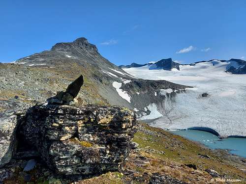
Smørstabbtindane is a very alpine area characterized by big glaciers, Smørstabbsbreen being the largest in Jotunheimen. The area is surrounded by Sognefjell mountain road (55) in north and west, Grausdalen in south and Leirdalen in East. Area has plenty of glaciersSmørstabbtinder are typically approached from Krossbu or Sognefjellhytta along Sognefjell mountain road or from Leirdalen (Leirvasbu, 1405m).
The highest peak of the area is Storebjørn (most commonly climbed either from Krussbu via Leibreen and col between Veslebjørn and Storebjørn (gully up tp 40-45°) or from Leivasbu (glacier 40°, both ~PD). From Krossbu, it is also possible to climb directly to the summit.
Store Smørstabbtind offers realtively straight forward ascent along north ridge (~PD-, 40°), all other routes are considerably more difficult (Søreggen NOR 3, Østveggen 55°). Traverse of the ridge (Kalven - Skeia - Veslebjørn - Bjønnungen - Saksi - Geiti - Kniven - Store Smørstabbtind) is a classic at NOR 4.
- Storebjørn 2222m
- Store Smørstabbtind 2208m
- Saksi 2189m
- Loftet 2170m
- Veslefjelltind 2157m
- Veslebjørn 2150m
- Kniven 2133m
- Skeii 2118m
- Gravdalstind 2113m
- Veslebretind 2092m
- Stetind 2020m
Ymisfjellmassivet (Galdhøpiggen)
Ymisfjell to the east of Leirdalen is home to Galdhøpiggen, the highest peak of the area. Normal routes are non-technical, either long glacier-free scramble from Spiterstulen (~F) or shorter glacier tour from Juvashytta (~PD-, very popular with daily guided groups). There is potential for technical routes from the north side, i.e Nordvesteggen offers 6 pitches (180m) of climbing up to NOR 3. On the opposite side of Porten (col between Galdhøpiggen and Vesle Galdhøpiggen) Sørøsteggen of Vesle Galdhøpiggen is also popular (NOR 3+, 150m).
- Galdhøpiggen 2469m
- Skarstind 2373m
- Vesle Galdhøpiggen 2369m
- Keilhaus Topp 2355m
- Storjuvtind 2349m
- Bukkehø 2314m
- Store Tverråtind 2309m
- Ymelstind 2304m
- Svellnosi 2272m
- Storgrovhø 2259m
- Styggehø 2213m
Hestrepiggmassivet
Hestrepiggmassivet is actually located on the north side of Sognefjell mountain road. The area is not actually part of Jotunheimen, but it is accessedfrom the Bøverdalen. Access is also possible from Ottadalen in the north.
- Høgste Hestrepiggen 2172m
C - Glittertind - Memuru - Heillstugutinder
Glittertindmassivet
Glittertind is located in the NE corner of Jotunheimen and it is the second highest mountain in Scandinavia. There are non-technical routes from both Glitterheim (7km) and Spiterstulen (12km, both routes are around F), while North face offers more difficult mixed climbing) NOR 5-, 45-50°, 350m).
- Glittertind 2464m
- Trollsteineggi 2300m
- Trollhøi 2201m
- Trollstein-Rundhøe 2170m
- Ryggjehøe 2142m
- Grotbrehesten 2018m
Memuru-Heillstugumassivet
Memumu- Heillstugumassivet covers a large area with long ridges and big glaciers. Traverse via Søstre Styggehøbretind - sørvestre Styggehøbretind - Søre Veotind - Østre Memurutind and Store Memurutind offers climbing up to NOR 3. Store Memurutind (usually either via NW Ridge or Memuru Skard and East Ridge) and Veotind (usually from SE, ~PD-) are propably the most visited individual climbing destinations.
- Surtninggsui 2368m
- Store Memurutind 2368m
- Store Memurutind, West 2364m
- Store Heillstugutind 2345m
- Midtre Heillstugutind 2339m
- Leirhø 2330m
- Austre Memurutind 2301m
- Søre Veotind 2267m
- Midtre Veotind 2240m
- Nestsøre Heillstugutind 2255m
- Semeltind 2236m
- Store Styggehøbretind 2232m
- Søre Heillstugutind 2189m
- Veobretind 2183m
- Hinnotefjell 2114m
- SpiterHøi 2033m
Visbremassivet
Visbremassiv is located in the middle point of Jotunheimen. Despite there being higher peaks around it, beautiful and free standing Kyrkja (2032m) is the domineering mountain of the area. Normal route follows South Ridge from the col between Kyrkja and Kyrkje-oksla. Much more difficult classic is "Wanda" on the north Face at NOR 7-, A1/YDS 5.11a (160m).
- Visbretind 2234m
- Semmelholstind 2147m
- Kyrkja 2032m
D - Leirvass - Utla - Tyin
Leirvass - Utla - Tyin area in SW Jotunheimen is located to the east of Utladalen, South of Storutladalen and Gravdalen and to the East of Leirvassbu - Langvatnet - Gjende - Bygdin - Tyin. In the South area is bordered by the road between Tyin and Øvre Årdal. The reasonably alpine area has several more or less isolated peaks.
First ascent of Falketind in 1820 via Falkebreen and Nordryggen (NOR 1-2) was the first really alpine ascent in Jotunheimen. Østeggen via Falkungen offers more difficult option (510m/12 pitches up to NOR 5-/YDS 5.9).
Uranostind is rather easy from the North. Østveggen is a snow ascent (PD, 45-50°).
Utladalen has the highest waterfall ice routes of the area. 330m high Vettisfossen is a lofty goal for true experts (WI6 with 270m continuous free hanging pillar, probably hard enough for most people!), while Avdalsfossen is better suited for mere mortals (200m, WI3). First ascent of Vettisfossen by Henry Barber and Rob Taylor in 1977 is legendary, as the pair had to climb upper part lay-backing with their hands, as the water reportedly flew horizontally for around 20m from pick holes. It took some 20 years before the route saw second ascent.
- Store Raudalseggi 2168m
- Uranostinden 2157m
- Sjogholstind 2141m
- Mjølkedalstind 2137m
- Stølsnostind 2074m
- Falketind 2067m
- Austre Høgvaglstind 1916m
E - Gjendealpene (Bygdin - Gjende)
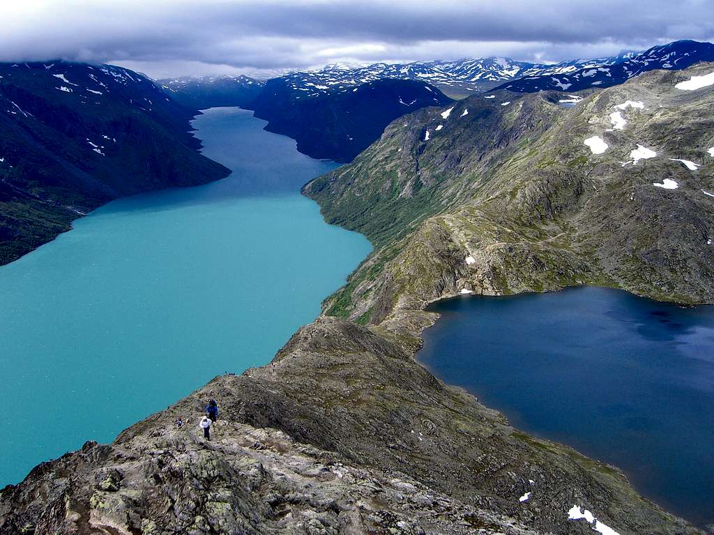
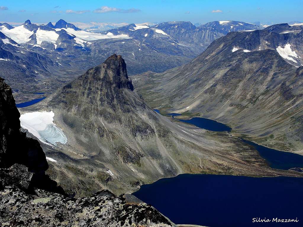
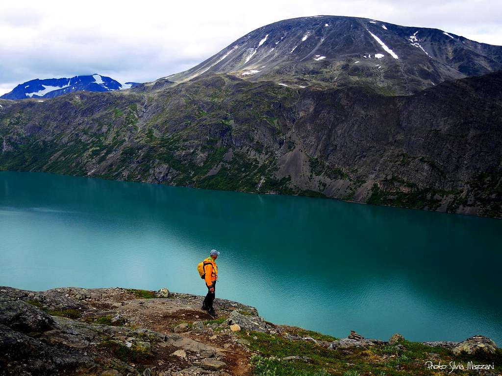
Gjendealpene are located in SE part Jotunheimen between the lakes Gjende (north) and Bygdin (south). The area consists of three distinct parts: Svartdalspigg - Torfinnstindmassivet furhest to the west between Vesleådalen and Svartdalen, Knutholstind - Tjørnholstindmassivet in NE (north of Leirungsdalen) and Kalvåhøgmassivet in SE. Besseggen ridge between Gjendesheim and Memurubu is one of the most popular hikes in whole Norway.
The outskirts of the area are easily accessed by car. DNT hut Gjendesheim (995m) on the east end of Gjende and along road 51 is propably the best starting point, with Valdresflya UH (1386m) and Bygdin Høyfjellshotel (1065m) being other options along road 51. Gjendebu (990m) and Torfinnsbu (1060m) are best located huts for the climbs. However, many climbs are best approached from a tent in either Leirtungsdalen or Svartdalen. Boats on the lakes Gjende and Bygdin can be used to access huts.
Svartdalspigg - Torfinnstindmassivet (Slettmark-Mesog massivet)
Slettmark-Mesog massif lies to the east of Svartdalen. Despite there being higher peaks, Midtre Torfinnstind is propably most interesting for climbers. North - South traverse of the massif from Gjendebu over Nordre (2137m), Store (2165m), Midtre (2065m) and Søre (2065m) Svartdalspiggen, Langedalstind (2206m), Mesmogtind (2264m), Kvitskardstind (2193m) and Vestre (2085m), Midtre (2110m) and Nordre (2085m) Torfinnstind toTorfinnsbu has 9-12 tops over 2000m depending on what constitutes a mountain and offers difficulties up to NOR 3-4. Traverse takes mostly 2 days. South - North traverse of Torfinnstindane offers shorter and easier traverse and the easiest ascend of Midtre Torfinnstind (NOR 2, 9-11h from Torfinnsbu, same route in opposite direction is harder at NOR 4). Mesmogtind (2264m) is usually climbed via the col between Mesmogtind and Kvitskardstind via SE and later SW ridges (45° snow, 9-11h from Torfinnsbu). Østveggen of Mesmogotind is another highlight (NOR 4, A0, 220m). The east of main ridge lies smaller massiv that runs mainly from East to West. Here Slettmarkpiggen (2163m) is usually climbed via North and West Ridges (NOR 1-2).
- Mesmogtind 2264m
- Langedalstind 2206m
- Kvitskardstind 2193m
- Slettmorkhø 2190m
- Store Svartdalspiggen 2165m
- Slettmerkpiggen 2163m
- Nordre Svartdalspiggen 2137m
- Midtre Torrfinstind 2110m
- Vestre Torfinnstind 2085m
- Nordre Torfinnstind 2085m
- Midtre Svartdalspiggen 2065m
- Søre Svartdalspiggen 2065m
- Slettmarkkampen 2032m
Knutholstind - Tjørnholstindmassivet
Most alpine peaks in Gjende Alps are found in Knutholstind - Tjørnholstindmassivet. The highest peak is steep sided pyramid of Store Knutholstind (2341m). The easiest ascent is via West Flank and North Ridge (850m of 40-45° scree from Svartdalen) with South Arete providing more climbing challenges (NOR 3). Knutholstraverse via Vestre Leirungstind (2250m), Vesle (2205m), Store (2341m) and Nordre Knutholstind (2185m) and Søre Nål på Knutseggi (2075m) has climbing up to NOR 4. Tjønnholstind in the eastern part of the massiv is far less popular.
- Store Knutholstind 2341m
- Tjørnholstind 2330m
- Steinflytind 2318m
- Østre Leirungstind 2288m
- Vestre Leirungstind 2250m
- Skarvflyløyttind 2250m
Kalvåhøgmassivet
Kalvehøgdi massiv lies to the south of Leirungsdalen and to the east of Svartdalen. it is least alpine area of Gjende Alps with three mountains above 2000m. Main ridge runs above 5 km from Leirungskampen (west) to Østre Rasletind (east) and southern slopes are reasonably gentle while northern side is much steeper. Nordøstpilaren of Vestre Kalvåhøgda offers 10 pitches of rock up to NOR 5- while Nordvestpilaren of Kalvåhøgda Ø1 (2159m) has 450m of mixed climbing (NOR 3, 40°).
- Store (Vestre) Kalvåhøgda 2208m
- Østre Kalvehøgdi 2178m
- Rasletinden 2105m
- Leirungskampen 2079m
- Nordre Kalveholstinden 2019m
- Østre Rasletind 2010m
Meteo
Weather forecast for Turtagrø
Meteo Eidsbugarden
Meteo Tyinholmen
Leirvassbu weather forecast
References
Guidebooks
- "Walks and scrambles in Norway" Hiking, Scrambling and Mountaineering in Norway guidedebook by Anthony Dyer - John Baddeley - Ian H. Robertson - Ripping Yarns 2006
- "Opptur Jotunheimen" 125 selected itinerary on Jotunheimen - Finn Loftesnes - Selja Forlag 2009
-Norsk Tindeklubb: Klatrefører for Jotunheimen. NTK 1996. 350pp. ISBN: 82-991002-1-6. Can be bought from NTK.
- Pollman Bernhard: Norwegen - Trekkingführere Jotunheimen - Rondane. Bergverlag Rudolf Rother, München 1997. ISBN: 3-7633-2706-1.
- Lennon Peter: Scandinavian Mountains. West Col Publishing, 1987. ISBN: 0906227321.
- Slingsby William Cecil: Norway - the Northern Playground. David Douglas, 1904 (original); David Blackwell, 1994 (re-published); 2003. ISBN: 1-904466-07-9. Available also as eBook.
- Thommessen Erik W & Skogheim Tor Harald: Bygdin - Gjende: turguide til 2000-metertoppene. Topografisk forl., 2005. ISBN: 8279810358
- Baxter James: Hurrungane: Scandinavian Mountains and Peaks Over 2000 Metres in the Hurrungane: Walks, Scrambles, Climbs and Ski Tours in Scandinavia's Most Spectacular Mountains. Scandinavian Publishing, 2005. ISBN: 0955049709


Maps:
-Turkarta Nr:2502 1:50 000, 20m. Jotunheimen Vest Statens Kartverk
-Turkarta Nr:2503 1:50 000, 20m. Jotunheimen Aust Statens Kartverk
-serie M711 1:50 000 1517 I Tyin
-serie M711 1:50 000 1517 IV Hurrungane
-serie M711 1:50 000 1518 II Galdhøpiggen
-serie M711 1:50 000 1518 III Sognefjell
-serie M711 1:50 000 1617 I Sikkilsdalen
-serie M711 1:50 000 1617 IV Gjende
-serie M711 1:50 000 1618 I Vågå
-serie M711 1:50 000 1618 II Sjødalen
-serie M711 1:50 000 1618 III Glittertind
-serie M711 1:50 000 1618 IV Lom
GPS Waypoints:
Jotunheimen and other Norwegian peaks on SP
See here on SP a great collection of Norwegian mountains pictures: Norwegian mountain landscapes
External Links
- DNT Norwegian Tourism Organisation
- Jotunheimen
- Visitjotunheimen
- Norwegian Mountains
- semantic map of Hurrungane