
|
|
Mountain/Rock |
|---|---|
|
|
37.90170°N / 107.6886°W |
|
|
12890 ft / 3929 m |
|
|
Overview
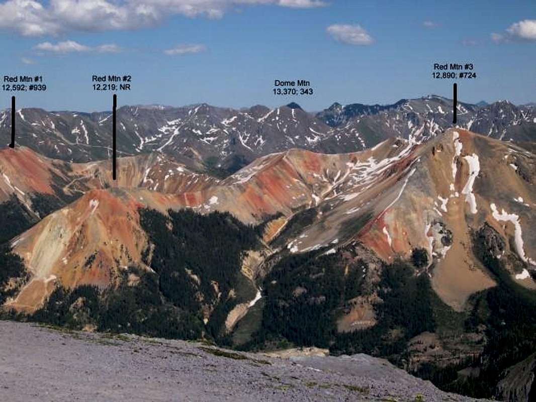
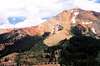
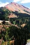
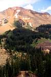
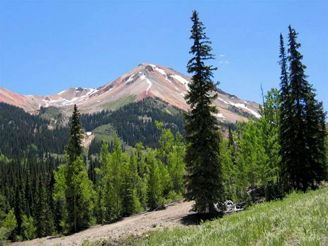
The San Juan Mountains are undoubtedly the most colorful mountains in Colorado. Mineral deposits have created slopes that are red, orange, yellow, purple, silver, brown or black. These colors combine with the blue skies, white snow and the various shades of green that grow on the mountains to produce a dazzling kaleidoscope. Red seems to be a recurring theme. In fact, many mountains have simply been named "Red Mountain". At least three such mountains aggregate near the "Red Mountain Pass" (11018 ft) on U.S. Route 550 that connects the towns of Montrose and Durango via Ouray and Silverton. The three mountains have been unceremoniously named Red Mountain #1 (12592 ft), Red Mountain #2 (12219 ft) and Red Mountain #3 (12890 ft) all of which are visible from the road (north of the pass). My favorite is #3 which rises directly to the east of the pass. With its gentle slopes it appears as a beautiful and friendly giant overlooking the pass.
A Jeep Road starts near Red Mountain Pass on Route 550 and goes to the summit of Red Mountain #3. This road is probably private property and may belong to San Juan Scenic Jeep Tours in Ouray, CO (970-739-1852). I contacted San Juan National Forest but they were unable to tell me if the mountain was private property. November 2019 Summitpost member Scott sent me a message indicating that a sign at the start of the road says hikers and skiers are welcome. When I climbed the mountain in July of 2002, I stayed away from the road and hiked up the thinly forested slopes to near the saddle with McMillan Peak to the south. From there, I followed the ridgetop to the summit of Red Mountain #3.
 |
 |
 |
 |
Getting There
From Ouray drive 11 miles south (or 12 miles north from Silverton) on Route 550 to Red Mountain Pass. About 1/4 miles south of the pass you will find a 4WD road on the east side of the highway. (On the west side, the 4WD road to Black Bear Pass begins). Turn east on this road and then make an almost immediate right turn. Follow the road for about half a mile until you see a gated spur road on the left.
 |
 |
 |
 |
Red Tape
See above.
 |
Geology and History
This section by mpbro.
Red Mountain's vivid colors attracted considerable mining attention, and this is no coincidence. In tectonically-active regions, where compressional and extensional forces open cracks and fissures in the subsurface, streams of superheated water from deep in the earth sometimes make their way toward the surface. These streams tend to be enriched in metallic minerals (hence the bright colors), including gold and silver. Some of the abandoned mines in areas like this also provide excellent prospecting for other minerals.
Here is a short history from the Montrose Daily Press Online:
"The Red Mountain District above Ouray was a hub of activity during the late
1800s. The towns of Red Mountain, Ironton and Guston all sprang up within a few
miles of each other and remained extremely competitive for riches as well as
population. Both the district and town were named for the three scarlet-hued
mountain peaks that surround this high mountain park.
Otto Mears' Silverton Railroad, which had the reputation of being one of the
steepest (5 percent) and most crooked (30-degree curves) in Colorado, linked the
towns and mines in this district with Silverton ... while a stage/toll road, also built by
Mears, provided a vital transportation route between the Red Mountain District and
Ouray."
When To Climb
summer.
Camping
Call San Juan National Forest (970) 884-2512.
Forecast
Click to see the forecast for Silverton, CO.
External Links
- Montrose Press Article
Overview of some of the natural and human history of the area, including a short history of the area surrounding Red Mountain. - Two Ski huts near Red Mountain pass
mpbro - Feb 13, 2002 1:24 pm - Voted 10/10
Untitled Commenthttp://www.skihuts.com/Locations.htm
mpbro - Feb 13, 2002 1:56 pm - Voted 10/10
Untitled CommentRed Mountain's vivid colors attracted considerable mining attention, and this is no coincidence. In tectonically-active regions, where compressional and extensional forces open cracks and fissures in the subsurface, streams of superheated water from deep in the earth sometimes make their way toward the surface. These streams tend to be enriched in metallic minerals (hence the bright colors), including gold and silver. Some of the abandoned mines in areas like this also provide excellent prospecting for other minerals.
Here is a short history from the Montrose Daily Press Online:
"The Red Mountain District above Ouray was a hub of activity during the late
1800s. The towns of Red Mountain, Ironton and Guston all sprang up within a few
miles of each other and remained extremely competitive for riches as well as
population. Both the district and town were named for the three scarlet-hued
mountain peaks that surround this high mountain park.
Otto Mears' Silverton Railroad, which had the reputation of being one of the
steepest (5 percent) and most crooked (30-degree curves) in Colorado, linked the
towns and mines in this district with Silverton ... while a stage/toll road, also built by
Mears, provided a vital transportation route between the Red Mountain District and
Ouray."
Aaron Johnson - Aug 18, 2003 7:36 pm - Voted 10/10
Untitled CommentNader's advice to stay off the private property should be heeded carefully. The guy's name presently escapes me, but over the years he has bought up mining claims northwest of McMillan Peak that include much of the Red Mountains and Ironton Valley on the east side of Route 550.
In recent years, a heated debate has been going on because the guy wants to sell and develop this land for large lot single dwelling homes. This of course has raised the ire of the City of Ouray, a number of historical societies and a host of other groups. Attempts to buy the land have been refused because the guy is asking for massive and ridiculous amounts of money.
Ouray has tried some legal stuff to stop the guy from doing his development plans, and I believe the Forest Service has gotten involved, much to its dismay. As a property owner, the guy is within his rights and that has been his argument. In light of the historical significance of the area, including the ghost towns of Red Mountain and Ironton, special circumstances may warrant a different treatment of this property rights issue. This remains to be seen, as it will be tied up in the courts for ages.
The guy, being a property owner, is justifiably inscenced by this. His rights have ben trampled on. But he doesn't seem (last I knew) to be open to reason and hearing others out over the issue either. So he's been a real pain in the ass, and to some extent, justifiably so. Hopefully an arrangement that satisfies everyone will be agreed upon.
HOWEVER-It would be a shame to see the area developed with multimillion dollar homes. That would be just pathetic. What the mountain lovers have going for them is this: Who in their right mind would want to live in this area in the winter? This place is just downright perilous and one of the most avalanche prone areas in the state. You could be stranded there for days or weeks, depending on how far back in the sticks your private road extends. This argument has been presented to dissuade the land owner from developing.
Another argument is environmental. Just running roads and infrastructure into the area would be a blight beyond belief, not to mention the massive expense (but when you're mega rich, all of this just doesn't matter any more than lint in your pocket).
As maintainer of this page, nader may have opened up an interesting can of worms that will make for informative and entertaining reading, if he can ever find and keep track of these events. Unfortunately, this could mean lots of work as a maintainer, similar to the Culebra Peak page which jgsman submitted and is currently burdened with. If nader really plans and wants to do a good job, keeping track of the "real time" elements concerning these legal issues involving this and a number of his other mountains, will be a chore.
Have fun, nader! HA!