

|
|
Area/Range |
|---|---|
|
|
46.15610°N / 10.87080°E |
|
|
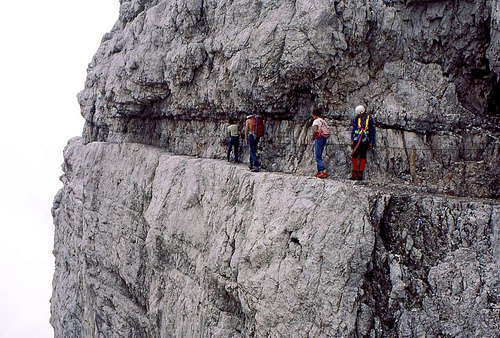
Hiking, Mountaineering, Trad Climbing, Sport Climbing, Big Wall, Scrambling, Via Ferrata, Skiing |
|
|
Spring, Summer, Fall |
|
|
10411 ft / 3173 m |
|
|
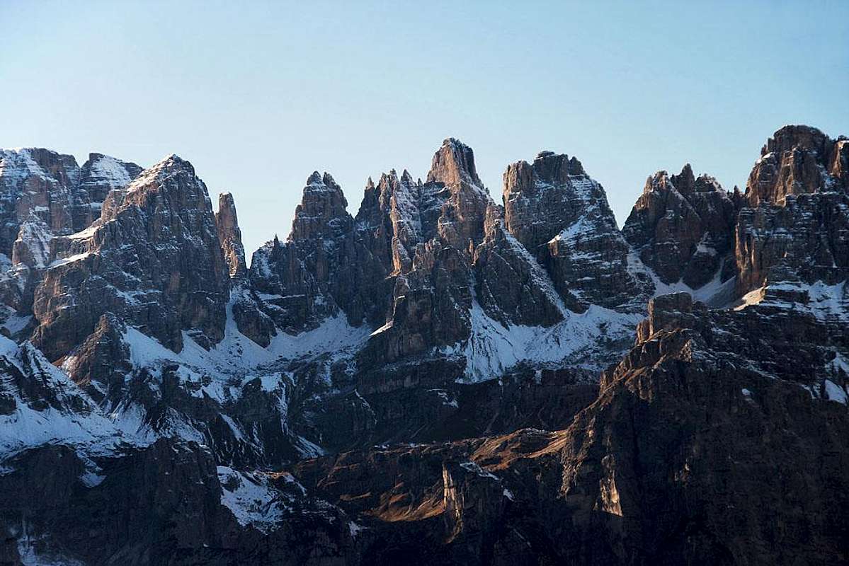
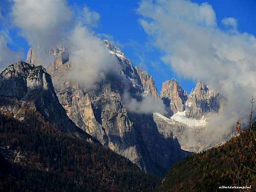
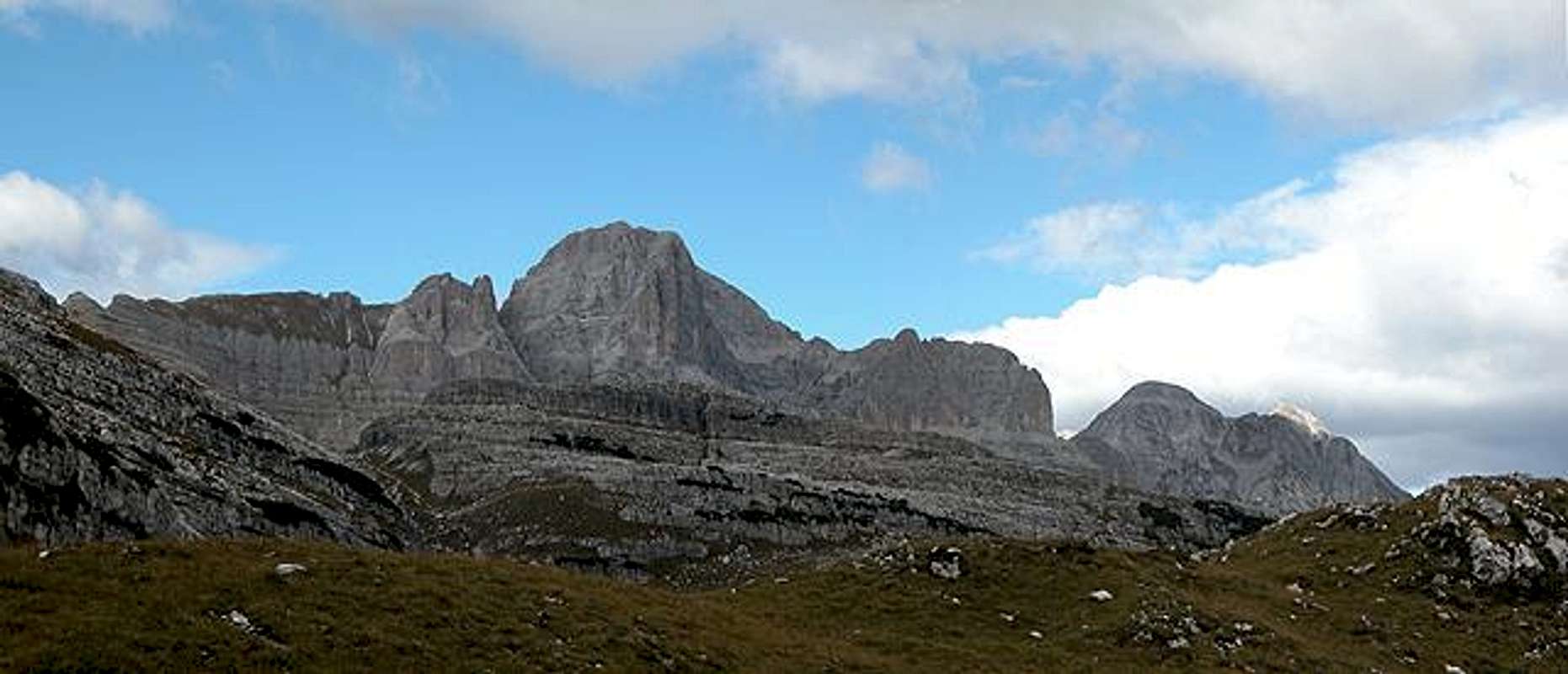
Overview
Brenta Group
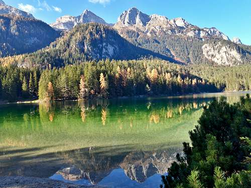
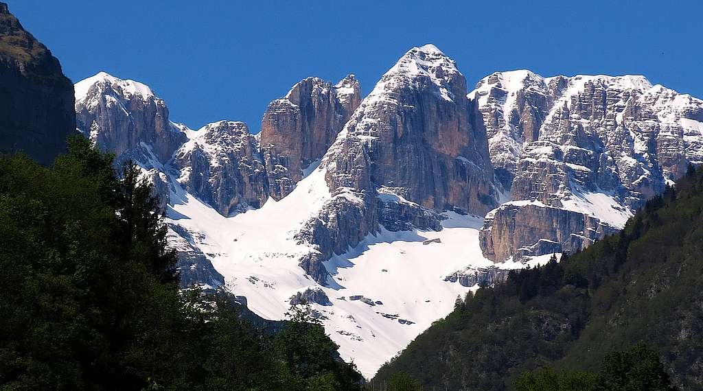
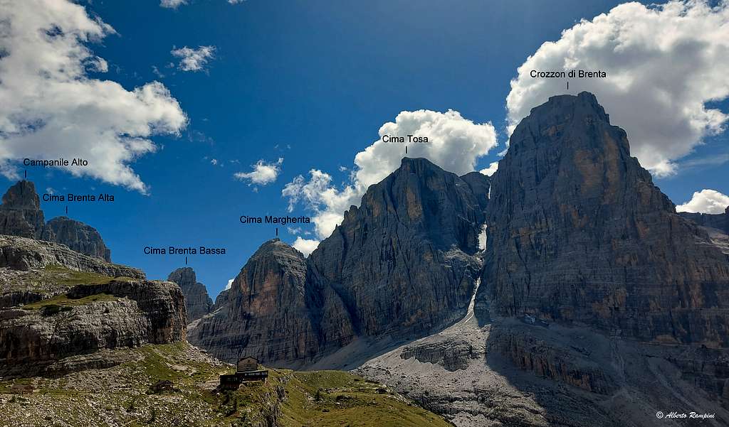
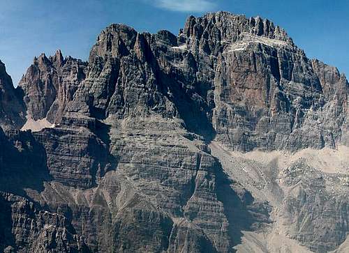
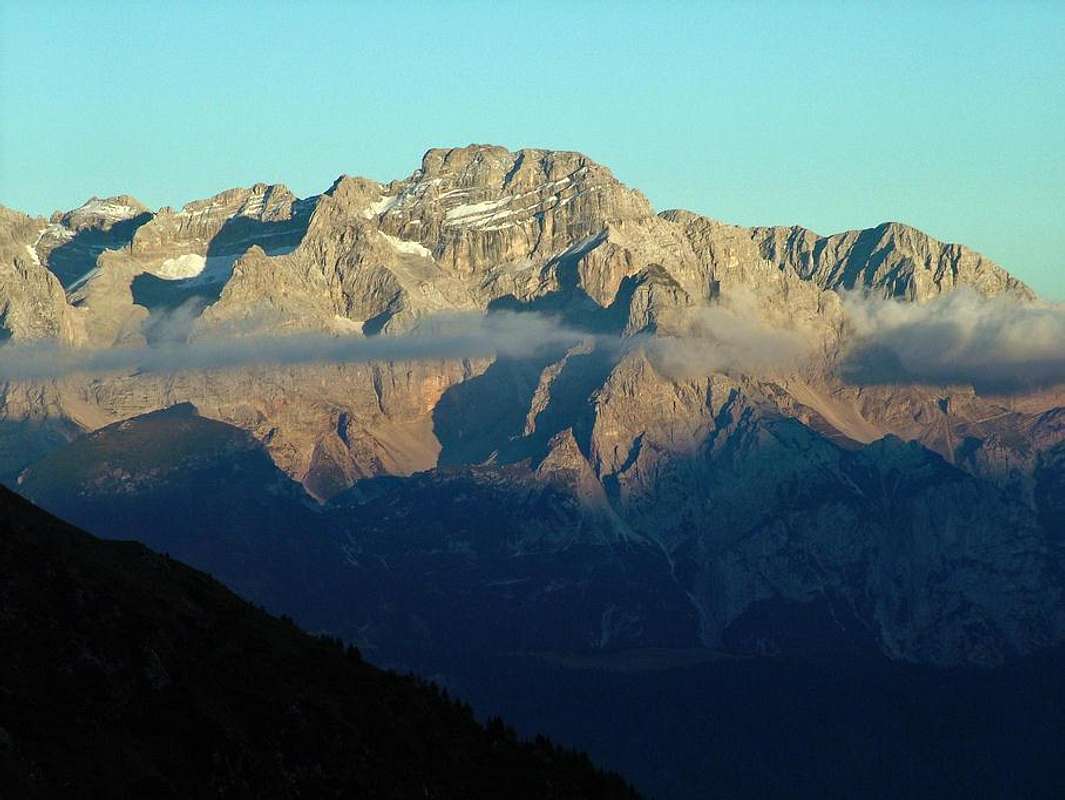
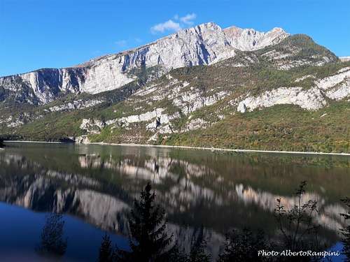
The Brenta Group (known in Italy as Dolomiti di Brenta) is located in Northern Italy, entirely in the Trento province. It's a complex mountain range made up of high dolomite and limestone peaks. Although formed of dolomite rock and in all similar to the Dolomites, due to its geographical position - to the West of the Adige Valley instead of on the right like the other groups of the Dolomites - the Brenta Group is considered to belong to the Alpi Retiche Meridionali (Central Alps). Its boundaries are 4 valleys: on the Northern side the Val di Sole, on the Eastern side the Val di Non and the Paganella plateau, on the Southern side the Giudicarie, and on the Western side the Val Rendena. There are several peaks overcoming the threshold of 3000 meters of altitude, among which the highest one is Cima Tosa 3173 m.
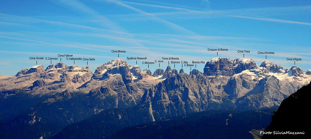
It is followed by Cima Brenta 3151 m, Crozzon di Brenta 3118 m, Cima Vallesinella 3114 m, Cima d' Ambiez 3102 m, Cima Mandron 3033 m, Torre Kiene XV 3030 m, Torre Kiene XIII 3026 m, Cima Garbari 3018 m, Cima Bassa d'Ambiez 3017 m, Torre di Brenta 3008 m and Spallone dei Massodi 3004 m. Many others summits overcome the 2500 meters.
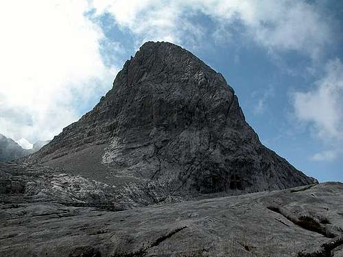
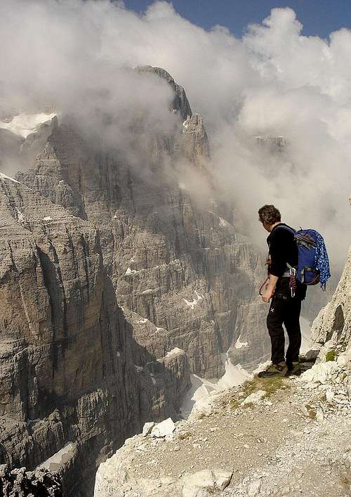
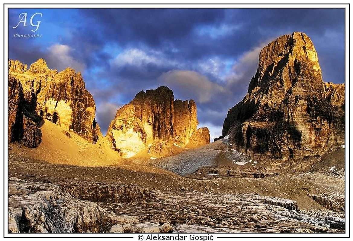
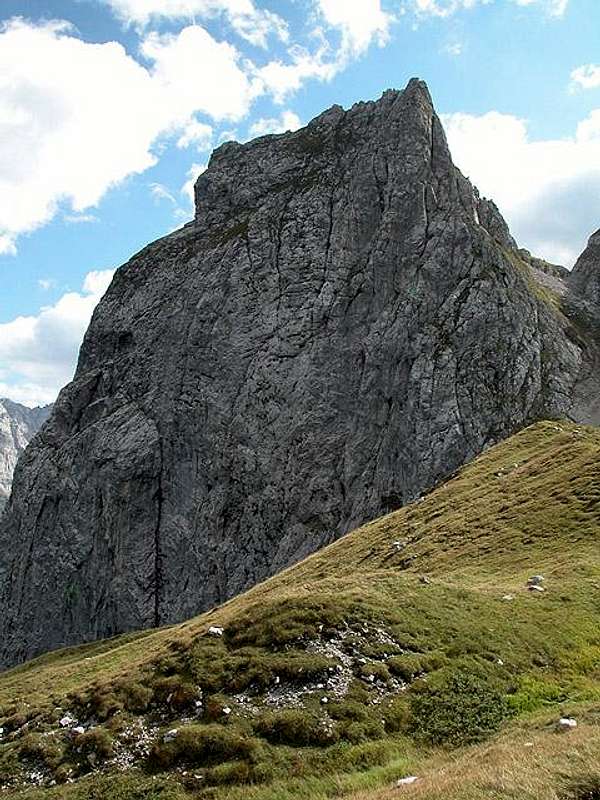
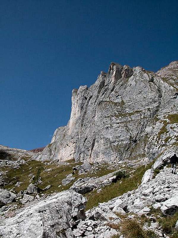
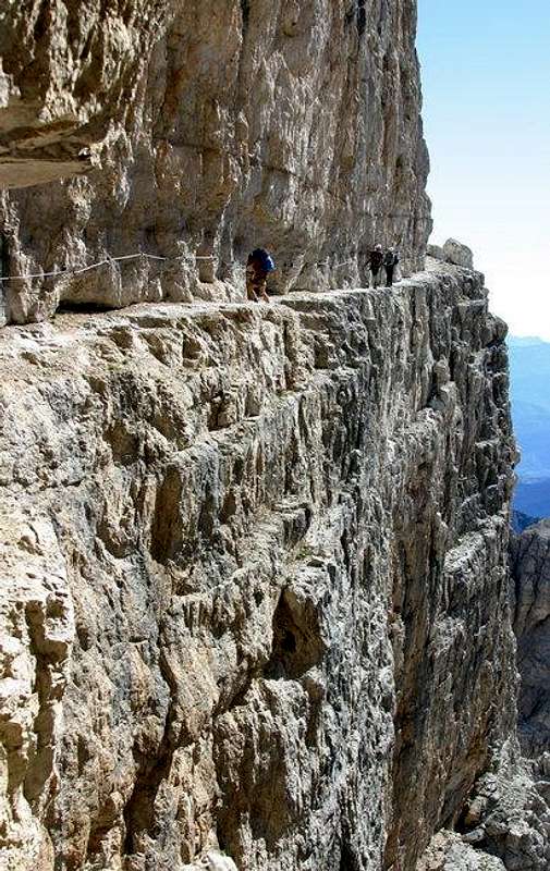
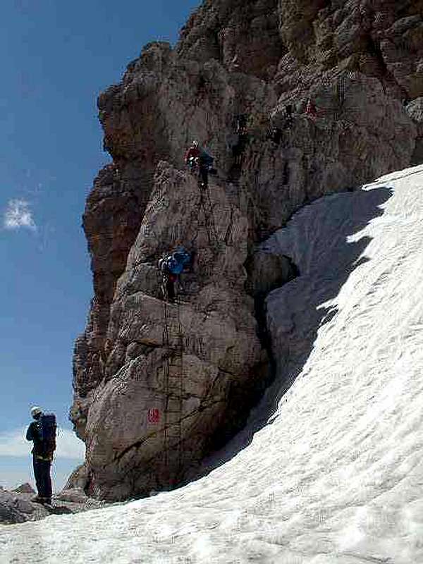
This group is a true paradise for climbers. You can spend here many summer weeks climbing one fine route after another: difficulties up to extreme, walls dropping up to 900 m. And, of course, one of the best place in the whole Alps for hikers that like "empty" spaces ... Very exposed "ferrate" are waiting for the enjoyment of all those who are not giddy.
Just remember one thing: in the Brenta group the snow remains longer than in the other Dolomite mountains, so you can find here snow and ice that can give you some problems while descending from the higher summits. The Brenta group is rich of small glaciers named "vedrette", although in recent years snow and ice as in many other Alpine groups are rapidly decreasing.
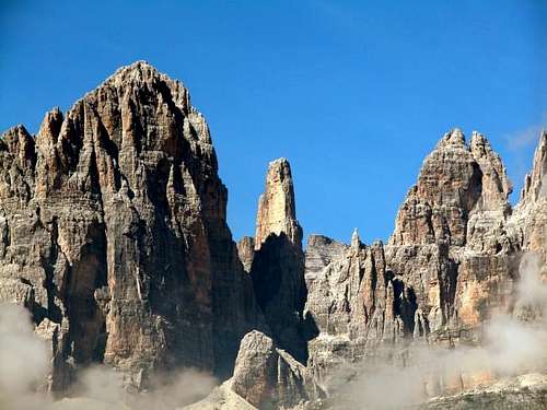
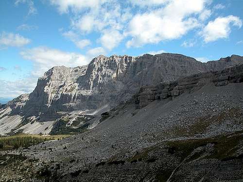
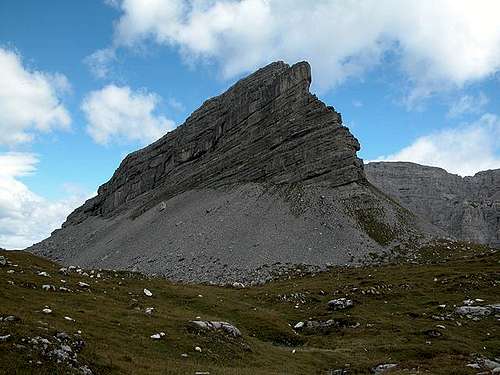
The whole Group can be divided into several subgroups. Each subgroup is listed below together with its main summits. A coarser classification distinguishes the central range from the peripheral ranges. The peaks of the former are predominantly made of dolomite rock, while the remaining summits are mostly limestone.
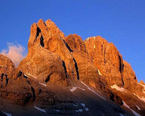
The two rocks are close relatives: the main difference is that limestone is rich in calcite instead of dolomite. The two minerals differ in turn because calcium has been partially replaced by magnesium in the latter. In spite of their similar make-ups, limestone and dolomite rock are quite different from a climber's perspective. Limestone is easily eroded by rain into smooth slanting slabs. Dolomite rock, which is not nearly as soluble in water, is horizontally stratified and tends to break into spires characterized by vertical walls.
Dolomite rock is often conveniently "color-coded:" yellow-orange rock is typically overhanging. Black rock is usually wet, while rock that has been washed by rain, but is usually dry tends to be gray.
Claude Mauguier notes that the name Brenta is derived from the local dialect term brent (brenta in Italian): a big wooden bucket used to carry water. Its shape reminds also the equivalent insular Celtic cwm; thus the local toponym bren da l'ors means bear cwm. The names Cadini and Catinaccio have similar origins. (Black bears, once common in the group, have become extinct.)
Getting There from Europe
Approaching the Val Rendena - Madonna di Campiglio (best for the central group) - some info
-------------------------------------------------------------------------------------------
coming from Milan: 2 different ways
----------------------------------------------------------------
the shortest but not easy to find
- follow for autoroute A4-E64
- enter it (pay) till Brescia Est
Then follow to Lago d'Idro - Tione - Pinzolo - Madonna di Campiglio (Km 220)
----------------------------------------------------------------
the longest but much easier to find
- follow for autoroute A4-E64
- enter it (pay) till the cross with the A22 (after Verona)
- enter the autoroute 22 toward north (Trento-Bolzano-Brennero)
- follow it till SAN MICHELE ALL'ADIGE ... you are at point 1 of the under approach (from Bolzano)
-------------------------------------------------------------------------------------------
coming from Bolzano : 93 km
autoroute A22 Brennero :
----------------------------------------------------------------
1 get out the autoroute at SAN MICHELE ALL'ADIGE
2 when you see indication BRENNERO/MODENA turn to the right and get the Ss43/ Strada Statale Della Val Di Non for 8.3 km
3 follow the Sp73 for 20.7 km
4 follow the per Ss42 fot 14.1 km
5 turn to left anfd follow the Ss239 till DIMARO
6 turn to the right and follow the Ss239 for 15.9 km
-------------------------------------------------------------------------------------------
coming from Trento : 70 km
autoroute A22 Brennero exit SAN MICHELE ALL'ADIGE 9.0 km
you are at point 1 of the upper
-------------------------------------------------------------------------------------------
coming from Italy NW - France - west Switzerland reach Milan
coming from eastern Switzerland - Austria - Germany reach Bolzano
coming from Italy NE - Slovenia - Croatia reach Trento
Getting There from other Continents (air)
Get Milano
- via Linate airport - get the Centre on Milan then by underground line 2 (green) reach "Porta Garibaldi" ...
this service is available in June, July and August
- via Malpensa airport there is a railway that brings you almost in the centre of town (P.zza Cadorna) , by underground line 2 (green) reach "Porta Garibaldi": there is a service by bus that brings you directly to Madonna di Campiglio (Autostradale)
Costiera del Sabbion
This is a minor subgroup that offers limited climbing possibilities, some ones for hiking, good for tourists with the possibility to arrive to the summit of Dos del Sabbion without making any effort ...
- Dos del Sabbion - 2101 m
- Monte Tov - 2050 m
Sottogruppo del Vallon
A wild subgroup, seldom frequented due to its limited climbing possibilities; some fine hikes here.
- Pala dei Mughi - 2321 m
- Cima XII Apostoli - 2699 m
- Croz delle Selvate - 2898 m
- Cima del Vallon - 2968 m
- Campanile dei Boci - 2093 m
Sottogruppo dei Fracingli
Almost forgotten, very wild, some climbing routes on its East side (Val Brenta)
- Cima di Nardis - 2616 m
- Dosson dei Fracingli - 2409 m
- Cima della Vedretta - 2670 m
- Cima della Farfalla - 2660 m
- Campanili di Fracingli - 2589 m
- Crozzon di Val d'Agola - 2673 m
")


")
Catena dell'Ambiez
The first important chain both for climbers and hikers.
Here some very difficult routes and a very spectacular and exposed "ferrata"
- Cima d'Ambiez - 3102 m
- Denti d'Ambiez - 2840 m
- Cima Bassa d'Ambiez - 3017 m
- Cima d'Agola - 2959 m
- Cima Susat - 2890 m
- Cime di Pratofiorito - 2900 m
- Le Tose - 2863 m
Sottogruppo del Ghez
Very wild group, rock here is quite different from the one you find in the central areas
- Dos di Dalun - 2680 m
- Torrione Dallago - 2568 m
- Cima di Ghez - 2713 m
Massiccio della Tosa
The highest and most massive subgroup, only one easy route here (but requiring some alpinistic skill) and a lot of serious ones.
- Crozzon di Brenta - 3135 m
- Cima Tosa - 3173 m
- Punta dell'Ideale - 2950 m
- Cima Ceda - 2766 m
- Cima Margherita - 2845 m
- Cima Brenta Bassa - 2809 m
Sottogruppo del Daino
A small, peripheral subgroup, the only frequented summit (due to easy and very short access from Rifugio Pedrotti) is Croz del Rifugio
- Monte Daino - 2695 m
- Cima delle Fontane Fredde - 2202 m
- Croz della Selvata - 1998 m
- Croz del Rifugio - 2615 m
Sottogruppo Centrale - Catena degli Sfulmini
The most important subgroup, a fantastic series of pinnacles bordered by two important and massive summits.
Here the finest "ferrata" of the group (and, maybe, of the whole Alps), the Bocchette Centrali, not difficult but aerial, in fantastic scenery and with some unforgettable views.
- Brenta Alta - 2960 m
- Campanil Basso - 2883 m
- Campanile Alto - 2937 m
- Sfulmini - 2910 m
- Torre di Brenta - 3014 m
- Torri Prati, Bianchi, Nardelli - 2680 m
- Cima degli Armi - 2951 m
- Cima Molveno 2917 m
Sottogruppo Centrale - Massiccio di Cima Brenta
A big massif with very wide (and high) walls on S and E sides.
In the mid of this wall there is a big ledge where 2 Vie ferrate pass through.
- Spallone dei Massodi - 2999 m
- Cima Baratieri - 2944 m
- Cima Iolanda - 2815 m
- Cima Brenta - 3150 m
- Punta Massari - 2846 m
- Cima Mandron - 3040 m
- Punte di Campiglio - 2969 m

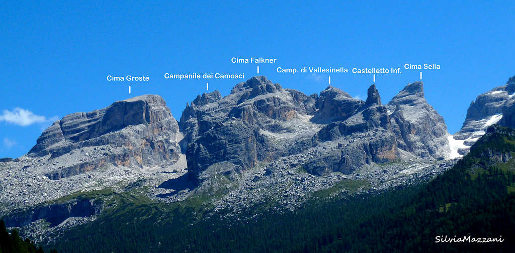
Massiccio del Grostè
An important subgroup for hiking, only few summits host fine climbing routes.
- Cima Sella - 2917 m
- Castelletto superiore - 2700 m
- Castelletto di mezzo - 2571 m
- Castelletto inferiore - 2601 m
- Torrione di Vallesinella - 2462 m
- Cima Falkner - 2999 m
- Cima del Grostè - 2901 m
- Cima delle Val Perse - 2811 m
- Cima Roma - 2837 m
- Cima della Vallazza - 2810 m
- Corna Rossa - 2350 m
Gaiarda - Altissimo
A strange but unique structure ... easy to climb almost everywhere but .. with one of the most impressive and difficult walls of the group
- Cima della Gaiarda - 2640 m
- Croz dell'Altissimo - 2339 m
Campa
A peripheral subgroup, just for hiking
- Monte Fibbion - 2671 m
- Cima di S.Maria - 2678 m
- Cima di Val Scura - 2670 m
- Cimon della Campa - 2598 m
- Torre di Flavona - 2335 m
- Croz del Re - 2505 m
Catena Settentrionale
As the previous one: the Northern chain page
- Pietra Grande - 2937 m
- Cima Vagliana - 2861 m
- Corno di Flavona - 2918 m
- Cima delle Palete - 2405 m
- Sasso Alto - 2897 m
- Cima Sassara - 2894 m
- Cimon della Pozza - 2824 m
- Pulpito Secondo (Frate) - 2678 m
- Cima del Tov - 2608 m
- Cima Maria Luisa - 2421 m
- Sasso Rosso - 2645 m
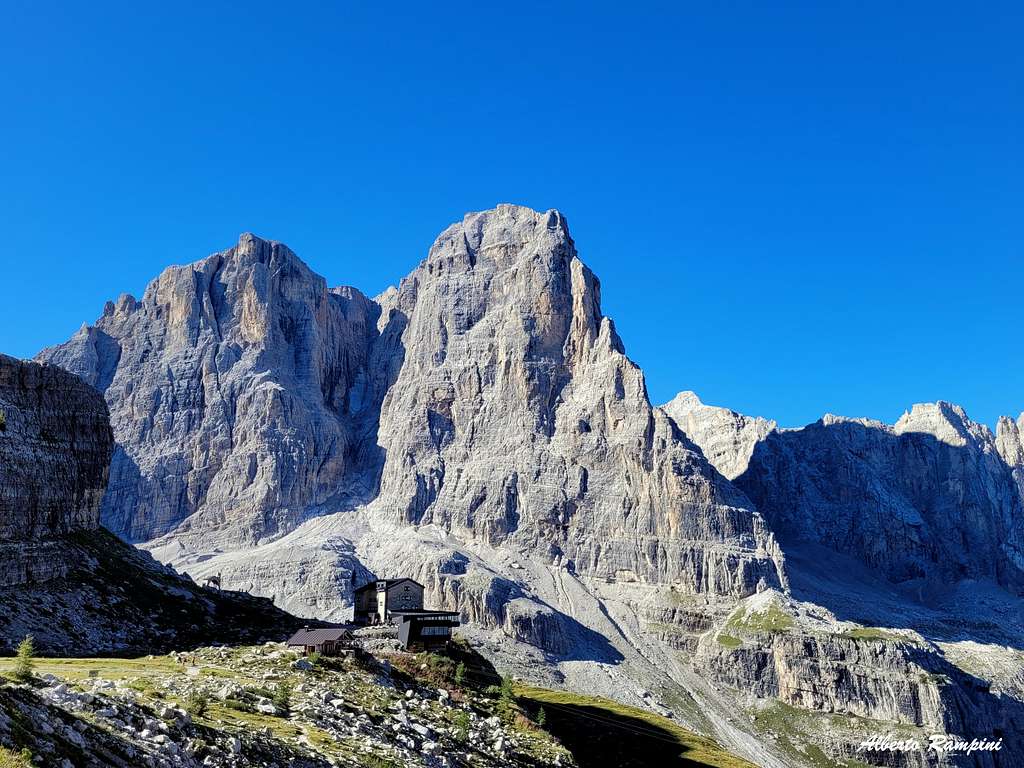
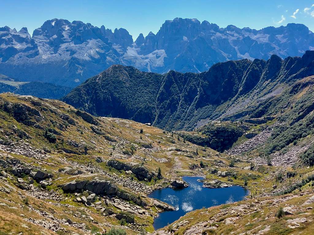
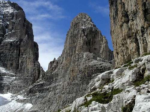
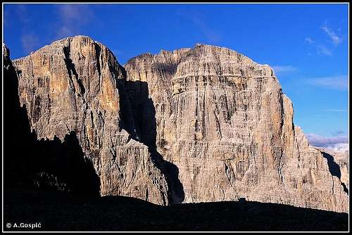
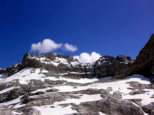
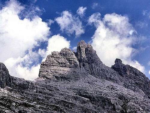
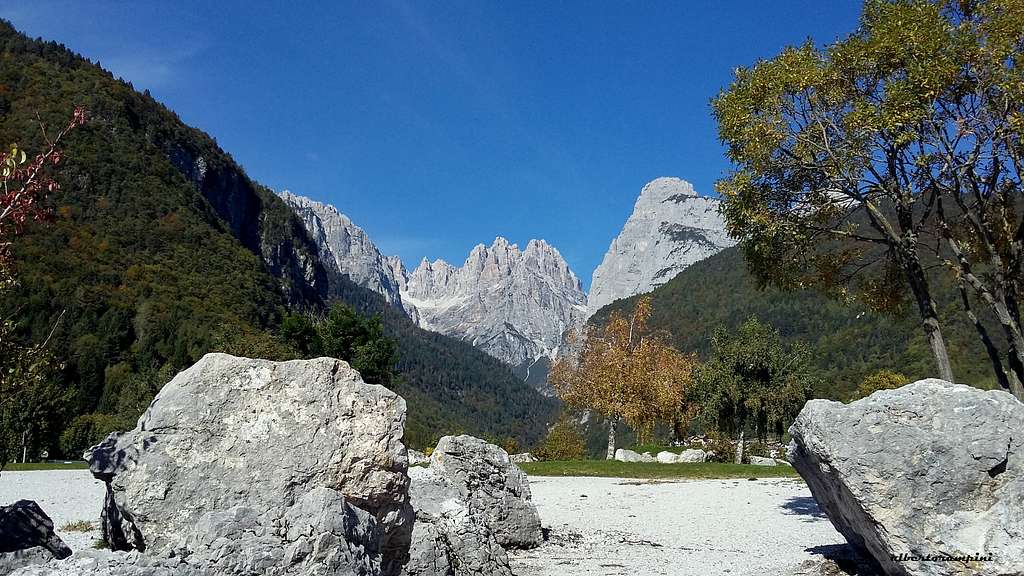
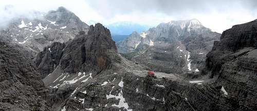
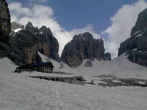
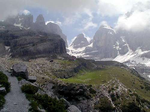
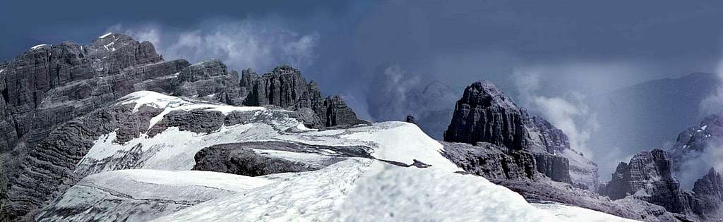
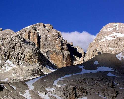
Hikers paradise
Some pics...
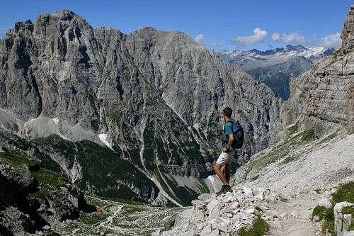
and some more pics...
Red Tape
Brenta group is located inside Adamello - Brenta Natural Park
Huts
| Rifugio - Hut | valley | height | where from | by car | hiking time |
| al Cacciatore | d'Ambiez | 1820 m | Lorenzo in Banale (Giudicarie) | 3,5 km | 2h 30' |
| Agostini | d'Ambiez | 2410 m | rif. al Cacciatore | 4h | |
| Ghedina | d'Algone | 1126 m | Tione (Giudicarie) | 9 km | --- |
| Garbari (XII apostoli) | Rendena | 2489 m | S.Antonio di Mavignola | 9 km | 3h |
|
-- or --
|
rif. Ghedina | 9 km | 3h | ||
| Brentei | Rendena | 2182 m | Madonna di Campiglio | 4km | 2h |
| Alimonta | Rendena | 2580 m | rif. Brentei | 1h | |
| Tuckett e Sella | Rendena | 2272 m | Madonna di Campiglio | 4km | 2h |
| Graffer | Rendena | 2261 m | Campo Carlo Magno | 2h | |
| Peller | di Sole | 2022 m | from Malè | 3h 30' | |
| Pradel | Paganella | 1367 m | Molveno by lift or Andalo | 4km | --- |
| Croz dell'Altissimo | Paganella | 1430 m | rif. Pradel | 1h | |
| Selvata | Paganella | 1630 m | Molveno | 2h | |
| Pedrotti e Tosa | Paganella | 2491 m | rif. Pradel | 3h 30' | |
|
-- or --
|
rif. Brentei | 1h 15' |
When (and where) to Climb
The best period to climb and hike goes from middle June to middle September. Some South faces can be climbed even in June and October, but refuges are normally closed.
Where to climb .... easy: the central chain, from Grostè to Ambiez is full of amusing routes of all difficulties, just remember that, starting from the 3° degree UIAA normally here you'll find vertical.
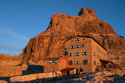
Best refuges for climbers:
Brentei - a lot of routes - from NE wall of Crozzon di Brenta (900m of wonderland) to all Sfulmini chain
Pedrotti - for Brenta Alta east wall (minimum TD) and the solar wall of Cima Margherita
Ambiez - the fine and difficult wall of Cima d'Ambiez and Cime di Pratofiorito ...
Tuckett - some amusing climbs and some mountain routes
Meteo
Guidebooks and maps

|
 |
 |
 |
 |
 |
 |
"Dolomiti di Brenta" vol. 1 – Val d’Ambiez by Francesco Cappellari and Elio Orlandi -165 classic and moderne climbs
"Dolomiti di Brenta" vol. 2 – Versante Sud Est by Francesco Cappellari -116 classic and moderne climbs
"Dolomiti di Brenta" vol. 3 – Tuckett, Campa e Catena Settentrionale by Francesco Cappellari - 274 classic and moderne climbs
"Dolomiti di Brenta" vol. 4 – Massiccio Centrale by Francesco Cappellari - 200 classic and moderne climbs
"Vie normali nelle Dolomiti di Brenta" by Roberto Ciri, Alberto Bernardi, Milo Muffato - 170 normal routes to all the main peaks of the Brenta Dolomites
"Dolomiti di Brenta" by Gino Buscaini and Ettore Castiglioni - Collana Guide dei Monti d'Italia, CAI TCI Italy - 1977 A complete guidebook, a true "Bible", nowaday rather old
Maps
1:50,000 - Tabacco, no. 10 (Dolomiti di Brenta, Adamello, Presanella)
1:50,000 - Kompass, no. 73 (Gruppo di Brenta)
1:25,000 - Kompass, no. 688 (Gruppo di Brenta)
1:50,000 - TCI - Gruppo di Brenta
There are also the 1:25,000 maps of IGM but some of them are very old.

Some "touristic" info
If you are spending a week in val Rendena maybe you would like to play golf (Madonna di Campiglio or Pinzolo) but if you stay in Pinzolo you can easily (by car) enter three areas where you can spend a fine day with the family, on the opposite (west) side of the valley :
- Val di Genova : a wonderful wild valley where, if you are lucky, you can see some bears and, in any case, beautiful sceneries of the Adamello group - you can go by car till Rif. Bedole
- Val d'Amola : a valley that brings you to a big highland on the east of Presanella : wild and full of granite walls
- Val Nambrone : another valley on the east side of Presanella group, wonderful sceneries and easy and amazing hiking
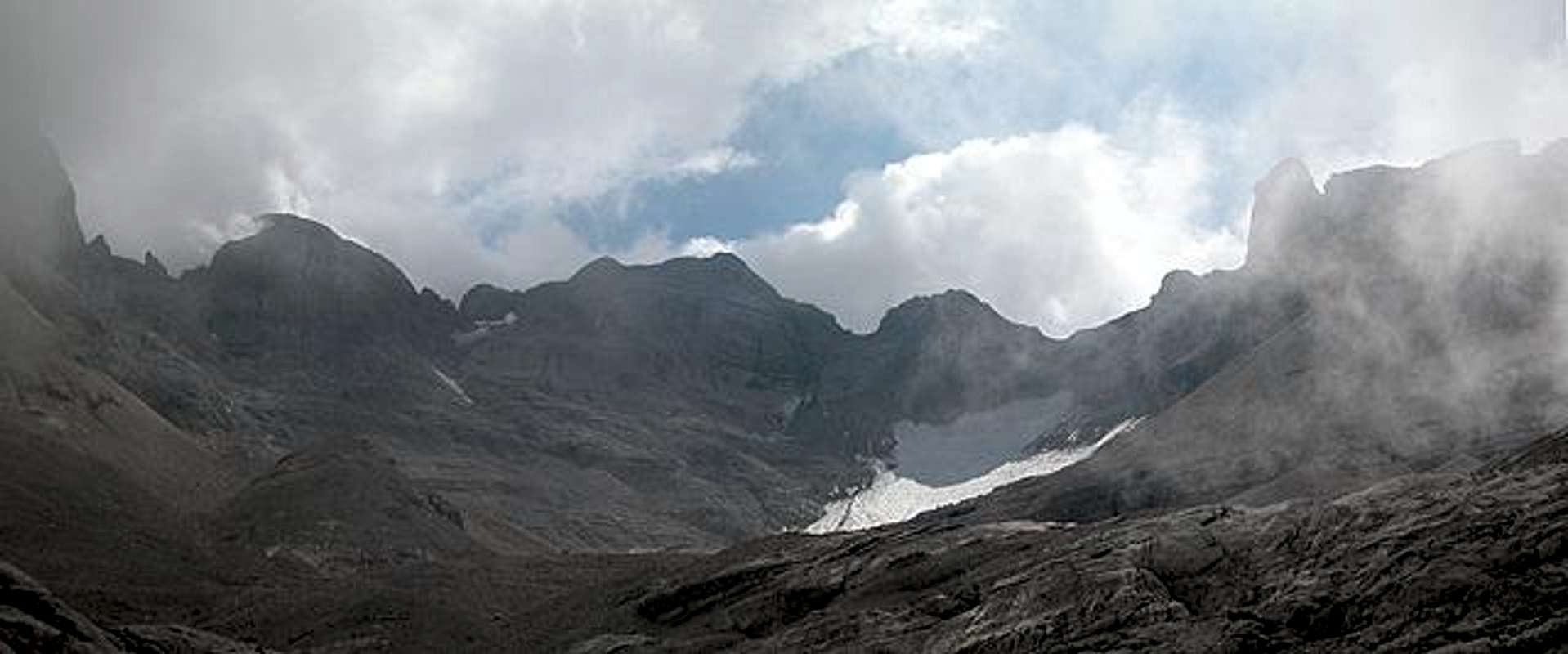
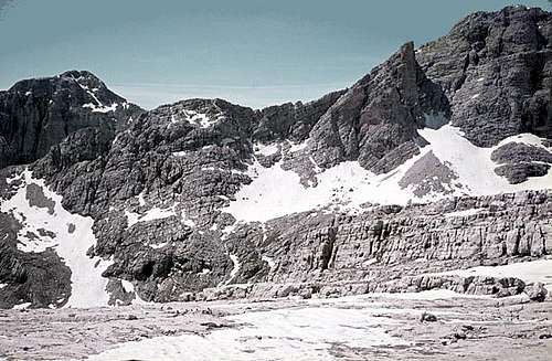
Panoramas
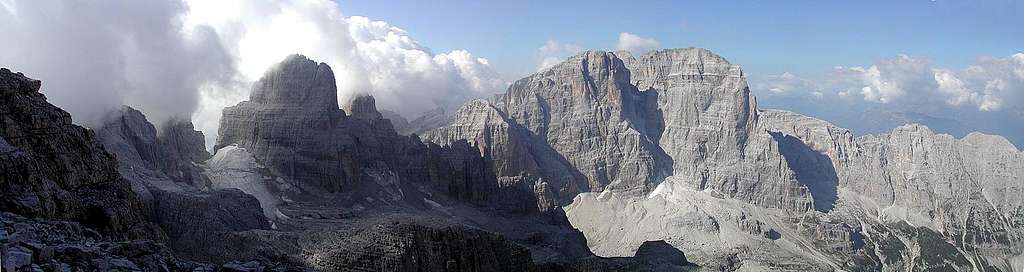
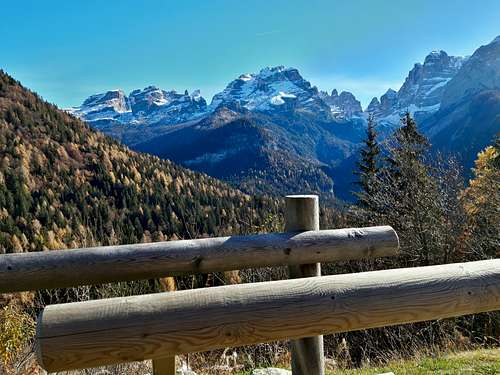
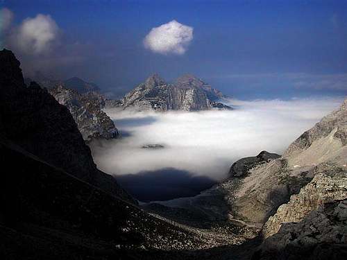
Brenta Group pics from outside
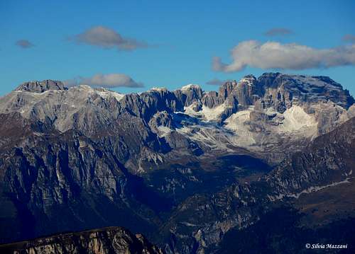
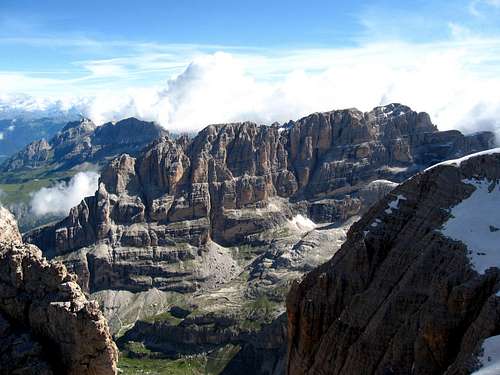
Brenta Group pics from inside
External links
PNAB - Parco Naturale Adamello Brenta
Route in the Brenta Group
This route runs through the center of the Brenta Group and it includes the best known trails. In Italian.