-
 13564 Hits
-
 83.69% Score
-
 17 Votes
|
|
Canyon |
|---|---|
|
|
40.20070°N / 9.58310°E |
|
|
Overview
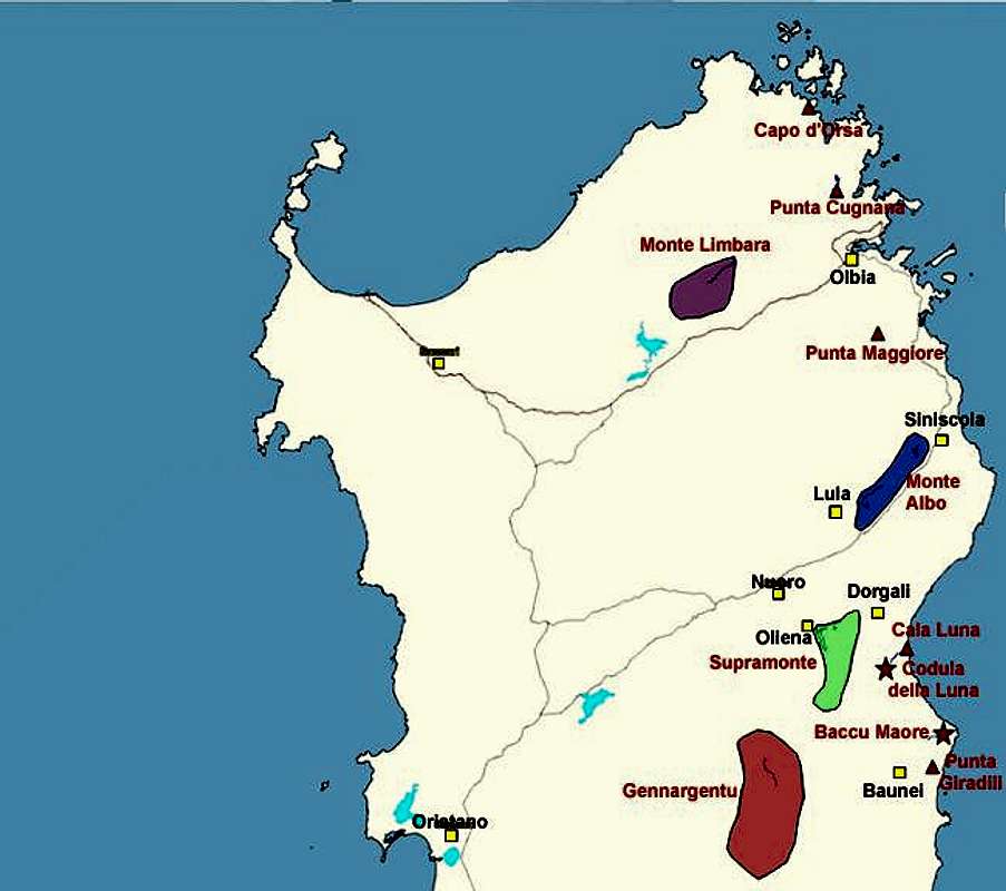
Codula della Luna is one of the typical gorges which cross the Supramonte Costiera region on the eastern coast of Sardinia / Sardegna. These gorges all run roughly from west to east, Codula della Luna only a minor exception since it runs from southwest to northeast. The whole gorge has been named by the bay which is its eastern enpoint, Cala Luna, a halfmoon shaped beach with great climbing possibilities.
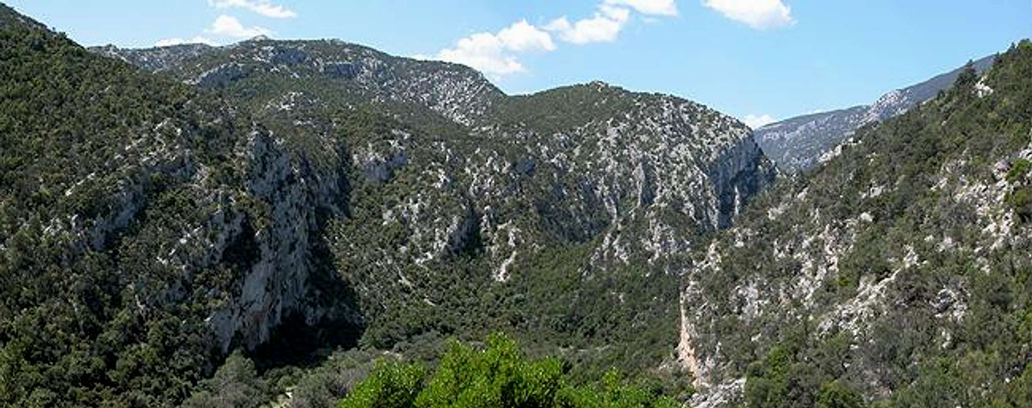
The gorge itself is rather wide - some 150 - 200m. The main attractions are the multiple gorges on both sides which have a great many caves which have been carved out of the limestone rock. Also in its western part the gorge shows some very bizzare rocks and spires, All high up on the slopes and due to the macchia undergrowth only very hard to reach. At the lower part of the gorge - near the Cala Luna Bay there are some beautiful vertical walls of good rock composition which are used by climbers when the crags at Cala Luna get too crowded. If you love adventurous climbs on unbolted "wild" crags this is the place to go.
The trail through Codula della Luna follows a creek bed often switching sides. Many possible trails have been marked by cairns and - though you can't get lost in the gorge - it is sometimes very hard to keep your orientation. The region is used to keep cattle grazing and since in some places the trails through the undergrowth get very narrow you need to negotiate with them. For us it got quite interesting each time when a newborn calf ran away from us and its mother tried to shove herself in between us and her kid. It's a strange sensation to have half a nervous ton of meat with pointy horns behind you nudging you onwards.
Codula della Luna is very hard on us tall people. Much of the trail leads through low forests and bushes - especially bothersome after a shower. You'll be dripping wet long before you reach the sea, mainly from your neck downwards :-(
 |  |  |  |  |
Rocks, Towers and Spires
The upper part of Codula della Luna shows a great number of bizzare rock formations. Many of them are in the vicinity of Punta Venadores high on the slopes of the gorge. The steepness of the slopes and the macchia undergrowth (even more so) prevent you from reaching them to have a climb. Still they are impressive to look at even from the distant valley floor. |  |  |  |  |
Getting There
Sardinia can be reached either by plane or by ferry. The main ports are Porto Torres and Olbia in the north and Arbatax and Cagliari in the south. Airports are at Alghero and Olbia in the north as well as (again) Arbatax and Cagliari in the south. For exploring the northeastern part of the island where most of the mountains are the best entry point is Olbia, which is where most flights go anyway.Approaching Codula della Luna from Olbia airport
Get on motorway SS 131 south in the direction of Siniscola / Nuoro. At the exit Lula / Dorgali get off and turn on SP38 south (again direction Dorgali). Shortly before you reach Dorgali, SP38 ends and you switch to SS125 direction Dorgali.
Get through the town (signs Cala Gonone, Baunei) and soon afterwards the road to Cala Gonone turns off through a tunnel to the left. Head onwards high above the Fiumineddu Valley towards Passo Jenna Silana. At km 172.1 a side road turns off to the left. You cross a virtual garden of Eden with all kinds of farm animals grazing openly on the high plain. The road soon drops to the right hand side and enters the upper part of Codula della Luna. It ends at a cul-de-sac 11km after its start at SS125.