
-
 11237 Hits
-
 82.48% Score
-
 15 Votes
|
|
Mountain/Rock |
|---|---|
|
|
45.80070°N / 7.53560°E |
|
|
8100 ft / 2469 m |
|
|
Overview
The double peak of Becca d'Aver and Cima Longhede is the southernmost summit of the ridge that culminates in Dent d'Herens, where it meets the main ridge of the Alps. The ridge runs from north to south with the summits gradually getting lower before the meadows on the northern slopes of the Aosta valley start. The summit is located in a triangle which is formed by Valle d'Aosta in the south, Valtournenche in the east and Valle di St Barthélmy in the west.
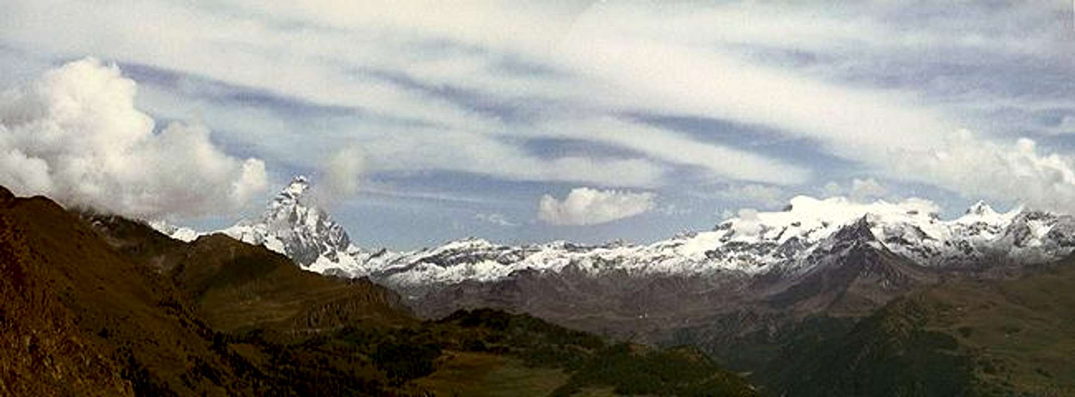
As stated above Becca d'Aver forms a twin summit together with the slightly lower Cima Longhede (2415m) the two peaks being connected by a broad ridge running from NE (Becca d'Aver) to SW (Cima Longhede). What stands out about these two summits is not their altitude - compared with the highest mountains around they are dwarves - but the great views of exactly these same 4000m summits. To the northeast it is Matterhorn / Cervino, to the east Breithorn, and Pollux as well as the remainder of the Monte Rosa Group. To the south you look across the Aosta Valley towards Monte Emilius and Punta Tersiva - farther away Gran Paradiso, Rutor and Mont Blanc can be seen.
The location between the three valleys results in a lot of different ascent routes, several from each valley. The routes themselves pose no serious problems - all are hiking trails. Strangely enough, when I climbed the mountain there were no other people around - an experience I have made in most of our climbs in Aosta valley.
 |  |  |  |  |
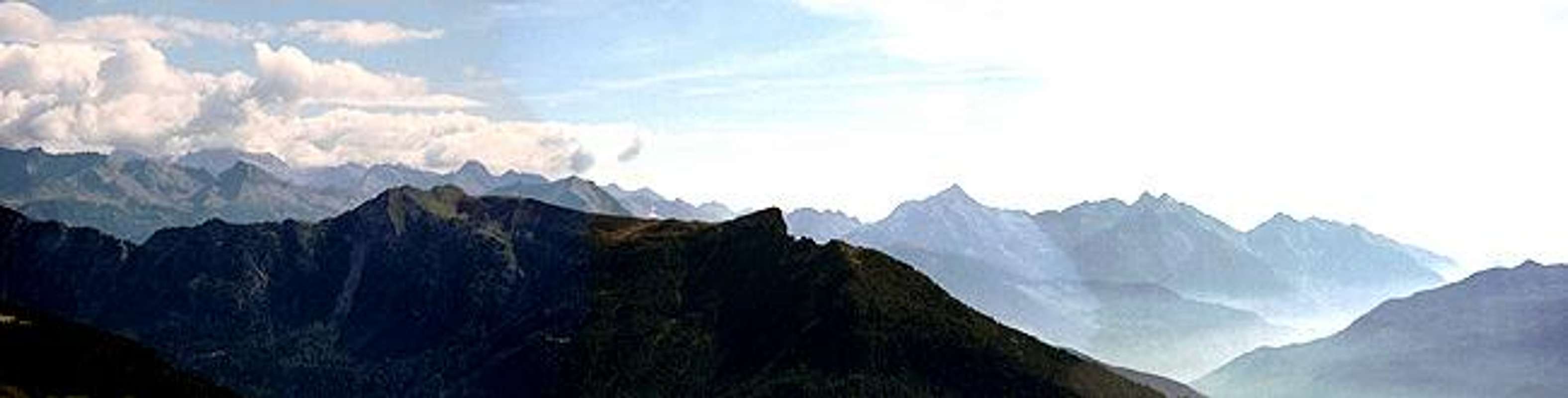
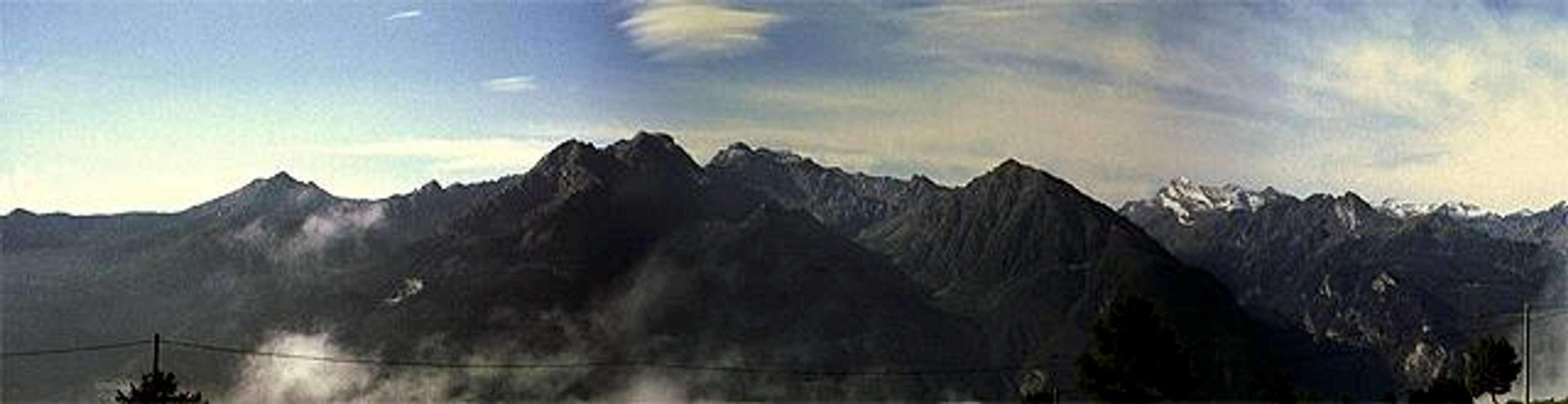
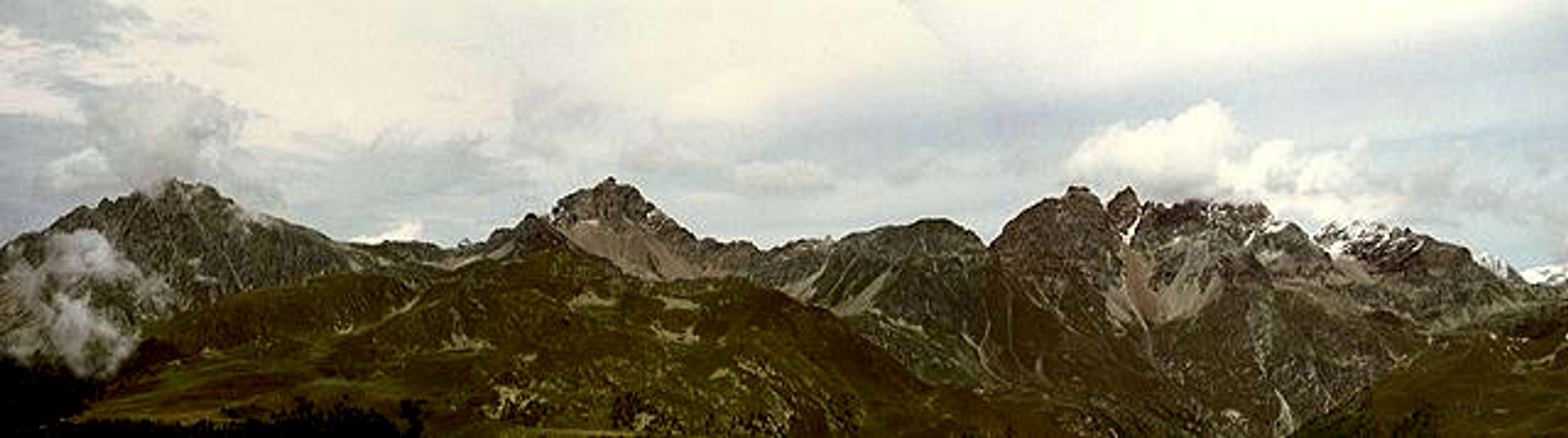
Summit views
East side:
South side:
West side:
360°-Panoramas
Much better summit panoramas can be found on buxlex's very recommendable web page www.vdaoutdoor.it. He kindly permitted the following links to be placed here (Thanks Beppe!). Click the thumbnails to see the large version.
| Detail Panorama from Dome de Tzan to Testa Grigia / Grauhaupt: |  |
| 360°-Panorama Cima Longhede: |  |
| 360°-Panorama Becca d'Aver: |  |
Getting There
Take Motorway A5 either from Torino or from the Mont Blanc tunnel. Depending on the trailhead you can either leave A5 at Chatillon (Valtournenche) or Nus (Valle di St. Barthélmy, Valle d'Aosta).
From Switzerland take the Gd. St. Bernhard Tunnel to get to Aosta. Shortly before Aosta take the tunnel leading southwest which leads you to SS26. This again goes parallel to A5 and leads to Nus as well as Chatillon.
Valle di St. Barthélmy trailhead at Issologne
From Nus take R36 into Valle di St. Barthélmy. The Road climbs to the village Blavy from where it flattens and leads more or less straight on to the hamlet of Issologne. Here several trails start to Becca d'Aver.
Valle d'Aosta trailhead at Grand Villa
From Nus take the road to Verrayes, from there on to Grand Villa. The best trailhead is at Lago di Lozon, where there is a vacational zone with parking lot and restaurant. From here trails No 12, 12B start in direction Becca d'Aver
Valtournenche Trailhead at community of Torgnon
From Chatillon take R46 into Valtournenche. At Antey St. Andrè turn left in direction Torgnon, Mongnod. Here again several trails start that lead in direction of Becca d'Aver.
 |  |  |  |
Red Tape

No red tape, no parking fees.
 |  |
When To Climb
Becca d'Aver and Cima Longhede can be climbed all year round. The various ascent trails pose no problems and are also available for ski tours in winter.
Accommodation
The peakbagging of Becca d'Aver is a 3 1/2 hour affair so that no overnight accomodation is neccessary. Within the valley you'll be able to find lots of hotels and appartments. More info at
Mountain Conditions
For weather conditions check with the Valle d'Aosta Meteo site.
Maps 'n' Books
I have used the following book, which unfortunately again is in German. Since Rother Verlag translated a lot of their titles to english it remains a question of time until this really very good hiking guise will be available in english as well. Please let me know of any other titles .
Books
Aostatal
J. Führer
Rother Verlag
ISBN: 3 7633 4033 5
Maps
Breuil-Cervina / Zermatt
Kompass Map WK87
Kompass Verlag
Scale: 1:50000
ISBN: 3 85491 095 9
La Valpelline, Valle di Ollomont, Valle di St. Barthelemy
IGC - foglio 115
Istituto Geografico Centrale - Torino
Scale: 1:30000
External Links
- 360° view from Becca d'Aver
Free download of 360° animated postcard, taken from Becca d'Aver, on 6th Nov 2002, sunset. Great lightning and sea of clouds. I was very lucky! Download it: it's free!