
-
 33363 Hits
-
 88.61% Score
-
 27 Votes
|
|
Mountain/Rock |
|---|---|
|
|
46.29576°N / 9.60110°E |
|
|
Lombardia |
|
|
Trad Climbing, Big Wall |
|
|
Summer |
|
|
11046 ft / 3367 m |
|
|
Overview
Pizzo Cengalo 3369 m
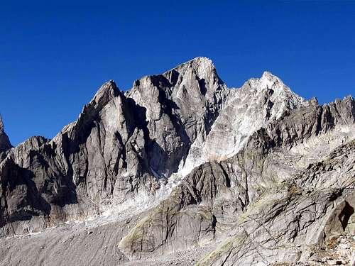
Pizzo Cengalo is a mighty granite mountain belonging to the Western Rhaetian Alps, Masino-Bregaglia-Disgrazia group, and located on the border ridge between Val Masino (Sondrio) in the Italian territory and Val Bondasca, side of Val Bregaglia, in the Swiss territory. This is the second one as height but the biggest rock structure in the whole Masino-Bregaglia-Disgrazia Group. Its North wall (on Bregaglia valley) is the highest wall (1300m) of the Rhaetian Alps.
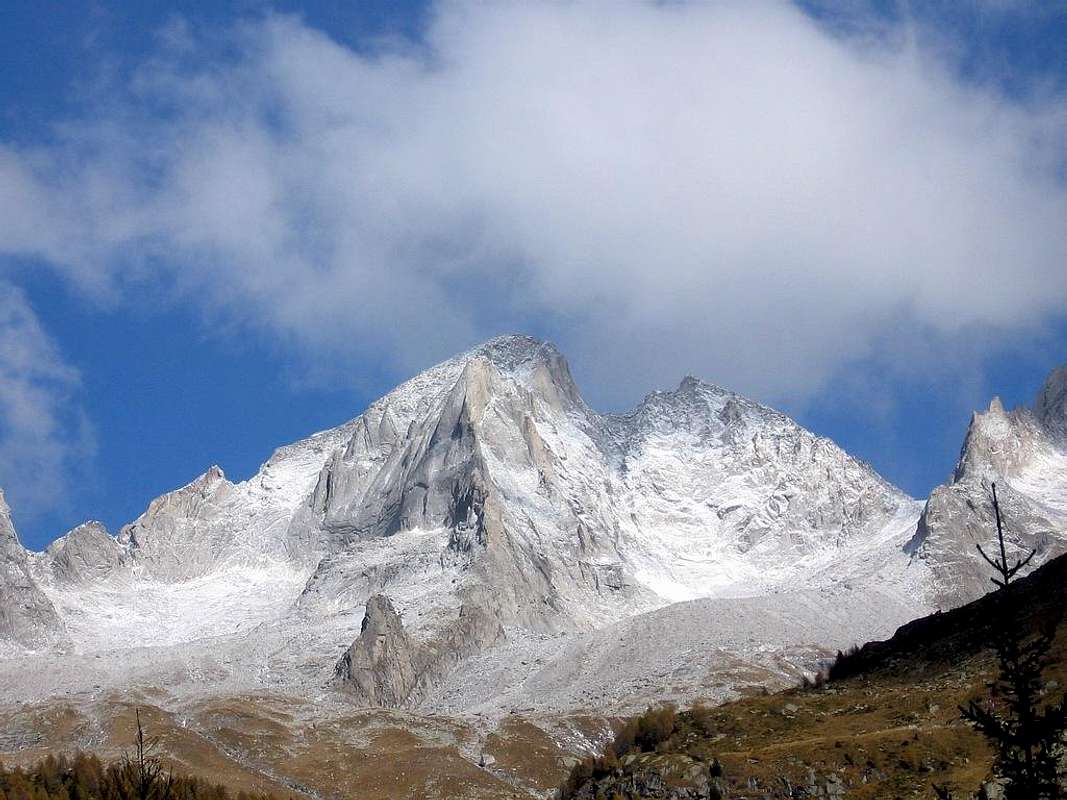
It is an imposing mountain in the shape of a truncated pyramid. The summit is formed by a large snowy dome with an ice cap covering in part its West side. From the summit three important ridges are generated, that make Pizzo Cengalo truly characteristic. The South ridge, snowy and rounded in the upper part, forms a conspicuous fore-summit, after which it becomes steep and sharp and descends in the upper part of Val Porcellizzo. The West ridge descends to Colle del Cengalo, while the East ridge descends to Colle dei Gemelli. These ridges delimit three sides: the North side, towards Switzerland, constitutes the highest and most complex wall, with mighty pillars and steep channels, the South-west face, on the Italian side, is clearly visible from the Refuge Gianetti, the South-East side shows wide and smooth slabs.
Pizzo Cengalo Normal route starts from the Rifugio Gianetti and climbs through the Cengalo pass and the wide West ridge. It is an easy and popular route, which however requires a certain mountaineering skill on rock and snow.
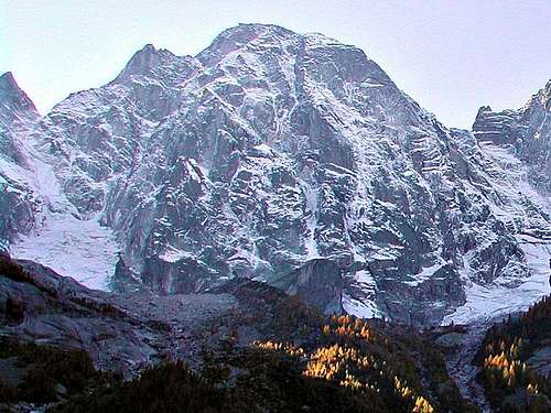
Pizzo Cengalo has been affected in recent years by some landslides, such as those of July 2011 and December 27 of the same year.
As for the damage to mountaineers, the landslide involved and partially made inaccessible the routes located on the north-north-west side such as the Classica route, the Attilio Piacco route, the eastern pillars of the wall, Kasper - Koch route, and the via Cacao Meravigliao on the north-east slope.”
Further landslides occurred on August 13 and 23, 2017. On 23 August 2017, around 9.30 am, an enormous landslide detached from the north-east wall of Pizzo Cengalo, at about 3000 meters above sea level, giving rise to a debris flow (estimated at 4 million cubic metres), which it devastated the underlying Val Bondasca and also partially affected the town of Bondo.
History
The first ascent was performed by the British pioneers D. W. Freshfield and C. C. Tucker with the alpine guide Francois Dévouassoud on 1866, july 25th, along what is still the Normal route of the mountain today.
Among the other routes the best known are the "Spigolo Vinci", a fairly popular rock route on the South ridge of the Southern fore-summit (400 m, TD V + / A0 or up to 6a in free climbing) and the route Gaiser-Lehmann on the North-west spur, rising from the Cengalo glacier (1100 m, TD V +).
Unfortunately in the winter 2011 a large part of the north face was hit by a landslide which changed its appearance, destroying several existing climbing routes. Further landslides on the North-East side occurred in the August 2017, including one of colossal dimensions (approximately 4 million cubic meters of material are estimated), further modifying the conformation of the wall and devastating the underlying Val Bondasca.
Getting There
Northern side: Val Bregaglia - can be reached by car from Milan (SS-36) - Milano - Lecco - Chiavenna .... Malojapass : along this road you can enter the Val Bondasca
Southern side: Valtellina - can be reached by car from Milan (SS-36) - Milano - Lecco - Colico .... Sondrio : along this road you can enter the Val Masino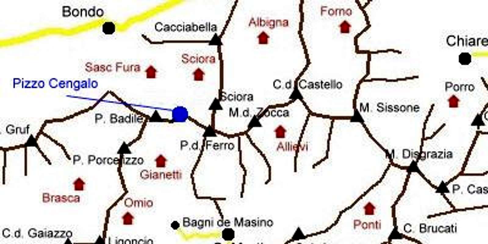
starting points :
- Ardenno - bagni del Masino - for Val Porcellizzo (Italy)
- Bondo for val Bondasca (Switzerland)
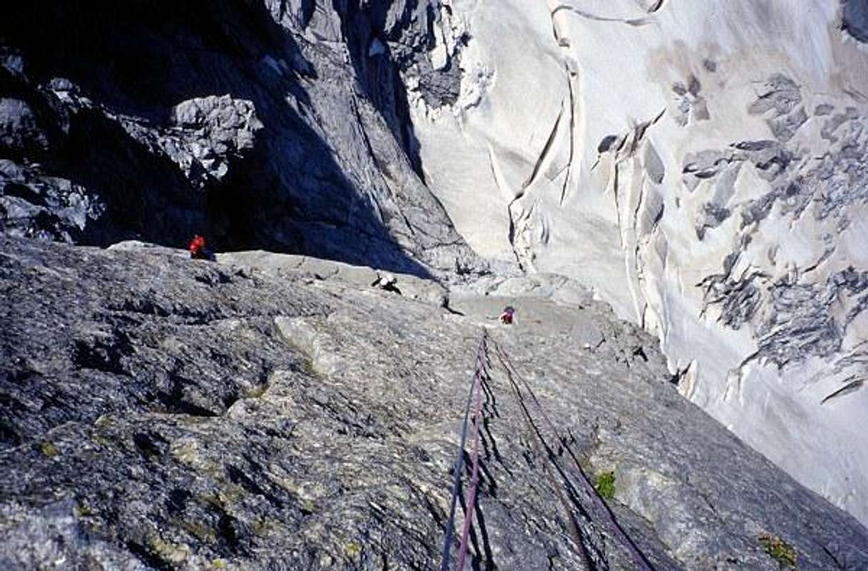
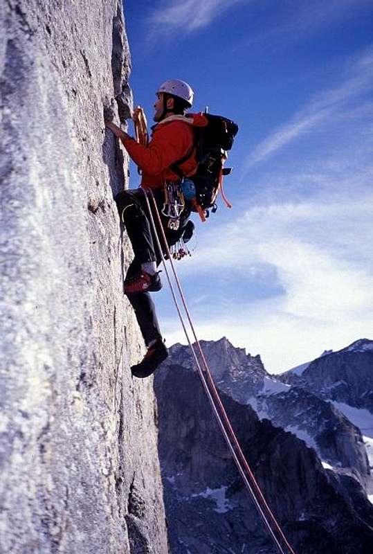
Routes overview
North wall the highest and most impressive wall
- NW pillar (Gaiser-Lehmann) TD - as fine as the NE wall to Piz Badile - 700 m + final ridge (WSW) -- (more pics from Lorenz)
- NNW wall (Schnitzler-Schocher-Borghese) - the classic - D - a big wall and a grand course - looks like a Mont Blanc Group classic
- NNW wall (Rusconi-Seinkotter-Tessari-Fabbrica) - few infos on it
- NNW wall eastern pillars - (Kasper-Koch) - ED - 600 m to get the classic route
East ridge - (Bonacossa-Prochownick) - D - 250 m - fantastic rock and climb
South-east wall
on this wall many routes and variants, difficulties starting from AD sup : the most important are the Bonacossa-Polvara and the via Chiara (Gugiatti)
South ridge 2 different possibilities on this ridge : - Via Vinci - TD - the finest climb you can make starting from Gianetti Hut --(more pics from Lorenz) - Via Bonacossa - D - this route goes round the Vinci route avoiding the main difficulties
South-west wall this is a wall that ends, after about 150m on easy rocks under the normal route, some routes on this wall can be used if you find Vinci route too difficult.
On this side some secondary towers (Selene and Sinistra) can be used for sport climbing
WSW ridge
the normal route - F or PD - snow and rock - wonderful views
 |
 |
 |
 |
 |
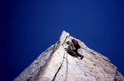
Some climbing pics
Gaiser Lehmann (NW pillar)
Vinci route (S ridge)
Red Tape
No fees no permits required.
Huts
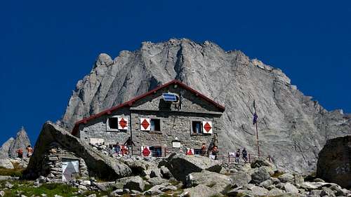
Three comfortable huts give you the possibilities you need.
- Rif. Gianetti 2534 m - Val Porcellizzo (Italian side)
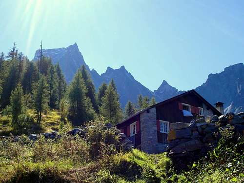
- Rif. Sasc Furà 1904 m - Val Bondasca (Swiss side)
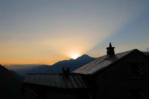
- Rif. Sciora 2118 m - Val Bondasca (Swiss side)
When To Climb
South-east side can be ready to climb in june, anyhow the descent could be a little complicate
all other sides from july to september
beware of bad weather, very dangerous on this summit just as on the near Piz Badile
Meteo
Meteo Arpa Lombardia
Meteoswitzerland
Guidebooks and maps
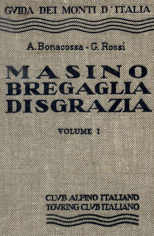
“Masino Bregaglia Disgrazia” Vol. I by Alberto Bonacossa and Giovanni Rossi, Collana Guide dei Monti d’Italia CAI-TCI
Maps
- CNS - Swiss National Map sheet 1296 - Sciora, scala 1:25.000 - Kompass, foglio 92, Chiavenna - Val Bregaglia, scala 1:50.000 -
External Links
Mountainpanoramas.com/Pizzo Cengalo
climberland: link to a page about Gaiser-Lehmann spur
climberland: link to a page about Vinci edge