
-
 37693 Hits
-
 91.75% Score
-
 36 Votes
|
|
Mountain/Rock |
|---|---|
|
|
37.92437°N / 105.54034°W |
|
|
Hiking |
|
|
Summer, Fall |
|
|
13604 ft / 4146 m |
|
|
Overview
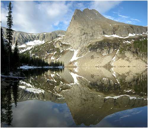
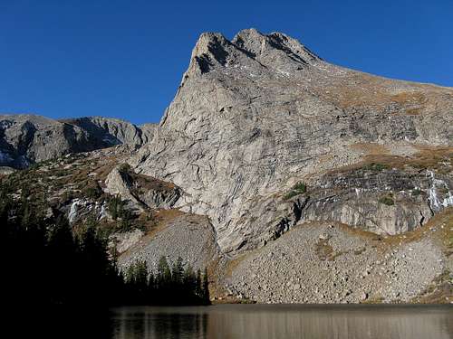
Tijeras Peak from Lower Sand Lake on May 30th, 2006.
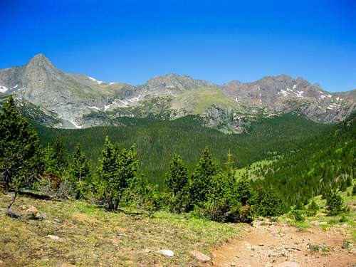
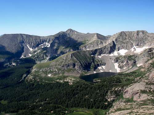
View of Upper Sand Creek Drainage from Music Pass. (L-R) Tijeras Peak, Music Mountain, Milwaukee Peak.
One thing that makes Tijeras and the other nearby peaks of the Sand Creek Valley unique is their geology. When people think of the Sangre de Cristo peaks in this area they think of the red, knobby Crestone Conglomerate that makes up the spectacular Crestone Peak, Crestone Needle, Humboldt Peak, and Kit Carson Group just to the north of Tijeras. But, when a hiker crests Music Pass on their way to climbing Tijeras Peak they will think that they have somehow been transported to the Sierra Nevada Range as the peaks across the Sand Creek Valley are composed of a gray granite reminiscent of the Sierras. In fact, these peaks are the only ones in the entire Sangre de Cristo Range that are composed of granite. The Blanca Peak massif to the south is actually composed of an gneiss older than the granite exposed here in the Sand Creek Valley.
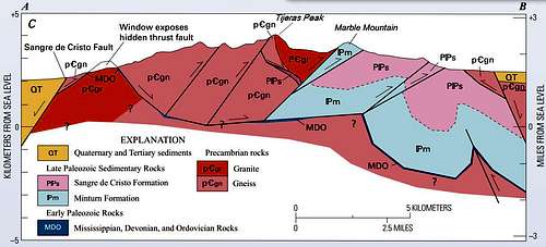
Geologic Structural Cross Section of Sangre De Cristo Mountains near Tijeras Peak
Getting There
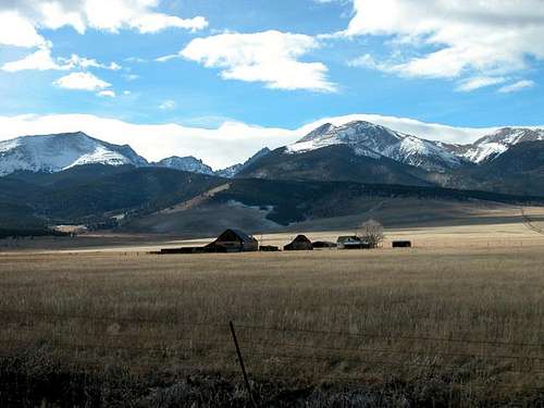
Photo taken on Nov. 30 2003 along CR 119 en route to Music Pass
To get to Music Pass from Westcliffe, CO:
Drive south on CO-69 for 4.6mi until you come to Co Rd 119/Colfax Ln. Right before the junction there will be a sign for the Music Pass Trailhead and National Forest Access and Great Sand Dunes National Preserve.
Turn RIGHT onto Co Rd 119/Colfax Ln and travel south for 5.5mi until the road comes to a "T" at South Colony Rd.
Turn LEFT onto South Colony Rd. and follow Co Rd 119/Colfax Ln. for 4.5mi until you enter the National Forest.
Shortly after entering the National Forest the road turns into a 4WD road requiring high clearance to reach the Music Pass Trailhead which is 2mi further at 10,750' elev.
Red Tape
Looking west from atop Marble Mountain. Tijeras Peak in center. Music Mountain to the right. Upper Sand Creek Lake sits below Music Mtn. Taken 7/18/2009 with the 2009 Summitpost gathering.
When To Climb
May-October is the best time to climb Tijeras Peak once the Music Pass Rd melts out and before the first snow of Fall comes. The Music Pass Rd is not plowed or maintained during the winter.
Camping
The east face of 13er Tijeras Peak from Lower Sand Creek Lake, Sangre de Cristo range, CO. Taken 10/3/09.
Leave No Trace suggests you observe these principles when traveling and camping in all public lands, especially wilderness:
1. Plan Ahead and Prepare
2. Travel and Camp on Durable Surfaces
3. Dispose of Waste Properly (at least 300' away from the Lake)
4. Leave What You Find
5. Minimize Campfire Impacts
6. Respect Wildlife
7. Be Considerate of Other Visitors
1. Plan Ahead and Prepare
2. Travel and Camp on Durable Surfaces
3. Dispose of Waste Properly (at least 300' away from the Lake)
4. Leave What You Find
5. Minimize Campfire Impacts
6. Respect Wildlife
7. Be Considerate of Other Visitors
Mountain Conditions
For up-to-date conditions call the Westcliffe Work Center @ (719) 783-2079 or call the San Carlos Ranger District Main Office at (719) 269-8500