

-
 19086 Hits
-
 85.36% Score
-
 20 Votes
|
|
Mountain/Rock |
|---|---|
|
|
44.95653°N / 6.38755°E |
|
|
Mountaineering |
|
|
Summer |
|
|
11856 ft / 3614 m |
|
|
Overview
Geographical classification: Western Alps > High Dauphiné Alps > Pic de Neige Cordier
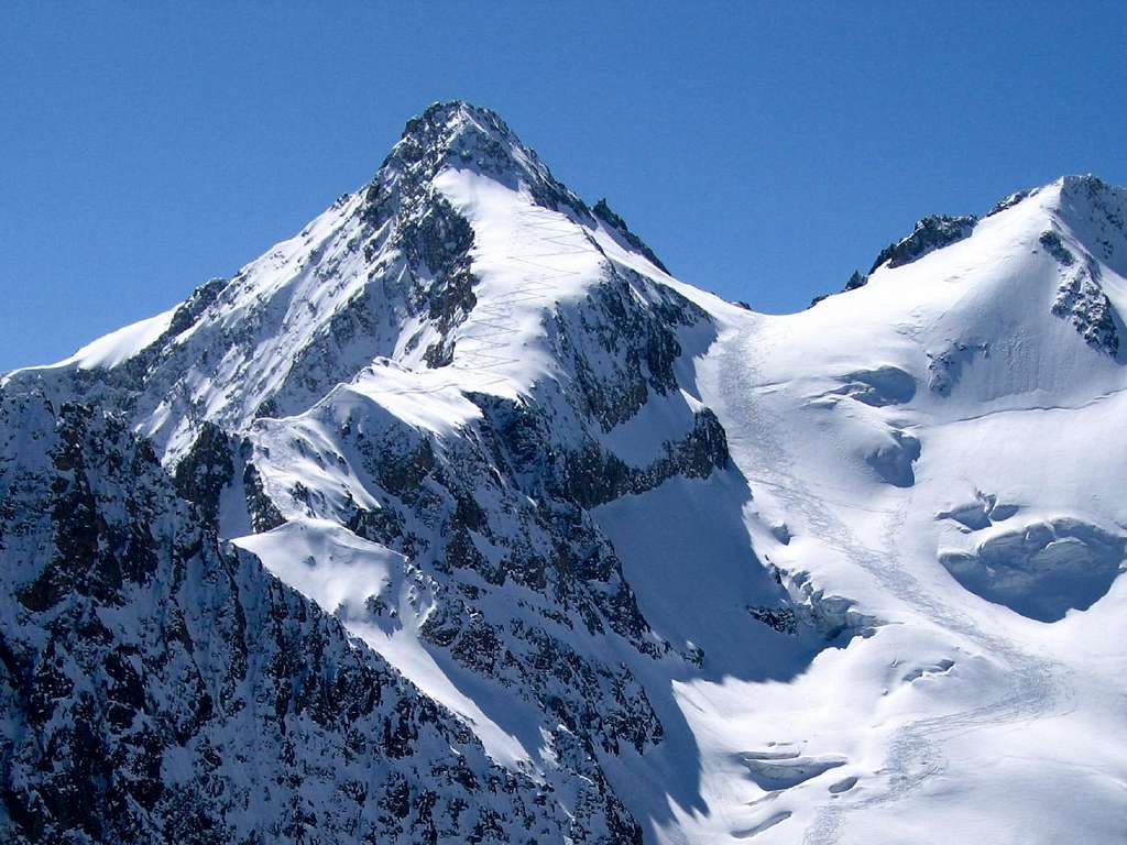
Pic de Neige Cordier 3614 m
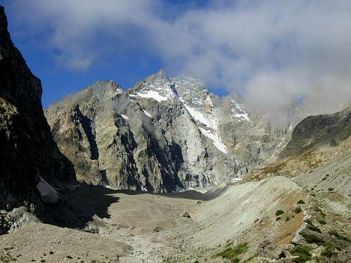
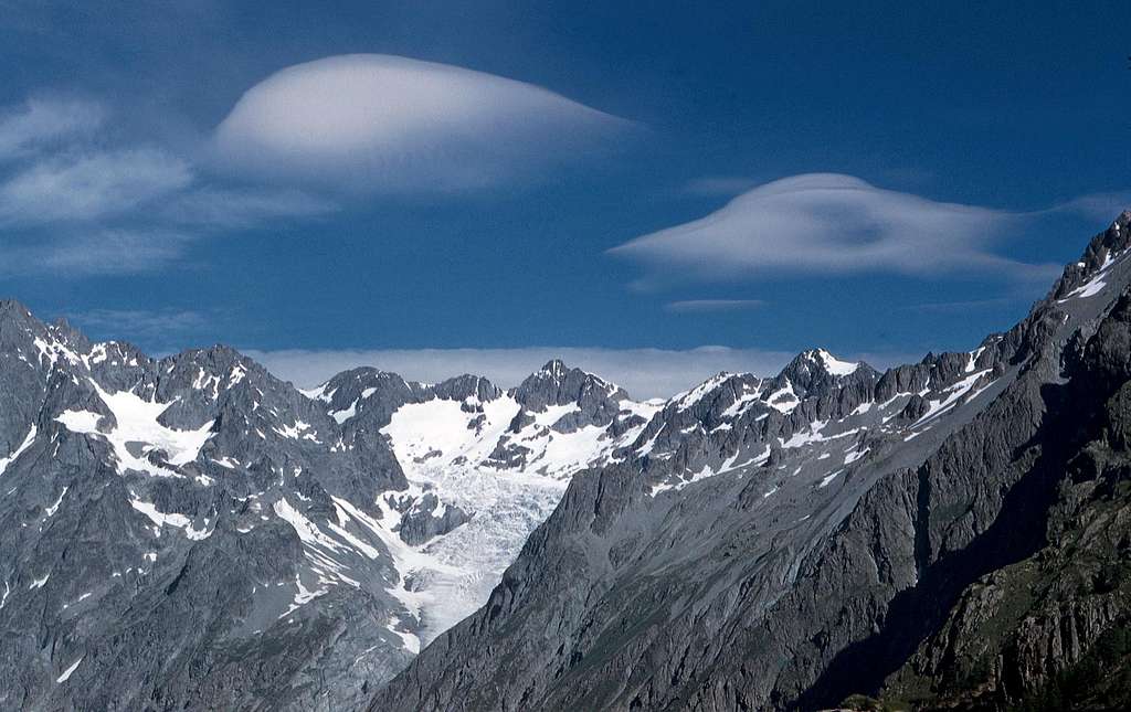
Pic de Neige Cordier 3614 m. is a fine mountain located in the Dauphiné Alps and belongs to the Écrins massif. It's a superb view point, situated at the apex of the Glacier Blanc. The South side of the mountain descends into the Glacier Blanc, while the North-East side descends into the Glacier d'Arsine. The mountain provides you with nice views of the entire Glacier Blanc, including the best perspective on Barre des Ecrins North side, and Glacier d'Arsine (to the North) as well.
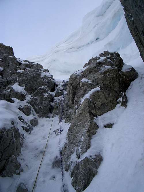
The summit is often climbed, being the easiest and quickest climbing target from the Refuge des Ecrins (3175 m), through the Normal route along the SW ridge starting from the col Emile Pic (3483 m). The ascent of this route is to be carried out at the beginning of the season. It was quoted F on the old reports, where there is talk of an easy climb to Col Emil Pic with a snowy gully without problems. This part of the Alps located far south of other mountain groups in recent times has perhaps more than other realities suffered a strong retreat of the glaciers. This climb was heavily affected by the retreat of the ice and in mid-summer there is already a steep, narrow and short snowy gully followed by a thin gully of ice and rock. There are insurance points and a stop for abseiling. Recent publications indicate an AD- difficulty.
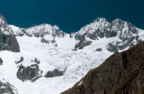
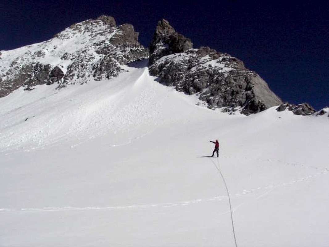
Pic de Neige Cordier Normal route
The normal route of Pic de Neige Cordier is beautiful and varied, snowy and rocky, and offers a wonderful view of the cirque of Écrins, the Grande Ruine massif and the basin of glacier Arsine. A very popular classic that can be done from the Refuge des Écrins, but also from the Refuge du Glacier Blanc. The ascent was rated F in the old guides, where it is described an easy ascent to the Emil Pic hill with a comfortable snow gully.
The retreat of the glacier in recent decades has radically changed the situation. At the beginning of the season there is a steep, narrow and short snow gully which is followed in the late season by an ice and rock gully with a small waterfall. There are belay points and a stop for rappelling.
Recent publications indicate a difficulty of AD-.
Ascent to be carried out preferably at the beginning of the season.
Approach to the Refuge du Glacier Blanc and to the Refuge des Ecrins - It starts from Pré de Madame Carle 1874 m at the bottom of the Ailefroide valley. In front of the ref. Cezanne take the path signposted Glacier Noir, Glacier Blanc, Glacier Blanc refuge and Ecrins refuge up to the footbridge over the Glacier Noir stream 1908 m. It then rises obliquely with wide hairpin bends up to a fork 2031m. Leave the path to the Glacier Noir on the left and take the one on the right that climbs up to a grassy terrace. From here you cross to the right side of the Glacier Blanc.
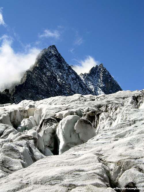
Cross the stream that flows from the head of the glacier and go up to the left among the rocks. Here the path turns right and rises up to a grassy plateau (old Tuckett refuge). Cross the plateau to the N, skirt the grassy strip where it's located the Refuge Glacier Blanc, which you will soon reach 2550 m (1h45 / 2h). From here continue on the path skirting the rocky strip. You reach and go up the moraine on the left side of the glacier. Go up the glacier on the left side up to about 3050 m and continue obliquely along the slope (you also pass some rocky sections), thus arriving at the refuge.
Route description
From the Refuge des Écrins you first reach the Col Émile Pic 3483 m. To do this, start NE crossing uphill via the snow slopes, or rocks and scree later in the season, until you reach the ice-slope descending from the col towards the Glacier Blanc, at an altitude of around 3240 m. Reach the foot of the couloir coming from the pass, possibly you have to cross a small bergschrund and go up it (45/50° at the end, unstable rocks). An old fixed rope with knots is in place but is hardly usable (placed too high). Possibility also to pass in the rocks (unstable) to the left of the corridor. To overcome the corridor requires some attention: at the beginning of the season, if it is completely covered with snow, it is steep at a short 45° or something more in the last section; in late season or with little snow it is a much more demanding gully of mixed rock-ice.
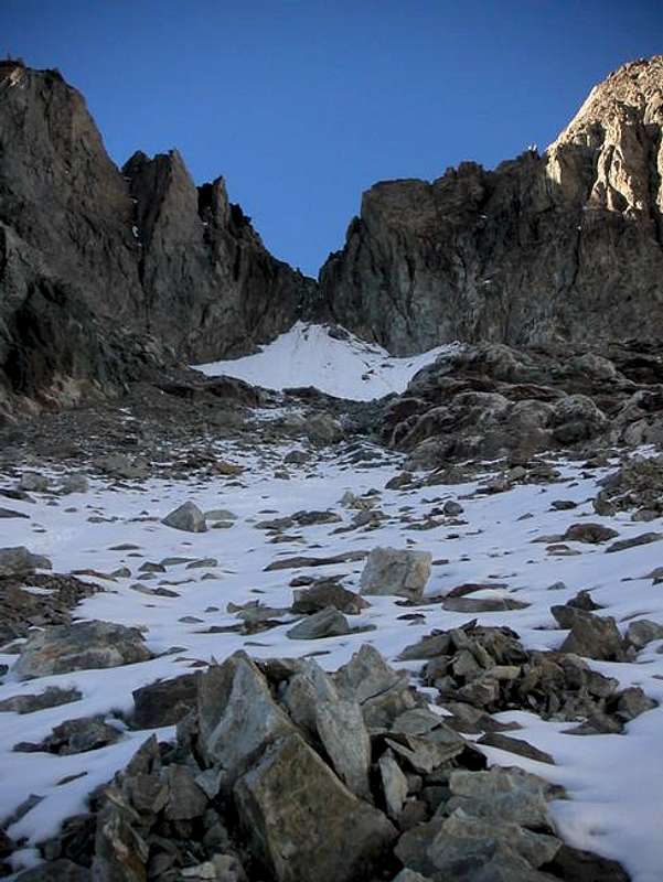
After overcoming the corniche, you reach the Col Emile Pic and continue on the opposite side up the snow or ice slope, located to the NE of the SW ridge. Heading right you reach the rocks on the W side. By following the systems of ledges below the ridge as well as possible with a few easy climbing passages (II), you first reach a fore-summit, then the summit. Count about 2h30 from the refuge.
Descent: reversing the same itinerary
Red Tape
No permits, no fees required. Possible that a parking fee is due in full season. Pic de Neige Cordier is situated inside the Parc National des Ecrins. The usual restrictions and regulations that apply within the parks must be respected. No fees, but fires, hunting, fishing, riding are prohibited. High level bivouac allowed without tent (alpine infantry troops are the only exception). You may not collect flowers, rock samples, or remove anything. Transistor radio banned also.
Huts, accomodation and camping
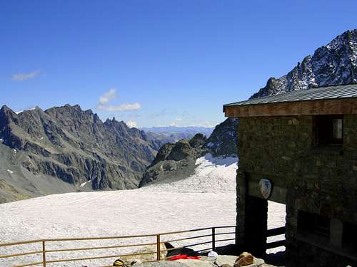
Refuge des Ecrins 3170 m - booking is necessary during the summer period
Owner: FFCAM (Fédération Française des Clubs Alpins et de Montagne)
Guardian: Damien Haxaire
Phone: 04 92 23 46 66 / 06 07 79 89 96
Open: from March 19th to September 24th
Access: Located at 3170 m, on a rocky promontory on the left bank of the Glacier Blanc, the Refuge des Écrins is located opposite the highest peak of the massif, the Barre des Écrins 4102 m. Access to the refuge passes across the Glacier Blanc: it is necessary to have equipment for progression on the glacier (crampons, harness and rope)
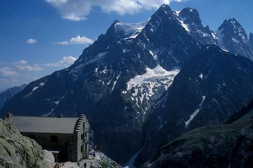
Refuge du Glacier Blanc 2550 m - reservation is compulsory.
Owner: FFCAM (Fédération Française des Clubs Alpins et de Montagne)
Guardian: Nicolas Chaud
Phone: 04 92 23 50 24 / 09 82 12 73 91
Open: from April 2nd to September 17th
Access: Located at 2550 m, the Refuge du Glacier Blanc is located opposite the Glacier Blanc. It is dominated by the north faces of Pelvoux, Pic Sans Nom and Ailefroides. accessible by families in 2h30 walk. Halfway between the Pré de Mme Carle and the Refuge des Ecrins, it's accessible in 2h 30 walk.
Extensive camping site in Ailefroide, Vallouise
When To Climb
Summer conditions usually met from mid-june to late september... first snow permitting! Be warned that the best conditions to climb the via Normale are in early summer, later the difficulties increase. The route is to be avoided in late summer when the gully is detrital.
The route is also a skiing target, but you may find heavy avalanche hazard in upper valley past Ailefroide village (road is not snow cleared up to Pré de Madame Carle).
Weather forecast telephone : 0892680205
Mountain rescue : P.G.H.M. Briançon (Peloton de Gendarmerie de Haute Montagne), telephone : 17.
Meteo
Guidebooks and maps
- Guide du Haut-Dauphiné, massif des Écrins, book 2, GHM and F. Labande, l’Envol