
-
 105348 Hits
-
 88.49% Score
-
 27 Votes
|
|
Mountain/Rock |
|---|---|
|
|
48.85946°N / 121.53282°W |
|
|
Download GPX » View Route on Map |
|
|
Whatcom |
|
|
Hiking, Mountaineering, Skiing |
|
|
Spring, Summer, Fall |
|
|
7115 ft / 2169 m |
|
|
Overview

Ruth Mountain at Night
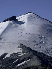
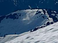
Ruth Mountain is located in the North Cascades near the Mount Baker Ski Area. It is often viewed from it's more popular neighbor Hannegan Peak and Hannegan Pass. Ruth Mountain is mostly a hike up but does involve some glacier travel near it's summit making a rope recommended. Most people go up this peak in a day, while the more ambitious people do the Icy Peak traverse that goes up both summits. Round trip it is around 12 miles in distance and a little over 4,000 feet of elevation gain car to car. The standard route has a decent slope to ski down.
A bonus to this moral building climb is the unique view of Mount Shuksan. Shuksan is most recognizable and photographed from the northwest around the Baker ski area, but the angle from Ruth displays Nooksack Tower and three glaciers cascading steeply into the valley below. Slides and avalanches can be witnessed by sight or sound from this massive face of ice and rock.
 Crevasses on Ruth Crevasses on Ruth |
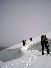 Snow Bridge Snow Bridge |
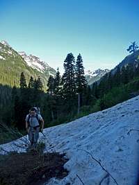 Approaching Ruth Approaching Ruth |
 Stream Above the Trail Stream Above the Trail |
 Going towards Ruth Going towards Ruth |
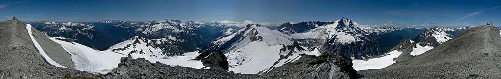 Ruth Mountain Summit Panorama
Getting There

Mount Shuksan from Nooksack Bridge
From Seattle: Head North on I-5 until you reach the city of Mount Vernon. At exit 230 take a right onto highway 20 for .2 miles. At the stop light turn left onto S. Burlington Blvd for about .4 miles. Then take a right (East) onto Highway 20 again for about 5.8 miles. Take a left (North) onto Highway 9 which goes North for 22.2 miles. At the edge of the city of Deming take a right onto Highway 542 for 31.9 miles. As you approach the Mount Baker Ski Resort look for NF Road 32 which will be on your left. This is a dirt road just before the Nooksack River Bridge on Highway 542. Take this road all the way to the Hannegan Campground/trailhead which is where you park.
From Bellingham: The directions are pretty much the same as above except that to get to the city of Deming you take Highway 542 (East) and proceed with the route above.
During the Winter and early Spring months it is not uncommon for large fallen trees to block this dirt road. Be prepared to hike an extra few miles to the trailhead during the Winter and Spring months.
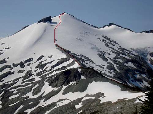 The Route up Ruth Mountain
Standard Route
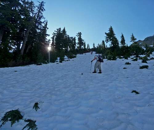
The trip starts out as a gentile 4 mile hike though the Ruth Creek valley towards Hannegan Pass. Looming above the valley is Mount Sefrit to the South while Ruth Mountain is the glacier covered peak to the southeast. During the summer it is best to get through this section before the heat of the day due to the vegetation creating a lot of humidity. On the way you cross over many creeks and see various flowers on the side of the trail.
 Hannegan Peak Hannegan Peak |
 Mount Baker's East Face Mount Baker's East Face |
 Goat Peak Goat Peak |
 Tomyhoi Peak Tomyhoi Peak |
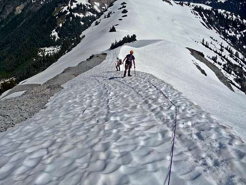
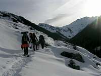
At Hannegan Pass start heading SouthEast towards Point 5930' which starts out as a wide ridge. The slope eases up and starts traversing around Point 5930 on it's Northern side. There is a little exposure in this section, take cation and have your ice axes ready. As you go around go slightly up hill until you reach the ridge where you get a view of Ruth Mountain. Head SouthWest and start following the ridge that goes to the bottom of Ruth.
 Heading up Ruth towards Point 5930
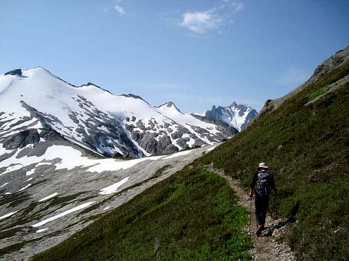 Hiking towards Ruth Mountain
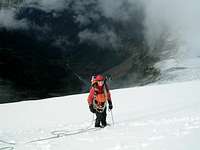
From here the route is straight forward. Once you arrive on the mountain itself you should rope up for glacier travel. It looks like a harmless snowfield in earlier season, but don't be fooled by appearance. Keep your eyes on the prize because the snow ridge just below the summit is the ridge you want to aim for as you climb. On the way up you pass by a small rock which offers a nice view if you feel like doing a mini side trip. With a little bit more of a push you arrive on the summit of Ruth Mountain. The North Cascades unfold with stunning views and deep valleys that go into the Picket Range.
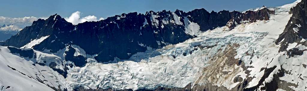 Nooksack Glacier Panorama
 Excited on the Summit Excited on the Summit |
 The Picket Range The Picket Range |
 The Summit Ridge The Summit Ridge |
 Looking Down the North Face Looking Down the North Face |
 Mox Spires Mox Spires |
 Hiking with Mount Shuksan Hiking with Mount Shuksan |
 Interesting Light on Ruth Interesting Light on Ruth |
 Snow Patterns Snow Patterns |
 Climbing up the Ridge
Red Tape
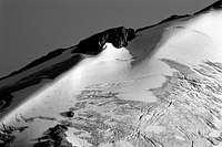
Ruth Mountain during October
Many creeks can be found on the way to Hannegan Pass which one could filter water or in later season you might find trickles near the Ruth Glacier. And of course when all else fails there is the glacier itself for water.
Hannegan Pass has been known for bear encounters, so keep your goodies stashed away when camping. I personally was about 15 feet from a bear in this area.
When To Climb
The best months to climb Ruth are May through September. If one is lucky with good conditions it can be done during the winter months which snowshoes or skis would be highly recommended. Use extreme caution in this avalanche prone area during Winter and early Spring.
Camping
Camping can be found at the Hannegan Peak trailhead as well as a few places near Hannegan Pass. I suppose you could also camp below the Ruth Glacier along the ridge where there are a few flat spots. If weather is looking good and your up for it there is a bivy spot on the summit.
Mountain Conditions

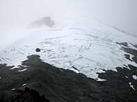
Gloomy Atmosphere
Crevasses on the Route
For current weather information on Ruth Mountain check in with the Noaa Forecast.
For Avalanche Conditions, check in with the Northwest Avalanche Center. (Limited based on the season)
Check in with the Forest Service Website for more information on the current road conditions which can be found at Road Number 32 "Hannegan". (the link give you most of the Mt. Baker Highway hikes)
Gear to Bring

Ice Axe and Crampons
Roped up for the Climb
Overnight Packs
Mandatory Gear for the Climb
- Ice Axe
- Crampons
- Rope
- Glacier Rescue Gear (prusiks, carabiners, webbing, ect.)
- 2 Snow Pickets (for standard glacier travel)
- 2-3 Liters of Water Per Person
- First Aid Kit
- Shell Jacket
- Glasses/Goggles (comes in handy when snowy)
Recommended Extras:
- Sun Screen
- Map and Compass
- Camera
Overnight Gear:
- Tent/Bivy
- Sleeping Bag
- Ground Pad
- Water Filter/Tablets
- Stove, Fuel, Pot, and utensils (for cooking)
Topographic Maps
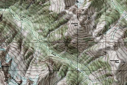 Ruth Creek Topographic Map Ruth Creek Topographic Map |
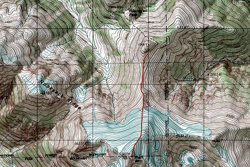 Ruth Mountain Topographic Map Ruth Mountain Topographic Map |
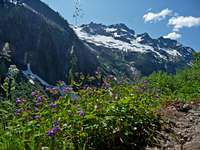
Wild Life and Flowers
 Ruth Mountain with Lupines Ruth Mountain with Lupines |
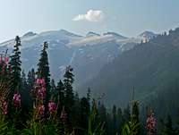 Ruth with Flowers Ruth with Flowers |
 Silky Phacelia on the Summit Silky Phacelia on the Summit |
 Ruth Mountain with Cabbage Ruth Mountain with Cabbage |
 Mount Sefrit with Flowers Mount Sefrit with Flowers |
 Butterfly on the Summit Butterfly on the Summit |
 Paintbrush with Mount Sefrit Paintbrush with Mount Sefrit |
 Tiger Lillies Tiger Lillies |
Video
Ruth Mountain July 2-4, 2011 by Mitchell Crane
External Trip Reports
- July 2, 2011 - Plenty of Photos and text that show a nice family outing up Ruth.
- February Ascent of Ruth with an attempt on Icy Peak
- 7/12-13/2008 -Eye Candy for the non Readers with a little bit of Description