
-
 30611 Hits
-
 89.32% Score
-
 29 Votes
|
|
Mountain/Rock |
|---|---|
|
|
46.53200°N / 8.07770°E |
|
|
13268 ft / 4044 m |
|
|
Overview

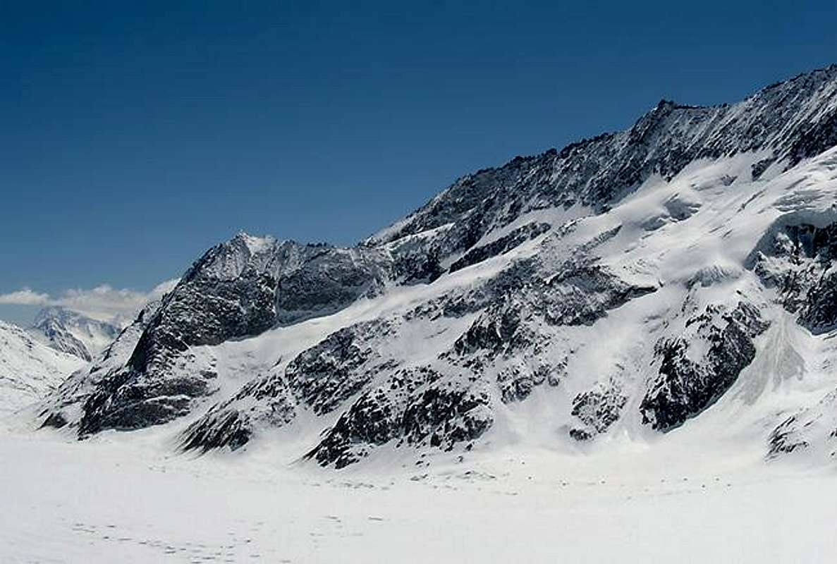
The Gross Gruenhorn (original spelling with "Umlaut" is "Gross Grünhorn") is the most central mountain in the glacier region of the Bernese Alps. Politically it belongs to the swiss federal state ("Kanton") of Wallis because the frontier to the Kanton Bern is more north on Eiger, Moench and Jungfrau. Gross Gruenhorn separates the two biggest glaciers of the Bernese Alps, which are the Aletschgletscher (also the longest glacier in the entire alps, with the upper part called "Ewigschneefäld") and the Fieschergletscher. If you climb Gross Gruenhorn, you can think that you are in the arctic, because you can see nowhere anything green, but only rocks and glaciers. I guess the name comes from the colour of the stones on the east side, which might be a bit green.
Gross Gruenhorn can be climbed in summer and winter, but normally on different routes.
The normal route in summer crosses the Gruenegghorn (PD, rocks II)
The ski route in spring is directly over the west face, where the glacier leads almost up to the summit. This route cannot be recommended in summer because of the risk of ice fall and it is sometimes not possible due to big crevasses.
If you are able to go with ski, I recommend this more than walking over the huge and flat glaciers in summer (at the approach to the Konkordia-hut).
First ascent by Edmund von Fellenberg with guides Peter Egger, Peter Michel and Peter Inäbnit, August 7th, 1885.
Getting There and huts
Konkordia-hut (2850 m) (you can also look at the page Aletschhorn) - overview map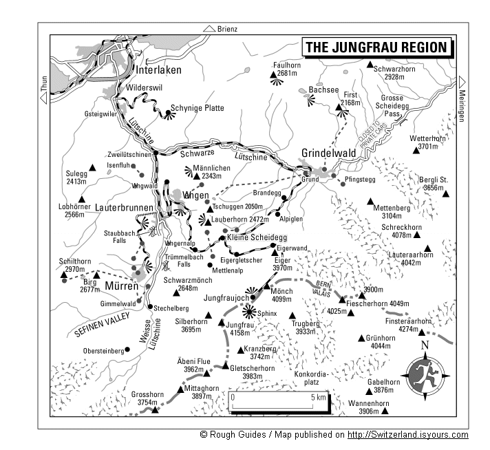
a) from north;
Zuerich & Basel have international Airports. Via Bern and Interlaken you can easily reach the region of the Berner Oberland by train or car and the famous town of Grindelwald on foot of the even more famous Eiger north face.
A nice but expensive train of the Jungfrau Railways brings you to the Jungfraujoch (3454 m). From there it is all the way down, mostly on the left side of the glacier "Jungfraufirn". Don't go directly over the even Konkordia-Platz, there can be melted snow like in a marsh. Make a curve to the east, pass the confluence of the Ewigschneefäld and the bottom of the Gruenegghorn. Directly after the confluence of the Grueneggfirn steep stairs lead over the almost upright rocks to the plateau with the huts.
2,5 h from the Jungfraujoch, very much shorter with Ski.
b) from south
By car or with railway you reach the village Fiesch in the upper valley of the Rhone = Ober-Wallis
- via Furka-Pass or Furka-Tunnel from the east
- via Brig from west or south
Take the Eggishorn-cablecar to mid station Chuebodenstafel (2221 m). Marked promenade to the interesting lake "Märjelensee". On the ice of the Aletsch-Gletscher, between the eastern side moraine and the middle moraine you have to walk 7 km, pass under the hut until you reach the iron stairs which lead from western side up to the hut; 6 h
 |
Red Tape
no limitations at all.Glacier condition / Konkordia
 hut climb on stairs
When you visit the Konkordia-Hut, you have an impressive example of melting glaciers in our times. You have to leave skis (if you are there with skis) at the shore of the Aletsch-Glacier. To the hut you have to climb 399 iron stairs and you can see on signs, when the surface of the glacier was at your present height: In the years since 1965, more ice is melted, then since the construction of the Konkordia-Hut in 1877 to 1965. Every few years, another ladder has to be added at the bottom. But you don't have to be afraid that the glacier could disappear soon: the ice at the Konkordia-Platz is still 800 m thick.
The famous Konkordia-place in the Karakorum in Pakistan got his name when the first visitors compared it with this site in the Bernese Alps.
 Konkordiaplatz seen from above
Pano of Konkordia as seen from Konkordia hut
 |  |  |  |
Panorama from Konkordiaplatz
Rock climbing at Konkordia
If you plan to stay more nights at the Konkordia hut and if you like rock climbing I recommend to take your EBs (climbing shoes) with you. There are many short routes around the hut secured with bolts. Descriptions can be read in the hut and you can also rent helmets and runners there. Due to normal snow conditions, you will start climbing Gross Gruenhorn (or other mountains) very early and be back at noon, especially in spring with ski. So you can spend the afternoon at these rocks with a splendid view over the Aletsch-Gletscher. |
Best Time
Juli to September by foot. Later in the summer the glaciers become more dangerousApril and May with ski. There are some experts who go there earlier in winter. Huts are not guided at this time and glaciers with less snow are more dangerous. And it is perhaps the coldest region of the Alps.
Maps and books
Swiss Maps:a) 1:25.000 Nr. 1249 "Finsteraarhorn"
b) 1:50.000 Nr. 264S (with Ski routes) "Jungfrau"
interactive swiss online map for Gross Gruenhorn
Books in german
a) Berner Alpen by Werner Munter (the swiss "pope of avalanches"), Bergverlag Rother
b) "Alpine Skitouren Band 4 Waadt-Freiburg-Berner Alpen", by Anker / Labande / Schnegg, Verlag Schweizer Alpen-Club, 1994 - my book, but obviously out of print
c) Skitouren Berner Alpen Ost by Daniel Anker and Ralph Schnegg, Verlag Schweizer Alpen-Club, 1999, the new one
Book in english:
The Alpine 4000m Peaks by the Classic Routes by Richard Goedeke, Menasha Ridge Pr; ISBN: 0897321111
Routes overwiew
according to Munter- via Gruenegghorn and the SW-ridge: 5-6 h from Konkordia hut, G 3-4
- west side and SW-ridge from the Ewigschneefeld: 6-7 h from the Konkordia hut, G 4-5. This is the ski route
- SW-ridge from the Finsteraarhorn hut: 5 h, G 4. More to recommend for a descent. There are bolts for abseiling. Infos available at the huts
- NNW-ridge from the pass to the Klein Gruenhorn, 7 h from the Konkordia hut, 3,5 h climb; IV-, G 6-7
- SE-ridge and -face from the Finsteraarhorn hut: 5 h, III, G 5-6
- E-pillar, 10 h from the Finsteraarhorn hut, V-, G 8
mountain conditions
Mountaindoc wrote:We climbed Gross Gruenhorn with ski / board on March,31st, 2002. There were only a few crevasses and the summit ridge was ice-free. Unfortunately we couldn't ski down the summit-couloir, as there was no snow... The seracs between 3400m-3700m are definitely ready to collapse at any time !! Have fun !!
External Links
- Gross Grünhorn at www.4000er.de
Images, routes, coordinates and more information about the highest peaks of the Alps