

-
 103960 Hits
-
 93.51% Score
-
 44 Votes
|
|
Mountain/Rock |
|---|---|
|
|
48.51560°N / 120.6567°W |
|
|
Mountaineering, Trad Climbing, Aid Climbing, Mixed |
|
|
Spring, Summer, Fall, Winter |
|
|
7720 ft / 2353 m |
|
|
Overview
Liberty Bell stands guard over Washington Pass, and all climbers driving over Highway 20 stop to drool. First is the East Face, with it's steep big wall climbs. Then comes the South and West faces with modest climbs in the 5.6 to 5.9 range, a peak baggers dream. Finally, is the mercifully short approach, especially for a Cascades climb. It is very popular with climbers during the summer months, and you might get stuck behind another group on the wall. The Liberty Crack is listed in the book "The 50 Classic Climbs of North America", which includes routes such as Denali's West Butress, the North Ridge of Mt. Stuart, and the Nose of El Capitan.
Fred Beckey, Jerry O'Neil and Charles Welsh are credited for the first ascent of the peak in 1946 via the original "Beckey Route" which is now one of the most popular alpine climbs in the state having a moderate 5.6 rating and a short approach. Unfortunately for Beckey and company, their approach was a 17 mile hike since the North Cascades highway had not yet been constructed. Today the approach hike can be done in about a mile of easy trail followed by a short rock gully.
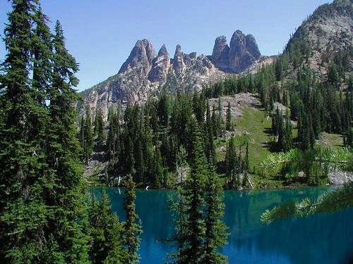 Liberty Bell (on the left) and Early Winters Spires (right) Liberty Bell (on the left) and Early Winters Spires (right) |
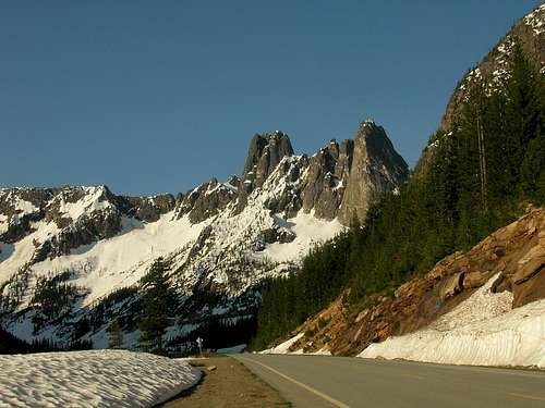 Liberty Bell from Highway 20 Liberty Bell from Highway 20 |
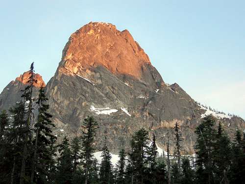
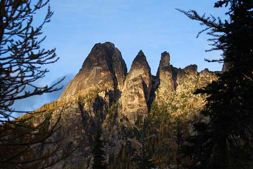 Liberty Bell at sunset Liberty Bell at sunset |
 Liberty Bell (far left) and the Early Winters Spires
Getting There
Drive the North Cscades Highway (WA 20) east out of Burlington passing the towns of Concrete, Marblemount, and Newhalem and continuing over Rainy Pass (~3 hours from Seattle). About a mile before reaching the top of Washington Pass, locate the Blue Lakes trailhead turning off the highway to the right (south). Pull in and park at the large trailhead.
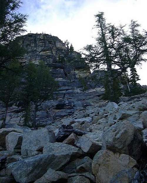
For the Beckey and other South\West routes, start up the mellow Blue Lakes Trail for a little longer than you may think, after a couple of small false trails the main climbers trail/trough comes into view. You will be able to see the gully between Liberty Bell and Concord Tower. If you leave the trail and cannot see this gully you left the trail too early. As with most climbers 'trails' it goes pretty much straight up. The gully, if not snow filled is a fine place to die from party induced rockfall, so wait until it's clear, and take a helmet. Staying on the right side of the gully near the upper end is less loose.
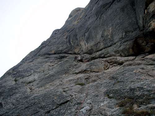
For the East face routes, Liberty Crack and Thin Red Line, continue over to the east side of Washington Pass on Highway 20 and descend a short ways to the hairpin curve and park off the side of the road at the curve. Walk back toward the pass and locate a pond on the south side of the road. At the East end of the pond, look for the trail heading into the woods. It is often marked with cairns and the trail will bring you to the East Face of Liberty Bell after about a mile of hiking.
 Looking up at the Liberty Bell from Washington Pass Looking up at the Liberty Bell from Washington Pass |
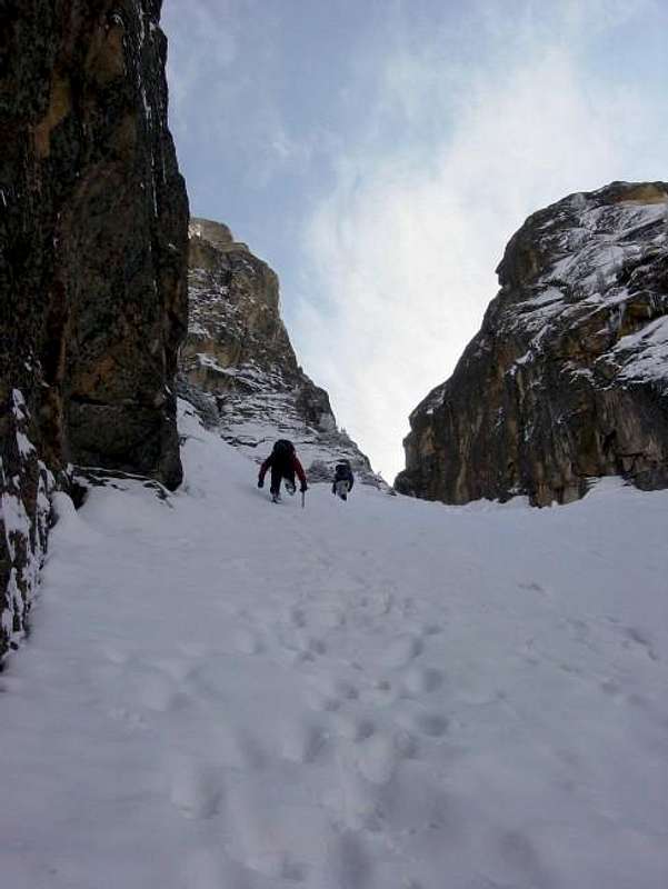 Climbing the gully when snow covered Climbing the gully when snow covered |
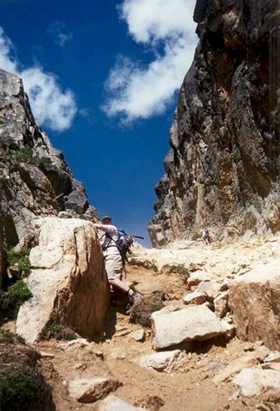 The gully in late summer The gully in late summer |
Route Options
There are 18 established climbing routes on Liberty Bell the easiest being the Beckey Route. This peak can please just about every type of climber out there from the new climber breaking in to some trad leads to the veteran aid climber looking for a serious challenge. Below is a brief description of some of the more popular routes.
| Name | Photo | YDS/Grade | Brief Description |
| Beckey Route |
 Start of the Beckey Route Start of the Beckey Route |
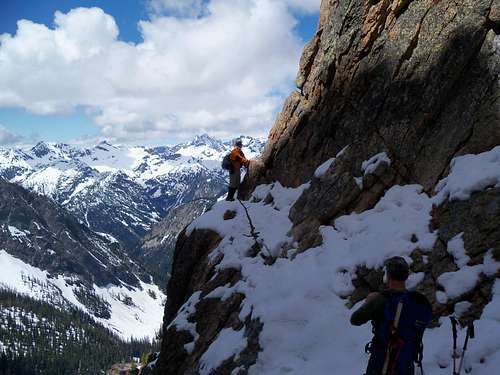
5.6/II | This is the original route done by Fred Beckey in September of 1946 which is 26 years before the North Cascades Highway opened. That's a long approach! This is one of the most popular moderate rock climbs in the state so don'e expect solitude. Even in April and May parties do a "ski and climb" outing making the area busy the entire time the highway is open. Rated at 5.6 and having great rock quality, this is a great route for beginners and intermediate climbers. The only issue I had with the route was rope drag. Don't feel like you have to make full 60 meter pitches. |
| Overexposure |
 Overexposure Route Overexposure Route |
5.8/II | This route is the nice line to the right of the Beckey Route and starts just below the col. Rated at 5.8 it boasts a difficult finger crack for 2 short pitches and meets the Beckey Route just below the 15 foot slab. There are bolted anchors on this route and this is the standard descent route down Liberty Bell with two rappels, both being about 20-25 meters long. |
| North Face |
 North Face North Face |
5.8/II | "This route takes a winding path up weaknesses and ledges over 1000' from the talus below the monolith of Liberty Bell to the summit. The route is longer and less crowded than the Southwest Face and despite the steepness of the feature, maintains a fairly low angle and moderate grade. Expect to climb a bit of dirty gully, runout easy slab, and great steep granite cracks." - Z-Man |
| Serpentine Crack |
 Start of Serpentine Crack Start of Serpentine Crack |
5.11/III | This 4 pitch line provides a greater challenge for those wanting to push their limits but aren't interested in aid climbing. Located on the west face of Liberty Bell it uses a similar approach as the Beckey Route but stay left when the gully forks. |
| Liberty Crack |
 Liberty Crack Lithuanian Lip Liberty Crack Lithuanian Lip |
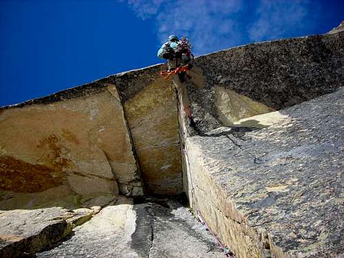
5.10d A2/V | One of the 50 classics in North America, this is an aid climb and therefore one of the harder classics. Located on the 1,200 foot tall east face, this 11 pitch climb is rated 5.9 C2 or 5.10 C1 and offers a fantastic and challenging climb for someone relatively new to aid climbing. Most people make the climb in two days but there has been parties push for single day ascents. |
| Thin Red Line |
 Pitch 3 Pitch 3 |
5.12/IV | "In 2008, local talent Mikey Schaefer had the vision and ability to unlock a free variation to the one blank pitch. His variation allows the whole line to go free at a relatively moderate grade. While this climb is more or less devoid of steep, clean splitters, it offers pitch after pitch of incredible climbing up intricate crack systems and faces on practically perfect rock." - From MountainProject Note this is the free version |
Red Tape
A Northwest Forest Pass is required. There is a debate about the legality of such a fee for low impact use of federal land, but most people meekly pay the fee, not questioning the authority. While this is not the place to express my views, you can participate in the debate by refusing to buy such a pass, and contesting any fines you may incur. I typically never buy a pass and have never been issued a ticket. The peak lies just outside the North Cascades National Park so no permits are required.
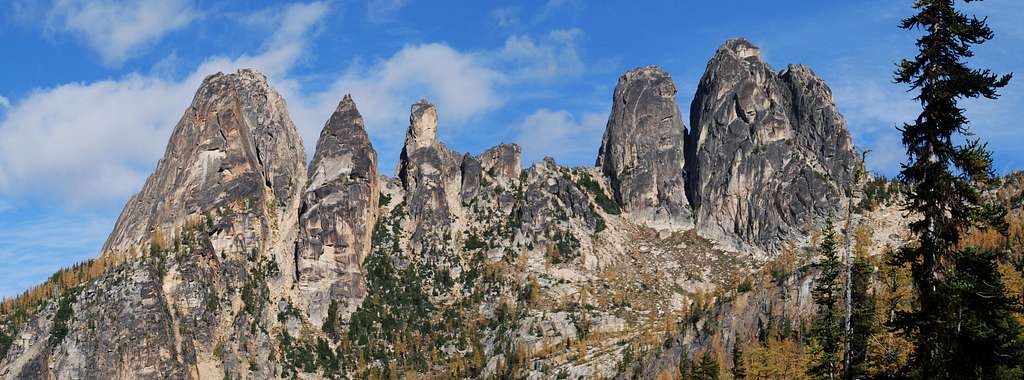
 Liberty Bell summit panorama
Camping
There are campgrounds on either side of Washington Pass. The closest is Lone Fir on the East side of the Pass, about a 10 minute drive from the Blue Lake Trailhead. Klipchuck and Early Winters campgrounds are further away, on the east side. Check with the Okanagen National Forest for more information. There isn't really a need to camp at Blue Lakes.
Mountain Conditions
Liberty Bell lies just east of the Cascade Crest, so it misses some of the worst of the moisture laden fronts that slam into the Western Cascades. Summer thunderstorms occur now and then as well. Rock comes into condition in May, and lasts until the Autumn storms, which usually arrive in October. The approach gully to the Beckey route is often filled with snow until late June, making an ice axe, and possibly crampons neccessary. It's possible to climb the Beckey route after a recent rain, the parts that stay wet, such as the chimney, are not that difficult. Rugged folks that want to climb in the winter face a 16 mile approach because the road is closed, plus some significant avalanche risk. Liberty Bell is made of mostly solid granite, which is not quite the quality of Yosemite, or peaks in the Stuart Range, but most of the popular routes are pretty clean.
 The approach to the notch between Liberty Bell and Concord Tower without snow The approach to the notch between Liberty Bell and Concord Tower without snow |
 Approach to the base of the Becky Route on Liberty Bell with snow Approach to the base of the Becky Route on Liberty Bell with snow |
meganerd - Sep 6, 2002 10:46 pm - Hasn't voted
Untitled CommentMazama is at least 30-40 minutes away and there is NO ranger station there. The nearest one is in Winthrop (with the thin veil of Methow Valley Information Center or something like that). You may be able to get basic conditions info at the general store in Mazama, but not much. Also, if coming from the west, the Marblemount Ranger Station should be able to provide some information.
ExcitableBoy - Sep 27, 2013 9:52 am - Hasn't voted
Liberty Crack and Thin Red LineMost climbers take two days on Liberty Crack, often fixing the first three pitches and returning the next day to climb to the summit. Very competent parties do it in a day. Thin Red Line has seen very few free ascents. It is a classic aid line at A3, although it has gone clean, which boggles my mind.