
|
|
Mountain/Rock |
|---|---|
|
|
29.24560°N / 103.3033°W |
|
|
7825 ft / 2385 m |
|
|
Overview
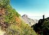
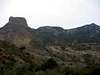
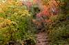
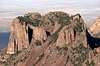
Big Bend National Park may be ten hours drive from anywhere, but the Chisos Mountains, a massive, circular igneous outcrop with lush alpine forests, provide nice respite from Texas heat. Emory Peak stands highest among the Chisos Mountains, at 7825 feet, though well below the highest peak in Texas, Guadalupe Peak.
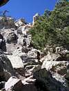
By Texas standards, the easiest dayhike to Emory Peak is quite challenging, with an elevation gain of 2400 feet over 3-4 miles. The standard route is a walk-up from the Chisos Visitor Center along the Pinnacles trail, with a steep 1.2 mile final section on the Emory Peak Trail. You'll find lots of fun and solid rock near the summit for casual scrambles. The west face of Emory boasts a big and sheer drop to the desert floor below. Certainly technical routes may exist here, though warns, "Sturdy rock for safe climbing is somewhat limited in the park, because the majority of the park's exposed vertical rock is composed of unstable igneous rock and sharp fluted limestone."
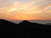
From the summit, the panoramas are stunning, particularly on a clear day. Expansive desert vistas on all sides, with views of rugged (and higher) peaks well across the Mexican border. The Chisos Mountains are amenable to extended backpacking trips, although finding adequate water is always an issue. Rock climbing at Big Bend is possible, but guidebooks are hard to find. Click here for rock climbing info and regulations.
 |
 |
 |
 |
 |
Getting There
From the entrance station on US 385 continue south to the dead-end at Panther Junction and turn right onto Highway 118. Continue for a few miles, then turn left at the signs toward Chisos Basin. Continue for 10 miles. Park at the visitor center. The trailhead is located on the south end of the visitor center parking lot. At the trailhead, you have two choices. The easiest and closest approach to Emory Peak is via the Pinnacles Trail (4.5 miles). The other begins on the Laguna Meadow Trail which you then have several choices from there. The Laguna Meadow trail is the "long way," and the reason most take it is to enjoy the south rim. This trail branches in several places. You can make your hike 6.8 miles, 9.6 miles, or 11.9 miles depending on which branch trail you take. The 11.9 mile route via the Southeast Rim Trail and the Northeast Rim trail will give you a grand tour of the south rim, Chisos Mountains, and Emory Peak. It's worth the effort. Just remember that this route is closed from February 1 - July 15 for Peregrine Falcon nesting.
Another approach is via the Juniper Canyon trail (8.5 miles). To reach the trailhead, turn left at Panther Junction and drive about five miles to Glenn Springs road. Turn right on Glenn Springs road and drive about two miles to Juniper Canyon road. Follow this road for about four miles until reaching the trailhead. Both Glenn Springs road and Juniper Canyon road require a four-wheel drive high clearance vehicle.
Here are several maps of the area: Online Maps (PDFs).
Public transportation is completely nonexistent in this area. The closest bus station is in Fort Stockton, 130 miles to the north. Southwest Airlines flies into both Midland, Texas and El Paso, Texas where you can rent a car.
| Driving information from Major Airports | ||
| City | Distance | Yahoo Driving Directions |
| Midland/Odessa | 217 miles | MAF to Big Bend Entrance |
| El Paso | 323 miles | ELP to Destination |
 |
 |
 |
 |
 |
Red Tape
Emory Peak is located inside Big Bend National Park. There is a $15.00 entrance fee per vehicle which is good for one week. See below for other fee information. There are no fees to hike or climb. Backcountry camping requires a permit. See camping section below.
From February 1 - July 15, the Southeast and Northeast Rim trails south of Emory are closed for Peregrine Falcon nesting.
Big Bend National Park
Big Bend, TX 79834
(915) 447-2251
ENTRANCE FEES
The National Park Service offers an "America The Beautiful Federal Lands Recreational Pass" for $80.00 and is good for entrance to all National Parks, National Forests, BLM, US Fish & Wildlife, and Bureau of Reclamation sites for one year from date of purchase. If you're disabled, you may want to get an Access Pass which are free and good for a lifetime. If you're 62 years of age or older, a Senior Pass can be purchased for $10 and they're also good for a lifetime. Click here for more info on fees and passes. Existing National Park Passes and Golden Age/Access/and Eagle Passes will be honored until they expire. (Info courtesy of SP Member Sequoia)
When To Climb
Fall, winter, and spring are the ideal times for Big Bend and Emory Peak. Summer climbing is going to be hot, but it could be worse. Snow is rarely significant enough to prohibit a hike, though it may make for a temporarily icy trail. Water is normally hard to come by, so pack your own. Backcountry hikers are forced to rely on spring water, and the springs are sometimes dry!
 |
 |
 |
 |
Camping
A backcountry permit (free) is required. Backcountry camping is allowed only in designated campspots and are on a first-com-first-served basis or can be reserved in advance through ReserveAmerica.com. Backcountry permits are available at the Chisos Mountain Ranger Station. The campspots are displayed graphically on this page. Emory Peak is an ideal dayhike, in which case you may choose to car-camp at a developed campsite.
Mountain Conditions
The path up Emory Peak is a well-traveled class 1 trail. Near the summit, the trail turns to class 3 on solid rock. Click here for monthly average temperatures and rainfall for Big Bend.
Emory Peak Weather
Miscellaneous Info
Biting flies and ladybugs are very common during sumer months all the way up to the summit.
Black-tail Rattlesnake (Crotalus molossus) are common along the Pinnacle Trail. Use caution at night and early morning. Considered among the mildest-tempered rattlesnake species.
Black bears are very common in the park, especially the Chisos Mountains. Mountain lions are also common and there have been at least two attacks since 1984. There are signs at the trailhead warning of taking children on the trail or hiking alone.
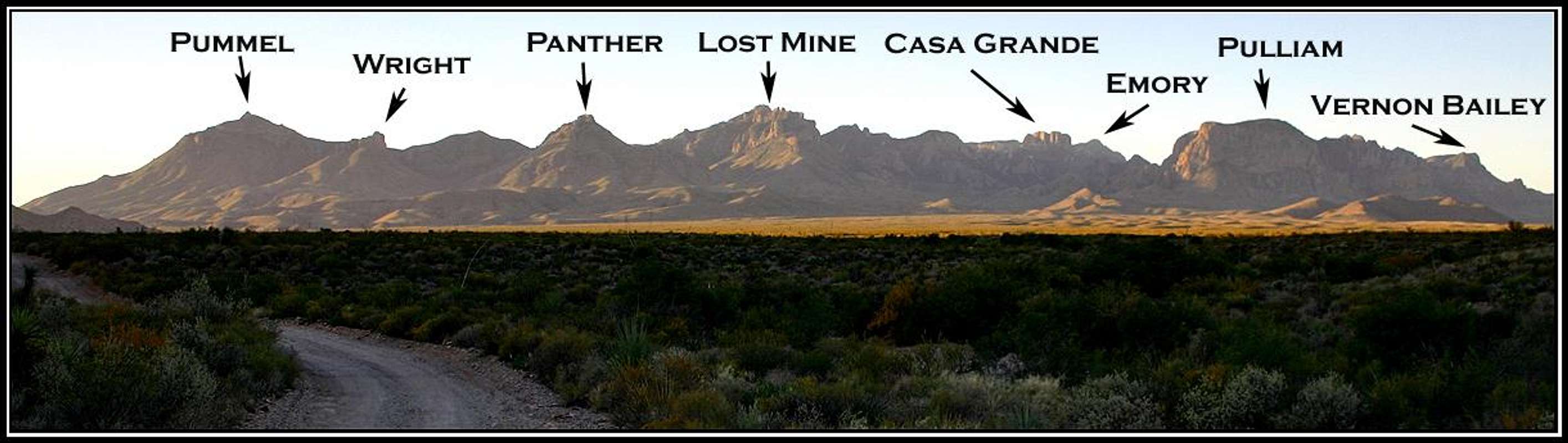
A panoramic of the Chisos Mtns from the Grapevine hills. November 27, 2005.
Photo by 01aCRViper
External Links
Big Bend National Park Official Site
Backcountry Information
Bicycling Big Bend
History and Culture of Big Bend
Big Bend National Park Chat and Message Board