
-
 130470 Hits
-
 96.01% Score
-
 57 Votes
|
|
Mountain/Rock |
|---|---|
|
|
48.16986°N / 121.68828°W |
|
|
Download GPX » View Route on Map |
|
|
Snohomish |
|
|
6870 ft / 2094 m |
|
|
Overview / Description
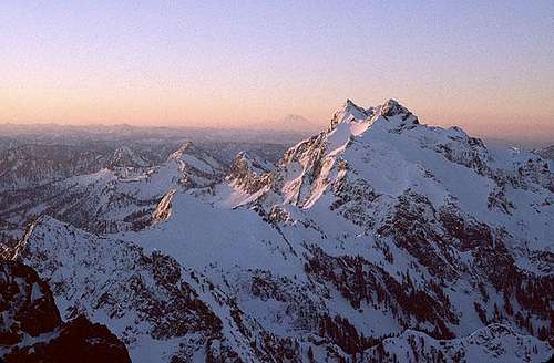
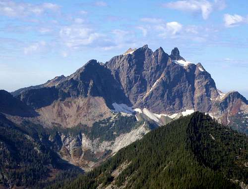 The East Face Of Three Fingers, October 2010
Three Fingers/Goat Flats/Saddle Lake Trail No. 641 Round Trip Distance: 16 miles Trailhead elevation: 3020 feet Summit elevation: 6,870 feet Cumulative Vertical Gain: 4,000+ feet Good Topographic Route Information The trail climbs gradually for 2.5 miles to Saddle Lake. There are plenty of mud and roots on this rut of a trail. There is evidence that earlier in the season, this part of the trail may actually be a small stream. Rumor has it that if you plan an earlier season trip, you should expect to get a little wet and mud-covered. There are quite a few minor ups and downs along the way. If the skies are clear, after a mile or so, you will catch the first really good view of Three Fingers off to your left. If your eyes are good (better than mine), you will be able to make out the white lookout house on the summit of the South finger.
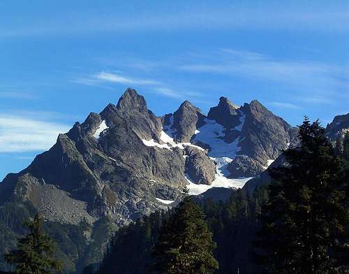 The West Face Of Three Fingers, October 2006
Right before the lake there is junction with Meadow Mountain Trail #715. Saddle Lake is not very big, but quite beautiful. Along the east side of the lake trail goes to the shelter build by Everett Mountaineers back in 1970s. No camping is allowed within 200 feet of the lake. No campfires are allowed anywhere between Saddle Lake and Three Fingers. From the northeast side of the lake trail continues on to Goat Flats (about 2.5 miles). Goat Flats is a wide open meadow that used to be heavily populated with mountain goats. In recent years, the majority of goats have been relocated but you still might see one if you're lucky. The great views back to the lowlands remain. You can see Mount Baker to the North and the back side of Whitehorse Mountain to the North-East. There is a junction where the left fork leads to campsites and backcountry toilet. This is an amazing place to stay the night and watch the cities light up. If 16 miles sounds like too much for one day, this might be a good spot to break it up some. Many people do it this way. Others choose to spend the night in the lookout. The right fork continues (about 2 miles) to Tin Can Gap. From here you can see what shape the Queest Alb Glacier is in. You can also decide if you should continue on. Normally, this is where the casual hiking ends. If yo wish to continue, expect some airy exposure, especially on the ladders. This is not for the faint of heart.
 The Lookout Hut Visible On The South Summit
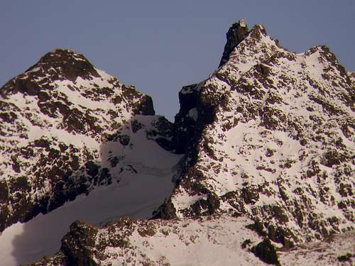
Conditions from here on up depend on the month, and especially the year. In late September of 1999 (after a record huge winter snow) the traverse was through moats, and up onto the glacier itself for an extended time. Short 45-degree slopes and crevasses were included. By contrast, in September 2005 the glacier was melted back quite a ways, with good paths to be found. During late october of 2006, after crossing two snow feilds and scrambing down a gully with an attached hemp rope, it was merely a walk up the entire way. If you want the easiest possible conditions, pick a time between mid-September and late October. The Queest Alb was suffering from the drought-like winters three of the past five years. Once off the possible glacier traverses, it's a nice hike up rock, heather and scree. You will round the mountain to the last large snowfield. This permanent snowfield is the best water on route. At the top of the snow triangle, a class 2 scramble takes you to the ladders.
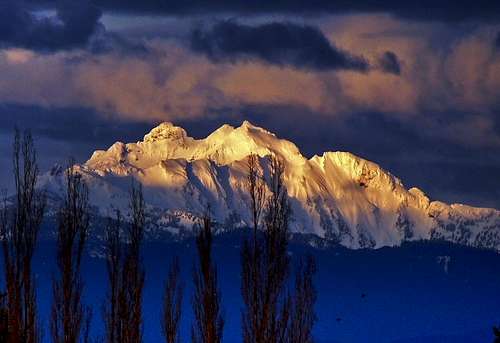 Three Fingers Seen From Lynnwood, March 2011
The ladders are solid, but being weathered some, they may leave you with some splinters. You might want to wear gloves. At the top of the rock face, The Everett Mountaineers leave a rope for the final pull to get to the lookout. Don't be dicouraged by how this sounds, this part is no more difficult than anything previous. Your success will grant you the reward of excellent 360-degree views. From the Cascades, the Olympics, and Puget Sound, and of course Mount Baker, Mount Rainier, and Glacier Peak. From this vantage point, you seem to be viewing the Cascade range from dead-center and the Puget Sound just spreads out before you. If you choose to spend the night up there, imagine waking to fog filled valleys. Be sure you are prepaired for sudden weather changes. Most parties take 10-12 hours for the roundtrip. This includes breaks, lunches, and trying to get the iron in the lookout to work. There is plenty to read, including old summit registers. Make sure that after you sign the current register, you put it back on the circular table in the middle. There is a resident Packrat named Andy who lives under the lookout and he likes to chew on things.
 Three Fingers seen from Whitehorse Mountain, January 1982
Lastly, please respect the old summit lookout house and all the objects therein. The National Forest service originally built it as a fire lookout and was going to burn it down to rid themselves of liability issues. But the Everett Mountaineers stood up and took the responsibilty of restoration and maintainence. They annually put a lot of time and effort into keeping it clean and safe so help them take care of it. If you don't mind extra weight and would like to help them carry up supplies, please contact them through their website. Many thanks to Arthur Wright and the many volunteers who completed the new roof project in September 2015. See their trip report here.
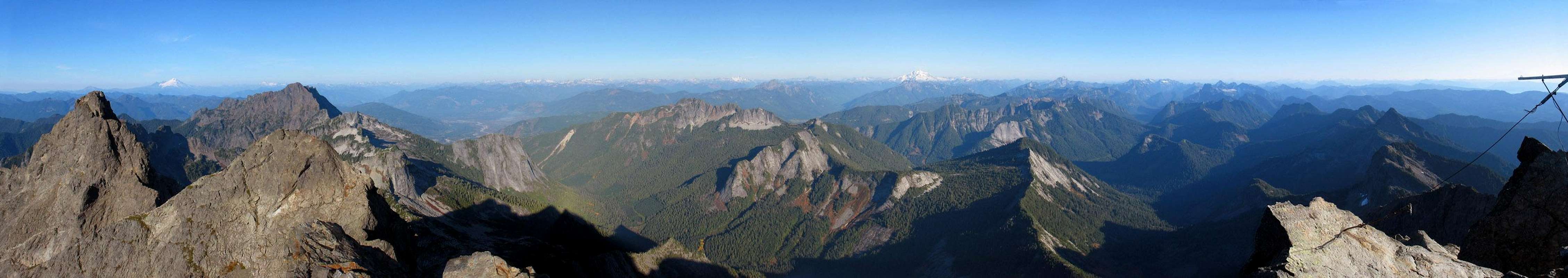
Route Map
Getting There
Drive the Mountain Loop Highway 6-1/2 miles east of Granite Falls and turn left (north) on Forest Service Road No. 41. 41 is not labelled out on the highway but you will see a sign about 50 yards down the road. At the junction where the pavement ends, keep left. Along the way you'll pass several obvious side roads and, at 17 miles from the Mountain Loop Highway, the road begins to peeter out and then it splits. If you see this, you've gone too far. Stop before the road peeters out and the trailhead is on the left. THIS ROAD MAY BE TEMPORARILY CLOSED DUE TO A RECENT WASHOUT Please check the current road conditions or bring a bicycle. "Gated at mile 8.6 just beyond the Canyon Creek bridge due to washouts, not expected to be repaired this year. Timber sale on private land at mile 1.7 may cause road to be closed between April and July. Reconstruction project between mile 3 - 8 will cause intermittent closures through summer."
Red Tape
A Northwest Forest pass required at trailhead. Depending on the season there might be an excessive amount of mosquitos of biting flies. Make sure you Bring lots of water or a purifier. Also, due to complaints about the aweful accumulation of bad smell at the lookout, the Everett Mountaineers have asked people to refrain from urinating or blue-bagging on the summit unless it is at night. During the day, they would kindly ask you to climb down the first latter and scramble to the right onto the ledge there.
When To Climb
July through October. But you will probably want technical glacier travel equipment if going before September. Access to the Mountain Loop highway is often difficult in the winter time, let alone getting to the trailhead that is 17 miles one way from the Mountain Loop Highway
 |
 |
 |
 |
 |
 |
Camping
Camping IS allowed along the trail. The first spot is at Saddle Lake elevation 3900 feet. On the approach you stay to the left instead of going around the lake to continue up the trail, so go right to go around the lake to the spots that are available for overnight camping. Goat Flats is the most popular spot to camp (elevation, 5200 feet), and takes about 2-3 hours to reach. There are lakes and tarns all over the place, but it can get crowded on the weekends. There is also one more spot that you can camp at which is located near Tin Pan Gap, where you access the Quest Alb Glacier, elevation 5600 feet. It is right on the saddle.
Mountain Conditions
Call the Darrington Ranger Station for current road information, 360-436-1155, but don't count on their knowledge of the route. I once asked them about it and they told me that the lookout was locked and the ladders were broken. The lady on the phone even said "trust me, you won't make it". I went up the next day to see for myself and found everything in perfect condition.
 |
 |
 |
 |
 |
External Links
- Tony's 2009 Trip Report Posted on NWHikers.net
- Wayne's 2009 Trip Report A north to south Three Finger Traverse
- Seattle Hiker's 2009 Trip Report on NWH Including many good photographs of the standard route
- Trip report of a 2007 winter ascent Possibly the first ascent of the North-East face
- Steph's Trip Report September 10 and 11, 2008
- Seattle P-I Newspaper article
- October 21,22, 2006 Trip Report A trip I did with Tom of NWHikers.net
- Read the story of a 2008 rescue of three boys
scot'teryx - Sep 11, 2001 12:36 am - Hasn't voted
Untitled CommentThey were successful, but they did not take the glacier route, they took a different route on rocks and stuff, and they were not rock climbers. I was really worried, but ignorance is bliss I guess? Even though many people stop at Tin Pan Gap where the glacier climbing starts, some people are just never satisfied
John - Sep 11, 2001 1:18 am - Hasn't voted
Untitled CommentWhile I agree that it's definately safer to bring mountaineering equipment, out of curiosity I found some route beta for the brave or foolhardy - those who end up here without an ice axe (and possibly crampons too - report doesn' t mention them):
John Guilford's September 23, 1989 Trip Report says:
The glacier under Tin Can Gap has some pretty good exposure. If you started sliding, and couldn't stop yourself, you'd go quite a ways before some crevasses stopped you. However, unlike my conclusion the last time I was here, you didn't really NEED an ice axe (although it was nice to have - I'm glad I brought mine). It turns out that you don't have to go very far across the gap (last time I thought you'd have to go a considerable distance across the glacier, all the time being exposed). At the gap itself, instead of the snow being corniced (as I imagined it might be), there is solid ground (and even the trail!) on the other side. You have to go maybe 20 feet over the top of the glacier, then you hop over the top onto the ground and continue along a trail on the "far side".
Also see Michael's September 3, 1998 Trip Report which is fairly detailed about his experience with an axe but no crampons.
scot'teryx - Sep 11, 2001 12:40 pm - Hasn't voted
Untitled CommentTo each their own I guess.
Better safe than sorry is what I always think.
Of course, I always use the same decision making process. If I question whether or not I should use the axe or crampons, I immediately use them. When there is exposure, I do not want to be a statistic. Up here in the Northwest there have been too many accidents altely. Just look at the news page on my web site (www.nwog.org), and see all the accidents that are happening. Of course you can never be prepared enough or experienced for the most common problem, whch is...."shit happens".
John - Sep 10, 2001 7:08 pm - Hasn't voted
Untitled Comment"I hate summiting something with glacier climbing equipment and then seeing someone else do it in sneakers and no axe or crampons."
Were the people in sneakers without axe and crampons successful in reaching the summit and getting down again? Did they have any accidents?
scot'teryx - Sep 11, 2001 12:36 am - Hasn't voted
Untitled CommentThey were successful, but they did not take the glacier route, they took a different route on rocks and stuff, and they were not rock climbers. I was really worried, but ignorance is bliss I guess? Even though many people stop at Tin Pan Gap where the glacier climbing starts, some people are just never satisfied
John - Sep 11, 2001 1:18 am - Hasn't voted
Untitled CommentWhile I agree that it's definately safer to bring mountaineering equipment, out of curiosity I found some route beta for the brave or foolhardy - those who end up here without an ice axe (and possibly crampons too - report doesn' t mention them):
John Guilford's September 23, 1989 Trip Report says:
The glacier under Tin Can Gap has some pretty good exposure. If you started sliding, and couldn't stop yourself, you'd go quite a ways before some crevasses stopped you. However, unlike my conclusion the last time I was here, you didn't really NEED an ice axe (although it was nice to have - I'm glad I brought mine). It turns out that you don't have to go very far across the gap (last time I thought you'd have to go a considerable distance across the glacier, all the time being exposed). At the gap itself, instead of the snow being corniced (as I imagined it might be), there is solid ground (and even the trail!) on the other side. You have to go maybe 20 feet over the top of the glacier, then you hop over the top onto the ground and continue along a trail on the "far side".
Also see Michael's September 3, 1998 Trip Report which is fairly detailed about his experience with an axe but no crampons.
scot'teryx - Sep 11, 2001 12:40 pm - Hasn't voted
Untitled CommentTo each their own I guess.
Better safe than sorry is what I always think.
Of course, I always use the same decision making process. If I question whether or not I should use the axe or crampons, I immediately use them. When there is exposure, I do not want to be a statistic. Up here in the Northwest there have been too many accidents altely. Just look at the news page on my web site (www.nwog.org), and see all the accidents that are happening. Of course you can never be prepared enough or experienced for the most common problem, whch is...."shit happens".
JohnGilbert - Aug 30, 2005 4:01 pm - Hasn't voted
Untitled CommentIt should be noted that in the late summer (end of September), the route to the summit can avoid all the step snow. It is then just a long hike.
At Tin Pan Gap the trail goes up and over the rock hump to the right. (Can't miss it).
Around the second bump the trail goes 200' down a dirty chute. It is fairly steep, so if there is hard snow, you might be able to avoid it by going down on the the glacier, (obvious when you get there). Some people have reported they climbed along the moat at the top of the glacier. Take the chute if at all possible.
From there, the trail is well stomped and/or marked with cairns.
Just before the top, there is a south facing snow/ice slope, (not part of the main glacier). This can be avoided by hugging the left (west) side. You probably have to step on snow at the very top of the slope, but it is flat.
The final section to the top is a cairn marked trail.
The last 30 feet are on ladders. Very cool. Not really any exposure to worry about.
lray - Jul 30, 2014 1:02 pm - Hasn't voted
Lookout open to stay in?Hello, We are traveling through the area and were hoping to bike/hike/climb up to the 3 Fingers Lookout on Friday, spend the night, and hike back out on Saturday. I'm hearing mixed reports about whether we can stay in the lookout tower. One Forest Service person answered the phone and gave us the thumbs up and encouraged us to go, on a 2nd call I made for clarification about parking our vehicle a different person answered and told us it's locked and we have no access and shouldn't go up there. I'm wondering if anyone knows of someone I can contact to get confirmation? Apparently someone does go up there and do a bit of maintenance and someone does open the lookout up each year? There was a recent article in Backpacker magazine that led me to believe it's accessible, though strenuous and relatively unmaintained, which we are fine with. We are aware that we need to mountain bike Rd. 41 in order to get to the trailhead. Any information you might have on whether it's worth making the effort to get up there would be really helpful! Thank you.
gimpilator - Jul 30, 2014 1:12 pm - Hasn't voted
Re: Lookout open to stay in?Good question. To the best of my knowledge, the lookout is never locked, but sometimes difficult to access because of snow on the route. The second time I went up there a forest service ranger had told me over the phone, "the lookout is locked, the ladders are broken, trust me, you won't make it". All untrue.
grahamj - Aug 19, 2014 1:45 pm - Hasn't voted
Re: Lookout open to stay in?Hi, Did you go to the lookout? Curious as to trail & snow conditions. Thanks!
gimpilator - Aug 19, 2014 2:16 pm - Hasn't voted
Re: Lookout open to stay in?Yes, I did, but the last time was in 2008. My friend Redwic went up recently though. I suggest asking him for more detail. Or you can check out his trip report.
ArthurW - Sep 16, 2014 9:13 pm - Voted 9/10
Current Info sourceWe posted updated information and info about our recent maintenance trip at: http://www.nwhikers.net/forums/viewtopic.php?t=8012739 Contact info is there for anyone wanting to help out. The lookout has a few urgent needs. Thanks
gimpilator - Sep 17, 2014 6:30 pm - Hasn't voted
Re: Current Info sourceI saw that report. Very cool! Thanks for posting the link. Hey, I don't know if you remember or not, but I ran into you once out by White Pass.