Sahale Mountain is one of the most popular climbs in the North Cascades National Park. It is located at the eastern edge of the north fork Cascade Valley located in the Boston Basin area near Marblemount. It is listed on the Washington Top 100 (rank 36). The word Sahale is a Native American word meaning "high place". It is debatable whether to call it Sahale Mountain or Sahale Peak. Climbers call it Sahale Peak, but USGS recognizes it as Sahale Mountain. The standard route has an elevation gain of 5,200 feet and a distance of 14 miles round trip. I consider this to be one of the most beautiful mountains I have ever climbed with incredible views of the heart of the North Cascades. Sahale Mountain is a fine alpine outing with an airy feel, moderate approach and an easy fourth class scramble to the summit. There are two standard routes to the summit. The most common of the two is the Cascade Pass/Sahale Arm route. The second route is via Boston Basin route which involves more glacier travel. If you climb Sahale, you may also consider climbing Boston Peak as well since it's summit is only a third of a mile away as the bird flies. But Boston is a bit more technical and is known for having loose rock. Climbing Sahale is very similar to the alps in terms of weather and the quality of alpine climbing. With peaks in the eight to nine thousand foot range does translate to wetter conditions and a shorter climbing season. Unless you are climbing in mid to late summer, it's not uncommon for the approach road to be covered over by avalanche snow deposit 5 or 10 miles before the trail head. From the Moraine of the Quien Sabe glacier you can see Sharkfin Tower (8,120 ft), Boston Peak (8,894 feet), Sahale Peak (8,680 ft), Forbidden Peak and the towering north face of Johannesburg (8,200 ft) Mountain with its hanging glaciers.
Sahale Mountain Panorama : From left to Right is Mount Torment, Forbidden Peak, Boston Peak, and Sahale Mountain
South Face
Summit via SW Ridge
Sahale with Doubtful Lake
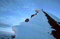
Sahale's Summit Block
Near the Summit
Routes
High up on Sahale
The West Ridge, June 2005
Cascade Pass/Sahale Glacier: This is the standard route up Sahale Mountain because it requires less glacier travel, goes though Cascade Pass, and has slightly less elevation gain than the Quien Sabe route. During the summer time it may be crowded because of both the popularity of Cascade Pass and the route itself. But it's not famous for nothing, on this route you see many glaciers, towering mountains and wildlife. There are around 35 short switchbacks to the pass. But after that it's pretty much straight up the ridge, across the glacier, and around the summit block to the summit. Boston Basin: From Marblemount, drive east on Cascade River road 21.7 miles to the fork. At 3200 feet, follow the abandoned Diamond Mine road for .75 miles and then follow the trail across 4 stream crossings over the next half mile. There are camping sites at a little over 5000 feet and 6000 feet with compost toilets. To get to the basin it is a 3 hour hike on a unmaintained climbers trail. Boston Basin is a very popular location for climbers because of its beautiful scenery and alpine grandeur. From the basin, ascend along the left (North) side of the Quien Sabe glacier until you reach the base of Sharkfin Tower between the summits of Sahale and Boston Peak. Traverse South along the base of the rock face until you reach the col. The glacier is steeper here and be sure to watch for crevasses. Traverse exposed snow to reach the loose class 3 summit scramble. Watch out for a cornice that lasts into early summer.
Getting There
Torment Peak Sunrise View
Easy Directions 122 Miles - 2 Hours & 53 MinutesFrom Seattle: Drive North on I-5 until you get to Arlington which you take a right at exit 208 onto highway 530. The highway briefly takes a left in down town Arlington onto highway 9 which a few seconds later be sure to turn right back onto highway 530 east to Darrington. At Darrington where the road pretty much ends you take a left onto highway 530 which goes north. In about 19 miles the highway ends, take a right onto highway 20 towards Marblemount. In about 7.5 you arrive at the city of Marblemount. After passing a few gas stations the highway curves, be sure to go strait which goes onto the Cascade River Road. This road takes you all the way to the trailhead of Sahale (Cascade Pass trailhead) which is at Mile Marker 23. Keep in mind that after mile marker 10 the road becomes gravel and washes out almost every year at some point. The last 2 miles are paved but is a little steep. The trailhead itself has a nice oval shaped parking lot with a bathroom. Easy Directions 69 Miles - 1 Hour & 57 MinutesFrom Mount Vernon: Depending on where your at if your taking I-5 be sure to take exit 230 east onto highway 20 (North Cascades Highway). Drive along Highway 20 to Marblemount (45 miles). From Marblemount drive strait which crosses a bridge and the road goes about 23 miles down the Cascade River Road. Park at the Cascade Pass trailhead which is right in front of Johannesburg. The views from the trailhead alone are quite impressive with Johannesburg looming over the valley as well as seeing many other impressive peaks like Eldorado, The Triad, Mixup Peak, and Mount Torment.
Biking to the Trailhead
Eldorado Peak on the Way
Alpenglow on Mount Torment
Fresh Snow on the Triplets
Cascade Peak Sunrise
Johannesburg with Clouds
Cascade Peak Above
Sahale from down Below
Eldorado Peak and the Triad from The Parking Lot
Standard Route
Approach - The Hike Up to Cascade Pass The trip begins on a nice and easy trail up to Cascade Pass which is 3.7 miles (5,400 feet). On the way up there are clearings through the trees which offer views of the Cascade Valley, the Triplets, and of Mixup Peak. Once your out of the woods the switch backs eventually stop and you traverse the bottom edge of Sahale Arm until you get to Cascade Pass. Be warned, when avalanche danger is high this is not the place to be hanging out. At the Pass you are rewarded with great views of Magic Mountain, Mix Up Peak, and the Stehekin valley.
Cascade Pass from Below
View near the Pass
Magic Mountain
Hiking near Cascade Pass
Johannesburg Mountain Through the Trees
Cascade Pass and Cascade Peak
The Hike up Sahale Arm From here go left (North) up the Sahale Arm trail which switch backs up the edge of Sahale Arm. Once the switch backs are over the rest of the travel to the Sahale Glacier is a nice ridge walk. The views get even better and better as you advance towards the upper part of the Sahale Glacier, big time peaks like Bonanza, Formidable, Glacier Peak, Eldorado, Boston, and many more come into view.
Looking Down Sahale Arm
Cascade Valley With Beams of Light
To the Summit
One of the Many Crevasses
Michael on the Edge of the Glacier
At the top of the Sahale Arm the trail disappears. The route goes onto the Sahale Glacier towards its center depending on conditions. Although few actually do rope up, it is still a good idea considering that crevasses do form in later season and I've traveled over a hidden one on this route. As your nearing the top of the glacier be sure to head to the right, exit the glacier, and then aim for the right side of the summit block. The route corkscrews around the summit from the south, to the east side, and at the very end onto it's north side for the last section. The scramble is class 3+ although some might argue class 4. There are some loose rocks in places with a bit of exposure, but for most mountaineers this is no problem. In early season this section can be dangerous due to steep and potentially loose snow. After mid July this section should be in good condition.
Scrambling near the Summit
Go right of This
Final Scramble Section
Looking Down Below
Almost there
Descending near the Upper Glacier
Sinister, Dome, and Spider Mountain
Rappeling off the South Side of Sahale
Also be sure to be careful on the descent from this route, one of my friends climbing partners got injured on Sahale Arm. For those who brought a rope, don't worry there are multiple rappel loops at the summit.
The View from The Summit looking North
Bonus - Boston Peak
For those wanting a bit more adventure, consider climbing Boston Peak as well. Adding this to the trip requires Sahale and Boston to be a full day or for slower folks a 2 day trip. Boston has a reputation for being loose and scary but it's not as bad as what some have made it out to be. The crux of the climb is class 4 but most of it is only class 3 on the East Face. The traverse over is pretty straight forward which follows the ridge. The rappels off the summit block are very good and bring you right down to the Boston Glacier.
Views to the North
Quien Sabe Below
On the Traverse
Ripsaw Ridge with Buckner
Boston Peak's South Face
Red Tape
Filtering Water on Sahale Arm
Making Good Time
Early Start near Summit
Gloomy Atmosphere
Water Sources: There is at least one tarn on the way up Sahale Arm, which you should definitely filter this water. On the way to Cascade Pass there are a few small creeks. If your willing to extend your trip, Doubtful Lake is another good source for water. Also if your lucky there may we water melting off of the Sahale Glacier near the bottom. And of course the remaining snow on the mountain. The Marblemount visitor center can be reached at 206-386-4495 ext.11. A permit is not required for single day ascents. Also a Northwest Forest Pass is not required for Sahale Mountain.
Other Regulations:
Pets are not allowed because Sahale is in the National Park.
Time it Takes: This peak is usually climbed in a full day, but for those who want to have a more alpine experience I personally like spending 2 days here. With a place as beautiful as this one why would you want to leave in such a hurry? Anyways, on average it takes climbers 8-12 hours round trip. Ideally you want to start hiking by 6-7 a.m. but later is fine but results in softer snow and more crevasse danger above.
Camping
Camping on Sahale
Camping on Rock
For overnight Camping you need a Back Country Permit which are free of cost, but is based on a first come first serve bases and may run out. One can be obtained though most of the ranger stations in the North Cascades, the most common place to obtain one is in Marblemount. There is no camping at Cascade Pass because the National Park Service is trying to restore its fragile vegetation. The best camping place on the standard route is near the Sahale Glacier which is about 5.7 miles in (7,600 feet high). There are also some camp grounds along the Cascade River Road which the closest one is Johannesburg camp near the trailhead. For those going up the Quien Sabe route (Boston Basin) there is camping in the basin itself. Pelton Basin is another option which is .5 miles from Cascade Pass but unfortunately goes down hill and is out of the way.
When To Climb
Fresh Snow on the Ridge
Road Closure
September Glacier Conditions
Sahale Arm during July
This peak is best done June though September. During the early season you have both avalanche danger and a longer approach to get to the mountain due to the road being snow covered. The snow pack plays a big roll in when the road is opened, it usually ranges from April to June. When ever it's gated off in early season its often closed at mile marker 20 which is 3 miles from the trailhead. If the snow pack is mild, you may consider bringing a bike for the way down. June: Sahale is usually mostly snow covered with potential avalanche danger and cornices near the summit. Also the weather can be questionable depending on the year. But at least it is more scenic than in the later part of summer. July: Late July is perhaps the best time to climb Sahale, although unfortunately that means crowds as well. The summit block still might be snow covered so don't be surprised if it is. August: The best weather month for the North Cascades where most of the days see sunshine with a nice and dry trail. Crevasses on the glacier start to open but with a dry summit block. September: Early to mid September is usually completely dry aside from the glacier. The glacier at this time of year may have massive crevasses that split across making a bit of navigation though the crevasse field. You may also have to go over a snow bridge or two during this time of year. If there is fresh snow, be very careful!
Mountain Conditions
Rim Ice near the Summit
Crevasse on Quien Sabe
For Weather Conditions check the Noaa Forecast for more info. If your heading up in Early Season be sure to check the Avalanche Forecast. Perhaps the most dangerous slopes when it comes to avalanche danger on the mountain are before Cascade Pass and near the summit. For road Conditions check in with National Park Service Website and scroll to where it says "Cascade River Road". For up to date trail conditions for Cascade Pass/ Sahale Arm see NPS trail conditions and scroll down to "Cascade Pass / Sahale Arm / Horseshoe Basin".
Gear for the Climb
Rope up for the Glaciers
Fuel up for the Climb
Ice Axe, Helmet, and Harness
Know your Limits
Using a Trekking Poll
This route is not very technical although I would recommend bringing basic mountaineering gear as well as glacier gear. A good majority of people who go up this route do it unroped, but don't be fooled this is still a glacier and certainly has crevasses on the route. You might consider bringing a small rack of nuts and a few slings for the last few hundred feet of the climb (for those not comfortable on class 4). I've made the mistake of going up this route when snow conditions were sloppy and ditched the rope a few hundred feet from the summit, which became the most scariest trip I have ever been on. Every step of the way was loose, and there are cliffs below the summit. But when dry or with solid snow I'm sure is much friendlier.
Mandatory Gear for the Climb
Ice Axe
Crampons
Glacier Rope
Helmet
Glacier Travel Gear (pickets, webbing, pulleys, and prusiks)
Shell Jacket
2-3 Liters of Water Per Person
First Aid Kit
Glacier Glasses/Goggles
Full Scale Mountaineering Boots
Plenty of Food
Recommended Extras:
Nylon Shell Pants
Sun Screen
Map and Compass
Long and Short Sleeve Shirt
Camera
History
Sahale Mountain was first climbed August of 1897 by John Charlton and Albert H. Sylvester. More History Coming later...
Topographic Maps
Downloadable Topographic Map of Route up Sahale
Wildlife on Sahale
While Sahale is a rugged mountain, on occasion you may see Marmots, Mountain Goats, Ptarmigans, Pikas, Deer, and possibly a bear. There is also wild flowers as well.
Children refers to the set of objects that logically fall under a given object. For example, the
Aconcagua mountain page is a child of the 'Aconcagua Group' and the 'Seven Summits.' The
Aconcagua mountain itself has many routes, photos, and trip reports as children.
Parents refers to a larger category under which an object falls. For example, theAconcagua mountain page has the 'Aconcagua Group' and the 'Seven Summits' asparents and is a parent itself to many routes, photos, and Trip Reports.

 166239 Hits
 97.08% Score
 65 Votes
 Sahale's Northern Ridge
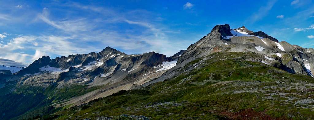 Sahale Mountain Panorama : From left to Right is Mount Torment, Forbidden Peak, Boston Peak, and Sahale Mountain
 South Face
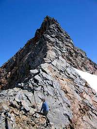 Summit via SW Ridge
 Sahale with Doubtful Lake
 Sahale's Summit Block
 Near the Summit
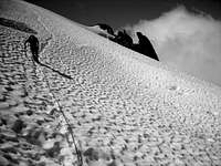 High up on Sahale
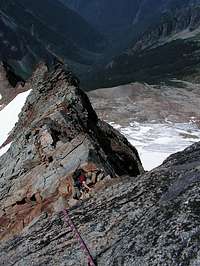 The West Ridge, June 2005
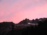 Torment Peak Sunrise View
 Biking to the Trailhead
 Eldorado Peak on the Way
 Alpenglow on Mount Torment
 Fresh Snow on the Triplets
 Cascade Peak Sunrise
 Johannesburg with Clouds
 Cascade Peak Above
 Sahale from down Below
 Eldorado Peak and the Triad from The Parking Lot
 Cascade Pass from Below
 View near the Pass
 Magic Mountain
 Hiking near Cascade Pass
 Johannesburg Mountain Through the Trees
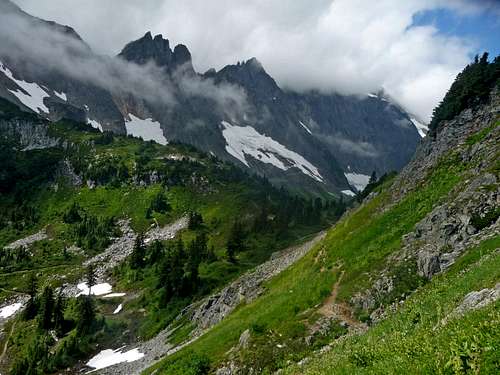 Cascade Pass and Cascade Peak
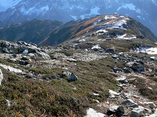 Looking Down Sahale Arm
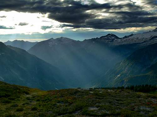 Cascade Valley With Beams of Light
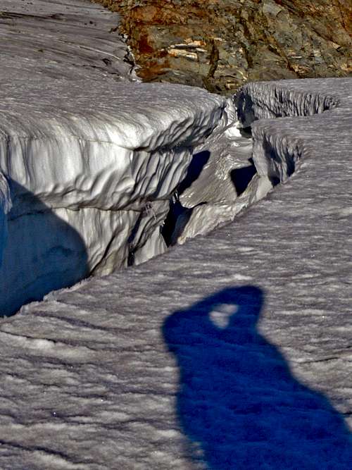 One of the Many Crevasses
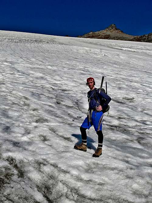 Michael on the Edge of the Glacier
 Scrambling near the Summit
 Go right of This
 Final Scramble Section
 Looking Down Below
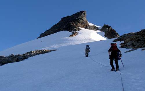 Almost there
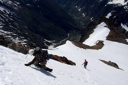 Descending near the Upper Glacier
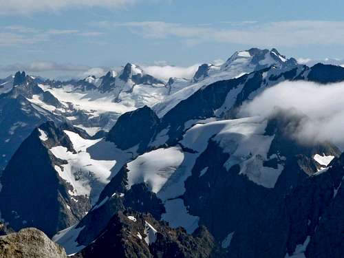 Sinister, Dome, and Spider Mountain
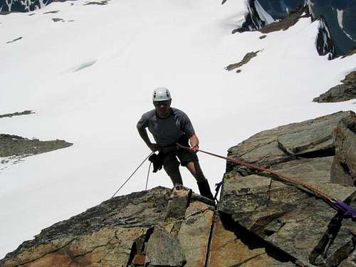 Rappeling off the South Side of Sahale
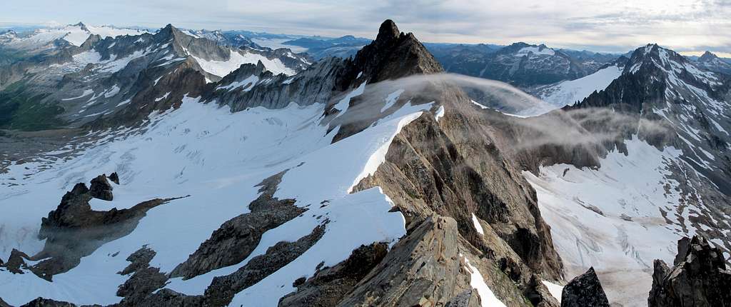 The View from The Summit looking North
 Views to the North
 Quien Sabe Below
 On the Traverse
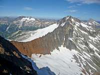 Ripsaw Ridge with Buckner
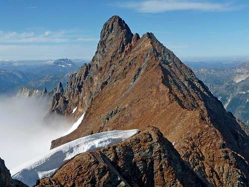 Boston Peak's South Face
 Filtering Water on Sahale Arm
 Making Good Time
 Early Start near Summit
 Gloomy Atmosphere
 Camping on Sahale
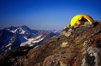 Camping on Rock
 Fresh Snow on the Ridge
 Road Closure
 September Glacier Conditions
 Sahale Arm during July
 Rim Ice near the Summit
 Crevasse on Quien Sabe
 Rope up for the Glaciers
 Fuel up for the Climb
 Ice Axe, Helmet, and Harness
 Know your Limits
 Using a Trekking Poll
 Downloadable Topographic Map of Route up Sahale
 Flowers near Cascade Pass
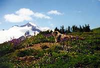 Marmot with Eldorado Peak
 Paint Brush Flowers
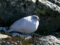 Ptarmigan
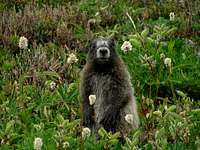 Hoary Marmot
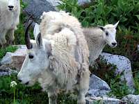 Family of Goats
 Marmot
 Bird Flying Over
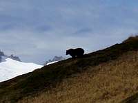 Bear on Sahale Arm
 Ice Crystals on the Plants
 Purple Flower
 Ash Berries
 Bees and Flowers with the Cascade Valley
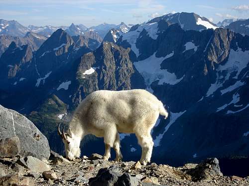 Mountain Goat on the Sahale Arm
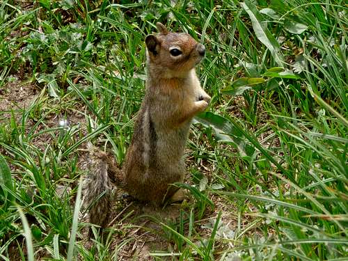 Cute Ground Squirrel at Cascade Pass
 Alpenglow on Sahale
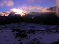 Sunrise from the East
 A Beautiful Sunset
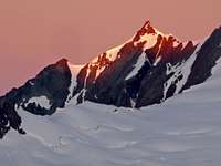 Sunrise from Logan
 Alpenglow from Eldorado
 Sunset from Sahale Camp
 Hidden Lake Peaks Sunset
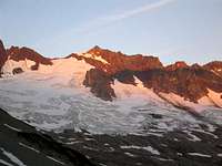 Quien Sabe Glacier
 Hidden Lake Peaks
 South Face Alpenglow
 Views to the Southeast
 Booker Mountain Sunset
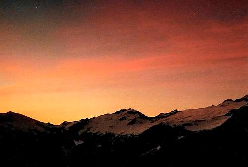 Sunset over the Cascade Valley
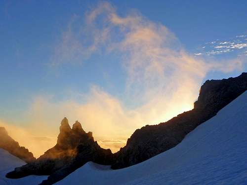 Swirling Clouds during Sunset
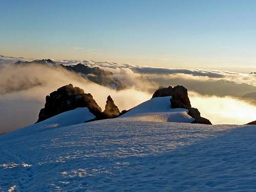 Above the Sun Lit Clouds
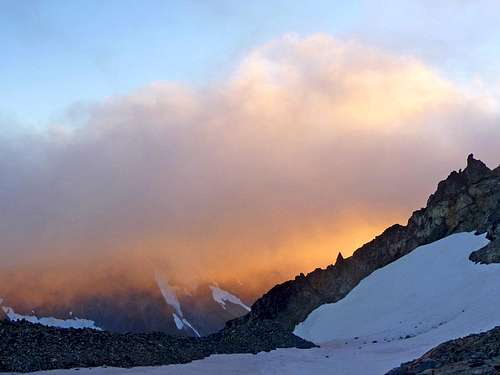 Sunset Underglow from the Glacier
 Waterfalls in Boston Basin
 Buckner Covered in Snow
 Mount Logan's West Face
 Black Peak in the Distance
 Mount Goode
 Boston Peak's Summit Block
 The Triplets
 Buckner from Sahale Arm
 Rime Ice on Boston's Spire
 Fresh Snow on Cascade Peak
 Mixup Peak Clearing Up
 Looking South East
 View to the South
 Storm over the Triad
 Hidden Lake Peaks
 Sharkfin Tower
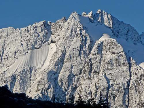 Johannesburg Covered in Fresh Snow
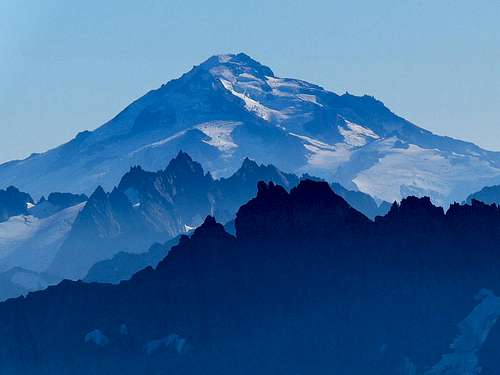 Glacier Peak with a Blue Haze