

-
 177025 Hits
-
 97.62% Score
-
 71 Votes
|
|
Mountain/Rock |
|---|---|
|
|
39.58860°N / 105.6428°W |
|
|
14264 ft / 4348 m |
|
|
Overview
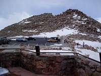
Towering over the Denver skyline, Mt Evans is a very popular mountain for hikers and climbers due to being the closest 14er to Denver. Highway 5 is a popular road to the top of the mountain, which rates as the highest paved road in the United States. During the summer, the summit is full of tourists who drive all the way to the summit. The road is closed in the winter.
There are routes up Mt Evans rated Class 1,2 3, and 4. This peak is often climbed in conjunction with Mt Bierstadt by crossing the classic "Sawtooth" route. The Mount Evans massif is considerably large, sporting numerous sub-summits worthy of their own outings. The sheer bulk of the range is known for creating its own weather, often violent, which marches toward Denver and the eastern plains beyond daily during the summer.
There are numerous trialheads including Echo Lake, Summit Lake, West Chicago Creek, Guanella Pass, Bear Creek, Deer Creek, Cub Creek and Scott Gomer Creek, which all access the Mount Evans Wilderness. Easy access from Highway 5 allows for wonderful short day hike access into the wilderness, but be sure to read the RED TAPE section below to fully understand the controversial and illegal access conditions currently imposed by the Forest Service. Mount Evans is a mountain in trouble.
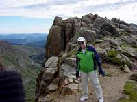
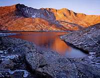
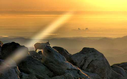 A Solitary Existence on Mount Evans is shared with the distant Denver skyline. A Solitary Existence on Mount Evans is shared with the distant Denver skyline.
Photo by SP member Brendon |
|---|
Getting There
HIGHWAY 5
The shortest, easiest route is to just go up the paved road... but what fun is that? From Denver go west to Idaho Springs (exit 240 ) then south on Highway 103 for 13.4 miles for the Echo Lake trailhead. Parking is available at the junction with Hwy 5 (Mount Evans Road). If you continue south on Hwy 5 from Echo Lake for 9.1 miles you will reach the Summit Lake Trailhead. As of May 2004 there is a $10 fee for driving up Hwy 5 or you can get a season pass. See RED TAPE section below for more important details.
Trails and mountains accessed from the highway are: Goliath Peak, Rogers Peak, Mount Warren, Mount Spaulding, Mount Evans, Mount Bierstadt, Epaulet Mountain and Rosalie Peak. The East Face trail from the highway to the summit is accessed approximately 3/4 of a mile from Summit Lake. At the third switchback from Summit Lake just past Mile Marker 11 is a trail accessing Abyss Lake drainage and a climb of Mount Bierstadt.
GETTING TO THE OTHER TRAILHEADS
WEST CHICAGO GREEK
This trailhead provides access to the northern end of the Mount Evans Massif and wilderness, including Sugarloaf and Gray Wolf Peaks. Proceed from Idaho Springs on Highway 103, exiting the road at the first switchback. Drive a county maintained dirt road to its terminus and the trailhead.
ECHO LAKE
Provides direct access to the Chicago Lakes drainage and the Mount Evans Wilderness. Take Highway 103 to Echo Lake. The trailhead is located at the southwest end of the lake. Accesses climbs of Mounts Warren and Evans and Rogers Peak.
BEAR CREEK
From Evergreen Lake, just west of Evergreen, take the Bear Creek road due west. Once through Bendemeer Valley at roughly 6.5 miles, stay right. At approximate 1.5 miles further, stay left. At approximately 1.7 miles, stay right. At 4.3 miles or so, arrive at the Camp Rock Campground and the trailhead accessing Beaver Meadows, Mount Evans Shelter House, Lincoln Lake, Bear Track Lakes and general eastern destinations within the Mount Evans Wilderness. This area is also popular with campers, casual hikers, hunters and fishermen.
CUB CREEK TRAIL
From the main intersection in Evergreen, head south on Jefferson County Road 73 for 1 mile. Turn right on Brook Forrest Road and drive for approximately 5.7 miles. Turn right at the Cub Creek Trail sign, making another quick right and drive to the large, loop parking trail head. This trail is popular with casual hikers as well as those accessing the Mount Evans Wilderness. Several miles up the trail, solitude will greet you. Accesses Shadow Mountain, Meridian Hill, Mount Rosedale, Beartrack Lakes and ultimately Rosalie Peak and southern summits of the Mount Evans massif.
DEER CREEK TRAIL
From Highway 285, take county road 43 due north, past Deer Creek school and the neighborhood of Highland Park approximately 9 miles to the trail head. Accesses Mount Logan, Bandit Peak, Rosalie Peak, Mount Rosedale via a network of well designed and used trails.
SCOTT GOMER CREEK TRAIL
From Highway 285 at the town of Grant, take the Guanella Pass Road approximately 5.2 miles. Just as the road enters the flat Geneva Valley, a pullout on the right is the location of the Scott Gomer Creek trail head. This is a popular trail, although the further up you go, the more solitude you will achieve. Accesses the Abyss Lake area (nice camping) in addition to the higher peaks of the Mount Evans massif, including Mount Bierstadt, the Sawtooth, Kataka Mountain, Rosalie Peak, Epaulet Mountain and Mount Evans.
GUANELLA PASS
From Highway 285 at the town of Grant, take the Guanella Pass Road to near the top of the pass. Guanella Pass can also be accessed from the north via Georgetown (Exit 228 on I-70). Follow the Scenic Byway signs. It is 10 miles to the top of the pass. This is an extremely crowded trail head accessing popular 14er climbs of Evans and Bierstadt, as well as points west such as Square Top, Mount Wilcox and Argentine Peak. Expect crowded conditions and limited parking during the high traffic warm seasons.

RED TAPE: A MOUNTAIN NO LONGER IN TROUBLE
The fee at Mount Evans has been overturned. Due to a judgement concerning a similar situation at Mount Lemmon, near Tuscon Arizona, the Arapaho National Forest can longer charge a fee unless visitors intend to utilize the facilities at the Dos Chappel Vistor Center or the summit of the mountain, Faciilties at Summit Lake are owned by the City of Denver, which at the time of this writing were not charging a use fee and wisely so, since they do not charge fees at any other Denver Park.
The Arapaho National Forest currently charges a $10 amenity fee to visit Mount Evans. If you intend on using any of the afformentioned amenities, you should drive through the RIGHT LANES to either ranger entrance kiosk and pay the fee. Otherwise, you are free to drive through the entrance station on the LEFT and proceed to your destination. You may park at any pull-out to access the Mount Evans wilderness area. The fee covers the use of amenities.
Highway 5 is not owned or maintained by the Forest Service, but by the Colorado Department of transportation. None of your fee goes toward maintenance of the road.
Fees continue to be a hot topic across the nation throughout the forest system. DO NOT PAY A FEE if you are simply accessing the wilderness, especially if no amenities are in place. You are permitted to Park to access ANY wilderness. If any ranger or concessionaire attendant argues otherwise, you may accept their "notice of required fee" and take it with you. You are not required to pay the fee. If you do not feel like a confrontation, you can pay the fee and demand a refund later from the concessionaire. Be sure to cite FLREA rules, and that they are in violation of the rules. You'll get your money back. They don't want a fuss, because they know they're wrong. They're counting on your ignorance for their income. The Forest Service has not successfully charged anyone, or collected a fee from anyone refusing to pay, because it's too much of a hassle and costly to pursue you for five or ten bucks.
REMEMBER: It is illegal to collect fees from people simply accessing a wilderness area. Numerous civil lawsuits across the nation are pending on the matter.
MORE INFORMATION: Western Slope No-Fee Coalition at westernslope.org
-Aaron Johnson
Permit Requirement
Several Colorado wilderness areas now require a free user permit to be in the wilderness, or shortly will require same. The wilderness areas are Holy Cross, Maroon Bells/Snowmass, Mount Evans, and Mount Massive. Permit tags are available at trailheads and are a two part tag. The white part goes in the box provided and the card portion is to be attached to the outside of your pack. There is currently no penalty if one does not have a permit. However, large fines could be levied within a few years for non-compliance. The preferred method now for dealing with violations is education of the users.
The reason for implementation of this required permit is the Forest Service has been unable to obtain accurate data on use patterns from the voluntary sign-in system. The estimated compliance range is currently 10-30%.
The hope is to obtain better data with this new method. While some may feel this is a precursor of some kind of quota system, the opposite is actually true. Accurate information on visitor use patterns will allow the Forest Service to attempt to evenly distribute impacts and encourage use of alternate trailheads for the same destinations. However, given the magnitude of the state's continuing population boom, folks should not be surprised if quotas in certain areas become a necessity.
Thanks to SP member mtnhiker13 for supplying this vital update via the Colorado Mountain Club's email service.
Specific information can be viewed here
Routes Overview
FROM SUMMIT LAKE
The shortest hiking route is really more of an outing than a climb. Starting at the Summit Lake Trailhead to the summit is only 2 miles and a gain of elevation of only 1420 feet. It is class 2.


MOUNT EVANS LOOP
A nice 4 mile outing rounding the top of Mount Spaulding, with an optional side trip to the Sawtooth before summiting Mount Evans and descending back to Summit Lake and your starting point. See the route description by clicking on the link in the ROUTES section (left hand column). This one is good for high altitude training.


FROM ECHO LAKE
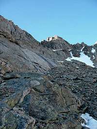
A common route for mountaineers is from the Echo Creek Trailhead. This hike is 14 miles and gains 4600 feet. It is class 2. This is called the Chicago Creek Route. The trail starts near the slight ridge SW of Echo Lake. Follow the trail to to west side of the ridge, descend and switchback to Chicago Creek. Cross the creek on the log bridge, then up the dirt road to the resevoir. Continue on the road to enter the Mount Evans Wilderness, then stay on the trail to the southernmost Chicago Lake. From here, locate a newly constructed trail for an easy climb out of the area on the west slope of Mt Warren. Pass Summit Lake and then climb up to the summit via any number of route choices.


FROM GUANELLA PASS
EVANS DIRECT FROM GUANELLA PASS
If you are going to climb Mt Evans only, start out on the Bierstadt trail. Stay on the trail until it starts to rise and head back to the right. Try to find a clearing in this area and work your way through the willows- keeping the big stand of trees to your right, and the creek to your left. As you work your way around the stand of trees on the right, you will see a gully heading up to a saddle at the left end of the sawtooth ridge. It is somewhat steep in parts, with loose scree, but it is a nice shortcut to get you to Mt Evans ridge. Take this gully up. As you reach the top Mt Spalding will be on your left, the sawtooth will be coming from the right, and the Mt Evans ridge will be slightly to your right. The ridge route is well marked with cairns, wooden stakes and yellow and red "brushes." Follow the trail to the summit and shake hands with a tourist that drove to the top and climbed the last 100 feet.


FOURTEENERS VIA THE SAWTOOTH
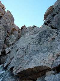
If you want to do Bierstadt and Evans both and do the classic Sawtooth, the recommended trailhead is from Guanella Pass. The Sawtooth is not as dangerous as it appears, but it is recommended to do it in dry conditions. There is some Class 3 scrambling going across the Sawtooth, but for the most part the route is well cairned. Once across the Sawtooth hike east 1/2 mile to the beginning of Evans west ridge. Take the ridge .7 mile to the summit.

WEST CHICAGO CREEK
A long and intricate affair, but solitude is guaranteed. Climb from Hell's Hole area over the bulk of Gray Wolf to Spaulding, the Sawtooth or Evans. This route is not recommended as a climb for Mount Bierstadt. Accesses popular Sugarloaf Peak as well.


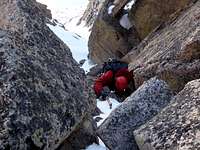
SNAVE II
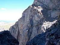
Snave II is a steep snow climbing route approached from Summit Lake that climbs to the summit of Evans up the steep granite north face. Ice axe, helmet and crampons are required, and in most cases for a team a rope should be utilized as well. Class 4 scrambling should be expected, and in dry conditions, Class 5. This is one of the more rewarding and challenging routes on Mount Evans.
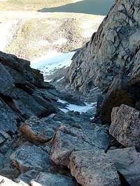
CRYSTAL
Crystal is a steep snow and ice climb rated Class 3, executed from Summit Lake to the summit of Mount Evans. Ice axe, helmet and crampons are required, ice tools may be needed later in the year. This route is sometimes utilized as a descent option from the Evans summit ridge. Do not descend this route without the required gear and skills necessary to do so safely.


NORTH FACE DIRECT
This is a snow climb, described here on SP (see description at upper left hand corner link on this page under ROUTES) as executed from Echo Lake, making for an extended day outing. The trip can be shortened by cutting the route in half and climbing from Summit Lake. Ice axe, helmet and crampons are required, along with lots of time and stamina if climbing from Echo Lake. People use this as a ski route, which can facilitate a quick descent.
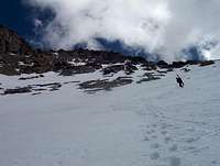
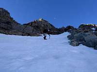

When To Climb
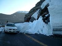
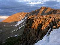
Peak season is June through September. The road closes with the first major snow of winter. This mountain is very popular, so try to climb during the week if possible. Mount Evans is noted for its dramatic weather and afternoon storms are quite common. Climb early in the day and be off the summit by noon. The exposed Mount Evans area above timberline is vast and there is no shelter from a serious storm.
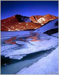
 Winter Conditions at Any Time Winter Conditions at Any Time |
 Ice Climbing the Snave Ice Climbing the Snave |
 High Winds Are Common High Winds Are Common |
 Family Friendly on Nice Days! Family Friendly on Nice Days! |
|---|
Camping
Phone 877-444-6777 for camping reservations.
Echo Lake Campground:
(This campground is located near the entrance to Mount Evans. There is no camping along the road to the top of the mountain.)
Sites: 18
Elevation: 10,600 feet
Max Vehicle Length 20 feet
Daily Fee: $10.00
Location: 14 miles south of Idaho Springs at the intersection of Hwy 103 and Hwy 5.
West Chicago Creek Campground:
Sites: 18
Elevation: 9,600 feet
Max Vehicle Length 30 feet
Daily Fee: $10.00
Location: 7 miles south of Idaho Springs on Hwy 103 then 3 miles off of Hwy 103 on Forest Road 188.
Guanella Pass Campground:
Sites: 18
Elevation: 10,900 feet
Max Vehicle Length 35 feet
Daily Fee: $11.00
Location: 9 miles south of Georgetown on Guanella Pass Road.
Cold Springs Campground:
Sites: 38
Elevation: 9,200 feet
Max Vehicle Length 50 feet
Daily Fee: $11.00
Location: 5 Miles north of Central City-Blackhawk on Hwy 119.
Columbine Campground:
Sites: 47
Elevation: 9,200 feet
Max Vehicle Length 20 feet
Daily Fee: $10.00
Location: 2.5 miles Northwest of Central City via Gilpin County Road 3 on Forest Road 176. To access, run left off the Hwy 119 and go through Central City on Hwy 279. At the top, near the cemetery, follow the signs to the campground.
Pickle Gulch Campground:
Sites: 6 Group Sites
Location: 4 miles north of Blackhawk just off Hwy 119. This is a nice campground for groups.
Mizpah Campground:
Sites: 10
Elevation: 9,200 feet
Max Vehicle Length 20 feet
Daily Fee: $10.00
Location: 5.5 miles west of Empire on US 40.
Clear Lake Campground:
Sites: 8
Elevation: 10,000 feet
Max Vehicle Length 15 feet
Daily Fee: $9.00
Location: 4 miles south of Georgetown on Guanella Pass Road.
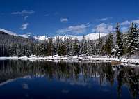
Mountain Conditions
NOAA FORECAST FOR MOUNT EVANS
The website 14ers.com is good for updating weather conditions. You can also call CAIC at 303-275-5360.
Also see this personal account of a lightning strike by Nelson- It will make you really think about lightning safety Struck By Lightning!
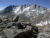
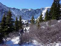
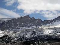
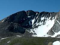
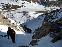
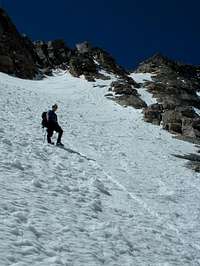
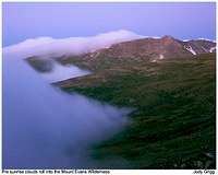
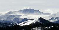
Mount Evans is a huge granite uplift, large enough to create its own weather, which can often be violent during the summer months. Go prepared for anything when climbing anywhere on the Mount Evans massif. Below are photos illustrating the varied less-than-ideal conditions that Mount Evans is known for.


Maps and Contacts
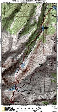
Maps:
USGS Quad: Mount Evans
Trails Illustrated® - TOPO Map # 104
Contact:
US Forest Service, Clear Creek Ranger District 303-567-3000.
Conditioning the Critters on Mount Evans
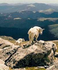
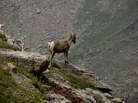
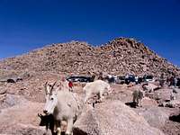
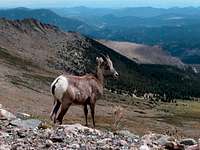
The unfortunate reality of having a highway to the top of Mount Evans is that the wildlife that calls the mountain home has been desensitized and conditioned by the ever present influence of mankind. As a result, the animals on the mountain that routinely come in contact with humans are now so used to this influence in their lives that they know no fear, and often depend on their daily intake of food to be literally handed to them.
Casual visitors to Mount Evans usually do not know any better, as they are not aware of the ramifications this situation has caused. Unlike those that actually climb Mount Evans, they do not have an awareness or knowledge of how damaging this situation can be to the denizens of the mountains. As stewards of Colorado's wilderness, mountain climbers should do what they can to get the message out about how the mountain's natural residents should be treated.
The animals are looking for hand outs and have been conditioned to perform accordingly. Goats and bighorn sheep have no reservations about walking up to a slow moving car to receive a tasty morsel. Please do your part and do not tempt the animals, and when possible, set an example for people that may be observing your actions. The animals are also after salt, from road treatments, snacks and urine, and often linger in tourist frequented areas for the inevitable hand out or deposit. If you encounter animals in the wilderness area of Mount Evans, steer clear of them. The animals must fend for themselves if they are to survive, just as you do when you visit their home.
Thanks for doing your part in watching over and protecting the wildlife on Mount Evans. Let's keep them wild!
 Mount Evans Goat Herd Mount Evans Goat Herd |
 Herds Stick Together Herds Stick Together |
 Bighorn Sheep Call Evans Home Bighorn Sheep Call Evans Home |
 Marmots Look for Handouts Too Marmots Look for Handouts Too |
|---|
 Awaiting Goodies-Don't Give In! Awaiting Goodies-Don't Give In! |
 Bighorn Sheep Majesty Bighorn Sheep Majesty |
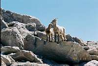 Families Also Live on Mount Evans Families Also Live on Mount Evans |
 Man's Presence Has Had a Profound Influence Man's Presence Has Had a Profound Influence |
|---|
External Links
- Western Slope No-Fee Coaliton
Learn about the fee scam spreading across the United States and the precedent setting situation on Mount Evans - Contact Your Representative Here
- Wild Wilderness
Protecting the Undeveloped Wilderness Experience from Commercialization & Privatization - 14ers.com - The Home of Colorado's Highest Peaks
Fourteener Photos, Route Descriptions, Forum, and more... - COLORADO 14ERS INITIATIVE
LEARN MORE ABOUT COLORADO 14ERS AND VOLUNTEER OPPORTUNITIES - Leave No Trace
Check out the web site of LNT and learn some important minimum impact hiking tips. - Colorado Mountain Club
CMC’s web site will tell you all you need to know about Colorado’s largest and oldest hiking club. - Colorado Climbers Club
Colorado Climbers Club is an online climbers club with links, photos and chat room with information about mountaineering in Colorado! - Tour de Evans (09/11/2004)
- Mt. Evans Routes Page
Contains description of the routes to Mt. Evans from Guanella Pass Trailhead - Mt. Evans Winter GPS Routes
This page contains GPS waypoints captured during a couple of winter ascents of Mt. Evans.The Mount Evans Spectacle
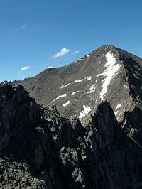
Here are some beautiful photographs of the mountain by some of SP's talented contributors!
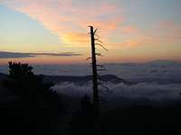
![]() Eastern Perspective by Niederbayer
Eastern Perspective by Niederbayer![]() Classic Event: Clouds Cover Denver by MyFeetHurt
Classic Event: Clouds Cover Denver by MyFeetHurt![]() Columbine-State Flower by Nate Smith
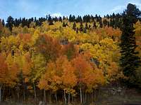
Columbine-State Flower by Nate Smith![]() Fall on Mount Evans by noahs213
Fall on Mount Evans by noahs213


Jeremy Hakes - Jun 27, 2012 11:28 pm - Voted 10/10
SpaldingThe fine little peak to the north of Evans is Spalding, not Spaulding. Otherwise, a fine page. Thanks, Jeremy
TimmyC - Sep 17, 2023 10:59 am - Voted 10/10
Mount Blue SkyAs of Friday, this peak is now called Mount Blue Sky. Let's get this page updated! - https://coloradosun.com/2023/09/15/mount-blue-sky-replaces-mount-evans/ - https://en.wikipedia.org/wiki/Mount_Blue_Sky#Renaming I wonder how long it will take to get the Mount Evans Wilderness renamed, if ever.