
-
 86338 Hits
-
 92.59% Score
-
 39 Votes
|
|
Mountain/Rock |
|---|---|
|
|
38.94530°N / 106.4375°W |
|
|
14012 ft / 4271 m |
|
|
Overview
Huron Peak is a beautiful hike from the South Winfield Trailhead. It is the most beautiful hike of any in the Sawatch Range in my opinion. Although it barely qualifies as a 14er (14,012) it compensates by being the farthest 14er peak from a paved road in the Sawatch Range. You cannot see a paved road from the summit. The route is class 2. If you start climbing from the South Winfield Trailhead you will encounter class 1 as you essentially walk up a dirt road until you reach the Forest Service closure gate after about 2 miles. This is where the 4WD drive ends and parking is readily available. The route starts just to the left of the closure gate. The route is a relatively easy route for a 14er and is quite scenic. It is on a dirt road to begin, then it is generally all switchbacks on well maintained trails for most of the rest of the hike. If you drive to the end of the 4WD road it is a very short, fast climb. The trail is in excellent condition thanks to the Colorado Fourteeners Initiative
 |  |  |  |  |
Getting There
To get to the South Winfield Trailhead, take Chaffee County 390 West from Hwy 24 (15 miles north of Buena Vista, 19.3 miles south of Leadville) and stay on the dirt road to mile 11.8. Here you will see the old restored ghost town of Winfield. Go south in Winfield and drive for .3 miles to the South Winfield Trailhead. There is parking here for about 10 cars. If you have a good 4WD you can drive 2 more miles up the 4WD drive road and cut about 4 miles off the climb.
 |  |  |  |  |
Route Information
The shortest and most popular route is from the South Winfield Trailhead. It is class 2. From here the climb is 8 miles roundtrip with an elevation gain of 3740 feet. The first two miles are on a wide 4WD road- an extremely easy walk with only 300 feet of elevation gain. There are a couple of other roads that break off from the main road- but just stay on the main road. At the end of the road is a parking area and a gate. If you have 4 WD you can drive up to here and start the hike from this point. From here, roundtrip is only 4 miles with an elevation gain of 3400 feet. At this point you are at 10,600 feet. Follow the trail as it switchbacks higher until you eventually break out of the forest about treeline and find yourself in a nice broad basin. Look to the right as you break into the basin for impressive views of Three Apostles and Ice Mountain. You can now easily see Huron in front of you. Stay on the trail as it heads southeast and takes you to a broad northwest facing slope. The trail winds up this gentle green slope to the summit. Alternative Rockdale TH and Route: From the Hwy 24 and County 390 intersection, as described before, head west on Chaffee Country 390 for 9.8 miles to Rockdale. Turn left at this point on an unmarked road. Go past a few cabins until you reach Clear Creek and park here at 9950 feet. From here the hike is 9.4 miles with an elevation gain of 4100 feet. Continue to cross the creek and hike to the 4WD parking area described next. If you have 4WD you can cross Clear Creek and continue another 2.4 miles to a parking area at 10,800 feet. From the 4 WD parking are near Clohesy Lake the route is 4.6 miles with a gain of 3200 feet. This route is class 2 also. The trail starts 100 feet south of this parking area. Follow the trail (faint in places) to treeline and a breakout into a small basin. From here hike west over some large boulders and climb to the saddle between Browns Peak and Huron. From here it is .7 mile up the north ridge to the Huron summit.
 |  |  |  |  |
Mountain Conditions
Conditions on this mountain, like all Colorado 14ers, are subject to change rapidly- especially during the prime climbing summer season. The mountains are their own weather system, and weather forecasts from nearby towns often have little to do with actual mountain conditions. You can generally count on clear to partly cloudy in the morning, and heavy clouds and thunderstorms in the afternoon during the summer. There is no substitute for getting an early start, and getting as much of the mountain "behind you" as early in the day as possible. Keep a good eye on the sky as weather conditions can deteriorate rapidly. The greatest weather danger is from lightning strikes, and climbers are killed almost every summer in Colorado by lightning strikes. July seems to be the most deadly month for lightning. Two climbers were killed by lightning in Colorado within a couple days of each other in the summer of 2003. I think the following important information from Gerry Roach's book "Colorado's Fourteeners From Hikes to Climbs" bears repeating. Added here with permission from Gerry Roach: Colorado is famous for apocalyptic lightning storms that threaten not just your life, but your soul as well. This section will have special meaning if you have ever been trapped by a storm that endures for more than an hour and leaves no gap between one peal of thunder and the next. The term simultaneous flash-boom has a very personal meaning for many Colorado Climbers Dangers 1. Lightning is dangerous! 2. Lightning is the greatest external hazard to summer mountaineering in Colorado. 3. Lightning kills people every year in Colorado's mountains. 4. Direct hits are usually fatal. Precautions 1. Start early! Be off summits by noon and back in the valley by early afternoon. 2. Observe thunderhead buildup carefully, noting speed and direction; towering thunderheads with black bottoms are bad. 3. When lightning begins nearby, count the seconds between flash and thunder, then divide by 5 to calculate the distance to the flash in miles. Repeat to determine if lightning is approaching. 4. Try to determine if the lightning activity is cloud-to-cloud or ground strikes. 5. Get off summits and ridges. Protection 1. You cannot outrun a storm; physics wins. 2. When caught, seek a safe zone in the 45-degree cone around an object 5 to 10 times your height. 3. Be aware of ground currents; the current from a ground strike disperses along the ground or cliff, especially in wet cracks. 4. Wet ropes are good conductors. 5. Snow is not a good conductor. 6. Separate yourself from metal objects. 7. Avoid sheltering in spark gaps under boulders and trees. 8. Disperse the group. Survivors can revive one who is hit. 9. Crouch on boot soles, ideally on dry, insulating material such as moss or grass. Dirt is better than rock. Avoid water. The following link is also helpful: Lightning Safety and Crouch Also see this report by nchenkin. It will make you really think about lightning safety: Struck By Lightning!
 |  |  |
Camping
Free camping is available along the left side of County 390 from highway 24 to the trailhead. There is no formal campground- just available primitive campsites. Many have fire rings and are near a creek. If you have a 4WD drive I would recommend camping along the 4WD road between the South Winfield Trailhead and the closure gate. This road is 2 miles long and the last mile of it is where there are some extremely nice free campsites. The sites are on the right side of the road, quite spacious, and have a creek and tremendous views. Even if you dont have a 4WD it might be worth it to park at the South Winfield TH and pack your camping gear a mile or so up the road to get these primo campsites.
 |  |  |  |
When To Climb
June-September are the most popular months with July and August being prime time. As always, expect thunderstorms in the afternoons in Colorado, so try to plan to be off the summit by noon or 1 pm. This is a popular mountain , so try to climb during the week if you can if you want to avoid some of the crowds. As a rule of thumb, I always say start as early as you can. Sunrise is ideal and if you have a headlamp or flashlight getting started even a bit earlier is advisable.
 |  |  |  |  |
People Pics
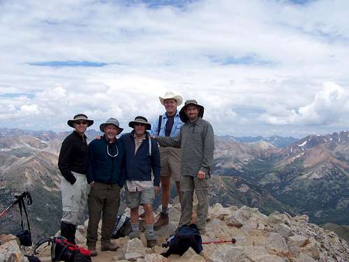
Add your People Pics here.
 |  |  |  |  |
Maps and Contact
MAPS San Isabel National Forest USGS 7.5 minute quadrangle: Winfield Trails Illustrated #129 Buena Vista/Collegiate Peaks Leadville Ranger District 2015 North Poplar - Leadville, CO - 80461 Phone (719) 486-0749 Fax (719) 486-0928
External Links
COLORADO 14ERS INITIATIVE LEARN MORE ABOUT COLORADO 14ERS AND VOLUNTEER OPPORTUNITIES Leave No Trace Check out the web site of LNT and learn some important minimum impact hiking tips. Colorado Mountain Club CMC’s web site will tell you all you need to know about Colorado’s largest and oldest hiking club.
- 14 Fourteeners in 60 hours
- 14ers.com - The Home of Colorado's Highest Peaks Fourteener Photos, Route Descriptions, Forum, and more...
mwalker2 - Aug 16, 2005 8:55 pm - Hasn't voted
Untitled CommentI know that Roach's book says it's 4 miles round trip from the 4x4 parking lot, but that's not correct - it's a bit more than 7 miles. It is almost funny how influential his book is - everyone on the trail the day I climbed was commenting that the mileage was wrong - I guess we all have our own dog-eared copies. I'll upload a GPS track and Topo USA map that shows the mileage.
spiderman - Nov 17, 2014 9:43 am - Hasn't voted
ElevationThe reported elevation for Huron is 14,003 and we used a Trimble GPS to determine a value of 14,005.4 +/- 0.7’ (95% confidence interval). It is one of the lowest 14ers, but definitely a 14er.