
-
 89568 Hits
-
 85.7% Score
-
 21 Votes
|
|
Mountain/Rock |
|---|---|
|
|
45.55900°N / 73.166°W |
|
|
1362 ft / 415 m |
|
|
Overview
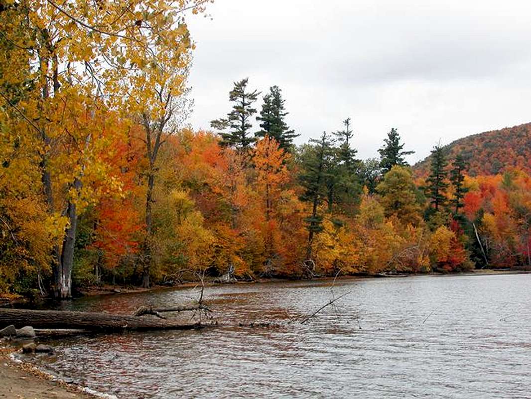
Mont Saint-Hilaire, a nature reserve and a popular hiking area close to the city of Montreal. It is the third mountain in a small chain that covers the Montreal and Eastern townships as far as Magog. Mount Royal, Mont Bruno, Mont Saint-Hilaire, Rougemont, Mont Saint-Gregoire (formerly Mont Johnson), Bromont, Sutton, Orford and Owls Head are the most notable high points on the flat plain the once was the Champlain Sea millions of years ago. On a clear day you can see excellent views of the far off city. This peak also boasts a natural lake, Lac Hertel. The trails are open all year round to hikers, cross-country skiers and snowshoe activists.
The land including the mountain itself was once owned by an weathy English business man named Gault who left the property to the University of McGill which maintains it today. His estate, The Gault Estate, situated on the lake is now used as a small convention and meeting centre. All of the hiking routes are easy.
There are some interesting rock climbing routes on the northern slopes facing the Towns of Saint-Hilaire, Beloeil and McMasterville. McMasterville is famous due to the CIL munitions plant which blows up on occasion.
There are several trails to reach the four main summits or high points of Mont Saint-Hilaire.
Pain de Sucre (Sugarloaf)
Follow the yellow markers to the left from the black trail to lac Hertel from the nature centre, 2,6 km. to a high point of 415 metres. One hour very easy, a small summit. Offers a overview of Lac (Lake) Hertel and nearby Rougemont.
Burned Hill
Follow the orange markers from the nature/visitors centre, 1.6 km, to a small summit 320 metres about 35 minutes. Good for older people and families with kids.
Lac Hertel
Follow the black or main trail from the nature/visitors centre, 0.6 km, to a small lake in about 10 minutes. Good for older people and families with kids.
Dieppe
Follow the black or main trail from the nature/visitors centre, turn left and follow the green markers 3.6 km, to a small summit 360 metres about 1.25 hours. Good easy trail steeper at the end. Good views of the north including Montreal, Mont Bruno and the smaller towns of Mont-Saint-Hilaire, Beloeil, McMasterville. The Richelieu valley and river. The ancient highway to Lake Champlain and beyond.
Rocky via the blue trail
Follow the black or main trail from the nature/visitors centre, turn left and follow the blue markers 3.9 km, to a larger summit 402 metres about 1.5 hours. Good easy trail steeper at the end. Good views of the north including Montreal, Mont Bruno and the smaller towns of Mont-Saint-Hilaire, Beloeil, McMasterville. The Richelieu valley and river. The ancient highway to Lake Champlain and beyond.
Rocky via the red trail
Follow the black or main trail from the nature/visitors centre, turn left and follow the red markers 4.8 km, to a larger summit 402 metres about 1.75 hours. Good easy trail steeper at the end. Good views of the north including Montreal, Mont Bruno and the smaller towns of Mont-Saint-Hilaire, Beloeil, McMasterville. The Richelieu valley and river. The ancient highway to Lake Champlain and beyond.
3D Animated Flags--By 3DFlags.com
 |
 |
 |
 |
 |
Getting There
From Montreal you head to highway 20 across either one of the major bridges, Champlain, Victoria, Jacques Cartier and or the Louis Hippolite Lafontaine Bridge Tunnel Complexe. From the 20 take exit 112 and follow the signs to the Centre de la Nature de mont Saint-Hilaire You will pass many Apple orchards with roadside stall that have, apples, apple sauce, apple cider, jams, jellies and various maple syrup products for sale. In the fall you can participate in the apple picking yourself. Migrant workers from as far away a Mexico come for the annual pick. There is a fee of 4$ for adults and 2$ for senors and children to park your car in the large area. Seasonal family passes are available. The parking can and does fill up in the fall when the colours of the leaves attract many more people.
 |
 |
 |
 |
Red Tape/Camping
You are asked to stay on the trails to avoid impacting the area further, no littering and no pets. As this is a nature preserve there are many animals, including birds that would be scared off by the presence of dogs.
No camping allowed on the mountain.
 |
 |
 |
 |
When To Climb
Mostly during the summer and fall months. Spring tends to be very muddy. Winter it is the domain of the cross-country skier but be warned it is very hilly, the trails are narrow and there are lots of trees.
Mountain Conditions
For more information contact:
Centre de la Nature mont Saint-Hilaire
422 chemin des Moulins
Mont-Saint-Hilaire
(Quebec)
J3G 4S6
Téléphone: (450) 467-1755
Fax/télécopieur: (450) 467-8015
Web site Centre de la Nature Mont Saint-Hilaire
This English version is small but there is a larger French site if you follow the links.
External Links
- Mont St-Hilaire
Pictures from Mount St-Hilaire