
|
|
Mountain/Rock |
|---|---|
|
|
36.55670°N / 105.4164°W |
|
|
13161 ft / 4011 m |
|
|
Overview
At 13,161 feet above sea level, Wheeler Peak is the highest mountain in New Mexico, which ranks as the 8th state in order of elevation. Located in the Sangre De Cristo
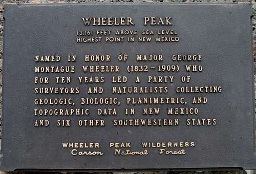
(Blood of Christ) range, it stands guard over the southern end of the Rocky Mountains, inviting all to enjoy its status.
It is not known who made the first ascent of Wheeler, probably the Indians of the Taos Pueblo. But, it is named for U.S. Army Major George M. Wheeler who surveyed much of New Mexico in the late 1870s. For years, the Truchas Peaks, located south of Wheeler Peak, were considered the New Mexico highpoint. In 1948, a survey was conducted by Harold D. Walker which confirmed Wheeler Peak is the highest point in the state. A sub-peak, north of Wheeler Peak, is named for Walker and is often mistaken for Wheeler.
Whether backpacking or dayhiking, Wheeler Peak offers a spectacular outdoor experience. Big horn sheep are abundant but are wary of visitors. There are two main routes to the summit, the Bull-of-the-Woods Trail, and the Williams Lake Trail. The Bull-of-the-Woods trail (also called the Wheeler Peak Trail) is 16 miles round trip and is a well-marked class 1 trail, The Williams Lake trail to the summit is approximately seven miles round trip and is a steep class 2 trail, with the final 1000 ft being a rocky scree slope.
The Sangre de Cristo mountain range is a spectacular collection of peaks which stretches 250 miles from Santa Fe, New Mexico to Salida, Colorado. Please note the left side bar which features all the mountains in the Sangre de Cristos, both in Colorado and New Mexico.
Getting There
From Taos, New Mexico: Drive four miles north on New Mexico (NM) state road #522. At about four miles, and at the first traffic light out of town, turn right (east) on NM 150 and drive for 15 miles until reaching the Taos Ski Valley ski area. As you arrive at the ski resort a huge "Taos Ski Valley" sign will greet you. Here the road forks. Stay left.
LaCal Basin. Photo by Jeff Moore
For the Bull-of-the-Woods trailhead: Continue left after the fork and head into the upper parking lot for about 50 yards until reaching a gravel parking lot marked "RVs Only" (which does not apply in summer). There are big trailhead signs in view from here.
For the Williams Lake trailhead: The key is to get to the Phoenix Grill (Bavarian) restaurant about a 1000 ft higher than the entrance to the ski area. Follow signs to "The Bavarian" restaurant and "Williams Lake Trail." Before reaching The Bavarian (or the Phoenix grill) follow signs to a large hiker's parking lot on the right. From the parking lot, follow the road (pedestrian only) next to the kiosk south past The Bavarian and then past the Phoenix Grill (ski season only) and onward up the road, which is now well marked with signage. (Updated 7-23-06. Courtesy of dgreaser)
Red Tape
Wheeler Peak is located in the Wheeler Peak Wilderness area in the Questa Ranger District of the Carson National Forest. No fees or permits are required to hike, climb, or camp. There is a 14 day camping limit in the Carson National Forest. The wilderness area begins on the Bull-of-the-Woods Trail between Bull-of-the-Woods mountain and Frazer mountain. On the Williams Lake Trail, the wilderness area begins about two miles into your hike after climbing through the ski area. The first two miles of the Williams Lake Trail, and the first three miles of the Bull-of-the-Woods Trail, is on private property so please respect this. No camping is allowed at Williams Lake. All wilderness rules apply including no mountain bikes, ATVs, or other vehicles.
When To Climb
Late May through November is considered the best time to climb. Winter storms can occur as late as May and June is considered a dry month. July and August are the typical monsoon season, with afternoon thunderstorms being a daily occurrence. September through early November are also dry months with several continuous days of cool, dry, and clear skies. However, storms, rain, hail, and snow can occur in any month. The Bull-of-the-Woods trail is considered the safest winter ascent route, with the west face of Wheeler being an avalanche hazard. Highly recommend getting a very early start in climbing Wheeler Peak. Thunderstorms are an extreme danger in the afternoonn.
Mountain Conditions
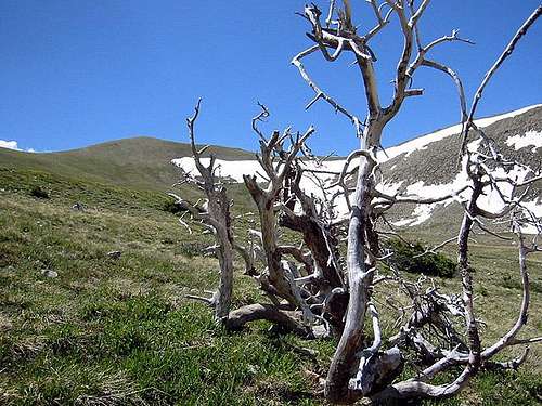
Wheeler Peak is in an alpine environment with like conditions. The west face of Wheeler Peak is a loose scree slope which can be unpleasant to climb. Check here for current weather. Fire conditions change on a daily basis. Check with the ranger station or the New Mexico Fire Information Site for current fire conditions. Treeline is at approximately 11,000 to 11,600 ft. In winter, Williams Lake basin, the valley leading up to Williams Lake, and the west face of Wheeler Peak is subject to avalanche. Here is a live webcam of Taos Ski Valley (Base of route) to get an idea of current conditions: Taos Web Cam
Camping
Backcountry camping is allowed without a permit in the wilderness area except within 100 yards of Williams Lake. La Cal Basin is a good place to camp if hiking the Bull-of-the-Woods Trail as an overnighter.
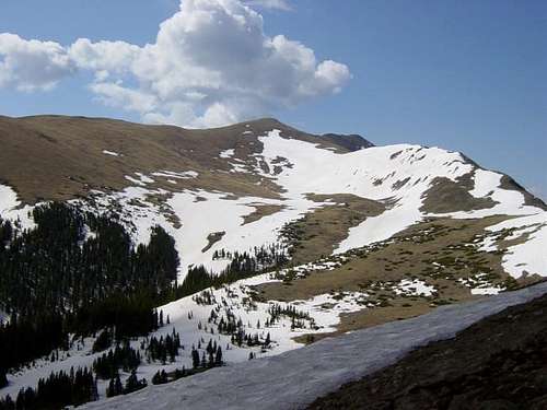
LaCal Basin. Photo by Alan Ellis
There are several Forest Service Campgrounds available on NM 150 before getting to the Taos Ski Valley. These include Lower Hondo, Cuchillo De Medio, Cuchillo, Italianos, and Twining. Most can accommodate trailers and tents, and have water and toilets. Twining campground is located at the Bull-of-the-Woods trailhead.
Maps
Paper Maps:
Carson National Forest (Forest Service)
Latir Peak/Wheeler Peak Wilderness (Forest Service)
USGS 1/24 quad Wheeler Peak
USGS 1/24 quad Eagle Nest
Click here to order Forest Service maps.
 |
 |
 |
 |
 |
In closing.....
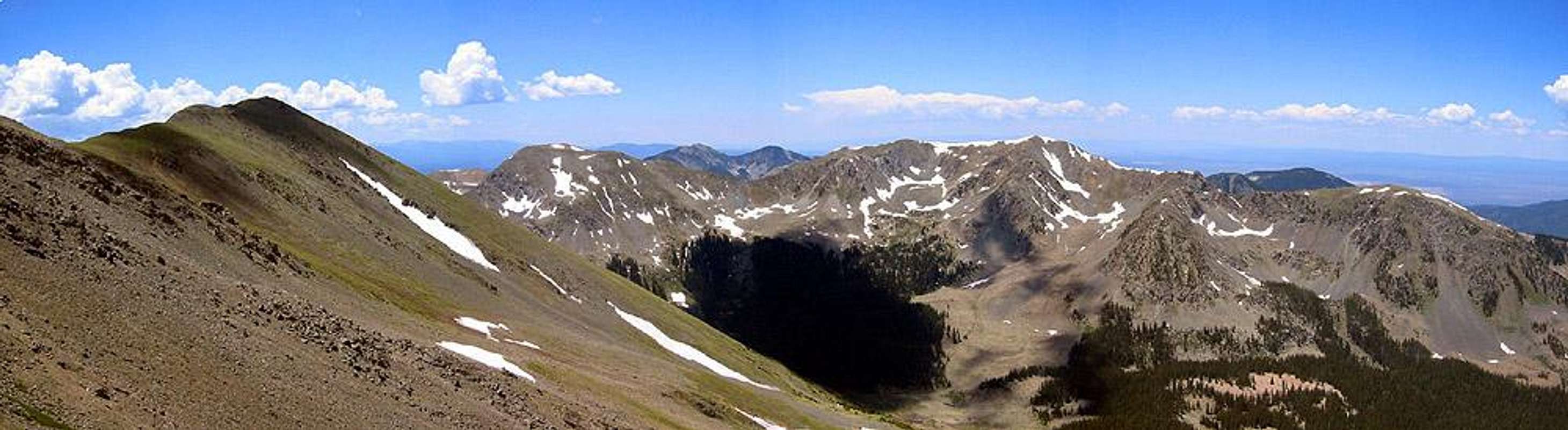
Wheeler Peak (left) and the Williams Lake Basin with Lake Fork Peak above.
Photo by Jeff Moore
Acknowledgments:
Many thanks to Alan Ellis for creating and maintaining the Wheeler Peak page for so many years. Nice work Alan!
External Links
- Wheeler Peak Trip Report: May 2003
Trip report with text and photos of a climb via the Bull-of-the-Woods trail.
jniehof - Sep 24, 2010 11:02 am - Hasn't voted
Carson NF maps have movedNew map URL: http://www.fs.fed.us/r3/carson/recreation/trails/images/Trail_62_map.gif http://www.fs.fed.us/r3/carson/recreation/trails/images/trail_90_map.gif It looks like the south section of Bull-of-the-Woods has been renamed the "Wheeler Peak Trail"
Alan Ellis - Sep 25, 2010 9:55 am - Hasn't voted
Re: Carson NF maps have movedThanks for the heads up. I made the change on the page. AE
Alan Ellis - Jun 27, 2013 10:16 am - Hasn't voted
Re: Carson NF maps have movedThanks. I'm out of town and will fix it next week. AE
Alpinist - Aug 1, 2011 3:28 pm - Voted 10/10
Broken linksAlan - there are several broken links in this page and Truchas' pano image has also been deleted.
Alan Ellis - Aug 1, 2011 5:41 pm - Hasn't voted
Re: Broken linksOk...I'll fix them. Thanks.. AE
Alpinist - Sep 12, 2011 10:24 am - Voted 10/10
Re: Standard RouteYou're right. I just hiked down that way on Sept 10th. There is a very nice trail now that switches back through the talus from Williams Lake. I will update the page shortly. Thanks...
flatlander - Jun 27, 2013 10:13 am - Hasn't voted
Re: Standard RouteI'm planning a trip in September 2013. Is the Williams Lake trail to Wheeler Peak still being maintained? Thanks for info! Just joined this site.
Alpinist - Jul 3, 2013 10:30 am - Voted 10/10
Re: Standard RouteThe last section of trail that climbs to the summit is fairly new. I doubt that it has been maintained since they cut the trail. However, the Williams Lake Trail is the shortest route to the summit and it is considered the standard route. It's a very good, clear trail.
basko - Jun 2, 2013 2:48 pm - Hasn't voted
New Place StayThe last time I hiked Wheeler Peak, I had a really hard time finding a good place to stay. Taos is not that close to the trailhead, so we chose to backpack into the lake. Now there are some condos that were built right by the Williams Lake trailhead. You can start the hike straight from the condos and on the way back you can have a big beer at the Bavarian and not have to worry about driving afterwards. I totally recommend considering these places to minimize driving and maximize fun and comfort! Check out this link: http://www.vrbo.com/408479
Alpinist - Jun 4, 2013 1:32 pm - Voted 10/10
Re: New Place StayI'm not sure if you are the owner of this condo but thanks for the link. Here's a link to other rental properties in the area for others to consider. http://www.vrbo.com/vacation-rentals/usa/new-mexico/taos-ski-valley
ckichura56 - Nov 8, 2013 12:13 am - Hasn't voted
March WeatherHey guys, new to the site and am very excited to what I can discover out here. Does anyone happen to know what the weather is like there around March?
Alpinist - Nov 10, 2013 1:09 pm - Voted 10/10
Re: March WeatherHi - welcome to SummitPost! March is typically the heaviest snow month but you never know on any given year. You should check conditions in the regional message forum for NM before your trip. One of the locals is more likely to see and respond to your inquiry there. http://www.summitpost.org/phpBB3/southwest-az-nm-nv-ut-tx.html
jpaulvh44 - Sep 23, 2014 5:12 pm - Hasn't voted
RoutesI hiked Wheeler Peak in 2013 and went by way of horseshoe lake, up from Fire road 58A, following east fork trail 56. Seemed to be a less traveled route with some beautiful scenery.
billwright510 - Jul 6, 2015 1:01 pm - Hasn't voted
Hiking RouteI climbed Wheeler on July 4, 2015 and was really impressed how great the trail was and how beautiful the views. We visited the lake after summitting and that is highly recommended. Here's a Strava link showing the hiking route: https://www.strava.com/activities/339044506
jfw18338 - Aug 2, 2015 1:48 pm - Hasn't voted
CampingI know the post said camping is available. But specifically, if you were to break up the hike into multiple days, would there be sufficient places to camp with access to water? Or would it be best to say, hike into Williams lake and camp 100 yards away and then take a day trip up to the peak and back?
Alpinist - Aug 4, 2015 10:59 am - Voted 10/10
Re: CampingYou'll find water at both the Williams Lake route and Bull-of-the-Woods Trail. The shortest option is to camp >100 yards from Williams Lake. The Bull-of-the-Woods is longer but not as steep. You can find water near La Cal basin from a stream that comes down from Middle Fork Lake. It's a fairly short hike to the summit from either camp.
gcrain - Oct 28, 2015 10:55 pm - Hasn't voted
Wheeler Attempt 10/28/15After speaking with the Forest Service, I attempted Wheeler yesterday (10/28/15). I made it to La Cal Basin and there was just too much snow so I turned around - I HATE turning around.... I was post-holing up to mid-thigh. The snow started at about 11-k and just got worse as I got higher. On my way down I ran into another group from Cali and the Clovis, NM area who had spoken to the Forest Service, as well. The reason I'm posting this is because both of us had been told there was just a "dusting of snow" on the mountain. And the weather reports stated there would be light wind and had been no precipitation. Well, above tree-line, the winds were just howling, so it was far beyond "light wind." I estimate it was hitting 25 - 35 mph. I don't know who or what to recommend for more a more accurate condition report, but I recommend bringing snow gear (snowshoes, x-country skis) if you're going to attempt this year. If you do attempt, it's well worth it - it's a spectacular trek!
Traildirt - Nov 5, 2015 9:38 am - Hasn't voted
11/1/15I climbed this weekend via Williams lake trail. The standard trail was easy to follow and the snow was well packed until the tree line. From there I went straight up the gulley. There were some foot print about half of the way up the face where some skiiers had traveled the previous day. The remaining maybe 750 feet was knee deep and made very slow progress to the ridge. From there it was an easy walk along the ridge to the summit. In response to the last comment, I DID bring snow shoes but did not end up using them. Had no one broke trail through the trees they would've been necessary
sam807 - Sep 19, 2017 1:15 pm - Hasn't voted
Excellent hikeExcellent hike with beautiful views from the top. I climbed during July. The first part of the hike is fairly straightforward and leads you through several miles of woods. Once you break out of the treeline, you'll be rewarded with green mountains covered with colorful flowers. Be sure to allot enough time for the hike. I miscalculated and reached the summit right at sunset. I got lots of good pictures, but as soon as the sun disappeared, it immediately became cold and a strong wind started blowing over the ridge-line. It turns out I was the only one on the mountain that day, and it was a long, lonely hike back in the dark. Also, it can be difficult to find camping. I was at Taos several days and repeatedly tried to get one of the camping spots in the area, but they were consistently full. I ended up staying at a hotel.
Gsschools - Sep 19, 2017 7:05 pm - Hasn't voted
LatestTwining campground--the closest to the trailhead--was unmarked my last visit, but easy enough to find. It is in the angle of land between the ski area parking lot and the road heading up to the trailhead, directly across the road from the Bull-of-the-Woods trailhead. I was lucky when I arrived late in the evening, early Sept--everything was empty and I had the place to myself. But it looked like a pretty heavily used campsite. Also, yes, the Williams Lake trail is very well established, and an easy alternative to Bull-of-the-Woods. From the upper parking lot trailhead (easy to access prior to Nov in a regular car), the trail will eventually take you to a marker directing you right to Williams Lake, or left to Wheeler. An easy intro to peak bagging, and if I'm back in the area next year I'll allow extra time to make it over to neighboring peaks easily accessible from Wheeler.