
|
|
Mountain/Rock |
|---|---|
|
|
45.93178°N / 7.87154°E |
|
|
14970 ft / 4563 m |
|
|
Overview
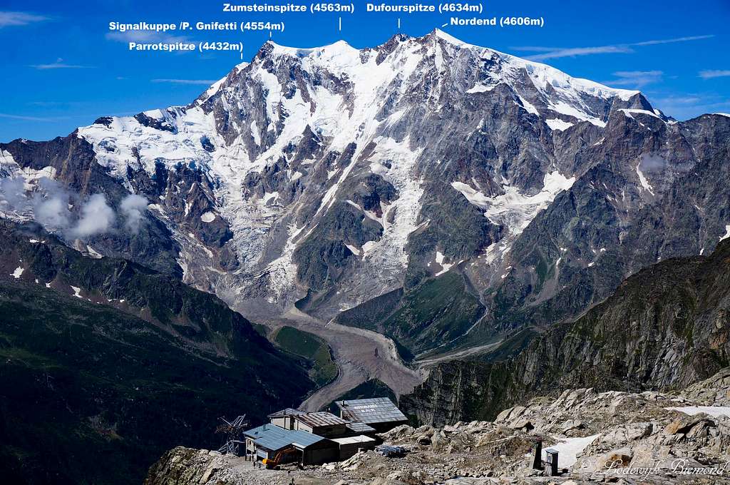
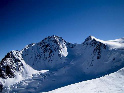
The Monte Rosa East Wall as seen from Monte Moro Pass
Zumsteinspitze is the 5th highest mountain in the Alps and part of the Monte Rosa Group, the second highest mountain range in the Alps after the Mont Blanc Group. Zumsteinspitze was first climbed on the 1st of August in the year 1820 by Joseph Zumstein and his company. Zumsteinspitze is one of the 4 Monte Rosa summits looming high above the Macugnagna valley and forming the famous Monte Rosa East wall, the biggest and highest rock face in the Alps. Zumsteinspitze is a popular objective for climbers, mainly because of the relative ease of the ascent (the normal route is graded PD) and being one of the 82 mountains (UIAA-list) above the magical 4000 meter barrier in the Alps.
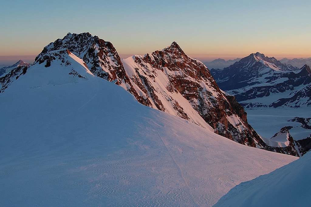
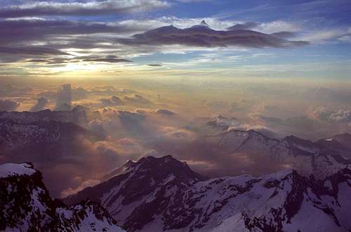 Sunrise from the Summit | 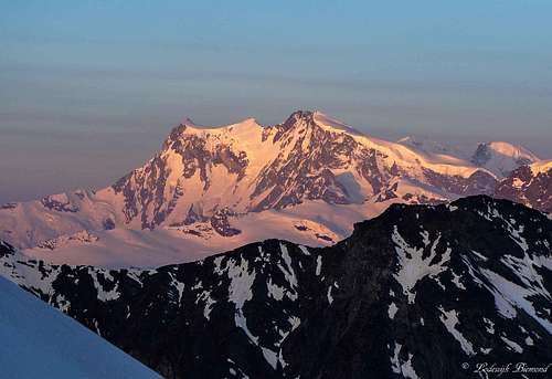 Monte Rosa sunrise | 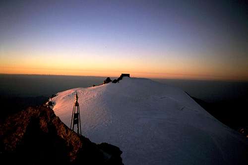 Summit view towards Signalkuppe |
The alpine history of the Monte Rosa began in 1778, when seven Italian climbers from Gressoney went up from south side of Monte Rosa to discover the mythical lost valley: they believed that behind the snowcapped mountains and ridges existed a paradise, full of animals and fruit trees, the ancient home of their ancestors. The highest point reached by the group (at about 4000 meters) was called "stone of the discovery". The first ascent off a Monte rosa peak was in 1801 when the preast Giordani conquered the peak now carrying his name: Punta Giordani. Other peaks were also named after their conquerors: Punta Gniffetti (Giovanni Gnifetti, 1842) and Pyramide Vincent (Johann Niklaus Vincent, 1819). On the 1st of August, 1820, forest inspector Joseph Zumstein, gold mining owner Johann Niklaus Vincent, his brother Joseph Vincent, engineer Molinatti and "gemsjager" Castel were the first to climb Zumsteinspitze. Also see the section "History" for more information.
 West Face | 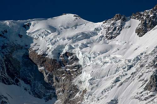 East Face | 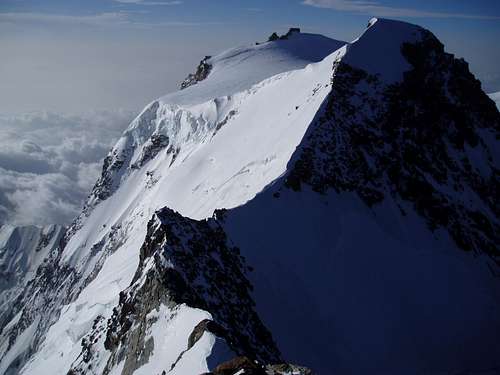 North Face |
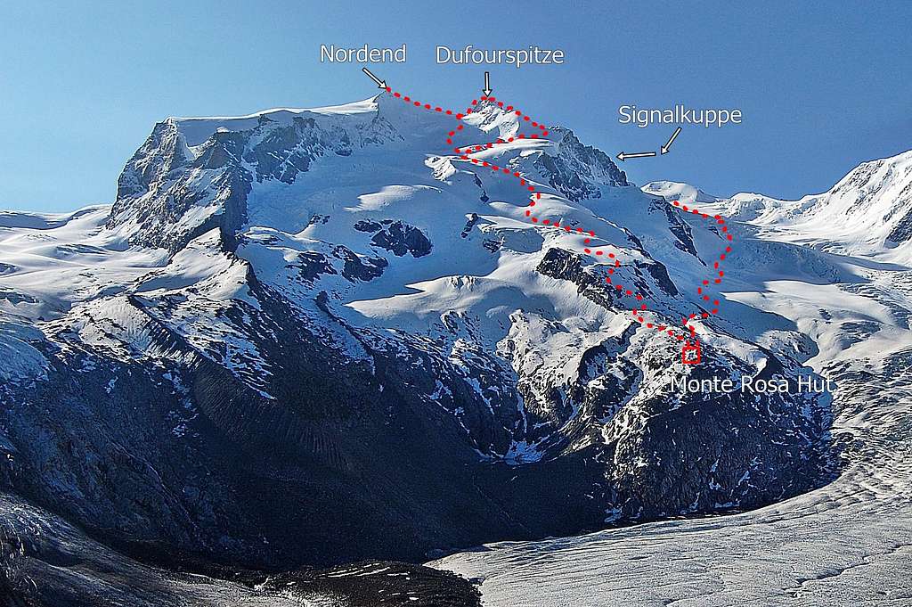
Zumsteinspitze (4563m/ 14.970 ft) is the 5th highest mountain in the Alps (UIAA-list) after Mont Blanc (4810m /15.774 ft), Mont Blanc de Courmajeur (4748m /15.577 ft) , Dufourspitze (4634m /15.203 ft) and Nordend (4606m /15.121 ft). Directly to the NW of Zumsteinspitze is Dufourspitze, the highest mountain in the group. They are separated by the Grenzsattel (also Zumstein Col). Directly to the SE is Signalkuppe / Punta Giordani, with 4554m /14.941 ft the 6th highest mountain in the Alps and separated from Zumsteinspitze by the colle Gnifetti. The western flank of the mountain is heavily glaciated with a gradual slope. The East side however, forms the highest and biggest rock face in the Alps: the near vertical Monte Rosa East wall consisting of 4 summits: Signalkuppe, Zumsteinspitze, Dufourspitze and Nordend.
 Summit Ridge | 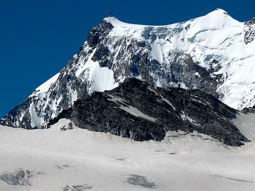 Gnifetti & Zumstein | 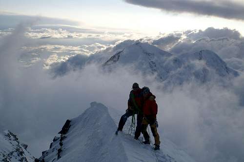 On the summit |
There are several routes to the summit of Zumsteinspitze. The normal route goes up along the Italian side of the mountain and starts from either the Gnifetti or Mantova Hut. The route follows the Lys glacier up to the Lys Col and further along the western flank of the mountain to its summit. The normal route is technically easy and is for 95% on glaciated terrain. Only the final part to the summit along the SE-ridge offers some light climbing in the first grade (UIAA I). The overall gradation is PD. An alternative to the normal route from the Italian side is the route from the Swiss side of the mountain starting from the Monte Rosa Hut. This route is also graded PD and joins the Italian normal route after the Lys col. Many climbers choose to traverse Zumsteinspitze towards its higher neighbour Dufourspitze via the Grenzsattel. This route is more difficult though: AD, UIAA III.
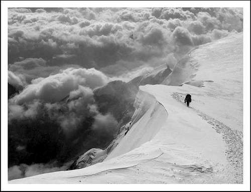
Zumsteinspitze offers fine views from its summit. Towards the north the mighty Dufourspitze and Nordend are dominating the view. To the east you look down the Monte Rosa East wall towards Macugnagna, which is over 3200 vertical meters lower, down in the valley. Towards the south you can reckognize the Capanna Regina Margherita, sitting atop the Signalkuppe / Punta Giordani. Also Parrotspitze (4436m) and Ludwigshohe (4342m) can be seen clearly. Towards the west Lyskamm (4527m) dominates the view with Matterhorn (4478m) sticking out behind.
Routes

I Italian Normal route
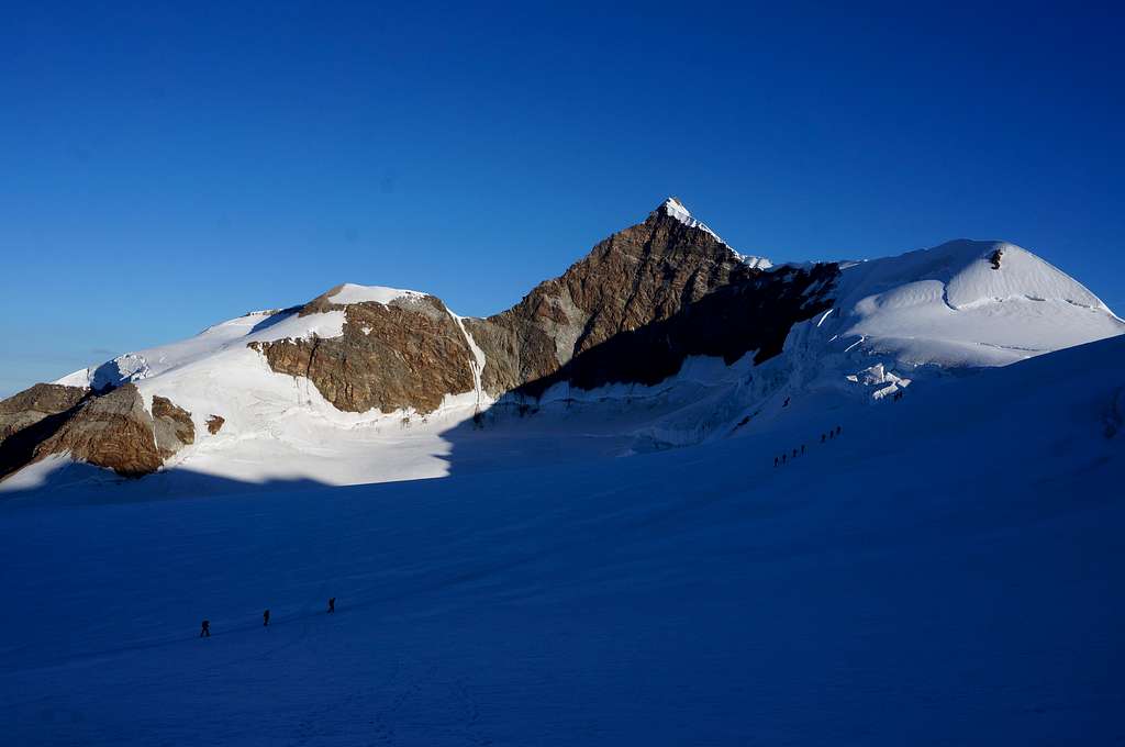
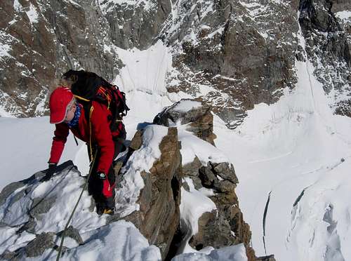
Climbers on the Lys glacier with Lyskamm behind
The time required for climbing this route is five hours from the Gnifetti hut and 30 to 45 minutes more from the Mantova Hut. Descend is the same way back, but a good alternative is to spend the night in the Capanna Regina Margherita, located onn top of the Punta Gnifetti / Signalkuppe (4554m). The Capanna is about an hour away from the summit of Zumsteinspitze. Although technically easy, watch out for crevasses along the route, especially on the Lys glacier. The Italian normal route is (very) popular, especially in the summer months there are many climbers on this route. Most of them climb (some of) the other 4000meter peaks along the route as well: Pyramide vincent, Balmenhorn, Corno Nero/ Schwarzhorn, Ludwigshohe and Parrotspitze.
If you start your route from the Mantova Hut leave the hut in a northern direction and enter the Garstelet glacier. Cross the glacier to the north and in 30-45 minutes you will pass the Gnifetti Hut. From the Gnifetti Hut enter the Lys glacier and head up towards the north. This is a walk over fully glaciated terrain. Watch out for crevasses since the Lys glacier is filled with them. Most times a path is visible along the glacier; this is a result of the popularity of the route. All routes towards the Monte Rosa 4000m peaks go up here. Eventually you will pass Pyramide Vincent (visible to the right of you) and reach a junction of trails at about 4000m of altitude. If you take a right you go up Pyramide Vincent, if you go straight ahead, you are heading towards Zumsteinspitze and co. In front of you the Balmenhorn is visible (with the shelter and large Maria statue). You can ascend the saddle to the west or the saddle to the east of Balmenhorn. If you do not want to climb Balmenhorn and Corno Nero taking the western saddle is somewhat shorter. With either choice, keep heading up towards the North. Both routes meet again at the Colle de Lys, the saddle between Ludwigshohe and P.4256 at 4248m. From the Lys Col keep heading towards the North/NE and head towards the col between Zumsteinspitze and Signalkuppe, now right in front of you. At your right you will pass Parrotspitze. After reaching the col take a left and walk up to the SE-ridge of Zumsteinspitze. The first part is on snow/ice, but soon makes place for rock. Climb along the SE-ridge (rock Climbing, mostly Grade I UIAA, up to grade I+) until you reach the summit of Zumsteinspitze.
II from the Monte Rosa Hut
Route from Monte Rosa Hut (at right) by MarkHallam
Leave the Monte rosa Hut in a south-eastern direction and follow the rocky path to point 3109. Enter the Grenz glacier and follow it upstream (towards the SE). The Grenz glacier truly is a maze filled with crevasses. Route finding can be quite difficult. Keep following the flowpath of the glacier (upstream) and you will pass Dufourspitze and Zumsteinspitze to the North of you. Keep heading up towards Parrotspitze until you reach the plateau at 4300 meters. The route now joins the Italian normal route (coming from the Gnifetti/Mantova Hut). Head towards the North/NE and head towards the col between Zumsteinspitze and Signalkuppe, now right in front of you. After reaching the col take a left and walk up to the SE-ridge of Zumsteinspitze. The first part is on snow/ice, but soon makes place for rock. Climb along the SE-ridge (rock Climbing, mostly Grade I UIAA, up to grade I+) until you reach the summit of Zumsteinspitze.
III from Capanna Margherita
Zumsteinspitze (left) from Capanna Margherita by MarkHallam
For more information about this route see the SP Page by member MarkHallam. (This route describes the Italian normal route on Dufourspitze. But part of this route is the ascent of Zumsteinspitze from the Margherita Hut.)
Approach Routes
There are several ways to get to the different mountain huts from the valley. The different approach routes are described below.
I to the Mantova / Gnifetti Hut

Approach routes from Gressoney/Alagna
From Gressoney, Staffal, take the cableway to the Indren glacier. The first cableway brings you to the middle station of Alpe Gabiet (there is a bar- restaurant called Rifugio Lys) a few minutes from the Gabiet Lake. The second cableway brings you to direct to Passo Salati, where you can find the new lift to Punta Indren (3250m).
From here you have to walk: you have to cross the glacier, therefore crampons are advised.
From the lift, follow the track that crosses the glacier, and in about 20 minutes you reach the place where the track splits in two, a low and a high track. Follow the low one until the end of the glacier. Go beyond a rock with fixed ropes (15 meters), than climb up again and and shortly the Mantova hut is reached. It takes about an hour from the lift to the hut.
If you choose the high track (you have to consider the season and the snow conditions), climb up slightly. When the snow ends, you go on a mixed path (earth, rocks and snow) and after a few bends you reach an equiped path. The fixed ropes and steps made with wooden trunks make your ascent of this steep section easier. When you reach the top of this path you see on the left, below, the Mantova hut. The duration is about 1 hour.
To reach the Gnifetti Hut from the Mantova Hut you have to cross the Garstelet glacier. This will take up to 30 minutes longer.
Fore information about the cableway to Indren from Gressoney (including prices, timetable) see this link
Coming from Alagna
From Alagna take the cableway system to Passo Salati (it consists of two sections: the cableway (1st part) to Pianalunga and then the cableway that bring you to the Passo Salati (2nd part). From here it is a 100m walk to the new Punta Indren cableway. Once reached Indren (3250m) you follow the same path as described above.
Otherwise, from Gabiet, follow the old path 6a to reach the hut on a very safe and well-marked path. The last part of the path is on stony ground.
The way from Gabiet to Mantova hut takes about 4-5 hours. To reach the Gnifetti Hut you have to cross the Garstelet glacier. This will take up to 45 minutes longer.
Fore information about the cableway to Indren from Alagna (including prices, timetable) see this link
II to the Monte Rosa Hut

Approach route: Rotenboden - Monte Rosa Hut
Take the Gornergratbahn (Mountain Railway) from Zermatt station to Rotenboden (2819m). From here a marked trail heads ESE following the flowpath of the Gorner Glacier. The final descent to the glacier involves down-climbing steep slabs using ladders and chains and finally crossing a small metal bridge to reach the ice at about 2500m. The trail on the glacier is well marked with flags and poles. Roping up is advisable. The glacier (ice!) is covered with a fine layer of grit so crampons are not obligated, but still, I would recommend using them.
The route crosses the junction of the Gorner and Grenz Glaciers, before following the eastern flank of the Grenz Glacier. The route leaves the ice and goes over into a marked trail, which goes straight up to the Monte Rosa hut. Total time is about 3 hours from Rotenboden.
How to get there
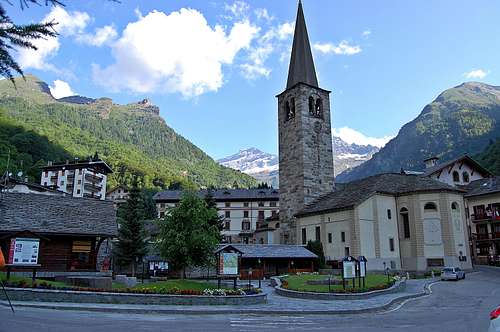
Alagna Valsesia
How to get to Zermatt: Click Here
How to get to Alagna: Click Here
How to get to Gressoney: Click Here
Mountain Huts
There are several mountain huts surrounding Zumsteinspitze. The Monte Rosa hut is the only Hut located on Swiss terrain. It is possible to climb Zumsteinspitze from the Monte Rosa Hut via the Grenz glacier. However, most people choose to climb Dufourspitze from the Monte Rosa Hut. From the Italian side of the mountain the Gnifetti and Mantova Huts are often used as a base for climbing Zumsteinspitze. The advantage of the Gnifetti Hut is the higher altitude and better location (closer to the mountain). These two huts are mostly used as a base for climbing Zumsteinspitze. The last hut is the famous Capanna Regina Margherita, the highest mountain hut in Europe at 4554 meters, situated on top of Punta Gnifetti / Signalkuppe. Many climbers choose to spend the night here and traverse Zumsteinspitze and Dufourspitze on the next day or descend back down to either the Italian or Swiss side of the mountain. From the Margherita Hut is takes about an hour to get to the summit of Zumsteinspitze. If you plan on spending the night in the Margherita Hut, be sure to have the proper acclimatization.
Clicking on the name of the Hut in the table below directs you to the official internet page. Also the SP-link is given when available.
| Hut | Elevation | Telephone | SP_Link | Photo |
| Monte Rosa Hut | 2883m | +41 (0)27 967 21 15 | Here | 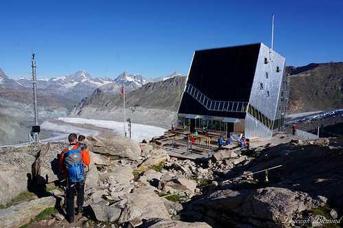 |
| Gnifetti Hut | 3647m | +39 348 141 5490 | Here | 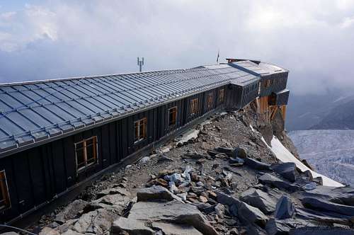 |
| Rif. Mantova | 3470m | +39 016 37 8150 | Here | 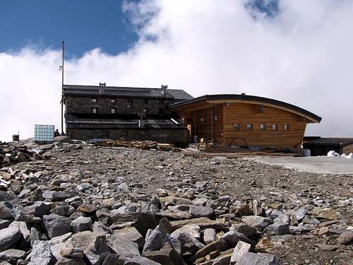 |
| Cap. Regina Margherita | 4554m | +39 348 141 5490 | Here | 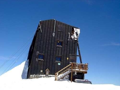 |
27 967 21 15")
When to climb
History
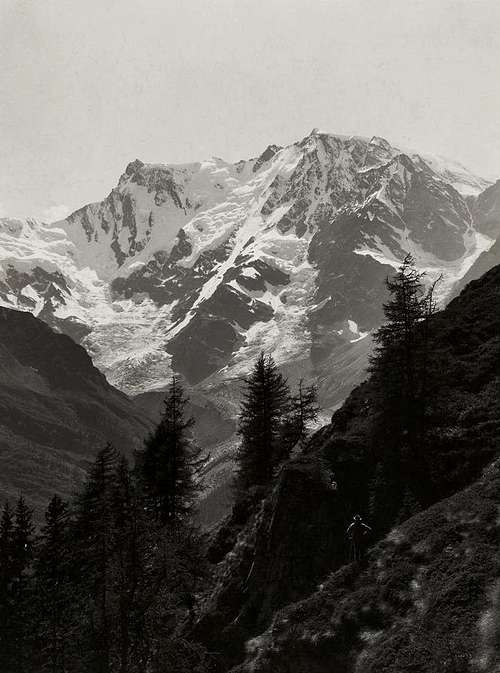
Monte Rosa in 1885 - Photo by Vittorio Sella
The first night they slept in the mining house of Johann Niklaus somewhere near the treeline at the base of the Monte rosa mountains. They climbed further up passing the Indren, the Garstelet and the Lys glacier and reached the Lys Joch (4248 m) the next day. Looking to the Northwest, the expedition recognized the upper part of the Matter Valley in Switzerland. The legend of The Lost Valley was now definitively unmasked. That night they slept, sheltered from the wind, in a tent on the bottom of a deep, "terribly beautiful" glacier slope at about 4200 meters of altitude.
At six o'clock in the morning, at first light, the group started climbing again and after a climb of one and a half hours, the Colle Gnifetti (4454 m) was reached. The immense 2500 meter deep abyss of the Monte Rosa East wall unfolded before them. Following the trail of Castel, who chopped in the ice, the Vincent brothers and Zumstein climbed over the ladder towards the 100-meter higher mountain. The last meters, over the rocks, Joseph Vincent climbed faster than the others. After arriving at the summit, he exclaimed: "Hail to the king! Hail to science!" Also his brother, Zumstein and the others reached the summit shortly after him. Molinatti, who was more or less dragged up, arrived at the summit the latest. His heavy angle-measuring instrument was dragged up the mountain for nothing because clouds covered the surrounding peaks.
At this point the climbers could also see that the mountain they had just climbed was not the highest Monte Rosa peak: Towards the north rose a steep rock wall with a peak that reached about 70 meters higher. They concluded that this "highest summit" (later called Dufourspitze) was unclimbable and decided to place the cross onto the rocks. The initials of the first climbers N.V., A.V. and J.Z. remained visible. At the last daylight, the company reached the mining house they had also used on the way up. Without any problems, the expedition arrived back in the valley the following day. The summit would be named "Cime de la Belle Alliance", as confirmation of the good cooperation between Zumstein and Vincent's brothers. However, Joseph Zumstein, who was also a corresponding member of the "Royal Academy of Sciences" in Turin, made it different. On his initiative the mountain was called Zumsteinspitze. The Vincent brothers have blamed him for this low act for the rest of their lives.
Books
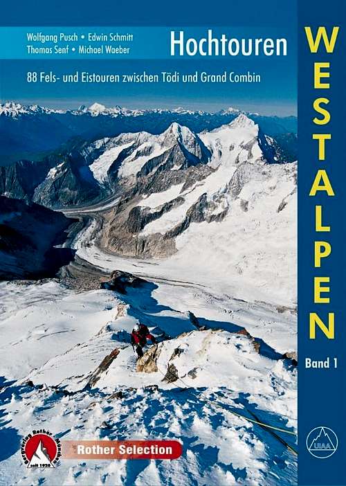
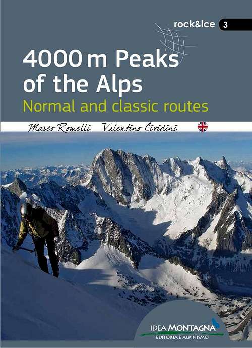
There are several books describing one or more climbing routes on Zumsteinspitze. The ''Hochtouren Westalpen'' by Rother Verlag is a very popular choice. This guidebook includes photos, route descriptions and detailed route maps for many climbs in the Western Alps, including Zumsteinspitze. For me this is the best guidebook at this moment. The ''Viertausender der Alpen'' by Dumler is a true classic. It is a 2014 reprint of one of the truly classic mountain books. The English version is still accessible as ''The high mountains of the Alps''. If you are looking for a smaller format the 4000er tourenfuhrer by Goedeke is a good choice as well. This guidebook has a description on every normal route on a 4000 meter peak in the Alps. If you are planning a ski-touring ascent of Zumsteinspitze the guidebook ''Walliser Alpen'' by Rother Verlag is the guide to go with. Other recent publications like ''the 4000m peaks of the Alps'' and ''Topo Verlag Walliser Alpen'' are shown below.
 |  |  |  |  |  |
| Publisher | Name | Author | Year (last Print) | ISBN / EAN |
| Rother Verlag | Hochtouren Westalpen Band I | Wolfgang Pusch | 2015 | 9783763330287 |
| Rother Verlag | Viertausender der Alpen | Helmut Dumler | 2014 | 9783763374311 |
| Rother Verlag | The High mountains of the Alps | Helmut Dumler | 1994 | 9780898863789 |
| Idea Montagna | 4000m peaks of the Alps | Marco Romelli | 2015 | 9788897299585 |
| Rother Verlag | Walliser Alpen Skitourenfuhrer | Daniel Haussinger | 2012 | 9783763359301 |
| Topo Verlag | Walliser Alpen | Daniel Silbernagel | 2016 | 9783033024311 |
| Bruckmann Verlag | 4000er Tourenfuhrer | Richard Goedeke | 2015 | 9783765457616 |
Maps
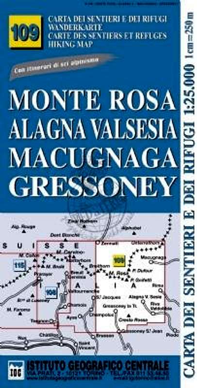
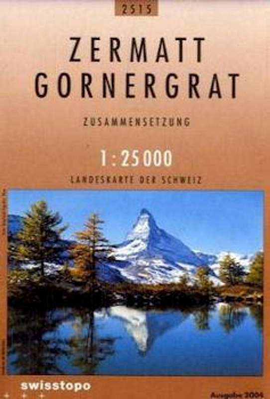
There are several maps for climbing Zumsteinspitze. However, the only map on a 1:25.000 scale that covers all routes on Zumsteinspitze is the Italian Instituto Geografico Centrale (IGC) "109 Monte Rosa Alagna Valsesia Macugnaga Gressoney" map. For climbing Zumsteinspitze (and a Monte Rosa 4000ers tour) I would recommend this map. It is the only map that covers the entire Monte Rosa Group (the Swiss and Italian part). Other maps on a 1:25.000 scale are the Schweizer Landeskarte "1345 Zermatt" and the "2515 Zermatt Gornergrat" maps. Both are excellent, but only include the Swiss part of the Monte Rosa Group. These maps can be combined with the SLK "294 Gressoney" map, which covers the Italian part of Monte Rosa. Other options are the Kompass "Zermatt Saas Fee" and the SLK "5006 Matterhorn Mischabel" maps. Both are on a 1:50.000 scale and do not include the Italian side of Monte Rosa.
 |  |  |  |  |  |
| Type | Name | Scale | ISBN / EAN | Additional Info. |
| Schweizer Landeskarte | 5006 Matterhorn Michabel | 1:50.000 | 9783302050065 | Covers_the_Swiss_side |
| Instituto Geografico Centrale | 109 Monte Rosa Alagna | 1:25.000 | 9788896455395 | Covers the entire area |
| Schweizer Landeskarte | 1348 Zermatt | 1:25.000 | 9783302013480 | Covers the Swiss side |
| Schweizer Landeskarte | 2515 Zermatt Gornergrat | 1:25.000 | 9783302025155 | Covers the Swiss side |
| Kompass Map | 117 Zermatt Saas Fee | 1:50.000 | 9783850269261 | Covers the Swiss side |
| Schweizer Landeskarte | 294 Gressoney | 1:50.000 | 9783302002941 | Covers the Italian side |
External links
Summit view with Madonna by MarkHallam
Zumsteinspitze at Camptocamp Description of all major routes on Zumsteinspitze; Partly in English, mostly French
Official Website Zermatt (CH) and Alagna Valsesia (I)
Photos of all the Monte Rosa peaks: Monte Rosa 4000
Mountain Guides for climbing Zumsteinspitze: Guide Alpina Alagna in Alagna, Alpincenter Zermatt in Zermatt
Weather Forecast by mountain-forecast.com
Weather
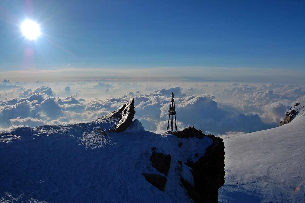
Annotated Summit Panorama
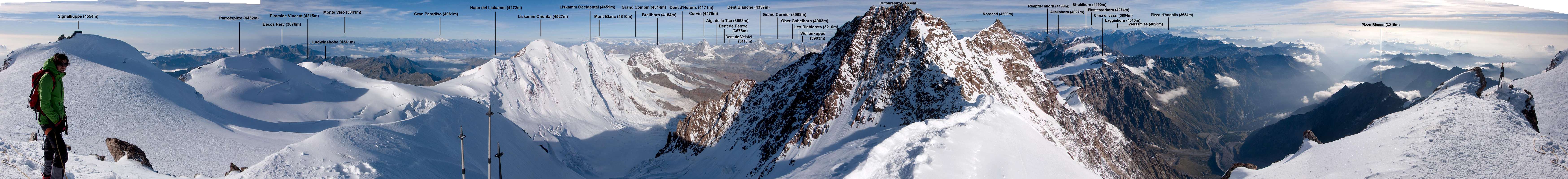  Annotated Zumsteinspitze 360 degrees Summit Panorama by Eric Laureys |