
-
 116809 Hits
-
 96.11% Score
-
 57 Votes
|
|
Mountain/Rock |
|---|---|
|
|
37.69920°N / 107.8064°W |
|
|
Hiking, Scrambling |
|
|
Spring, Summer, Fall, Winter |
|
|
12968 ft / 3953 m |
|
|
Overview
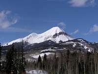
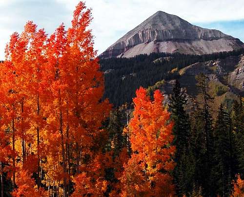 Engineer in Autumn | By LDpro
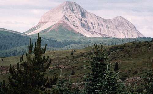
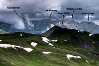
Engineer Mountain is a distinctive, high 12er rising to the southwest of the historic mining town of Silverton, Colorado. The lower of two summits named "Engineer Mountain" in Colorado, the bulking mass of Engineer Mountain is visible from various points along US Hwy 550. This summit has nearly 1,500 of vertical prominence, with the visual prominence to match! The mountain is easily accessible thanks to the proximity of US Hwy 550, but carries the tradition of rotten San Juan ruggedness well. The standard Northeast Ridge route catches the character of this peak well, complete with luxurious blankets of summer wildflowers, steep loose scree slopes and "souvenir handholds" that readily release from the mountain. Easy access from Hwy 550 makes Engineer Mountain, just few feet shy of being a 13er, a great option for a half-day outing in the summer, and thanks to the fact that Hwy 550 is plowed in the winter, this peak provides a moderate-approach snow-season outing as well. Rank: 655th highest peak in Colordo Prominence: 1,428 feet USGS Quad: Engineer Mountain Planning Map: Both primary Engineer Mountain trailheads are visible on the Trail Illustrated Map #140 Weminuche Wilderness. If not for the fact that the mountain itself was blocked out by a text box containing nonsense about Mountain Lions, Bears and Mountain Goats, this would be a fine planning map for this peak. Rank & Prominence: Lists of John Profile image by thebeave7
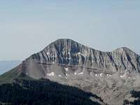
Rock Glacier
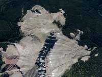 Rock glacier aerial view | gliderman
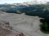 Rock glacier aerial view | tonka
Notably, Engineer Mountain features a massive rock glacier on its northern side, quite the site to behold. Generally, a rock glacier is a combination of rock debris and sometimes ice that may be still moving slowly down the slope of the mountain, or stationary ("fossilized").
| Per (former) SP member Aaron Johnson: Engineer Mountain was first climbed by a civilian topographic assistant by the name of H.G. Prout in June of 1873. |
Getting There
 From Hwy 550 | ktimm
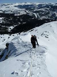
Most visitors to this peak will access the mountain from Coal Bank Pass. Coal Bank Pass is 35 miles north of Durango and 13.5 miles south of Silverton, on US Hwy 550. There is a parking area and restroom facility on the east side of the road at Coal Bank Pass (though this isn't where you'll want to park to access the peak). Just north of the restroom facilities, turn onto a road on the west side (opposite the rest area) which goes to the Pass Creek Trailhead in under 200 yards.
 From Hwy 550 | bb44caesar From Hwy 550 | bb44caesar |
 From Jura Knob | flyinghighpete From Jura Knob | flyinghighpete |
Weather & Seasons
 Click for weather forecast Click for weather forecast |
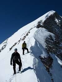
Thanks to proximity to nearby US 550, which is plowed throughout the snow season, Engineer Mountain is accessible year-round barring a major snow event. • In the summertime, the wildflowers here are positively insane. The trail to the base of the peak may be covered with wildflower-admiring day-trippers, but there should be relatively little traffic on the peak. • Autumn is fantastic in this area as the aspens blaze and the tundra plants turn burned reds and oranges. • Snowseason, particularly winter and spring, will make reaching the summit of Engineer Mountain a short but worthy mountaineering effort. |  Click for weather forecast Click for weather forecast |
 |
 |
 |
Camping & Lodging
 Above Little Molas Lake | slowbutsteady
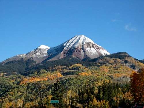
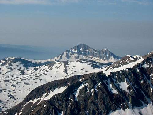 Engineer Mountain from Fuller
There are numerous, simple options for rustic camping, established Forest Service campgrounds, Mom & Pop RV campgrounds, hotels and B&Bs in the Silverton area, the closest town to Engineer Mountain. Rustic Dirt Road Camping This is the San Juans! Grab a map, shift your truck into 4-wheel and find a campsite that suites you. Haul in your own water, haul out all of your garbage. Try the nearby loop road RT 591 for options. US Forest Service Campground South Mineral Creek Campground Less than 15 minutes' drive to Silverton. Elevation: 9,800 feet Number of Sites: 26 2wd accessible? Yes Facilities: Picnic tables, composting vault toilets, fire grates, trash disposal, potable water. Driving Directions Per the US Forest Service: South Mineral Campground is accessed by turning off U.S. Highway 550, about 3 miles west of Silverton, onto Forest Rd. 585, which heads west along South Mineral Creek. The campground is 4 miles off the highway. Commercial Campgrounds Silverton hosts at least three commercial campgrounds offering services such as RV hookup, snacks and showers. These include Silverton Lakes Camper Park, Silver Summit RV Park and Red Mountain RV Park. Additional RV parks can be found by visiting the Silverton Magazine online lodging guide Cabins, Cottages, Hotels and Bed & Breakfasts The lodging in and around Silverton could be described as “limited” and “eclectic”. Many are family owned and operated and tend toward the friendly and cozy, versus the sophisticated or luxurious. The Silverton Magazine provides a good online lodging guide.
Red Tape
 |
 |
 |