
|
|
Mountain/Rock |
|---|---|
|
|
40.39090°N / 111.646°W |
|
|
Utah |
|
|
Hiking, Mountaineering, Scrambling, Skiing |
|
|
Spring, Summer, Fall, Winter |
|
|
11752 ft / 3582 m |
|
|
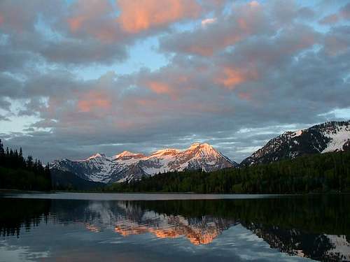
OVERVIEW
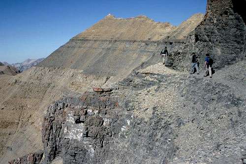
There's a trail here somewhere, right?
Mt. Timp, as the locals call it, is the 2nd highest mountain in the Wasatch range (only Mt. Nebo is higher). What sets "Timp" apart is its location. It towers over the Provo, Orem, Pleasant Grove area and its a very dominant feature. It rises 7000 feet from the valley floor and draws your gaze to it again and again.This mountain may be the most popular one in the state of Utah and is certainly the most climbed. Mt. Timpanogos is a huge mountain, extending almost seven miles in a north to south direction with many of its peaks reaching over the 11000 foot mark. You can normally hike to the top of the highest summit but when the snow flies or a storm is present, it becomes very quickly a mountain you need to take very seriously. One interesting fact about Mt. Timp is that is has the only real glacier in Utah, although it is very small. The glacier is one of the highlights for many of those who summit the mountain, using it as a quick descent route.
The vast circues and basins were carved and gouged into this mountain by much more extensive glaciation as recently as 12000+ years ago. There are 2 main trails that lead to the summit, joining at a gap not far from the main summit.
GETTING THERE
You can access Mt. Timpanogos easily from Highway I-15, using the 272 exit and driving east along highway 52 ( 800 North in Orem) to the junction with highway 189, the Provo Canyon road. Go East on 189 for 7 miles to the Sundance Ski resort turnoff (watch for it just after you go through a tunnel) and turn left on highway 92 for 6 miles, going past the Sundance ski area and the Aspen Grove recreation area. Proceed until you come to a fee booth (pay the fee ) and look for parking just beyond in a lot at the left. If full, look for additional parking just up the road. From the parking lot, you'll find the most popular trail, the Aspen Grove trail that heads on up the mountain
The other way to access Mt. Timp from I-15 is to take the 284 exit and go east on highway 92. Go 8 miles until you enter the American Fork Canyon and you'll be confronted by a fee booth. Continue on another 8.2 miles (passing the Timpanogos Cave national monument area) until you come to the Timpooneke Campground on the right side of the road. The trailhead to the Timpooneke route is just beyond the campground area.
BTW, the nearest major airport is Salt Lake City international, located about 45 miles north.
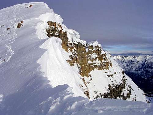
Everest Ridge - Photo by Pellucid Wombat
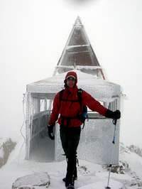
WHEN TO CLIMB AND MOUNTAIN CONDITIONS
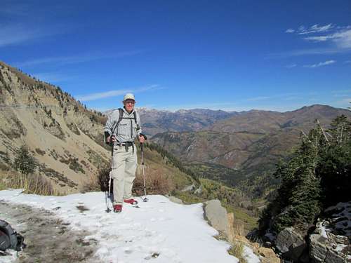
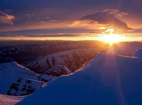
The best time of year to climb Mt. Timp is late spring through late fall. Of course, if you take the time to look at the photos, you'll see that there are those who love to climb it during the winter. Winter climbing requires a different level of experience and risk taking but the challenge is there and Timp is climbed in all seasons.
While a trail takes one to the top of Mt. Timp during the summer and early fall, there are still times of the year when climbing Mt. Timp poses a good challenge. One route that poses more of a challenge is to use ice axe and crampons to go up the glacier route, although this is generally best in the early and late spring. Snow obliterates the trail for a good part of the year and there are places where ice axe and crampons would be needed. This is a big mountain and fatalities have occurred on it when people underestimated it when snow still persisted.
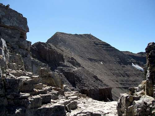
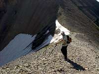
Hitting the 10,000 foot level
Other possibilities abound on this huge mountain and its area.
Advice on mountain conditions may be obtained by calling the Pleasant Grove Ranger station at 801-785 3563 or the Uinta National forest office at 801 377-5780. Also, current hiking trail conditions are provided by TERT, the Timpanogos Emergency Response Team, and should be fairly accurate.
Nice to have micro spikes even in June
PARKING, RED TAPE, and weather
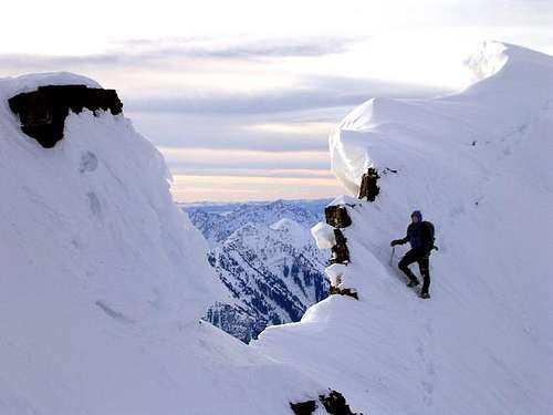
Photo by PellucidWombat
The biggest problem that summertime hikers (of the two major trails) are likely to run into is parking, at least if you are hiking on a Saturday, Sunday, or holiday. Even though the Forest Service recently expanded the Aspen Grove parking area, both it and the Timpooneke trailhead parking lots fill up very fast on weekends and holidays - often before sunrise. Once they are full, there are not a lot of options, and illegal parking is becoming a huge problem. Please do not park illegally, recently they have been towing illegally parked cars, and it is probably an expensive bill! If you find yourself in a pinch, here are a few suggestions. First of all just know that the Aspen Grove lot is larger, so if it is full then the Timpooneke lot is definately full also. If the Timpooneke lot is full - drive further up the campground road - about 1/2 mile or so, and follow the sign for the Timpooneke Road, which branches off to the right. You may park along this dirt road, but be careful to leave enough room on the dirt road for others to pass, then just walk back to the trailhead. Do not park in the campground, you will be ticketed or towed. Many people at the Timpooneke trailhead have been parking back on the Alpine Loop, many of them illegally, so this is not recommended. For the Aspen Grove trailhead - there are some turnouts along the Alpine Loop nearby, either up or down the Alpine Loop road, and you can park in the turnouts. Do not park in the campground or at the Aspen Grove Alumni Resort, you will be ticketed or towed. So to avoid the hassles of parking on a weekend do one of these: 1) Arrive very early 2) Carpool 3) Arrange to be taxied.
The Mt. Timpanogos area is part of a Recreation Fee Demonstration area, $6 a day and payable at either end of the Alpine Loop Scenic Highway. It helps to have your 6 bucks ready to pay the fee. Season passes are also available and credit cards and checks are accepted.
Nearby Provo Utah's weather (at 7000 feet lower)
 >
>CAMPING
If you want to camp out easy, you have a myriad of motels in the Provo, Orem, Pleasant Grove area. There are some campgrounds on the American Fork Canyon road although theTimpooneke campground would be the most convenient for those who will hike the Timpooneke trail. It fills up fast on the weekends, however. A fee is charged for camping overnight and it has restrooms and running water. To access the Aspen Grove trailhead, you can continue driving over the Alpine Loop highway from American Fork Canyon (or drive up the North Fork of Provo Canyon, past Sundance Ski Resort). There is camping available at Aspen Grove but it is on a very limited basis. I have observed several people who simply stealth camped nearby the day before they went up the trail.
Driving a motorhome or towing a trailer is discouraged on the Alpine Highway - it is a steep and narrow road, with many tight corners and blind curves. Please drive safely - several cars each year are driven (or inadvertently forced) off the highway, and need to be winched back up by a tow truck.
If you want to do a little backpacking, there are several places to camp on both the Aspen Grove and the Timpooneke trail. The best places to camp on the Aspen Grove trail are found at the "upper bench" area (about 3/4ths of the way to Emerald Lake) just above the conclusion of the many zig zagging switchbacks. There are several decent places to camp but be forewarned that they generally are taken early on the weekends. Places to camp near the Timpooneke trail are spaced adequately apart with the best camping in the area just as you enter the basin at about 10,000 feet. Hennessey Hammock users can find many places to camp in the trees prior to timberline. Water is plentiful on both trails but as usual, consider treating it prior to drinking by filtering or boiling it.
TRAILS
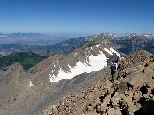
Closing in on the summit
As mentioned earlier, there are two main trails that provide easy access to Timp's summit. They are:
TIMPOONEKE TRAIL: See route section for a description
ASPEN GROVE Trail: See route section for a description.
TIMPANOGOS LOOP HIKE: See route section for a description.
If you can park a car at one end (shuttle), an interesting hike is to go from TH to TH, a distance of about 12 miles. Even better is to go up Timpooneke, then down Aspen Grove to a little-used but excellent trail will take you around Roberts' Ridge and over to Horse Flat and the Alpine Loop summit, where you can take the Great Western Trail back to Timpooneke. This is a 16-mile loop detailed in the Routes section as the Timpanogos Loop Hike.
Runners regularly train on Timp. They used to post their records in wikipedia until wikipedia decided that running records were not encyclopedic enough for them, so here are some interesting stats (if you have your own record, please comment!):
The record to the summit via Timpooneke is 1:15:36, established August 12, 2006 by Danny Moody, a member of the Sojourners Running Club. The fastest documented time to the summit and back via the Timpooneke Trail is that of Phil Lowry, 48, of Mapleton, Utah, who did the round-trip in 2:55 on August 9, 2009. Multiple uninterrupted summit records include that of Lowry, who has run to the summit and back twice in succession in 6:45 via the Timpooneke trail, and the endurance record of David Crockett of Saratoga Springs, Utah. He is the only person who has ever climbed the mountain five times, back to back. He did so on the Timpooneke trail on August 18-19, 2006. Youth records include that of Phillip Lowry III, at age 13, who ran to the summit in 2:29:30 on July 31, 2008, and Ian Lowry, at age 16, who reached the summit in 2:17 on August 11, 2008. On August 18, 2007 James Leblow, at age 12, reached the summit in 2:41:28 via a circuitous route on the Timpooneke and the Emerald Lake cutoff trails. More recently, Kaden Hunter ran to the summit from the Timpooneke trailhead on July 26, 2010 in 2:13:40. As you can see, there are many of all ages that can put up great times and yet I am very proud of my own time last year at the ripe old age of 72 when I hiked to the summit in 4.5 hours. I'll take it and regardless of how long any of you take to reach the summit, it isn't the time it took, its the fact that you had the resolve to get it done and you can pat yourself on the back. I've also seen the cross country teams from local highschools run to the summit and back. Kudos to all of them.
Summit Trail
Wildlife and other information about Mt. Timp
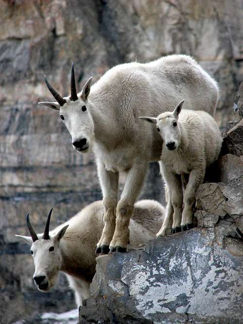
Photo by Kris247
Named by the indigenous people to this area, Timpanogos roughly translates into "water on rock". It is easy to accept this description after you've experienced the cascades of tumbling water and realize that the vast cirques and basins were gouged into this huge mountain by abundance of glacial ice within the not so distant past.
Deer, moose, mountain goats, marmots and pikas (coneys) are inhabitants of this area. I'm sure there are bear and probably cougars (not the BYU kind) also but I have no personal
experience with bear information in this area but I indeed have seen many BYU cougars on the trails. : ) On my last trip up the Timpooneke trail, I saw three deer and about a dozen mountain goat and too many pikas to count.
Phil Lowry has encountered moose, both cow and bull, over 50 times, mostly on the Timpooneke Trail. They are pretty accustomed to humans, but can be VERY aggressive. They are by far the biggest four-legged danger on the mountain. Give them a wide berth.
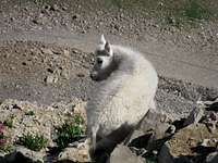
Recently (see summit log) robtvahle mentioned that he saw moose on the Timpooneke trail and the goat pictures provided here were taken by Kris247 who has this incredible picture featured to the left. He has taken some special shots and my favorite is the one at the far left of a goat descending a cliff face. Nice work DB. The other shot, taken by Phil Lowry while actually taking a break from running to the summit, features the three highlights of Timpanogos: goats, flowers, and one of the main hiking trails 1500 feet below (the trail is the Emerald Lake cutoff from the Timpooneke Trail).
Timpanogos Kid
USGS quad: Timpanogos Cave
Two good books on Mt. Timpanogos are:
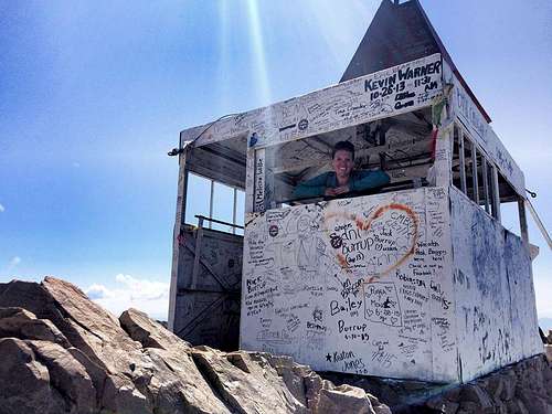
Climbing and exploring Utah's Mt. Timpanogos by Michael Kelsey and the book called High in Utah " by Michael Weibel and Dan Miller. Also, one other book worth checking is Dave Hall's Hiking Utah book. It has an interesting description of the history of the summit "shack" (as locals call it) which adorns Timp's main peak.
From the summit of Mt. Timpanogos, you can see many of the other meaningful summits of the Wasatch. To the south you see Mt. Nebo and to the north you can make out Lone Peak, the Pfeifferhorn, Broads Fork, Sunrise, and Dromedary Peaks. From the summit of Mt. Timp, you have an impressive drop that looks straight down on Emerald Lake below which demonstrates the exposure on the northeast side.
An interesting note is that the '92 Utah Mt. Everest expedition used Mt. Timpanogos as a training ground during a previous winter.
I might add that I've been up this mountain twice and everytime I look up at it, it tempts me to want to be up on top again. The summit is a small point in the long ridge about midway on the mountain. I have many pictures to post. I've stood on top of both Mt. Rainier and Mt. Timpanogos and although they are totally different, they both have that magic quality that makes you say to yourself, "I want to stand on top of that" .
One additional attraction that is easily worth a side trip to is Timpanogas Cave National Monument.
"That guy" - Ben Woolsey
Ben Woolsey - over 835 summits and counting
Ben Woolsey, aka "That Guy" a retired postal worker from Utah County, regularly places and maintains the summit register on the mountain. (Personal note, I met him on August 16, 2013 as he was coming down from the summit which he had made in about 3 hours. Pretty doggone good for a guy 71 years old at the time. He hikes the mountain on Monday (often does two climbs in the same day), Weds, Fri, and Saturday so keep your eyes open for him and thank him for the effort he puts into maintaining the summit register.) He now has over 835 summits of the mountain and will keep pushing that record higher and higher. The Daily Herald recently had this superb story about him. Lick HERE. Stay tuned as I update the total.
As of late 2017, the number is now over 955 and climbing.
Yes, you read that correctly, 955 times. Ben is hoping to reach ONE THOUSAND by August or September of 2018. Kudos Ben, you have my respect.
72 summit visits in one year? Ben achieved 72 summits in 2014 to celebrate his 72nd year. Read the neat article HERE
I hope the link will remain working for awhile since it is a very nice article about Ben and his dedication to hiking to the summit on a regular basis. But wait, there's more: Ben summitted 100 times in 2015. You read that right, 100 times. Many a day he made the round trip to the summit twice, in the same day. CONGRAT'S BEN, YOU ARE AMAZING.
Here is a TV link (for as long as it will stay up) that is a nice tribute to Ben.
Phil Lowry is another who has summitted over 400 times. Anyone else?
This page, adds a trip report to the collection, so check it out.
Neat pic of Mt. Timpanogos can be seen here
Weather for the area
Other Peaks in the Timpanogos area
Joseph Bullough's outstanding shot of getting there the hard way.
When you consider what a huge mountain overall that Mt. Timpanogos is, you also have to consider the many peaks that also are part of the mountain and now have pages here on Summitpost. This section provides links to those peaks that will make it easier for you to know which ones are part of the Mt. Timpanogos Massif.
North Timpanogos
Bomber Peak
East Peak/Elk Point
Roberts Horn
South Timpanogos/Second Summit
Forgotten Peak
Razorback Ridge
Mahogany Peak
Big Baldy
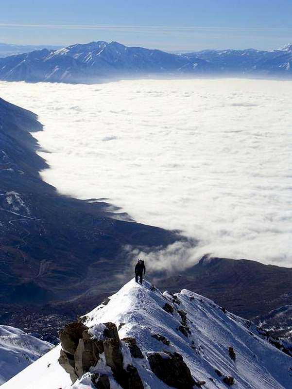
The Everest Ridge route
A summit smile - pic by Jenna Lisonbee
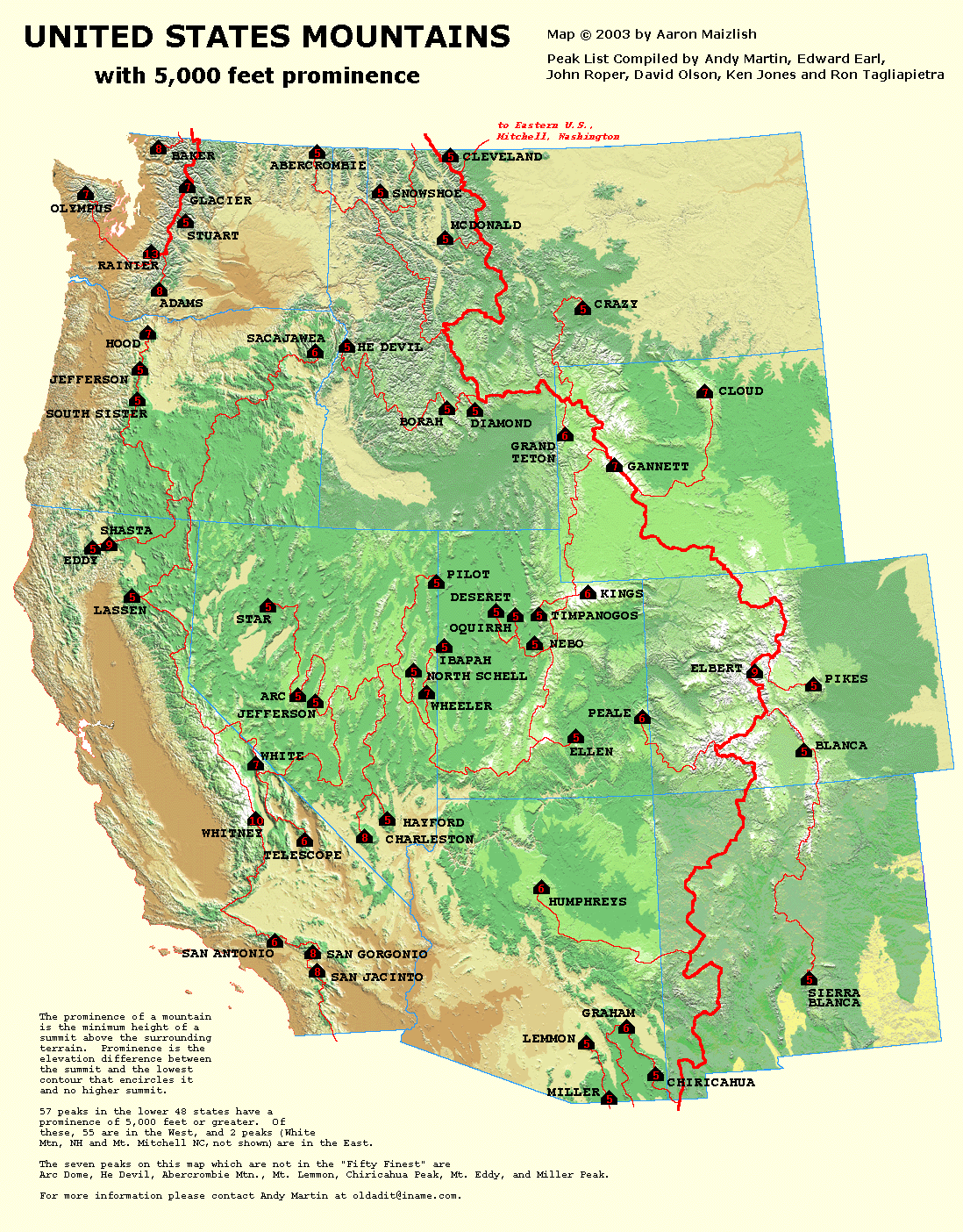
One of (57) 5000 ft. Prominence Peaks in USA
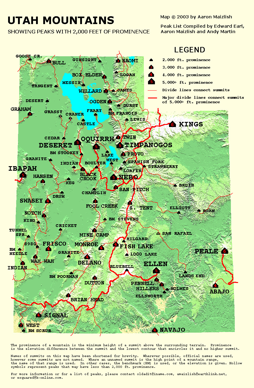
I won't try and explain the concept of Prominence but it is worthy to note that Mt. Timpanogos is one of the (8) 5000 ft. prominence peaks in the state of Utah. Aaron Maizlish has put together this fantastic map of the Western United States showing the peaks that qualify for this special rating. More information on prominence can be found at this site, peaklist .org Check out all the maps they have put together, it'll keep you busy on a rainy weekend.
Utah has (8) 5000 ft. prominence peaks:
Kings Peak
Mt. Peale
Mt. Ellen
Mt. Nebo
Mt. Timpanogos
Mt. Ibapah
Deseret Peak
Flattop Peak (in the Oquirrh mtns)
Utah's other prominence peaks are worth noting HERE
Mt. Timpanogos is a great viewpoint for lots of these prominence peaks that abound in the area. A few are: Provo peak, Spanish Fork peak, Loafer Mtn, West Mtn, Lake Mtn, Boulter Peak, and a few others.
Avalanche Danger
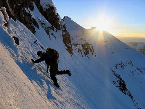
Joseph Bullough's gorgeous sunrise shot
Even though this occurred two years ago, this story should serve as a
reminder that this big beautiful mountain has a very dark side in winter. This year, 2008, we are seeing a huge snow season and so reading this might serve to remind us of avalanche danger:
January 2nd 2006
Snowshoer lost in avalanche; boarder missing
By Jason Bergreen The Salt Lake Tribune
Two people were missing in Utah's snow-packed mountains Saturday night - a Salt Lake County snowshoer swept away in an avalanche in the Timpanogos Mountains and a teenage snowboarder who disappeared after apparently venturing into an out-of-bounds area of Snowbird Ski resort.
At 11:30 p.m., search and rescue teams in Salt Lake and Utah counties were still searching for the teen, who was reported missing in the Mineral Basin area, said Utah County Sgt. Darren Gilbert.
The teen, who was believed to be snowboarding out of bounds at the Snowbird ski resort, was reported missing about 6 p.m. Gilbert said poor weather and visibility was hampering searchers, who set up command at Tibble Fork Reservoir.
Avalanche danger is high in the area in which the teen went missing, Gilbert said.
A winter storm forced the Utah County Search and Rescue Team to call off the search for the snowshoer at 6 p.m., about 4 1/2 hours after he and a friend were caught in the slide on the back side of the mountain near Emerald Lake.
The search was to resume this morning, according Gilbert, who added, "We're holding high hopes at this time."
The man, whose name was not released, was reported missing by his friend, Jeff Frederick, 32, of Salt Lake City, who was able to ride out the avalanche and contact police dispatchers by cellular phone.
Frederick's sister, Tamara Love, said she was told her brother got caught in some trees and was able to stop himself in the slide.
Gilbert said Frederick searched the area but could not find his friend, who Love said was a man named Marshal. The men were neighbors and members of the same LDS ward, she said. "We're just so sick about not knowing of Marshal," Love said.
Low-lying clouds and snow prevented the search and rescue team from reaching the site, Gilbert said. At 4:30 p.m., when conditions cleared, a Department of Public Safety helicopter spotted Frederick and was able to land near him, about 1,000 feet below the slide.
Frederick, who was uninjured, was flown to the Aspen Grove trailhead several miles from Emerald Lake. Love said her brother had returned home by 9 p.m. and met with his church bishop. Frederick liked to go to the mountains almost every weekend, Love said.
Gilbert described Frederick and the other man as fairly competent backcountry adventurers, but noted they did not carry avalanche beacons on this trip. The sergeant said it took the pair about 5 1/2 hours to reach the area near where the avalanche occurred.
Investigators have not determined what triggered the avalanche, but Utah Avalanche Center director Bruce Tremper said about 92 percent of slides are caused by the victim or his party.
Tremper said the avalanche danger near Emerald Lake was "considerable" Saturday - meaning natural avalanches are possible and human-triggered avalanches are probable - and was expected to reach "high" - when both types are likely - by today. The forecast for Saturday night was expected to be warm, around 32-degrees, but windy and snowy all night.
The search for the missing snowshoer was in the same general area where three friends were killed in an avalanche Dec. 26, 2003.
Rod Newberry, 20, of Pleasant Grove; Adam Merz, 18; and Mike Hebert, 19, both of Orem, were among a group of five friends swept down as they snowboarded in the Roberts Horn Chute of Aspen Grove, about 2 1/2 miles north of the Sundance Ski Resort. There have been no avalanche deaths this year in Utah. But last year eight people were killed in the state, making it one of the deadliest avalanche seasons since records have been kept.
As a follow up to this tragic story, Phil Lowry and Joey Dempster, along with family volunteers and members of Utah County SAR, spent a good deal of time in May 2006 poring through the melting snow looking for any sign of the dead snowshoer. As the month progressed, more items were found. Snowshoes. A bite valve to a camelback. A ski pole. Finally in June members of Utah County SAR found his body some 1800 feet below the PLS (point last seen).
Please be careful on Timp in winter.
Nearby Timpanogos Cave Nat'l Monument
You can find more information on this nice side trip here.
Here's a link to an overview map of the area
Additional info can be found.....HERE.
Stewart Falls
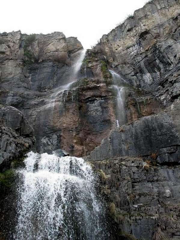
Stewart Falls
Approached from the parking lot for the Aspen Grove trail, the trail for Stewart Falls is found just to the right of the restrooms on the south end of the parking lot. It is about 1.9 miles to the falls and has about 330 feet of elevation gain going to the falls and 450 feet of gain coming back so expect close to 800 feet round trip with 3.8 miles of effort. This is a popular trail on any nice summer day. I think I counted over 100 people of all ages on my recent visit (july 22). Don't climb near the falls, fatalities have occurred here in the past. Enjoy the view and the nice workout the hike provides. Best done in late spring to when the snow flies in the fall.
Scout Falls is worth a visit when the snowmelt is in full swing. Scout Falls is about a mile and a half up the Timpanooke Trail and is marked by a sign at the top of the first major switchback.
Books
There are two books that have coverage of Mt. Timpanogos in them and the newest kid on the block is written by SP'er Randy Winters. Check out his new book HERE.
The other book is by Mike Kelsey and is totally about Mt. Timpanogos. Another book mentioned above is "High in Utah", about the county highpoints and a mention of Mt. Timpanogos as well. Read the trip reports that have been put up for more information about routes and experiences. We are fortunate to have many very good ones posted for this mountain.
Trip Reports
July 2007:
An excellent trip report on a summit via the Aspen Grove trail will whet your appetite to get out there and do this one too next summer when the snow diminishes.
Click here for the newest trip report
A good trip report about Timp features a loop trip that goes from the Timpanooke TH to the Aspen Grove. Take the time to read this TR, it'll
be worth it:
Trip Report
Another good trip Report, "The Joy of Misery"
Maps
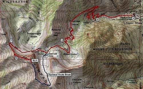
Aspen Grove route
See route reports for maps but this is the most popular route as shown below.
External Links
See the caption for the info on this one
- Mt. Timpanogos Cave National Monument
This page has information about nearby Mt. Timpanogos Cave national monument. - A climb while on vacation
- Provo Weather
- Another worthwhile site about Timp
In words and pictures, this site is a winner. Links to other Utah summits can be accessed from here. - Mick's great report on his Timp experiences
A good read with lots of good pictures. - July 21st trip report
Good report and pics. - Mount Timpanogos Trip Report
- Mount Timpanogos (07/21/2003)
- Safety on Mount Timpanogos page (mentioned below on disclaimer section)
Disclaimer
Hiking or climbing in a mountain environment has many risks. Any who choose to participate in such activities must assume the responsibility for their own actions and safety. Any information provided here cannot substitute for your own sound judgement and decision making skills. For example, hiking into an electrical storm or during an electrical storm is reckless and dangerous. It is not my intent to describe every risk you may encounter on visiting this area but the author of this page is not responsible for your safety. You need
to be prepared for the unexpected and proceed accordingly. People have died on this mountain and you need to treat it with respect. All risks are assumed by the participant. Be careful and enjoy your Mt. Timpanogos
experiences.
An outstanding resource concerning safety is found HERE. Please read what is found on this page, it is very sobering and towards the end, it offers a list of those who have died on Mt. Timpanogos.
More
Latest trip report below:
Best Utah Hike - Timpooneke Loop
Wasatchvoyage made a recent visit to the summit on May 20th but it was under winter conditions.
From the summertime, here's a neat Trip Report posted elsewhere on a recent hike to the summit of North Timp. Worth a look as it gives you a good feel for conditions on the mountain as a whole.
I'd like to feature a trip report from the past about the Everest Ridge (west face of Timp) See that HERE.
Autumn has different variations as this pic below shows
Vanman's pic at the summit in late October
A new section has been added that includes links to all the other peaks in the Timpanogos Massif area.
DCGTimpanogos - Dec 3, 2005 3:56 am - Hasn't voted
Untitled CommentMount Timpanogos has a local Legend to it. The Legend is about an Indian Princess and an Indian Chief that were in love with each other. One day while the Chief was fighting in a war, an arrow hit him in his heart and he died. When the Princess found out about his death, she climbed to the highest mountain she could find and jumped to her death. The spirits of the Chief and the Princess went into the mountain to be together forever as Mount Timpanogos. To this day they are still part of Timpanogos. If you look at the slopes of Timpanogos that faces Utah Valley then you can see the profile of the Indian Princess laying down. If you were southwest of Timpanogos in Utah Valley and looked northeast to Timpanogos you will be able to see the profile of the Chief's face. The location of the face is just a little bit north of the summit. In the caves of Timpanogos there is a heart called The Great Heart of Timpanogos. This heart is the combinded hearts of the Chief and the Princess.
mtn_pika - Aug 11, 2006 8:09 pm - Voted 10/10
Re: Untitled CommentI love this! It should definitely be added to the main page.
pauldw - Aug 11, 2014 11:23 am - Hasn't voted
Re: Untitled CommentAn alternate version of the legend is that she was being sent up the mountain as a sacrifice, and was rescued by someone she thought was a god, but when he was later injured and she realized he was human, she completed her sacrifice by throwing herself off the mountain. The various legends are versions of a story once told at the annual pre-Timp Hike firesides by "Timp" Roberts. -- Paul W. http://user.xmission.com/~wake/timp.html
thayne - Sep 23, 2009 6:13 pm - Hasn't voted
Summit RecordSupposedly Karl Meltzer did the round trip in 1:58. I believe it after seeing him run. See: http://coachingendurance.com/blog/labels/Mount%20Timpanogos.shtml
hyperphil - Oct 9, 2009 2:47 pm - Voted 10/10
Re: Summit RecordDork. He didn't tell me. I have been egging him on to do it for years. Good for him!
Bob Sihler - Dec 9, 2009 2:10 pm - Voted 10/10
Timpanogos MassifSince there are now several peaks here from the Timp massif, I was wondering if you had considered attaching them as children here. It's been done before to have mountains as children to other mountains. Anyway, it might be nice to have all the peaks grouped, though making a separate page to do it might not be necessary.
Dean - Dec 10, 2009 8:08 am - Hasn't voted
Re: Timpanogos MassifBob, I've added a section for these other peaks on the Timpanogos page. Check the table of contents and note the section that is in bold print.
mbhunter - Jul 27, 2010 12:36 am - Hasn't voted
Possible Youth RecordNot sure what the latest youth records are beyond what is mentioned on this site. My 12 year old son Kaden Hunter ran to the summit from the Timpooneke trailhead today July 26, 2010 in 2:13:40.
rocket21 - Sep 6, 2013 9:53 am - Hasn't voted
Summit RecordOn August 28, 2013, Ben Woolsey climbed Mt. Timpanogos for the 600th time.
pauldw - Aug 11, 2014 11:08 am - Hasn't voted
Anyone Know About the Old Aspen Grove Trail?There's an old article in the newspaper (http://www.heraldextra.com/news/local/local-man-wants-to-see-original-aspen-grove-trail-reopened/article_e50ae16b-d03c-5f75-84a9-c181cfae835f.html) about the original route of the Aspen Grove (Mount Timpanogos) trail. Caine Alder, the gentleman quoted in the article, has apparently since died. Phil Lowry did tell me where the access to the old trail segment is, and I found it, but after heading up the old trail through the overgrowth, and switchbacking the other direction awhile I got to a rock ledge where the trail seemed to disappear into a bunch of game trails. Does anyone know where the old trail goes from there? While I'm posting, I'll add that I heard that after 50 years the Forest Service can consider structures to be historical. The Timpanogos Shelter at Emerald Lake is now over 50 years. It would be nice if people asked to Forest Service to restore it. TERT director Glen Meyer is encouraging them to do so. Thanks. -- Paul W. http://user.xmission.com/~wake/timp.html
pauldw - Apr 12, 2015 11:32 pm - Hasn't voted
Re: Anyone Know About the Old Aspen Grove Trail?I went back up later and figured it out. At the rocky ledge there was a big stick that looked as if it had been placed pointing uphill, to direct hikers up that way. Turns out that's wrong. It was just a stick that had fallen funny. The trail Mr. Alder liked goes on straight at that part. -- Paul Wake http://user.xmission.com/~wake//timp.html
lsheen - Oct 17, 2015 1:21 pm - Hasn't voted
Timpanogos Elevation IncorrectAccording to Wikipedia (and several other sources), the elevation of Timpanogos is 11,752' (3,582m)? Listed here as "Elevation: 14743 ft / 4494 m"??? Methinks there's an oops here...
Dean - Oct 17, 2015 3:32 pm - Hasn't voted
Re: Timpanogos Elevation IncorrectYes indeed, a big oops. I can't believe it was listed as over 14K and no one noticed that before you. Thanks for the heads up.
DCGTimpanogos - Jul 1, 2017 2:14 am - Hasn't voted
Timpooneke HikeA few years ago I went with a group of people from school to hike on the Timpooneke Trail to the summit of Mount Timpanogos. It was really hard and strenuous for me, so a little pass Scout Falls some others and I had to turn around and head back down. While going back down I got sick from over doing it, and yes I did puked. Other than getting sick and turning back, the hike was really excellent and I enjoyed it a lot. It was really beautiful and Scout Falls was nice and cold.
mikro39 - Sep 27, 2020 1:12 am - Hasn't voted
TrashJust did the hike this weekend. There is a shocking amount of trash and unburied human waste in the basin, including excrement and feminine hygiene products in the trees. We hauled out a trash bag full of garbage, including a zip lock bag full of human excrement that was left next to the trail and wrappers to food and snacks. There was also a lot of trail cuttings, and the trails up there are in pretty rough condition. Regardless of who is "responsible"....we are all literally responsible for our land. If you can, bring up a bag and pick up trash on the way up and down. If you drop trash or crap on the surface....please stop. If you hike the hill, please refresh up on leave no trace so the trail stays open. If we keep this up, we are going to loose access or permitting is going to take place and they will limit who can climb.