Toggle navigation
Mountains
Routes
Images
Trip Reports
Forum
What's New
People
Areas & Ranges
Articles
Trailheads
Canyons
Huts & Campgrounds
Albums
Logistical Centers
Fact Sheets
Lists
Custom Objects
Gear
Plans & Partners
WELCOME TO SUMMITPOST
SIGN IN
REGISTER
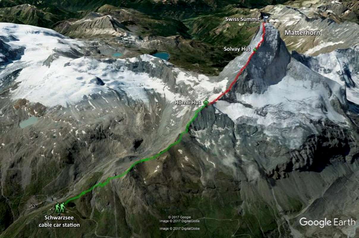
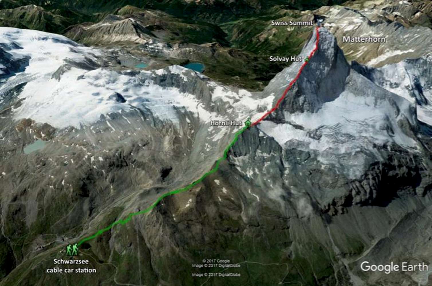
Matterhorn GPS track
View High-Resolution Image
Matterhorn GPS track
Google Earth map using the GPS data from my watch for the approach hike to the Matterhorn from the Schwarzsee gondola station to the Hornli hut and the Hornli Ridge route to the summit. Green is the approach hike, red is the climb to the summit.
« PREV
NEXT »
LukeJennings
on
Jan 1, 2018 4:24 pm
Comments & voting
Other parents
Lat/Lon:
45.97591°N / 7.65875°E
Image Type(s):
Alpine Climbing
Image ID:
1013220
5897 Hits
71.06
% Score
1
Votes
Log in to vote
Comments
No comments posted yet.
to post!
Don't have an account?
Remember the Matterhorn
(Trip Report)
You are at
the First
Image
Viewing
#1 of 1
GALLERY
You are at
the Last
Image
LukeJennings's Image Gallery
« PREV
Viewing
#238 of 393
GALLERY
NEXT »
Remember the Matterhorn
(Trip Report)
Loading....
×
You need to login in order to vote!
User Name
Password
Remember me
Forgot your password?
Log me out when I close my browser.
Keep me logged in all the time.
sign in as a user
Don't have an account?
Register now for FREE
Rating available
Suggested routes for you
People who climb the same things as you
Comments Available
Create Albums
Register Here


