Toggle navigation
Mountains
Routes
Images
Trip Reports
Forum
What's New
People
Areas & Ranges
Articles
Trailheads
Canyons
Huts & Campgrounds
Albums
Logistical Centers
Fact Sheets
Lists
Custom Objects
Gear
Plans & Partners
WELCOME TO SUMMITPOST
SIGN IN
REGISTER
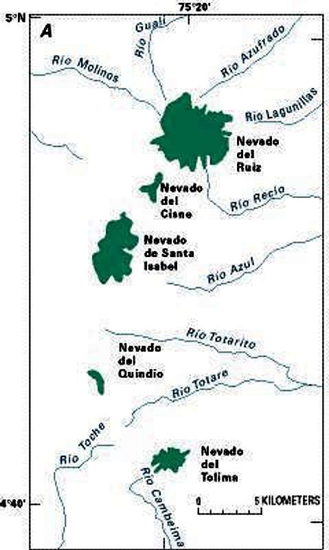
Mapa con la ubicacion de los...
View High-Resolution Image
Mapa con la ubicacion de los...
Mapa con la ubicacion de los picos del parque de los nevados.
fuente:
www.pubs.usgs.gov
« PREV
NEXT »
Engendradodelayuca
on
May 15, 2004 7:45 pm
Comments & voting
Other parents
Lat/Lon:
4.84470°N / 75.3113°W
Image ID:
53203
4755 Hits
72.42
% Score
3
Votes
Log in to vote
Comments
No comments posted yet.
to post!
Don't have an account?
Santa Isabel - Poleka Kasue
(Mountain/Rock)
You are at
the First
Image
Viewing
#1 of 1
GALLERY
You are at
the Last
Image
Engendradodelayuca's Image Gallery
« PREV
Viewing
#53 of 113
GALLERY
NEXT »
Santa Isabel - Poleka Kasue
(Mountain/Rock)
Loading....
×
You need to login in order to vote!
User Name
Password
Remember me
Forgot your password?
Log me out when I close my browser.
Keep me logged in all the time.
sign in as a user
Don't have an account?
Register now for FREE
Rating available
Suggested routes for you
People who climb the same things as you
Comments Available
Create Albums
Register Here


