Toggle navigation
Mountains
Routes
Images
Trip Reports
Forum
What's New
People
Areas & Ranges
Articles
Trailheads
Canyons
Huts & Campgrounds
Albums
Logistical Centers
Fact Sheets
Lists
Custom Objects
Gear
Plans & Partners
WELCOME TO SUMMITPOST
SIGN IN
REGISTER
The Hump Trail & Pear Lake
Additional Parents
Image
Map of possible ski routes in...
View High-Resolution Image
Map of possible ski routes in...
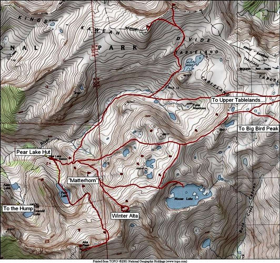
Map of possible ski routes in the Alta Peak/Pear Lake area. Red lines show selected ski tours. Small arrows show possible ski/snowboard descents.
« PREV
NEXT »
steeleman
on
Oct 1, 2002 5:24 pm
Comments & voting
Other parents
Lat/Lon:
36.59060°N / 118.6611°W
Image ID:
12085
11371 Hits
73.06
% Score
3
Votes
Log in to vote
Comments
No comments posted yet.
to post!
Don't have an account?
The Hump Trail & Pear Lake
(Route)
« PREV
Viewing
#6 of 10
GALLERY
NEXT »
steeleman's Image Gallery
« PREV
Viewing
#250 of 414
GALLERY
NEXT »
Alta Peak
(Mountain/Rock)
Loading....
×
You need to login in order to vote!
User Name
Password
Remember me
Forgot your password?
Log me out when I close my browser.
Keep me logged in all the time.
sign in as a user
Don't have an account?
Register now for FREE
Rating available
Suggested routes for you
People who climb the same things as you
Comments Available
Create Albums
Register Here


