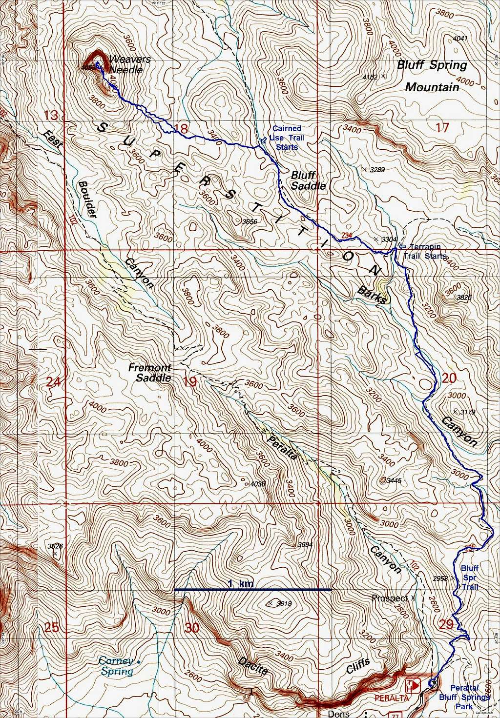
Map for Weaver's Needle Eastern Route
The route is mainly by the Bluff Springs Trail, which starts at the north end of the Peralta parking lot, goes right and drops down to a gully before climbing up to the first saddle. It is important to leave the Bluff Springs Trail and start the Terrapin Trail, as indicated on the map, then important to leave the Terrapin Trail for a cairned use trail, head over yet one more saddle, cross a gully and continue up toward the "White Band" below the base of the class 4 (5.2?) climb. If you look for cairns, you will find them. There is just one class 3 section before the start of the cliffs on Weaver: A big chockstone, which can be bypassed on the right (N). This is distinct from the other 2 notable chockstones on the steep part of the route!
While this is often suggested as the way to Weaver's with the least elevation gain. that characterization is probably misleading. The Bluff Springs route does not go over the big saddle at Fremont Pass... but DOES go over 7 minor saddles and shoulders. It is a very pretty route, and often has water in the winter. (Weaver's Needle Eastern Route.)

